DocumentsStaff ReportOct 17, 2016Pages 15–24
Staff Report to Planning, Zoning and Affordable Housing Committee - Z16-0013 (1128 Finlayson Arm Rd)
Planning staff report (Z16-0013) recommending rezoning 1128 Finlayson Arm Rd from RR4 to the new RAE1 zone to permit expanded equestrian therapy, riding activities and associated agri-/eco-tourism uses; includes background, site analysis, DP areas, and recommended conditions for First Reading.
Key facts
- Applicant/Owner: Mary Rostad
- Civic Address: 1128 Finlayson Arm Road
- Property size: 110,367.58 m2 (~27.3 acres / ~30 acres referenced elsewhere)
- Recommendation Option 1: Consider giving First Reading to Bylaw No.1658 subject to (a) site servicing feasibility review to satisfaction of Director of Engineering; (b) applicant to provide a Section 219 covenant prior to bylaw adoption
- Site is unserviced by municipal water and sanitary sewer (well and septic on-site)
Staff Report to Planning, Zoning and Affordable Housing Committee - Z16-0013 (1128 Finlayson Arm Rd)
Date:
September 12, 2016
Department:
Planning
Application No.:
Z16-0013
Subject:
Application to Rezone 1128 Finlayson Arm Rd from RR4 (Rural Residential 4) Zone to RAE1 (Rural Agricultural and Eco-Tourism) Zone to allow for equestrian therapy and riding activities on the property
PURPOSE
Mary Rostad, owner of the property, has applied to rezone 1128 Finlayson from RR4 (Rural Residential 4) zone to the new RAE1 (Rural Residential and Eco-Tourism 1) zone to allow for equestrian based therapy (for humans) and riding activities to occur on the parcel.
BACKGROUND
PREVIOUS APPLICATIONS
City records show a building permit issued for an addition to an existing barn in 1997 and for an accessory building in 1998. Records do not show any other applications pertaining to development or rezoning on this site.
Table 1: Site Data
| Item | Details |
|---|---|
| Applicant | Mary Rostad |
| Owner | Mary Rostad |
| Civic Address | 1128 Finlayson Arm Road |
| Legal Description | Lot A, Section 41, Highland District, Plan 3622, Except in Parts in Plans 25640 and 30287 |
| Size of Property | 110,367.58 m2 |
| DP Areas | Steep Slopes and Habitat and Biodiversity |
| Zoning | Existing: RR4 (Rural Residential 4) Proposed: RAE1 (Rural Agriculture and Eco- Tourism 1) |
| OCP Designation | Existing: Hillside or Shoreline Proposed: No Change |
SITE AND SURROUNDING AREA
The subject parcel is located on Finlayson Arm Road that is accessed via the TransCanada Highway. The 30 acre parcel includes a one-family dwelling, riding stable and an accessory building. The surrounding parcels are also accessed by Finlayson Arm Road and include one-family dwellings on large parcels. To the immediate West of the subject site is Goldstream Provincial Park. The park is 477 hectares of protected area, and part of the Nanaimo Lowlands Eco section of the Coastal Douglas Fir Biogeoclimatic Zone. The Goldstream River is the site of annual chum salmon spawning which takes place in mid to late October and November.
The immediate area has seen relatively little changes in terms of development and subdivision. The parcel to the immediate South of the subject parcel underwent a subdivision to create two lots but retained the RR4 zoning in 2012. The parcel to the East had been vacant until 2014 when a one family dwelling was constructed on the site. Other adjacent lands have remained undeveloped or unchanged.
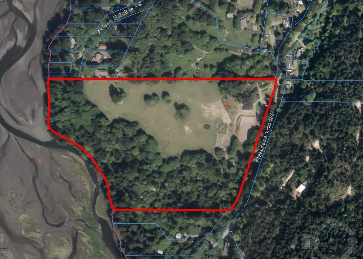
Surrounding Land Uses
Table 2: Surrounding Land Uses
| Location | Zoning | Use |
|---|---|---|
| North (1124 Finlayson Arm Rd) | RR4 (Rural Residential 4) | Agricultural/Residential |
| North (1706 Falcon Heights Rd) | RR4 (Rural Residential 4) | Residential |
| East (1159 Finlayson Arm Rd) | RR4 (Rural Residential 4) | Agricultural/Residential |
| South (1170 Finlayson Arm Rd) | RR4 (Rural Residential 4) | Agricultural/Residential |
| West (Goldstream Provincial Park) | P4 (Park and Open Space) | Park |
COUNCIL POLICY
OFFICIAL COMMUNITY PLAN (OCP)
The subject property is designated as Hillside Shoreline within the Official Community Plan Bylaw No. 1200. The Hillside Shoreline designation is designated as:
Hillside Shoreline
- Predominantly residential area that supports a range of low, medium and high density housing choices including secondary suites
- Schools, community facilities and other institutional uses are permitted throughout the area
- Home based businesses, live- work housing is encouraged; home-based accommodations (ex. Bed and breakfasts) are permitted.
- Parks, open spaces and green corridors (creeks, wildlife corridors, trails etc.) are integrated throughout the area.
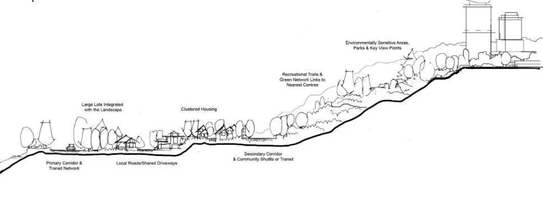
A Concept of Hillside or Shoreline Areas
DEVELOPMENT PERMIT AREAS
The subject property is within the Habitat and Biodiversity Development Permit Area as well as the Steep Slopes and Interface Fire Hazard Development Permit Areas. Rezoning the property will permit new accessory uses as well as the intensification of the current use on site. Council should be aware that a development permit will be required prior to any land clearing or construction.
COMMENTS
DEVELOPMENT PROPOSAL
As an equestrian based therapy centre, the current activities on the site are permitted under the “agriculture” use in the current RR4 zone. The purpose of the rezoning application is to expand the current activities to allow for groups of people to engage in agricultural based pursuits and education in a natural setting.
New uses under the proposed eco-tourism zoning include: conference and meeting facilities, campsites, group day cares, riding stables, nursery, health centre, recreational equipment rentals and assembly use.
Council should note that the site is not serviced by municipal water or sanitary sewer systems therefore there are limits to the kind of development that can occur on site. If Council is supportive of this application and the proposed new Zone, they may wish to require the applicant to enter into a servicing agreement prior to the issuance of a development permit or building permit. The proposed uses are outlined in Table 3 below for Council’s consideration.
Table 3: Proposal Data
Permitted by RR4
- accessory buildings and uses;
- agriculture;
- boarding kennel;
- breeding kennel;
- group day care;
- home occupation;
- intensive agriculture on lots of 4 ha (10 acres) or more in area;
- one-family dwelling or two-family dwelling;
- secondary suite in a one-family dwelling;
- temporary construction and real estate marketing offices;
- the keeping of not more than four boarders in a one-family dwelling; and
Permitted by RAE1 (Proposed Zoning)
- accessory buildings and uses;
- temporary construction and real estate marketing offices;
- agriculture;
- intensive agriculture on lots of 4 ha (10 acres) or more in the area;
- nursery;
- riding stables;
- siviculture;
- single unit (cabin) or multi-unit (bunkhouse) dormitory;
- campsite;
- rental of recreational equipment;
- health centres;
- assembly use;
- riding academies, including riding rings;
- schools and preschools;
- home occupations;
- one family dwelling; and
- secondary suite in a one-family dwelling.
PEDESTRIAN, CYCLING AND MOTORIST NETWORK
As no development is occurring, a site plan was not obtained as part of this application. The current use, an equestrian based therapy centre, must have parking on the site that adheres to Zoning Bylaw 300. Section 4.01.01, Table 1 regulations for a Riding Stable, which requires 1 parking stall per boarded and rental horse in addition to 1 space per employee. While the subject parcel has ample space to provide required parking, a parking review will be done with at time of business license application and again with any subsequent development or building permits.
The property is within a rural area and is not in close proximity to the BC transit stops or bicycle lanes. It can be assumed that patrons and visitors to the site are purposely accessing the site.
INFRASTRUCTURE
Due to the lack of servicing to the site (no sewer or water) Council should note that no development or subdivision may occur until the property is serviced or a variance to Bylaw 1000 is issued by Council.
WATER: The subject property is serviced by a well system which limits the future development potential of the site due to capacity constraints.
SEWER: The subject property is serviced by septic. Any construction taking place should outline a servicing agreement detailing how waste is to be dealt with. Council should note that Westshore Environmental has indicated that sewage generated by the property must be managed by an on-site sewer disposal system that is approved by Island Health or other governing authority.
FIRE SAFETY: Fire access and fire services protection had no current issues but urged the applicant to take out a business license prior to starting up their eco-tourism business to ensure all fire and life safety requirements are met.
OPTIONS
That the Planning, Zoning and Affordable Housing Committee recommend that Council:
Option 1
- Consider giving First Reading to Bylaw No. 1658 to amend the zoning designation of the property located at 1128 Finlayson Arm Road from RR4 (Rural Residential 4) to the new RAE1 (Rural Agriculture and Eco-Tourism 1) Zone subject to the following terms and conditions:
a) A site servicing feasibility review must be conducted, to the satisfaction of the Director of Engineering, for any development prior to issuance of a development permit.
b) That the applicant provides, prior to Bylaw Adoption, a Section 219 covenant, registered in priority of all other charges on title, that agrees to the following:
i. That any necessary underground or above ground servicing upgrades, extensions, or other requirements should be fulfilled at the applicant’s expense.
Option 2
- Take no action at this time with respect to rezoning 1128 Finlayson Arm Road
Submitted by:
Lauren Morhart, MCIP RPP Planner II
Concurrence:
- Matthew Baldwin, MCIP, RPP Director of Planning
- Bob Beckett, Fire Chief
- Lorne Fletcher, Manager of Community Safety and Municipal Enforcement
- Michelle Mahovlich, P.Eng, P.Geo, Director of Engineering
- Brent Molnar, Manager of Land Development
- Steve Ternent, Director of Finance
- Jim Bowden, Chief Administrative Officer
:lhm
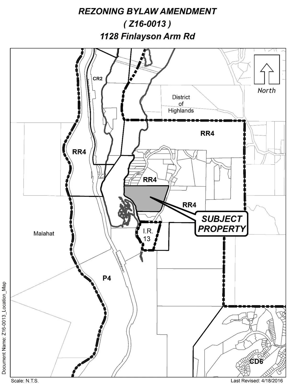
Appendix A – Location Map
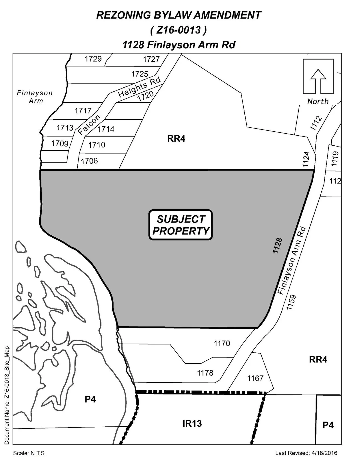
Appendix B – Site Map
Appendix C – Bylaw 1658
Section 6.18 – Rural Agriculture and Eco-Tourism (RAE1) Zone
The intent of the Rural Agriculture and Eco-Tourism zone is to provide for opportunities for a mix of residential, agricultural/agri-tourism, eco-tourism and educational uses.
6.18.01 Permitted Uses
The following uses and no others are permitted in the Rural Agriculture and Eco-Tourism (RAE1) Zone:
General Uses:
(1) accessory buildings and uses;
(2) temporary construction and real estate marketing offices;
(3) uses permitted by Section 3.01 of this Bylaw;
Agricultural Uses:
(4) agriculture;
(5) intensive agriculture on lots of 4 ha (10 acres) or more in area;
(6) nursery;
(7) riding stables;
(8) silviculture;
Educational Uses:
(9) riding academies including riding rings;
(10) schools and preschools;
Agri-Tourism and Eco-Tourism Uses:
The following uses are permitted as accessory uses to any agricultural or educational use:
(11) single unit (cabin) or multi-unit (bunkhouse) dormitory;
(12) campsite;
(13) rental of recreational equipment including, but without limited the generality of the foregoing: bicycles, kayaks and canoes, horses, clothing and outdoor gear;
(14) health centres;
(15) assembly use;
Residential Uses:
(16) home occupation in accordance with Section 3.09;
(17) one-family dwelling; and
(18) secondary suite in a one-family dwelling in accordance with Section 3.08.
6.18.02 Subdivision Lot Requirements
(1) No lot having an area less than 0.4 ha (1 acre) may be created by subdivision in the Rural Agriculture and Eco-Tourism (RAE1) zone; and
(2) Notwithstanding Subsection 6.04.02(1), no lot having an area less than 40 ha (100 acres) may be created by subdivision in the Rural Agriculture and Eco-Tourism (RAE1) Zone unless that lot is serviced by the municipal sanitary sewer system.
6.18.03 Density of Development and Lot Coverage
(1) There may not be more than one one-family residential dwelling per lot; and
(2) Lot coverage of all buildings and structures may not exceed 20% or 1000 m2.
6.18.04 Height and Size of Principal Use Buildings
(1) No building or structure may exceed a height of 10.5 m (34 ft); and
(2) Despite article (1), the height of a building for agriculture or intensive agriculture use may not exceed 12 m (39 ft).
6.18.05 Setbacks
(1) No building or structure may be located:
(a) within 10 m (33 ft) of any rear lot line;
(a) within 7.5 m (25 ft) of any other lot line; and
(2) Despite article (1), the siting of any building or structure used for agriculture or intensive agriculture must comply with Section 3.05 of this Bylaw.
6.18.06 Landscape Screening
The relevant regulations of Section 3.21 of this Bylaw must apply.
6.18.07 General
The relevant regulations of Part 3 of this Bylaw must apply.
Document Images
(1)