DocumentsStaff ReportOct 23, 2023Pages 38–54
Staff Report: Z23-0010 / Bylaw No. 1927 - Application to Rezone 957 Walfred Road (RS1 to RT1)
Report recommending Council proceed with first reading of Bylaw No. 1927 to rezone 957 Walfred Road from RS1 to RT1 to permit ~17 townhomes, outlining required amenity contributions, covenants, variances, development permit area impacts, and infrastructure conditions.
Key facts
- Civic address: 957 Walfred Road; Lot size: 3,631 m2
- Proposed: ~17 townhouse units (RT1)
- Amenity contributions (per Council policy): $610 per townhome to Affordable Housing Reserve; $3,660 per townhome to General Amenity Reserve; total policy contributions $72,590 for 17 units
- Estimated Development Cost Charges (DCCs) total ~ $182,914.05 (incl. CRD water and school site)
- Requested variances: front lot line setback from 3.0 m to 1.2 m (corner Block A) and rear lot line setback from 5.5 m to 1.5 m
Staff Report to Sustainable Development Advisory Committee
DATE: Monday, October 16, 2023
DEPARTMENT: Planning
APPLICATION NO.: Z23-0010
SUBJECT: Bylaw No. 1927 - Application to Rezone 957 Walfred Road from the (RS1) Residential Small Lot 1 Zone to the (RT1) Residential Townhouse 1 Zone to allow approximately 17 townhomes.
PURPOSE:
Kyle Velikovsky has applied on behalf of White Wolf Homes Ltd to rezone 957 Walfred Road from RS1 (Residential Small Lot 1) to RT1 (Residential Townhouse 1) to allow for a townhouse development with approximately 17 units.
BACKGROUND:
PREVIOUS APPLICATIONS
- Z07-0035 – In 2007 the property (955 Walfred) was rezoned from GR2 (Greenbelt 2) to R2A (One-and Two-Family Residential A) to create two lots, one inclusive of the existing home (955 Walfred), and one remainder lot for future development potential (957 Walfred). The applicant initially proposed a 10-lot subdivision through this rezoning, but due to issues such as access to lands beyond that could not be resolved in a timely manner, the applicant scaled back the proposal to two-lots. Through this rezoning, the applicant dedicated 5-meters of road along the Walfred frontage and secured that a sidewalk or trail would be constructed as part of the frontage improvements when 957 Walfred was developed.
- Z09-0015 – In 2009, the same applicant returned to rezone 957 Walfred Road from R2A to RS3 (Residential Small Lot 3) to allow for a 9-lot subdivision. Council included a requirement for a pathway from the proposed cul de sac to the adjacent property at 953 Walfred Road to allow for pedestrian connection to future parkland and /or roads that may be created should 953 Walfred redevelop. This was secured through the development covenant and is included in the applicant’s new proposal. In line with Council’s policy in 2009, they also requested and secured through the bylaw that the owner would provide 10% cash-in-lieu of park dedication on the property, as well as pay an additional fee to the General Amenity Fund for stormwater improvements. These additional fees will be discussed further in the Financial Implications section of this report. The development covenant registered also included a requirement that the owner install a 6 ft high fence along the northern property line. This is already required through the Zoning Bylaw for all townhouse projects and will be included as part of the landscape plan through the development permit. Council may wish to note that in 2020 the Residential Small Lot Zones, inclusive of RS3, were combined for simplification purposes. The RS3 Zone was collapsed into the RS1 Zone which is why it is designated RS1 today.
- DP10-0003 – In February of 2010, the City issued a development permit for the property. The permit allowed for land alteration and clearing within the Extreme Fire Hazard and Potential Wildlife Habitat and Biodiversity Development Permit Areas. This included a 5-meter buffer along the southern and eastern property lines to protect small diameter trees (less than 10 cm dbh) and native understorey vegetation. Large trees were required to be removed from the 5-meter buffer due to windthrow concerns. Site clearing took place between 2010 and 2013 and some regrowth has since occurred.
- DP22-0017 – In April of 2022, the City issued a development permit to address the form and character for 9 single family lots, inclusive of some minor setback variances. This permit also addressed the Extreme Fire Hazard and Potential Wildlife Habitat and Biodiversity Development Permit Areas as the regrowth would need to be removed.
Despite receiving a development permit, the applicant has chosen not to proceed with the subdivision and instead pursue this application for 17 townhouses. The applicant has expressed that after reviewing the Statement of Conditions from the City outlining what would be required to complete the subdivision, they determined that the 9 single family lots were not financially viable to complete.
Table 1: Site Data
| Applicant | Kyle Velikovsky |
|---|---|
| Owner | White Wolf Homes Ltd. |
| Civic Address | 957 Walfred Road |
| Legal Description | LOT 1 SECTION 84 ESQUIMALT DISTRICT PLAN VIP86631 |
| Size of Property | 3,631 m2 |
| DP Areas | Habitat and Biodiversity Area and Extreme Fire Hazard Area |
| Zoning | Existing: RS1 Proposed: RT1 |
| OCP Designation | Existing: Neighbourhood Proposed: Neighbourhood |
SITE AND SURROUNDING AREA
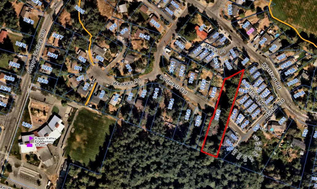
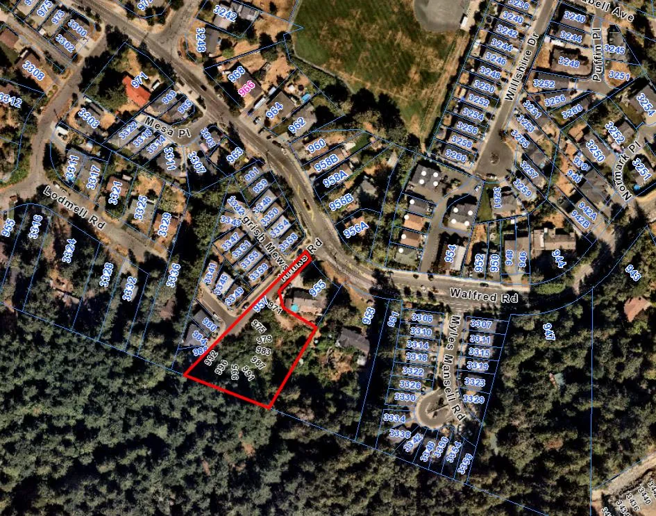
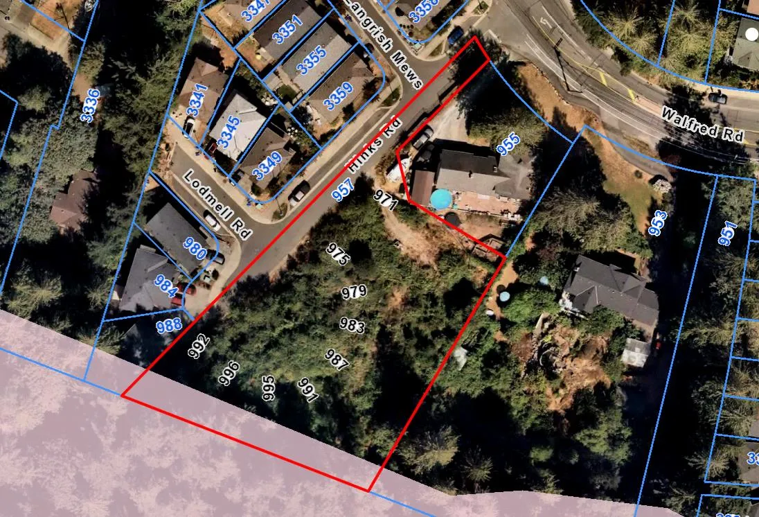
The subject property is a panhandle lot off of Walfred Road at the intersection of Hinks Road. The City has a Statutory Right of Way over the panhandle portion where Hinks Road is built, providing access to residents on Langrish Mews and some on Lodmell Road. This area will be dedicated to the City as Road through the redevelopment, along with the completion of a cul de sac. The property slopes upwards towards the rear and, as noted above, the property was cleared approximately 10 years ago with some regrowth occurring. The project biologist has noted that the regrowth has been predominantly young red alder trees, Scotch broom, Himalayan blackberry, spurge laurel, and agricultural grasses and other weedy species. An arborist report has been submitted for the property and will be discussed later in this report.

Table 2: Surrounding Land Uses
| Zoning | Use |
|---|---|
| North: R2 (One- and Two-Family Residential) | Single Family Homes |
| East: RR5 (Rural Residential 5) / RS1 (Residential Small Lot 1) | Single Family Homes |
| South: RR2 (Rural Residential 2) | Undeveloped |
| West: RS1 (Residential Small Lot 1) | Single Family Homes |
COUNCIL POLICY
OFFICIAL COMMUNITY PLAN
The Official Community Plan (OCP) Bylaw No. 1200 designated the subject properties as “Neighbourhood”, which is defined by the following text:
Existing settled areas throughout the community predominantly located on the valley floor.
- Predominantly residential precinct that supports a range of low and medium density housing choices including secondary suites
- This area allows for residential and mixed-use commercial intensification of streets that connect centres and/or are serviced by transit.
- Schools, community facilities and other institutional uses are permitted throughout the area.
- Retail serving local residents is encouraged along transportation corridors.
- Home-based businesses, live-work housing is encouraged.
- Parks, open spaces and recreational facilities are integrated throughout the area.
- This area allows for Neighbourhood Centres to emerge in the form of medium density mixed-use nodes at key intersections.
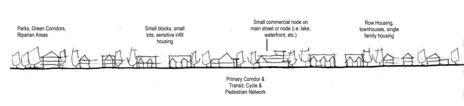
A Concept for Neighbourhood Areas
The Neighbourhood OCP designation has an overall density objective of 16 units per acre. While the proposal equates to 18.8 units per acre, just above the OCP target, when considered in isolation, the overall density of the original parent parcel (including the lot subdivided off as phase 1 as well as the subject proposal), is slightly under the OCP density objective, at 15.7 units per acre. The Neighbourhood designation also encourages townhousing as a medium density housing choice, to diversify the housing options available in traditional single-family neighbourhoods.
Another objective of the Neighbourhood designation is to secure public right of way dedications through developments to improve the pedestrian network. This proposal includes a 2 m wide pathway that aligns with a linear City park and pathway located adjacent to Myles Mansell Road. Connection between the two is not yet possible as 953 Walfred, located between them, has not yet redeveloped. Should they pursue redevelopment in the future, the City could secure the final link between the two paths.
SOUTH LANGFORD NEIGHBOURHOOD PLAN (SLNP)
The South Langford Neighbourhood Plan designates 957 Walfred Road as Urban Residential. This designation is described as the following:
Urban Residential – applies to areas where the availability of municipal services allows for a variety of residential development that is more intensive than suburban residential, and that may include single family residential dwellings without secondary suites, townhousing, and attached housing. A maximum density of one unit per 200 m2 (2152.85 ft2) is applicable.
Based on the lot size and the density maximum noted above, the property would be suitable for a maximum of 18.2 units according to the SLNP. As this proposal includes only 17 units, it would be considered in compliance with the South Langford Neighbourhood Plan.
Council may wish to note that the South Langford Neighbourhood Plan precedes the City’s Official Community Plan. At the time, the SLNP was retained within the design guidelines as a reference. Council may wish to note that zoning is required to comply with the OCP but is not required to comply with the design guidelines (including the SLNP).
DEVELOPMENT PERMIT AREAS
The entire property falls within the Extreme Fire Hazard Development Permit Area, and a strip of land along the southern property line, approximately 7m in width, falls within the Potential Wildlife Habitat and Biodiversity Development Permit Area (Figure 2). As noted in the Previous Applications section, the property was cleared between 2010 and 2013 and the applicant received a Development Permit in 2022 that re-addressed both development permit areas. The applicant has had their biologist’s report updated to reflect the new townhouse proposal and they have noted that blasting and clearing will be required into the previously retained native understorey, impacting approximately 250 m2. To compensate, the project biologist has prepared a landscaping plan with 215 m2 of native species planting that will be secured through the required form and character development permit, should this application proceed. A copy of the proposed landscape plan has been attached to this report for reference.
LOW CARBON CONCRETE
In accordance with Council’s Low Carbon Concrete Policy POL-0167-PLAN, Council may wish to require the applicant to utilize ready-mix concrete that meets or exceeds the weighted average Global Warming Potential targets based on Concrete BC Baseline (average) mix data for the construction of the proposed development.
COMMENTARY:
DEVELOPMENT PROPOSAL
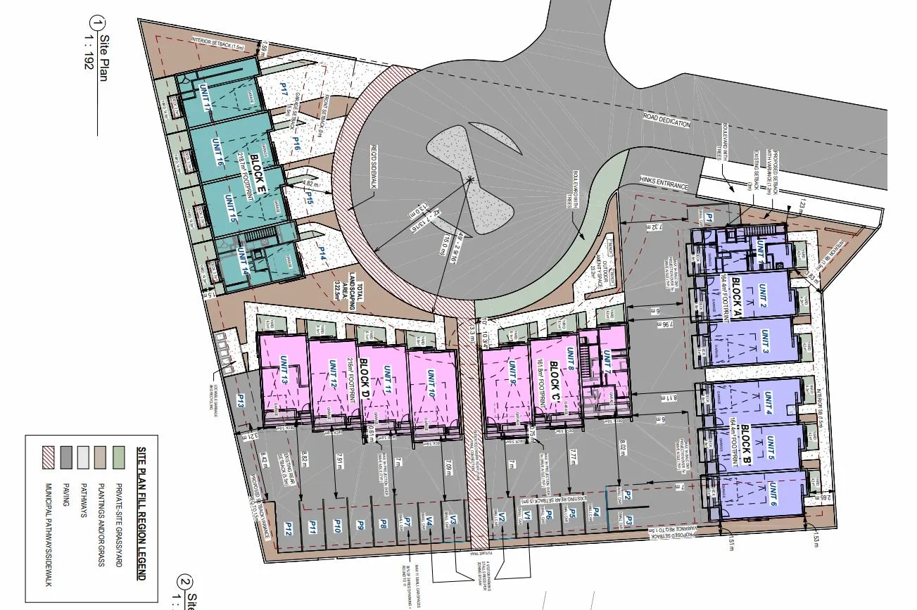
The applicant is seeking to rezone 957 Walfred Road from RS1 (Residential Small Lot 1) to RT1 (Residential Townhouse 1) to allow for a townhouse development with approximately 17 units, shown below as Figure 3. The applicant is requesting a few setback variances which will be discussed later in this report and are shown more clearly on a detailed version of the site plan that is attached to this report for reference.
As shown above, the applicant intends to complete the remaining portion of Hinks Road, inclusive of a cul de sac with bow-tie parking spaces. The proposal contains 5 blocks of townhouses with 3-4 units each. The blocks have been oriented with front doors facing the street whenever possible, and garage access predominantly from an interior access road. This allows for a more pleasant street presence, reduces vehicle interactions with the sidewalk, and provides better screening of surface parking. The access to the interior drive aisle occurs just north of the new cul de sac, and the drive aisle has been reviewed by the Fire Department to ensure access by the Langford Ladder Truck is possible.
As per the previous zoning requirement, the applicant has included a 2 m wide pathway through the site that can be carried through to the neighbouring property should they choose to redevelop, ultimately meeting up with a linear park and path connecting to Myles Mansell Road. Council may wish to secure through a Section 219 Covenant that a Statutory Right of Way be registered over the pathway to allow public access through the private strata, and that the path be delineated to the satisfaction of the Director of Parks, Recreation, and Facilities.
Each unit is 3 storeys in height, large enough for at least 3 bedrooms, and offers at least 10 m2 of private outdoor space either in a yard, a balcony, or a combination of the two. As discussed previously, the applicant has submitted a native planting landscape plan which also includes a small common outdoor amenity space in front of Block C with plantings and benches for resident use. The applicant will also be required to install a 6-foot-tall privacy fence along all property lines that do not face the road to screen the project from adjacent neighbours.
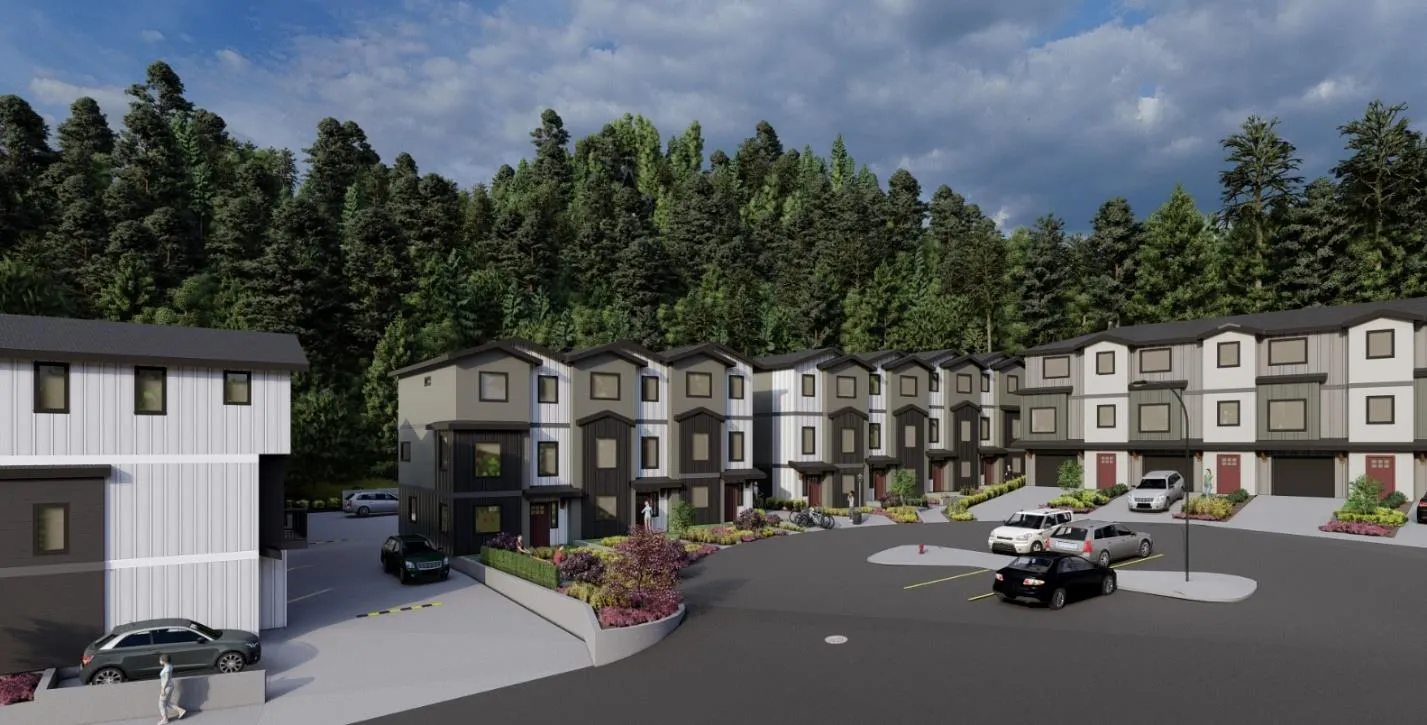
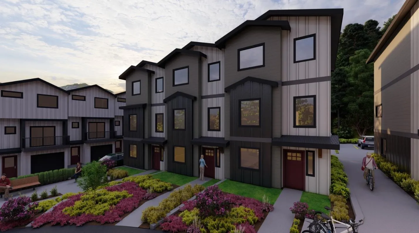
The applicant has submitted some renderings of their proposal to better articulate their design and site layout. The primary material proposed for the units is cementitious panel in neutral tones. The final design will be secured through the Form and Character development permit, in accordance with the City’s Multi-Family Design Guidelines.
The proposal meets the City’s Zoning regulations for parking by providing two parking spaces per unit and at least 4 visitor parking spaces on site, not inclusive of street parking. Council may wish to request that the applicant register a Section 219 Covenant securing that the garages of the townhouses are not used for storage in a manner that prohibits the parking of vehicles. Council may wish to have the covenant registered in favour of the strata so they are responsible for enforcing the covenant instead of the City.
The applicant is requesting two setback variances for their proposal, as shown below in Table 3.
Table 3: Proposal Data
| Permitted by RS1 (Current Zoning) | Permitted by RT1 (Proposed Zoning) | Proposed by Rezoning Application |
|---|---|---|
| Permitted Use | Single family homes | Townhousing |
| Density (FAR and/or min. lot size) | 200 m2 min. lot size | 1.2 FAR |
| Height | 9 m | 3 storeys |
| Site Coverage | 50% | 60% |
| Front Yard Setback | 3 m except for a garage which must be 6 m | 3 m except for a garage which must be 5.5 m |
| Interior Side Yard Setback | 1.5 m | 1.2 m |
| Exterior Side Yard Setback | 3.5 m except for a garage which must be 6 m | 3.5 m except for a garage which must be 5.5 m |
| Rear Yard Setback | 5.5 m | 5.5 m |
| Vehicle Parking Requirement | 2 parking spaces per unit | 2 parking spaces per unit |
*variance requested
The first variance is a request to reduce the front lot line setback from 3 m to 1.2 m for the corner of Block A only. Once the applicant constructs and dedicates the cul de sac to the City, the final front lot line will be quite unconventional as it will follow the full curve of the cul de sac and the length of Hinks Road until it meets 955 Walfred. Council should note that the applicant is demonstrating the 3 m front lot line setback requirement for the rest of the proposal, and that the variance request only applies to Block A.
The second variance request is to reduce the rear lot line setback requirement from 5.5 m to 1.5 m. According to the Zoning Bylaw, the rear lot line is defined as the lot line that is opposite the front lot line, meaning both the southern and eastern property lines would be subject to the 5.5 m rear setback. On a conventional lot, one of these lot lines would typically be considered an interior side lot line with a 1.2 m setback requirement. Along the eastern property boundary, the variance request to 1.5 m would be for the side of Block B only, which will visually appear as a side lot line. On the southern lot line, the variance would be required for the back of Block E. The rear face of the block is 2.5 m from the rear property line, and the second-floor balcony projects to 1.5 m from the rear lot line. Additionally, the corner of unit 13 (Block D), is 3.21 m from the rear lot line.
Council may wish to authorize the Director of Planning and Subdivision to grant these variances within the Form and Character development permit, given the unconventional lot shape and corresponding application of setback requirements.
ARBORIST REPORT AND LANDSCAPING
As noted previously, the applicant has submitted an arborist report pertaining to the property, attached to this report for reference. The arborist assessed all on-site trees as well as any surrounding trees that could potentially be impacted by the proposal. The arborist has found that nine trees on the subject property will need to be removed, including 3 Douglas fir, 5 Western cedar, and a Willow tree. Two of these trees are considered shared property line trees with the property to the south, 919 Mountain Top Road. The applicant has approached the owners of 919 Mountain Top Road about the trees and will need to receive their consent before removing the trees for this project. No other surrounding trees are expected to be impacted by the proposal, but the arborist has suggested tree protection fencing around the perimeter of the site to best protect them. Council may wish to require the tree protection fencing through a Section 219 Covenant.
Council may also wish to note that the landscape plan demonstrates 14 trees to be planted on site, predominately maples and arbutus trees. This will be in addition to street trees planted in the boulevard which are typically planted 12 meters apart.
MULTI-MODAL NETWORK
As part of the proposal, the applicant will be required to complete the cul de sac at the end of Hinks Road, inclusive of bow-tie parking. This cul de sac and the remaining half of Hinks Road will be dedicated to the City as road. The Director of Engineering has noted that no Traffic Impact Assessment is necessary for the proposal development. The proposal has also been reviewed by the Ministry of Transportation and Infrastructure and they have expressed no objection.
There is sidewalk on the west side of Hinks Road which the applicant will be adding to should this rezoning be approved, as well as a patchy network of sidewalk on both sides of Walfred Road. Gaps in the sidewalk network on Walfred are expected to improve as remaining parcels redevelop in the future. If 3336 Lodmell Road redevelops in the future, the City will be able to connect Hinks Road to the other side of Lodmell Road which further offers a trail connection to Happy Valley School. This would result in a much quicker and safer pedestrian route for residents of Hinks Road and Langrish Mews to the school and beyond.
Bike lanes exist on the south side of Walfred Road with a patchy network on the northside, which leads to the Galloping Goose trail, approximately 500 m away from the site. The Galloping Goose provides further connection to downtown Victoria and other municipalities and Langford neighbourhoods along the way.
The subject property is located within 350 meters of local bus service, specifically the 48 Happy Valley via Colwood, 64 Langford Exchange via East Sooke, and 64 to 17 Mile House via East Sooke. These local routes provide further connection to key destinations like Westshore Town Centre and, Langford Exchange, which includes access to the Blink RapidBus Line 95, a key commuting service into downtown Victoria.
FRONTAGE IMPROVEMENTS
The Director of Engineering has noted that frontage improvements will be required to Bylaw No. 1000 standards and will include constructing a cul de sac and bowtie parking, connecting the existing sidewalk on Hinks Road to the on-site pathway, boulevard, and streetlighting. As per the covenant registered through the initial rezoning in 2007, the applicant will also be responsible for completing frontage improvements at 955 Walfred Road.
INFRASTRUCTURE
STORMWATER MANAGEMENT
The applicant will be required to provide a stormwater management plan to the satisfaction of the Director of Engineering prior to the issuance of a building permit or subdivision approval, whichever is first. As part of their application, the applicant has submitted a stormwater technical memo outlining how they plan to adequately manage stormwater on-site. This memo has been reviewed and approved by the Director of Engineering.
SEWERS
A sewer main exists along Hinks Road and a connection from the units to this main would be required. Any improvements, extensions, or modifications needed to the sewer main within the municipal road right-of-way will be completed by West Shore Environmental Services at the applicant’s expense.
CONSTRUCTION IMPACT MITIGATION
Council may wish to require a Construction Parking and Traffic Management Plan as a condition of rezoning and require that it be provided to the satisfaction of the Director of Engineering prior to any land alteration. This should be secured within a covenant, prior to Bylaw Adoption.
NEIGHBOURHOOD CONSULTATION
The applicant has noted to staff that they have conducted door-to-door canvassing of the surrounding neighbourhood and left letters in the mailbox for people who were not home. They provided their contact information to allow them to follow up with them directly with any questions or concerns.
FINANCIAL IMPLICATIONS:
As noted in the Previous Applications section of this report, this site was previously rezoned in 2009 through Bylaw No. 1261. This bylaw included amenity contributions that form part of the City’s Zoning Bylaw and will still apply to this proposal, where applicable, unless Council chooses to remove it through this rezoning. The contributions secured through the bylaw are as follows:
- $9,300 per lot towards the General Amenity Reserve Fund;
- $4.19 per m2 of site area towards the General Amenity Reserve Fund; and
- An amount equal to the 10% of the assessed value (post-rezoning) of the parcel to be subdivided towards the General Amenity Reserve Fund.
Item 1 would no longer be applicable as it pertains to single family lots and all the proposed townhouse units would be on one large strata lot. A specific townhouse rate will be applied to the project as outlined in Table 4 below.
Item 2, the requirement that the owner pay $4.19 per m2 of site area towards the General Amenity Reserve Fund, was implemented as a transition measure at the time for projects that were going through rezoning before the South Langford Storm Drainage Development Cost Charge was introduced. The contribution was originally intended to go towards the South Langford Drainage Fund, which was later collapsed into the General Amenity Reserve Fund. If the $4.19 per m2 payment was still applied, it would require a payment of $15,213.89, which is less than the City would currently collect through Development Cost Charges, as outlined below in Table 5. Council may find it unnecessary to collect both the storm drainage DCC and per m2 fee and consider removing the $4.19 per m2 requirement.
Item 3, the requirement that the owner pay 10% of the value of the property to the City in lieu of park dedication, originated out of the former Affordable Housing, Parks, and Amenity Contributions Policy which required park dedication, or cash-in-lieu, on a sliding scale basis on all lots. This and all other Parks related amenities were removed from the Policy in a 2012 amendment with the idea that Council would target specific properties where park dedication was needed instead. The assessed value of the property has also tripled since 2009 and would now result in a required payment of approximately $88,100.
Given the above, Council may wish to remove the Bylaw No. 1261 amenity contributions from the Zoning Bylaw and replace it with contributions shown below in Table 4 which align with the City’s current amenity policy. The amenity contributions would be secured through Bylaw No. 1927, as attached.
Rezoning the subject properties to permit higher density of development will increase the assessed value of lands and eventually will increase municipal revenue due to the number of units created. As the developer is responsible to complete all frontage improvements, the direct capital costs to the City associated with this development will be negligible. A summary of Amenity Contributions and Development Cost Charges that the developer will be expected to pay, is outlined in Tables 4 and 5 below.
COUNCIL’S AMENITY CONTRIBUTION POLICY
The amenity contributions that apply as per Council’s current Affordable Housing and Amenity Contribution Policy are summarized in Table 4 below, based the total density of 17 residential townhouse units.
Table 4 – Amenity Contributions per Council Policy
| Amenity Item | Per Unit Contribution | Total (17 units) |
|---|---|---|
| General Amenity Reserve Fund | $3,660 per residential townhouse unit | $62,220 |
| Affordable Housing Reserve Fund | $610 per residential townhouse unit | $10,370 |
| TOTAL POLICY CONTRIBUTIONS | $72,590 |
Table 5 - Development Cost Charges
| Development Cost Charge | Per Unit Contribution | Total (17 units) |
|---|---|---|
| Roads | $3,865 | $65,705 |
| Storm Drainage | $1,028 | $17,476 |
| Park Improvement | $1,948 | $33,116 |
| Park Acquisition | $130 | $2,210 |
| ISIF | $331.65 | $5,638.05 |
| Subtotal (DCC’s to Langford) | $124,145.05 | |
| CRD Water | $2,557 | $43,469 |
| School Site Acquisition | $900 | $15,300 |
| TOTAL DCC’s (estimated) | $182,914.05 |
LEGAL IMPLICATIONS:
Should Council choose to proceed with consideration of Bylaw No. 1927, a Public Hearing will be scheduled in accordance with the requirements of the Local Government Act.
The amenity contributions specified in Table 4 above are incorporated into Bylaw No. 1927 and will be payable at the time of building permit along with the current Development Cost Charges specified in the various DCC Bylaws.
Council’s other conditions of approval would be registered in a Section 219 Covenant in priority of all other charges on title prior to consideration of Bylaw Adoption. Council may wish to discharge the existing development covenant that is registered on title that was secured through the 2009 rezoning as all aspects will be covered under the new covenant required or are already required through various City bylaws.
OPTIONS:
Option 1
That the Sustainable Development Advisory Committee recommend that Council:
- Proceed with consideration of First Reading of Bylaw No. 1927 to amend the zoning designation of the properties located at 957 Walfred Road from RS1 to RT1 subject to the following terms and conditions:
a. That the applicant provides, as a bonus for increased density, the following contributions per dwelling unit, prior to the issuance of a building permit:
i. $610 towards the Affordable Housing Reserve Fund; and
ii. $3,660 towards the General Amenity Reserve Fund; b. That the applicant, prior to Bylaw Adoption, discharge the previous rezoning covenant and register a new Section 219 covenant in priority of all other charges on title, that agrees to the following: i. That the following will be provided and implemented to Bylaw No. 1000 standards to the satisfaction of the Director of Engineering prior to the issuance of a building permit: 1. Full frontage improvements, inclusive of constructing a cul de sac and bowtie parking, connecting the existing sidewalk on Hinks Road to the on-site pathway, boulevard, and streetlighting. It must also include improvements to the frontage of 955 Walfred Road;
2. A storm water management plan; and
3. A construction parking management plan. ii. That a separate covenant be registered prior to the registration of a strata plan for the proposed development agreeing that the garages are to be used for the parking of vehicles and not the storage of items preventing the parking of vehicles therein, in favour of the strata. iii. That tree protection measures, inclusive of tree protection fencing, are implemented prior to commencement of work to protect the trees identified for retention in the arborist report throughout the construction period; iv. That all concrete used on-site will utilize ready-mix concrete that meets or exceeds the weighted average Global Warming Potential targets based on Concrete BC Baseline (average) mix data, and that prior to the issuance of a Building Permit the applicant shall provide a Type III Environmental Product Declaration that is 3rd party verified specifying the total Global Warming Potential value and confirming that the proposed development meets the requirements of Low Carbon Concrete Policy POL-0167-PLAN; v. That a Statutory Right of Way be registered over the public pathway prior to the issuance of a building permit; vi. That the public pathway shall be demonstrated within the landscape plan and be clearly delineated to the satisfaction of the Director of Parks, Recreation, and Facilities.
And
- Amend the text of Schedule AD of the Zoning Bylaw No. 300 to remove the amenity contributions related to Bylaw No. 1261;
And
- Authorize the Director of Planning and Subdivision to issue the following variances within the form and character development permit:
a. Section 6.28.07(1)(a) to reduce the front lot line setback from 3 m to 1.2m; and
b. Section 6.28.07(1)(d) to reduce the rear lot line setback from 5.5 m to 1.5 m
OR Option 2
That the Sustainable Development Advisory Committee recommend that Council take no action with respect to this application to rezone 957 Walfred Road under Bylaw No. 1927 until such time as the following items are addressed and reviewed by the Sustainable Development Advisory Committee:
a. ________________;
b. ________________;
c. ________________;
SUBMITTED BY:
Julia Buckingham, Planner II
Concurrence: Leah Stohmann, MCIP, RPP, Deputy Director of Planning and Subdivision
Concurrence: Donna Petrie, Senior Manager of Business Development and Events
Concurrence: Yari Nielsen, Director of Parks, Recreation and Facilities
Concurrence: Matthew Baldwin, MCIP, RPP, Director of Planning and Subdivision
Concurrence: Katelyn Balzer, P.Eng., Director of Engineering and Public Works
Concurrence: Michael Dillabaugh, CPA, CA, Director of Finance
Concurrence: Marie Watmough, Deputy Director of Corporate Services
Concurrence: Braden Hutchins, Director of Corporate Services
Concurrence: Darren Kiedyk, Chief Administrative Officer
Document Images
(2)