DocumentsAppendixOct 23, 2023Pages 55–56
Appendices (957 Walfred) - Schedule A & B (Site Map, Location Map)
Appendix maps for the 957 Walfred rezoning: Appendix A site map (plan of proposed townhouses) and Appendix B location map showing neighbourhood context.
Key facts
- Appendix A: site map for 957 Walfred
- Appendix B: neighbourhood location map relative to Walfred, Hinks Road and surrounding parcels
- Supports Bylaw No.1927 rezoning application
Appendix A – Site Map
REZONING BYLAW AMENDMENT ( Z23-0010 )
957 Walfred Rd
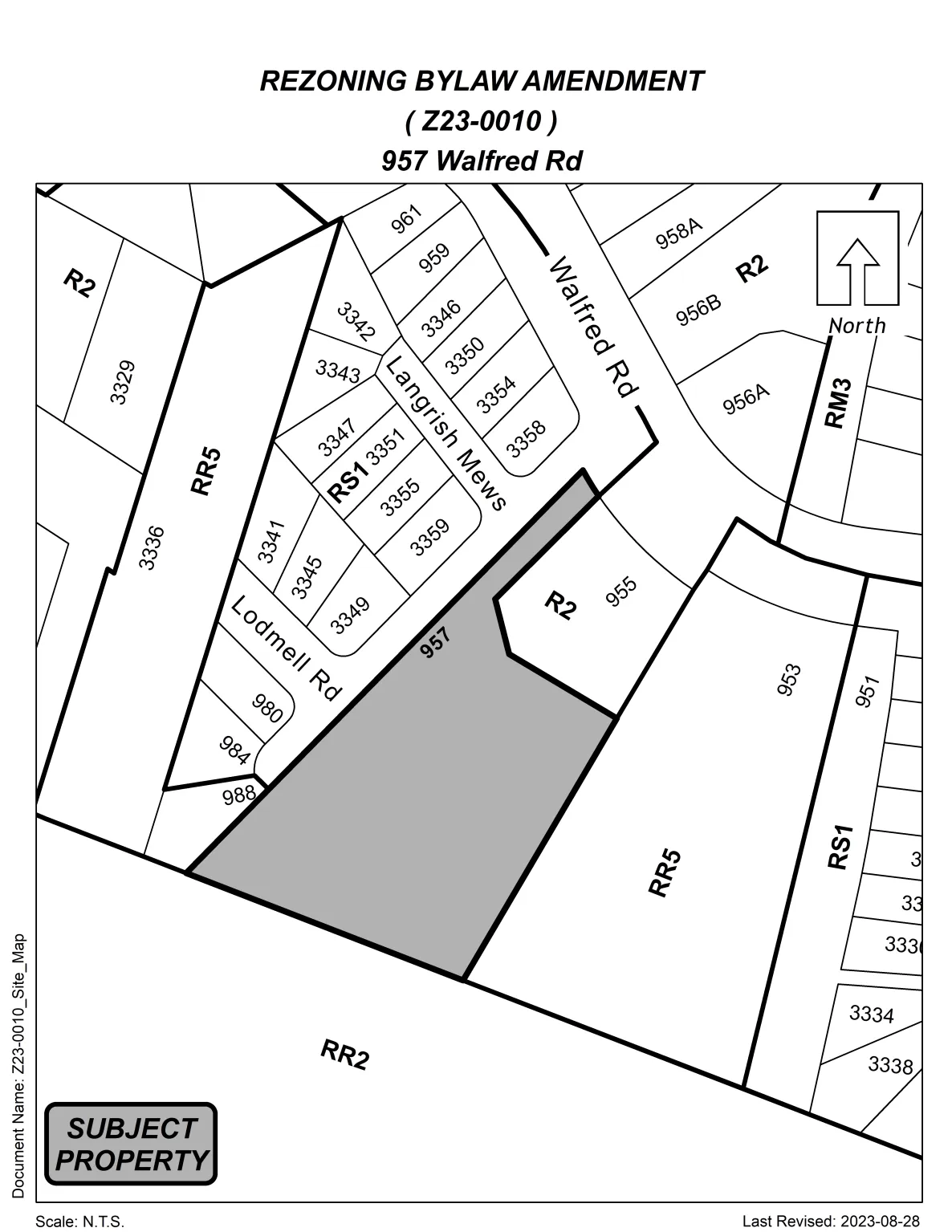
Document Name: 223-0010_Site_Map
Scale: N.T.S.
Last Revised: 2023-08-28
- SUBECT LABEL: SUBJECT PROPERTY (shown in a boxed label on the map)
Langford — where it all happens.
Page 55–56
Appendix B – Location Map
REZONING BYLAW AMENDMENT ( Z23-0010 )
957 Walfred Rd
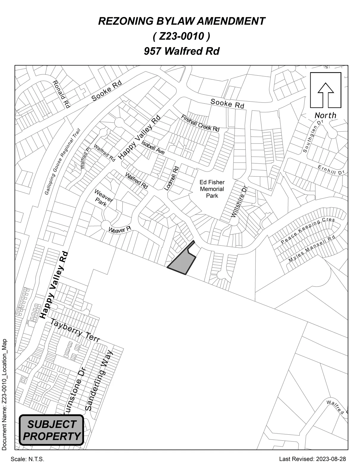
Document Name: 223-0010_Location_Map
Scale: N.T.S.
Last Revised: 2023-08-28
- SUBJECT LABEL: SUBJECT PROPERTY (shown in a boxed label on the map)
Langford — where it all happens.
Page 55–56
Extracted from: Agenda(190 pages total)