DocumentsAppendixMay 6, 2024Page 7
Appendix A – Transit-Oriented Areas Map
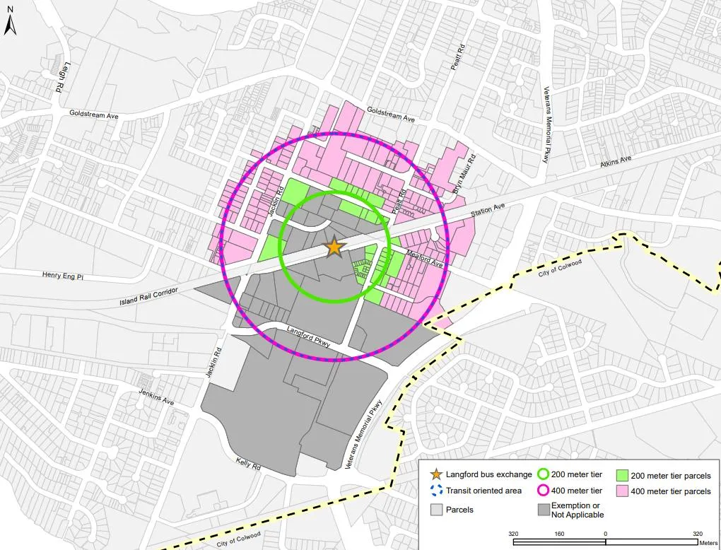
Map appendix showing properties within Tier 4 and Tier 5 of the Transit-Oriented Area around the Langford Bus Exchange, and exemptions (commercial/industrial).
Key facts
- Map identifies Tier 4 lands (shaded green) and Tier 5 lands (shaded pink)
- Properties currently zoned commercial/industrial (dark grey) are exempt from the TOA
- Illustrates 0–200m and 200–400m banding around specified coordinates at Station Avenue
Appendix A – Transit-Oriented Areas Map
Document
Bylaw No. 2160: Establishing Transit Oriented Areas
20240506 – Special Council
Page 7
Related Documents
(1)Extracted from: Agenda(25 pages total)