DocumentsAppendixFeb 2, 2026Pages 45–79
Appendix B – Arborist Report (Capital Tree Service Inc.) for 1029 Marwood Avenue
Arborist report and tree protection plan assessing existing trees on site, identifying trees proposed for removal and measures for tree protection during construction for the proposed subdivision at 1029 Marwood Avenue.
Key facts
- Arborist report date: December 10, 2025
- Eighteen (18) bylaw-protected trees observed; 11 proposed for removal, 7 to be retained/protected
- Two trees (OS2 and 887) are offsite/shared and removal requires neighbour permission
- Recommendations include Tree Protection Fencing, pre-job arborist meeting, root-zone protection and on-site arborist oversight
Appendix B – Arborist Report (Capital Tree Service Inc.) for 1029 Marwood Avenue
Capital Tree Service Inc.
- Arborist Report
- 1029 Marwood, Langford, BC V9C 2P7
- Date: December 10, 2025
Prepared for: Dan Wheldon
Prepared by: Capital Tree Service Inc.
Capital Tree Service Inc.
310-777 Royal Oak Dr, PO Box 53512, Victoria BC, V8X 5K2
Ph: (250) 415-7244, email: stevetaylor@capitaltreeservice.ca
GST # 861289783RT0001
WSBC Account #713323
Liability and Professional E and O, HSM Insurance - $5 Million
Summary / Scope of Work
Capital Tree Service Inc. (CTS) was contacted by Dan Wheldon (Client), a local homeowner, regarding a subdivision at 1029 Marwood (the Site) in the City of Langford. The Client indicated they required an Arborist Report and Tree Protection Plan (TPP) to move forward with the permit application.
The Client has requested that CTS provide a Basic Visual Tree Assessment (BVTA) and TPP for the Site. CTS agreed to complete the assessment and provide findings in an Arborist Report Form including a TPP.
Under the current proposal seven (7) trees will be retained while eleven (11) are proposed for removal due to building impacts. A tree inventory is included as Appendix ‘A’. Photographs and a Site Plan are included as Appendix ‘B’ of this report.
Methodology
- The Site was entered on January 6th, 2025, by CTS for the purpose of conducting tree assessments and collecting inventory. Keegan Durovich and Rita Slania, consulting arborists and representatives of CTS, provided the BVTA for the site. The weather that day was 8°C and sunny with a 10 km/hr breeze North gusting to 15 km/hr.
- The Site was assessed from grade. No form of diagnostic tools or invasive techniques were used during the assessment, including excavation or assessment of roots below.
- Tree heights were measured using Forestry Pro II Laser and diameters were measured using a Richter Diameter Tape. Diameter at Breast Height (DBH) was measured approximately 1.4 m above grade.
- Measurements and observations were recorded with the intent to provide a static representation of the area. A tree inventory is included as Appendix ‘A’ of this report. Photographs and a Site Plan are included as Appendix ‘B’ of this report.
- During the assessment, eighteen (18) trees were observed – all (18) of which are protected under the current City of Langford Tree Protection Bylaw. Trees referenced in Appendix ‘A’ and located on the site have been tagged. Tags are located approximately 1.5–2 m above grade on tree stems and were visible at the time of assessment. Trees not tagged are labeled Offsite (OS) one (1) to two (2).
- Protected Root Zone calculations are based on the ISA recommended one foot for each one inch of trunk diameter (0.3 m for each 2.5 cm). Matheny and Clark’s ‘Trees and Development’ was used to assess relative tolerance to Development Impacts.
Observations / Discussion
- The Site is a lot with an existing single-family dwelling in a suburban neighborhood. The Site is observed to be treed with a variety of tree species and appears to receive plenty of direct sunlight.
- The site is located within a “moderate” fire hazard zone, per the City of Langford’s Fire Hazard Areas.
- Under the current proposal four (4) trees will be retained and protected. Construction activities are expected to have a low impact on the trees proposed for retention.
- Eleven (11) trees will be required for removal under the current proposal.
- All trees along the proposed property frontages (including trees 893–896) will require removal due to building envelope impacts and likely servicing as well as municipal upgrades impacts.
- Trees 890–892 are located within the proposed building envelope of Lot 2.
- Trees 889 and OS2 will be significantly impacted (i.e. they are within 3x their stem diameter) and are not expected to survive and may be destabilized by building envelope excavation.
- Tree 888 will require removal due to construction impacts on both lots 2 and 3.
- Tree 887 (shared ownership) is located ~1x its stem diameter from the edge of the building envelope of Lot 4 and will therefore be significantly impacted by excavation and will require removal.
- Tree 886 is located ~6.5 m from the edge of Lot 4’s building envelope. Although impact to 886 is expected to be low considering its size and distance from the building envelope, house excavation along the northern edge of the envelope should be conducted under arborist supervision.
- OS2 and 887 are located partially or entirely offsite and will require neighbour permission for removal. CTS has been informed that both neighbours have agreed to the removal of these trees but has not verified their consent.
Tree Dynamics
- A tree inventory is included as Appendix ‘A’ of this report.
Observed Tree Impacts
- Seven (7) bylaw protected trees will be retained and protected.
- Eleven (11) bylaw protected trees are proposed for removal.
- Construction impact to the retained trees is expected to be low.
- Assessment of the site may expose further tree issues or conditions. If this occurs the project arborist will contact City staff for further recommendations.
Common and Latin Names
- Maple – Acer sp.
- Arbutus – Arbutus menziesii
- Douglas Fir – Pseudotsuga menziesii
- Staghorn sumac - Rhus typhina
Tree Condition Ratings Summary
Health Condition:
- Poor - significant signs of visible stress and/or decline that threaten the long-term survival of the specimen.
- Fair - signs of stress.
- Good - no visible signs of significant stress and/or only minor aesthetic issues.
Structural Condition:
- Poor - Structural defects that have been in place for a long period of time to the point that mitigation measures are limited.
- Fair - Structural concerns that are possible to mitigate through pruning.
- Good - No visible or only minor structural flaws that require no to little pruning.
Species Relative Tolerance to Construction Impacts
(Reference: Nelda P. Matheny and James R. Clark, Trees and Development: A Technical Guide to Preservation of Trees during Land Development (Champaign, Ill: International Soc. of Arboriculture, 1998).)
- Maple (Acer spp.) – Generally Poor–Good – “Tolerant of root pruning and injury but not fill. Intolerant of mechanical damage (poor compartmentalization). Select specimens with good crown structure.”
- Arbutus/Madrone – Poor – “Intolerant of site disturbance.”
- Douglas-fir – Poor–Good – “Tolerant of fill soil if limited to one-quarter of root zone. However, may decline slowly following addition of fill. Tolerates root pruning. Intolerant of poor drainage. Susceptible to bark beetles following injury.”
- Staghorn sumac – Good – “Regenerates quickly from root sprouts following disturbance.”
Tree Protection Plan
- Utilize Tree Protection Fencing (TPF) to restrict access to Tree Protection Zones; see Appendix C for fencing specifications. Provide signage on fencing which states: Tree Protection Area – No Admittance. Signage must be in a visible location attached to the fence. Signage must be attached to the outside of each Tree Protection Fencing area.
- Contact CTS to mark locations for the Tree Protection Fencing. All Tree Protection Fencing must be installed in the locations indicated by CTS. CTS must provide inspection and verification of the fencing detail for District approval.
- Each Tree Protection Zone (TPZ) must be vacated of all construction materials and/or equipment. At no time may the fencing be removed or modified unless the Project Arborist is contacted and approval given. In such cases the Project Arborist must assist fence removal and assess combined impacts which are required for construction completion. Capital Tree Service (250) 415-7244 – Five business days notice required.
Landing / Storage Area
- All construction materials will be stored in areas identified as ‘Landing/Storage’ in site plans. These locations are indicated on the Site Plan.
Access
- A single point of access shall be utilized. This shall be in the location marked ‘Access’ on the Site Plan. Contractors and workers shall be made aware of the Tree Protection Zones and Measures in place. Site access will be along the new property frontages. No access should be allowed from the current Marwood frontage. Tree Protection Zones and areas of the Site not under construction or within the Zone of Impact will be strictly off limits.
- It is the responsibility of the Client to schedule a pre-job meeting with the Project Arborist to discuss Tree Protection Plans, Zones, and requirements.
- Five business days notice required. Project Arborist. (250) 415-7244
Root Assessment and Observation
- The Project Arborist must be on site for observation and assessment when working within the Protected Root Zone of any Protected Trees. This shall include trees: 886
Compaction Reduction
- Utilize ‘hog-fuel’ (wood chips or a similar alternative), mats, steel plates or ¾” plywood in and around the PRZ’s of trees in locations where it is not practicable for TPF to protect the entire PRZ. This must be done prior to any construction activities. This will reduce the impact to the tree’s protected root zone. Hog-fuel or similar to be placed at a depth of not less than 20 cm.
Tree Pruning
- Tree pruning required for access and egress, tree health and safety shall be performed by an International Society of Arboriculture (ISA) Certified Arborist without the use of climbing spurs.
- All tree pruning shall be performed in accordance with ANSI A-300 Standards for Tree Care Operations.
Blasting
- The use of blasting for removal of rock may cause serious damage or death to nearby trees if not managed appropriately. CTS recommends the use of an expanding foam (e.g., Geobreak) to break the rock; if powder must be used, a low nitrogen and low velocity explosive should be utilized. Furthermore, we recommend the use of foam to strategically fracture the rock before using an excavator to breakup (using a hoe ram) and remove the rock. It is critical that ¾” plywood is used to protect (armour) retained trees and that heavy matting is used to dampen shockwaves if explosives are utilized. A removal plan for the rock will be developed with the blasting contractor and the Project Arborist. It is recommended that this plan is created prior to the blasting contractor providing a cost estimate.
Typical Excavation within PRZ Process Plan
- Provide and schedule Project Arborist to assess site prior to construction.
- Inventory and identify trees and hazards which could complicate excavation process.
- Utilize hand tools and cutting equipment when large tree roots are anticipated.
- When possible, utilize small, rubberized track excavation equipment which will reduce soil compaction.
- Excavator operator must be well informed about dig site and goal to complete project.
- Use shallow excavation sweeps across the site to establish a depth which roots can be easily identified. (3 cm to 5 cm in depth of soil for each sweep across the soil face)
- Roots greater than 6 cm in diameter shall be preserved and inspected by the Project Arborist. The project arborist will determine if roots should be pruned or cut.
- All roots greater than 6 cm in diameter should be identified and documented for project records.
- Photos are highly recommended for documentation purposes.
Assessment of the site may expose further tree issues or conditions. If this occurs the project arborist will contact City Staff for further recommendations.
Role of the Project Arborist
- As well as creating the Tree Preservation Plan, the Project Arborist must be on site to supervise work within or immediately adjacent to the tree protection areas identified on the attached tree plan. This will include sidewalk, driveway and any improvements proposed for the municipal boulevard.
- The Project Arborist will be present to supervise landscaping operations and activity within the tree protection areas.
- At completion of the project, the Project Arborist will confirm that any tree protection or remediation related deficiencies have been addressed by the owner and building contractor. Once all deficiencies (if any) have been remedied, the Project Arborist shall prepare a letter to the City of Langford confirming completion of the project.
Tree Protection Plan Summary
i. Provide a detailed sign specifying that tree protection measures are in place and will be followed during the project. Fines will be posted for malicious acts and can be placed on individuals who disregard the tree protection plan and its guidelines. Signs will be placed at each entrance of the project detailing what is expected when working in potentially high impact tree protection zones.
ii. Provide tree protection fencing for all trees identified with protection requirement in this report. This fencing shall be four (4 ft) feet in height and made of orange plastic. If required, header and footer boards will be used to secure the protective fencing.
iii. Tree protection and root protection signs will be placed on the fencing (see Appendix C). No entry will be allowed, unless specified by the Project Arborist and in their presence while on site.
iv. Restrict vehicle traffic to designated access routes and travel lanes to avoid soil compaction and vegetation disturbances.
v. Make all necessary precautions to prevent the storage of material, equipment, stockpiling of aggregate or excavated soils within tree protection areas. No dumping of fuels, oils or washing of concrete fluids will be allowed in tree protection zones.
vi. Provide an onsite arborist when a risk of root damage, root cutting, or limb removal is required within the tree protection zone.
vii. Avoid alterations to existing hydrological patterns to minimize vegetation impacts to the site.
viii. The use of a Project Arborist is required to provide layout of tree protection zones. The Project Arborist(s) will provide pre-construction information to all parties involved with the project. The Project Arborist must be notified five (5) business days prior to construction activities in sensitive areas. The Project Arborist should be used to provide root and branch pruning when diameters are greater than 6 cm.
ix. At no time will tree protection zones be removed from the project unless approved by the Project Arborist.
Project Arborist Key Roles (Summary)
- Participation in a site meeting prior to the commencement of works adjacent to Tree Protection Zones to discuss the preservation plan and tree protection measures in place. It is the responsibility of the Client to schedule a pre-work site meeting. 5 business days Notice Required. CTS (250) 415-7244
- The meeting will review the Tree Protection Plan, Tree Protection Zones and the specific measures required to protect the trees during the site preparation, construction, and landscape phases of construction.
- The Project Arborist will inspect the Tree Protection Fencing and any other tree protection measures prior to a tree permit being issued by the District and prior to work commencing on site.
- The Project Arborist will be on site during the following work within or immediately adjacent to the Tree Protection Areas as indicated on the attached Site Plan:
- demolition
- grading
- excavation
- rock removal or blasting
- trenching for underground services and utilities
- preparation of grade for the proposed driveways and parking areas
- site inspections to insure adherence to Tree Protection Measures
Although this site has been assessed trees in the landscape are dynamic and changes could occur. This report is a static representation of the site during our assessment.
Keegan Durovich 2025-12-10
Capital Tree Service Inc.
ISA Certified Arborist TRAQ PN-9272A
B.A.Sc.
Conditions of Assessment Agreement
This Conditions of Assessment Agreement is made pursuant to and as a provision of CTS, providing tree assessment services as agreed to between the parties, the terms and substance of which are incorporated in and made a part of this Agreement (collectively the “Services”).
Trees are living organisms that are subject to stress and conditions and which inherently impose some degree or level of risk. Unless a tree is removed, the risk cannot be eliminated entirely. Tree conditions may also change over time even if there is no external evidence or manifestation. In that CTS provides the Services at a point in time utilizing applicable standard industry practices, any conclusions and recommendations provided are relevant only to the facts and conditions at the time the Services are performed. Given that CTS cannot predict or otherwise determine subsequent developments, CTS will not be liable for any such developments, acts, or conditions that occur including, but not limited to, decay, deterioration, or damage from any cause, insect infestation, acts of god or nature or otherwise.
Unless otherwise stated in writing, assessments are performed visually from the ground on the above-ground portions of the tree(s). However, the outward appearance of trees may conceal defects. Therefore, to the extent permitted by law, CTS does not make and expressly disclaims any warranties or representations of any kind, express or implied, with respect to completeness or accuracy of the information contained in the reports or findings resulting from the Services beyond that expressly contracted for by CTS in writing, including, but not limited to, performing diagnosis or identifying hazards or conditions not within the scope of the Services or not readily discoverable using the methods applied pursuant to applicable standard industry practices. Further, CTS’ liability for any claim, damage or loss caused by or related to the Services shall be limited to the work expressly contracted for.
In performing the Services, CTS may have reviewed publicly available or other third-party records or conducted interviews and has assumed the genuineness of such documents and statements. CTS disclaims any liability for errors, omissions, or inaccuracies resulting from or contained in any information obtained from any third-party or publicly available source.
Except as agreed to between the parties prior to the Services being performed, the reports and recommendations resulting from the Services may not be used by any other party or for any other purpose. The undersigned also agrees, to the extent permitted by law, to protect, indemnify, defend and hold CTS harmless from and against any and all claims, demands, actions, rights and causes of action of every kind and nature, including actions for contribution or indemnity, that may hereafter at any time be asserted against CTS or another party, including, but not limited to, bodily injury or death or property damage arising in any manner from or in any way related to any disclaimers or limitations in this Agreement.
By accepting or using the Services, the customer will be deemed to have agreed to the terms of this Agreement, even if it is not signed.
Acknowledged by:
Name of Customer: Dan Wheldon, 1029 Marwood, Langford, BC V9C 2P7
Authorized Signature: _______________________________________________
Date: 2025-12-10
Appendix ‘A’ — Tree Inventory
Table 1. Tree Inventory for 1029 Marwood Avenue. Diameter at breast height (DBH) is measured in centimeters. Protected root zones (PRZ) are calculated using a 0.12 multiplier and represent the protected radius area around the tree in meters. Canopy spread is the radius of the dripline measured in meters.
Conditions: Sunny 8̊, Wind from the North 10–15 km/h
| Tag # | Species | DBH (cm) | PRZ (m) | Canopy (r) (m) | Health / Structure | Bylaw Protected | Action | Observations |
|---|---|---|---|---|---|---|---|---|
| 884 | Maple | 65 | 8 | 4 | G/P | Yes | Retain | 3x stem. 0.4-1.2 m above grade (27, 17, and 21cm DBHs). Poor aspect ratios. Epicormics. Narrow angles of attachment. Included bark at unions. |
| OS1 | Staghorn sumac | 38 | 5 | 3 | F/P | Yes | Retain | 2x stem (20+18cm DBHs). Poor aspect ratios. Narrow angles of attachment. Deadwood, dieback IN 25% of canopy. |
| 885 | Douglas Fir | 99 | 12 | 7 | G-F/G-F | Yes | Retain | Ivy. Epicormics. Elongated limbs. Minor Stem deflections. |
| 886 | Douglas Fir | 134 | 16 | 5 | G-F/G-F | Yes | Retain | 2 stems at grade (61+73). Poor aspect ratios. Narrow angles of attachment. Deadwood, dieback. (smaller stem- has deflection) |
| 887 | Douglas Fir | 92 | 11 | 7 | G-F/F | Yes | Remove | Sweeping stem at grade. Ivy previously removed. Minor thinning. Over-extended limbs. |
| 888 | Arbutus | 101 | 12 | 5 | F/P | Yes | Remove | Some blight. Poor previous pruning(large amount of canopy removed) Poor aspect ratios. 2 STEMS 0.4 m above grade (62+39cm DBHs). Swing hung in tree. |
| 889 | Douglas Fir | 89 | 11 | 8 | F/F | Yes | Remove | Sunken area on north side of basal stem. Deadwood, dieback. Epicormics. Good foliar colour. Long limbs. |
| 890 | Douglas Fir | 64 | 8 | 6 | F/F | Yes | Remove | Sweeping stem. Some Epicormics. Slightly Raised canopy. Elongated limbs in upper canopy. Minor thinning. Minor Deadwood. |
| 891 | Douglas Fir | 51 | 6 | 3 | F/F | Yes | Remove | Raised canopy to almost 50% height. Epicormics. Light thinning. |
| 892 | Douglas Fir | 63 | 8 | 5 | F/F | Yes | Remove | Raised canopy to almost 50% height. Epicormics. Light thinning. Uneven canopy. |
| 893 | Douglas Fir | 100 | 12 | 9 | F-P/F-P | Yes | Remove | Uneven canopy. Elongated limbs. Deadwood, dieback. Epicormics. Raised canopy. Healed wound 1.5m above grade. |
| 894 | Douglas Fir | 78 | 9 | 6 | F-P/F-P | Yes | Remove | Uneven canopy. Elongated limbs. Deadwood, dieback. Epicormics. Raised canopy. |
| 895 | Douglas Fir | 92 | 11 | 5 | F/P | Yes | Remove | Raised canopy. 2x stems 1 m above grade (36+56cm DBHs). Uneven canopy. Epicormics. Poor taper. Poor aspect ratios. Included bark. |
| 896 | Douglas Fir | 40 | 5 | 4 | F-P/P | Yes | Remove | Stem deflection at grade-corrected. Deadwood, dieback. Uneven canopy. Missing top. |
| OS2 | Douglas Fir | 96 | 12 | 10 | F/G-F | Yes | Remove | Stem deflection. Long limbs. Minor Deadwood. Some dieback. Raised canopy. |
| 897 | Douglas Fir | 170 | 20 | 9 | F/P | Yes | Retain | 2x stems at 0.3 m above grade (104+66cm DBHs). Sunken area basal stem on large stem. Grade change 1 m from stem. Uneven canopy. Long limbs. Previous significant correction cuts. |
| 898 | Douglas Fir | 175 | 21 | 10 | F-P/P | Yes | Retain | 2x stems at 0.3 m above grade (116+69cm DBHs). Uneven canopy. Significant lean-towards road. Significant Suspected Porodaedalea pini (Pine conk). Epicormics. Deadwood, dieback. Swollen basal stem. |
| 899 | Douglas Fir | 108 | 13 | 10 | F/F-P | Yes | Retain | Uneven canopy. Epicormics. Raised canopy. Long limbs. Swollen basal stem. Ivy removed. |
Date: January 6, 2025
Appendix ‘B’ — Photos and Site Plan
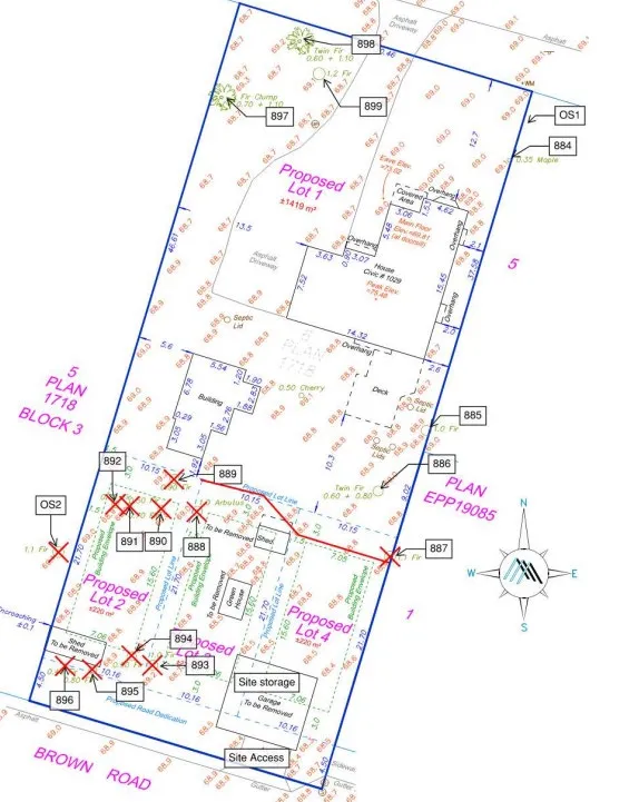
Figure 1. Site Plan. Red lines indicate Tree Protection Fencing. See Appendix C for Tree Protection Fencing specifications.

Figure 2. 1029 Marwood Property frontage.
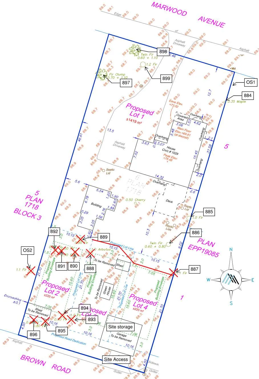
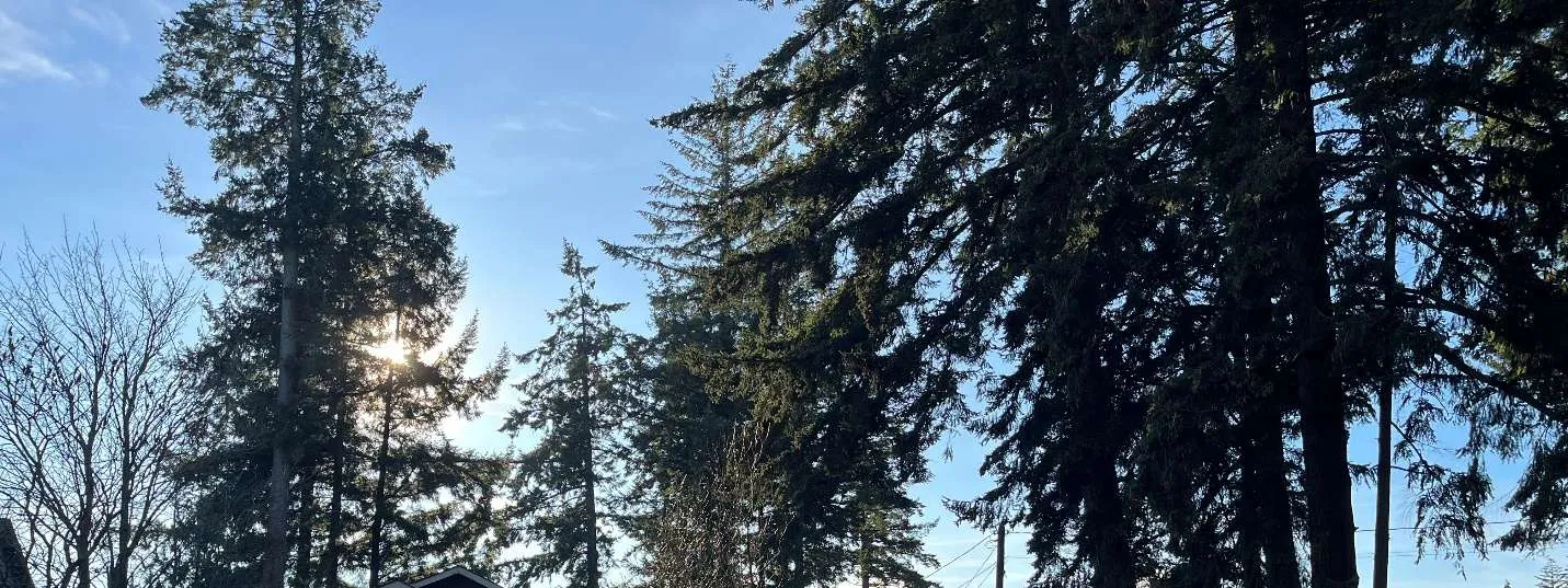
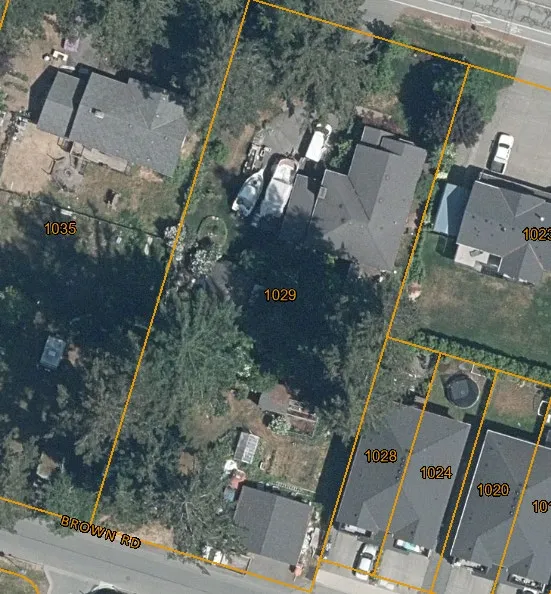
Figure 3. Rear (Brown Road) property frontage.
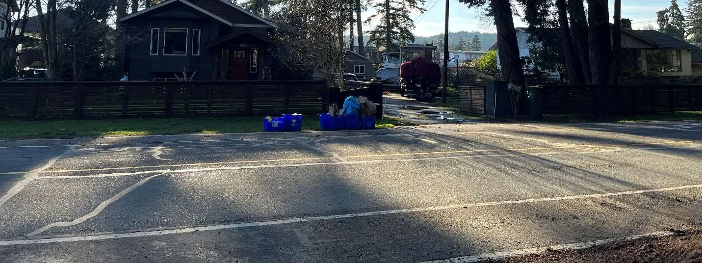
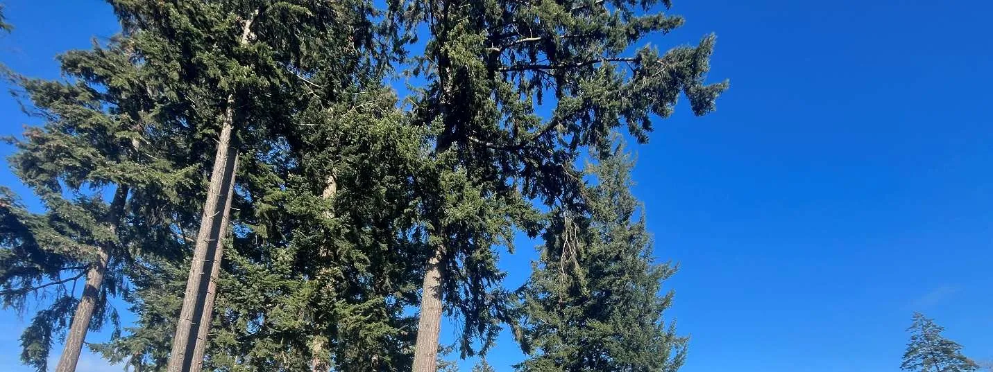
Figure 4. View of proposed lots 2 and 3.
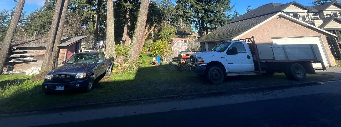
Figure 5. Northeastern side of Lot 4 and southeastern corner of Lot 1.
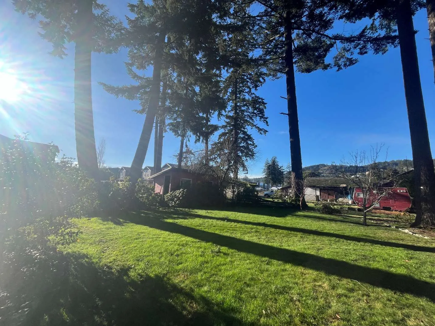
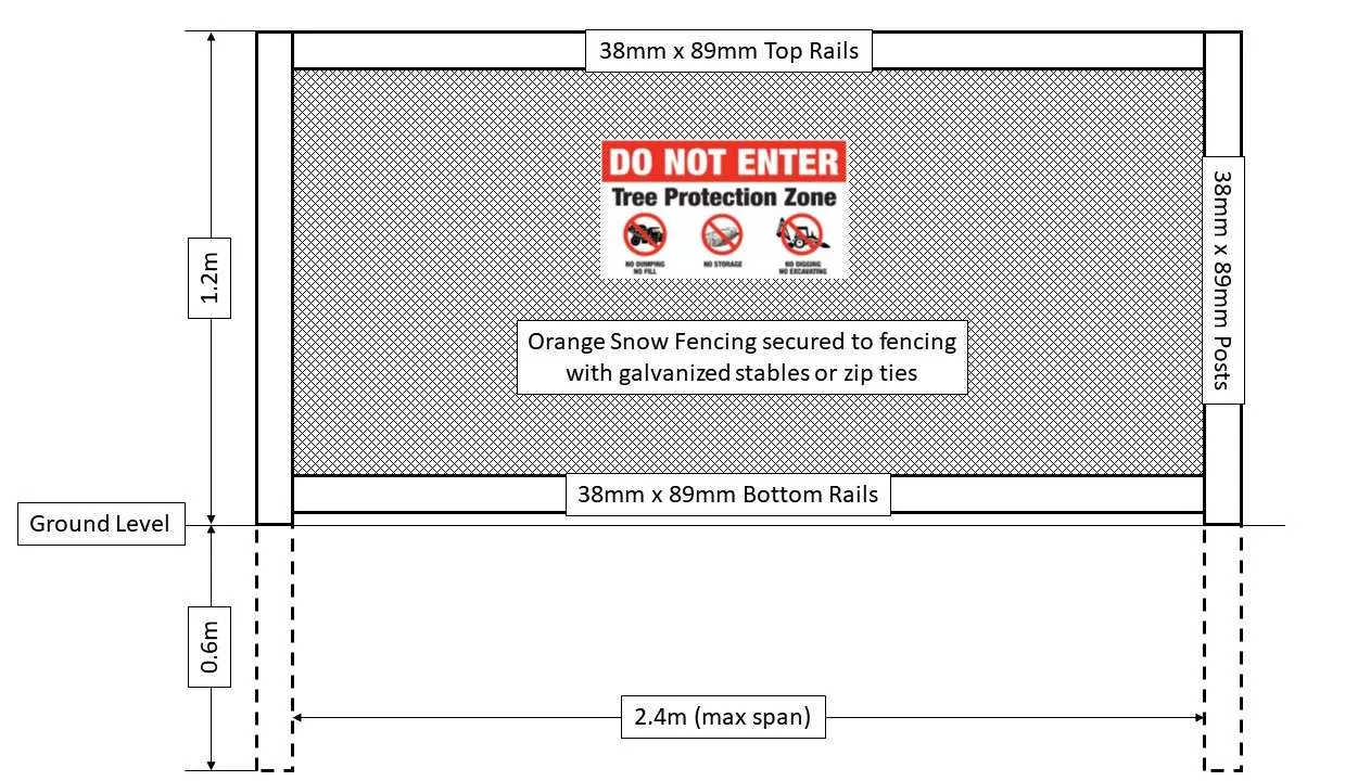
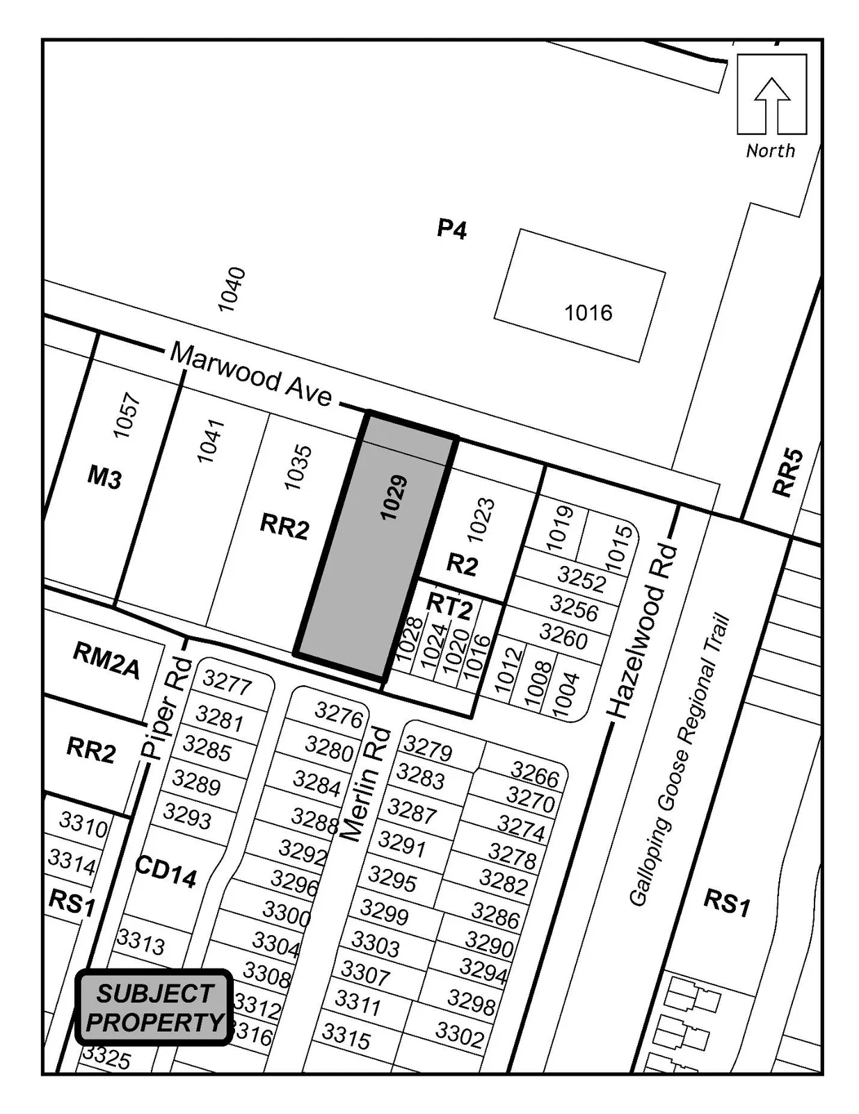
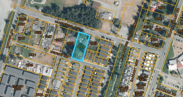
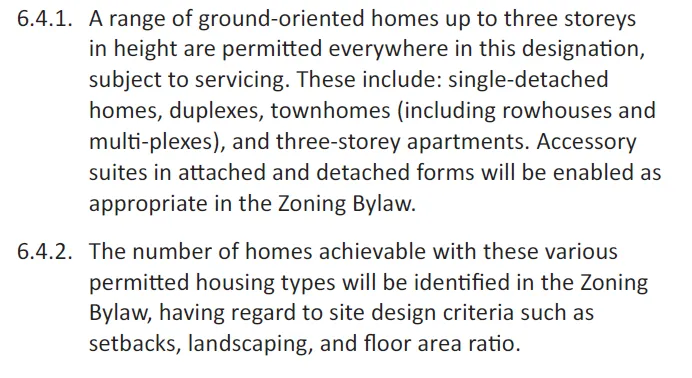
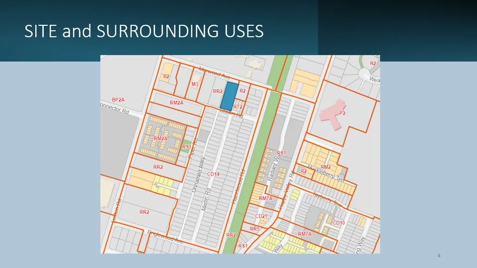
Figure 6. Northern section of Lots 2 and 3.
Appendix ‘C’ — Tree Protection Fencing
Figure 1. Tree Protection Fencing. In rocky areas, metal (t-posts or rebar) drilled into rock will be accepted instead of wooden posts.
- Attach a sign with a minimum size of 407 mm x 610 mm (16” x 24”) with the following wording:
- a) DO NOT ENTER – Tree Protection Zone (for retained trees) or;
- b) DO NOT ENTER – Future Tree Planting Zone (for tree planting sites).
- These signs must be affixed on every fence face or at least every 10 linear meters.
CITY OF LANGFORD — Bylaw No. 2250 (Amendment No. 754) — Excerpt
A BYLAW TO AMEND BYLAW NO. 300, “LANGFORD ZONING BYLAW, 1999"
The Council of the City of Langford, in open meeting assembled, hereby enacts as follows:
A. Langford Zoning Bylaw No. 300, 1999 is amended as follows:
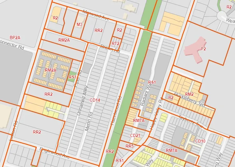
By deleting from the RR2 (Rural Residential 2) Zone and adding to the RS1 (Residential Small Lot) Zone the property legally described as Lot 6, Block 3, Section 86 and 87, Metchosin District, Plan 1718, PID No. 006-820-123 (1029 Marwood Avenue); as shown shaded on Schedule A attached to and forming part of this Bylaw.
By deleting section 6.20.02(2) and replacing it with the following:
“Despite Subsection 6.20.02(1), on land whose legal description is set out in Table 1 Schedule AD, the minimum lot area for subdivision may be 200 m² (2,153 ft²) if the owner of the land proposed to be subdivided:”
- By adding the following to Table 1 of Schedule AD:
| Zone | Bylaw No. | Legal Description | Amenity Contributions | Eligible for Reduction in Section 2 of Schedule AD |
|---|---|---|---|---|
| RS1 | 2250 | Lot 6, Block 3, Section 86 and 87, Metchosin District, Plan 1718, PID No. 006-820-123 (1029 Marwood Avenue) | a) $660 per new lot created, with a lot area under 550m², towards the Affordable Housing Reserve Fund; b) $3,960 per new lot created, with a lot area under 550m², towards the General Amenity Reserve Fund; and | No |
B. This Bylaw may be cited for all purposes as “Langford Zoning Bylaw No. 300, Amendment No. 754 (1029 Marwood Avenue), Bylaw No. 2250, 2025".
READ A FIRST TIME this day of, 2025.
READ A SECOND TIME this day of, 2025.
READ A THIRD TIME this day of, 2025.
APPROVED BY THE MINISTRY OF TRANSPORTATION AND TRANSIT this day of, 2025.
ADOPTED this day of, 2025.
Rezoning Proposal — 1029 Marwood Avenue (SDAC January 19th, 2026)
INTRODUCTION
- Application to rezone 1029 Marwood Ave. from the existing RR2 Rural Residential Zone to the Residential Small Lot RS1 Zone to create 3 new lots now, and potential subdivision of the remainder in the future.
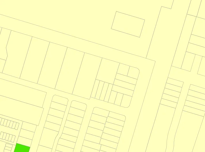
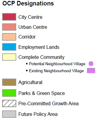
- Complies with the Official Community Plan for the “Complete Communities” designation for a variety of housing choices.
- No variances requested.
OCP COMPLIANCE
- The property lies within the Complete Communities OCP designation.
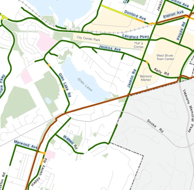
SITE and SURROUNDING USES

EXISTING CONDITIONS
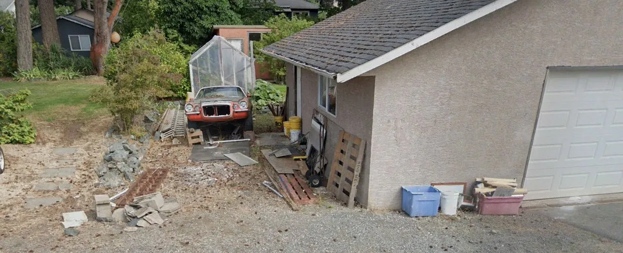
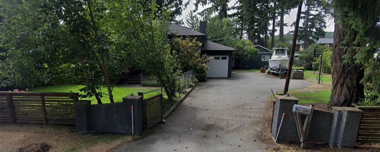
- Existing Home & Outbuildings
- View from Marwood Ave
- View from Brown Ave.
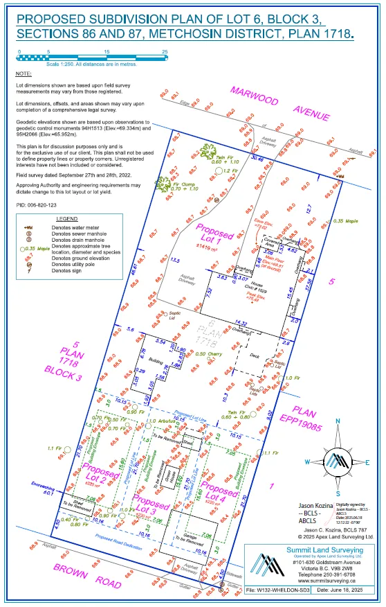
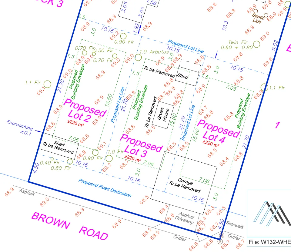
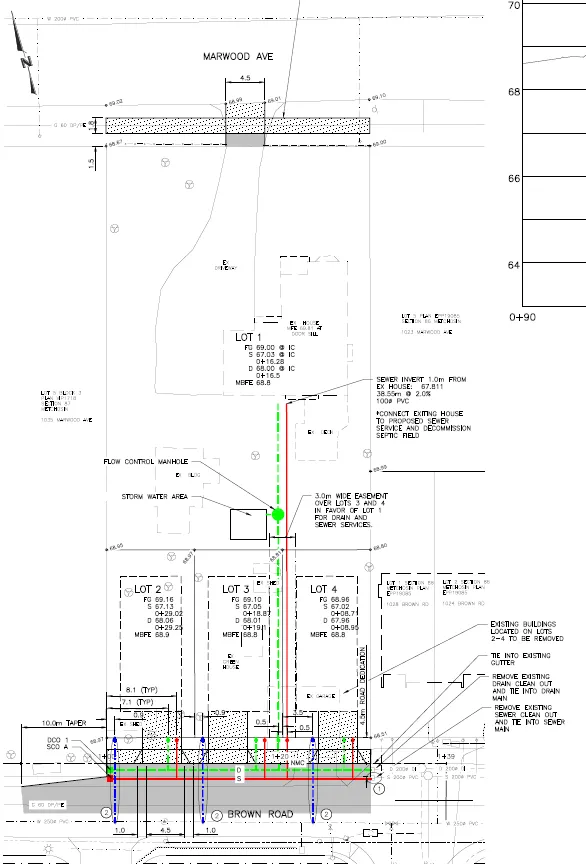
PROPOSED SUBDIVISION
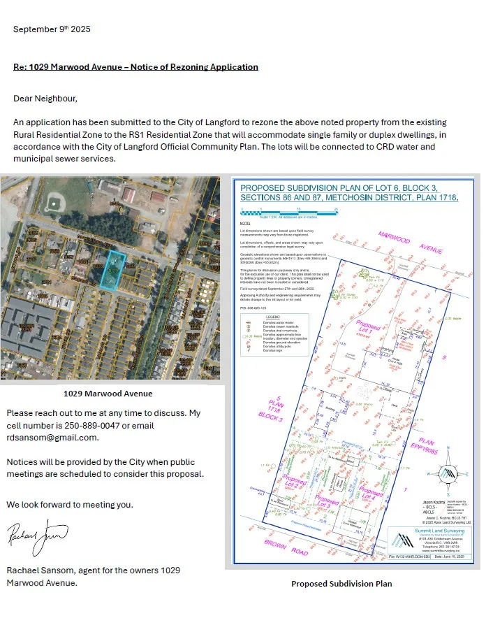
- 3 lots 220 m² each
- 4.5 m Road Dedication
(Plan of Subdivision shown in presentation — see slides)
PROPOSED SUBDIVISION CONCEPT
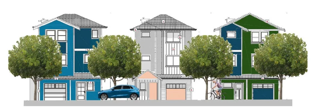
- The RS1 Zone allows 3 storey homes with secondary or garden suites.
- Each home will have a minimum of 1 parking space per bylaw (likely 2) plus a separate parking space for the secondary suite.
- If SSMUH was applied here, each lot could have 3 units.
SITE SERVICING and CONSTRUCTION
- West Shore Environmental Sewer Service Available.
- CRD Water for domestic and fire fighting.
- Frontage works and sidewalks on both Marwood and Brown Avenues.
- Storm Water to be managed per Bylaw 1000.
- All services to be underground.
- “Good Neighbour” Construction practices will be employed for noise, dust and mud control. Minimal blasting is expected.
- Trades parking will be on site.
TREE RETENTION PLAN
- 18 Bylaw protected trees
- 11 to be removed
- 7 to be retained
- Neighbour has consented to removal of OS2, as roots may be impacted
GREEN CHECKLIST
- 7 trees to be retained.
- Electric heat pumps for reduced fossil fuel dependency.
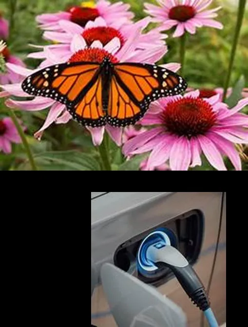
- EV Charger ready in each garage.
- Built to the Step Code of the day for residential construction.
- Carbon sequestered concrete for foundations.
- Long lasting low maintenance exteriors.
- Energy Star appliances.
ACCESSIBILITY / CONNECTIVITY
- Access to cycling facilities and the Galloping Goose Trail nearby.
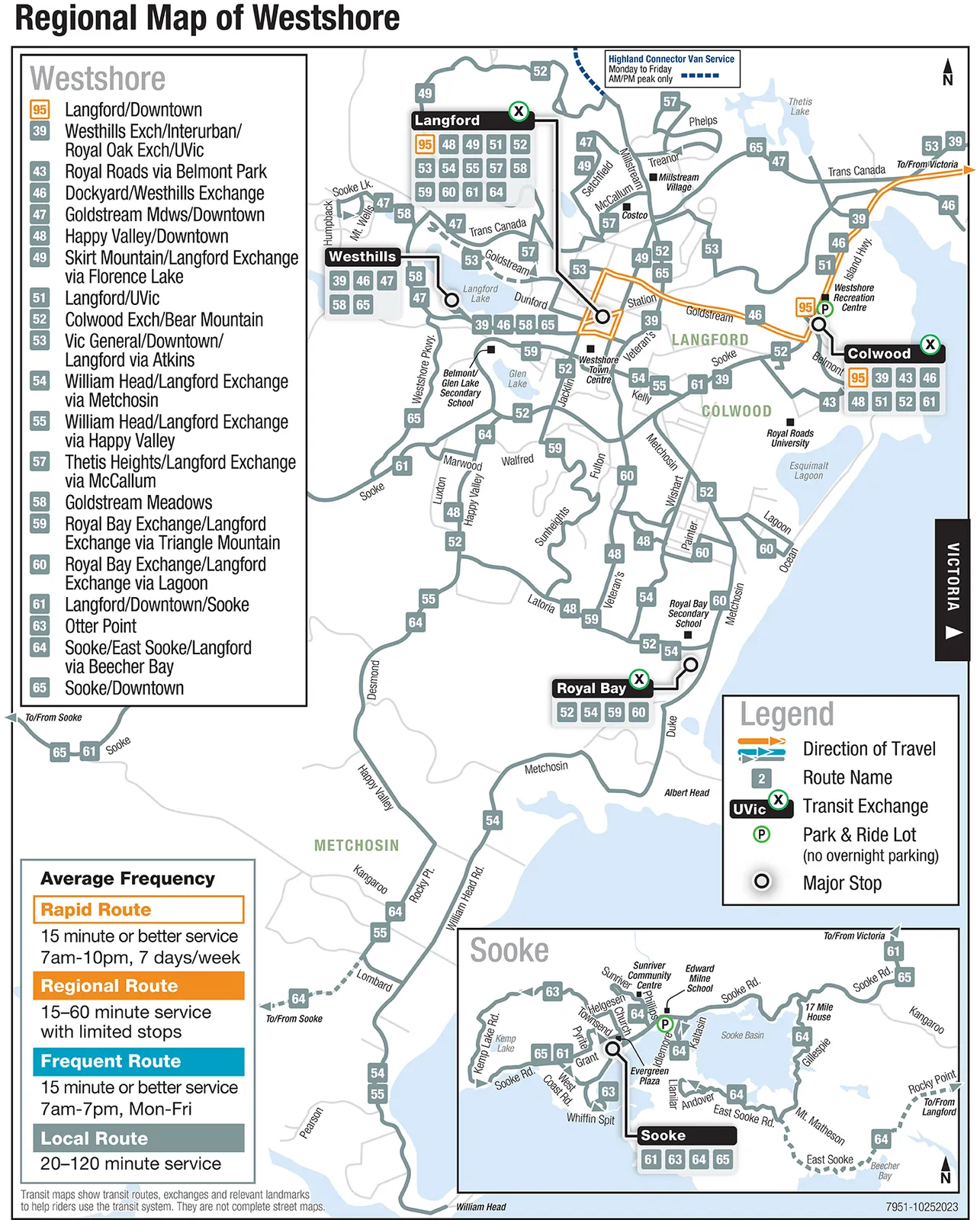
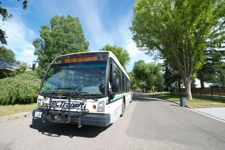
- B.C. Transit available Happy Valley (Routes 52, 48 and 64) and Sooke Road (Route 52).
NEIGHBOURHOOD CONSULTATION
- Notices were distributed to the neighbourhood by the owner in September 2025. No objections to the development were voiced at that time.
1029 MARWOOD AVENUE — THANK YOU FOR YOUR TIME
(End of pages 45–79 extract.)