DocumentsAppendixJul 20, 2026Page 95
Future Cycling and Micromobility Network
Appendix map showing the future cycling and micromobility network proposed in the Active Transportation Plan.
Schedule B: Future Cycling and Micromobility Network
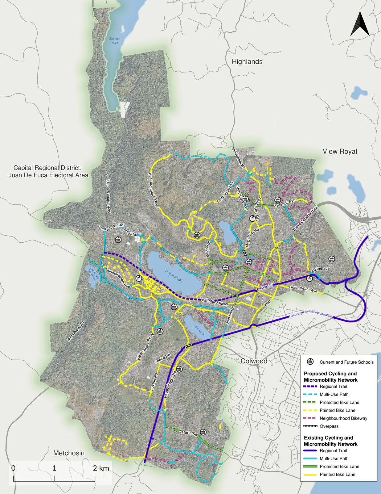
Map labels
Communities and areas: Saanich Inlet; Highlands; View Royal; Capital Regional District: Juan De Fuca Electoral Area; Colwood; Metchosin.
Roads and trails: Trans-Canada Hwy; Millstream Rd; Bear Mountain Pkwy; Echo Valley Dr; Sooke Lake Rd; Amy Rd; Humpback Rd; Constellation Ave; Leigh Rd; McCallum Rd; Treanor Ave; City Gate Blvd; Atkins Ave; Goldstream Ave; Langford Pkwy; E & N Trail; VMP; West Shore Pkwy; Sooke Rd; Happy Valley Rd; Luxton Rd; Latoria Rd; Galloping Goose Regional Trail.
Water features: Langford Lake; Glen Lake; Saanich Inlet.
Scale: 0–2 km
Map legend
| Category | Network type |
|---|---|
| Current and Future Schools | School locations |
| Proposed Cycling and Micromobility Network | |
| Regional Trail | |
| Multi-Use Path | |
| Protected Bike Lane | |
| Painted Bike Lane | |
| Neighbourhood Bikeway | |
| Overpass | |
| Existing Cycling and Micromobility Network | |
| Regional Trail | |
| Multi-Use Path | |
| Protected Bike Lane | |
| Painted Bike Lane |
Page 95
Extracted from: Active Transportation Plan FINAL 20260717