DocumentsAppendixJul 20, 2026Pages 5–50
FORM & CHARACTER DEVELOPMENT PERMIT AREA GUIDELINES — Schedule A
Design guidelines for form and character development permit areas in Langford, covering the permit process, site planning, architecture, landscape architecture, special considerations, and design examples.
Key facts
- Schedule A
- July 2026
- Guidelines cover site planning, architecture, landscape architecture, and special considerations
FORM & CHARACTER DEVELOPMENT PERMIT AREA GUIDELINES
JULY 2026
Schedule A
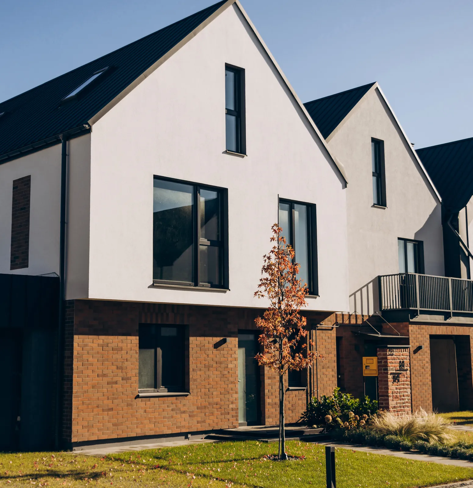
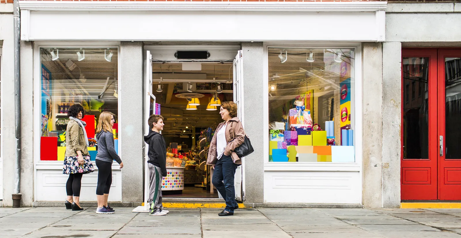

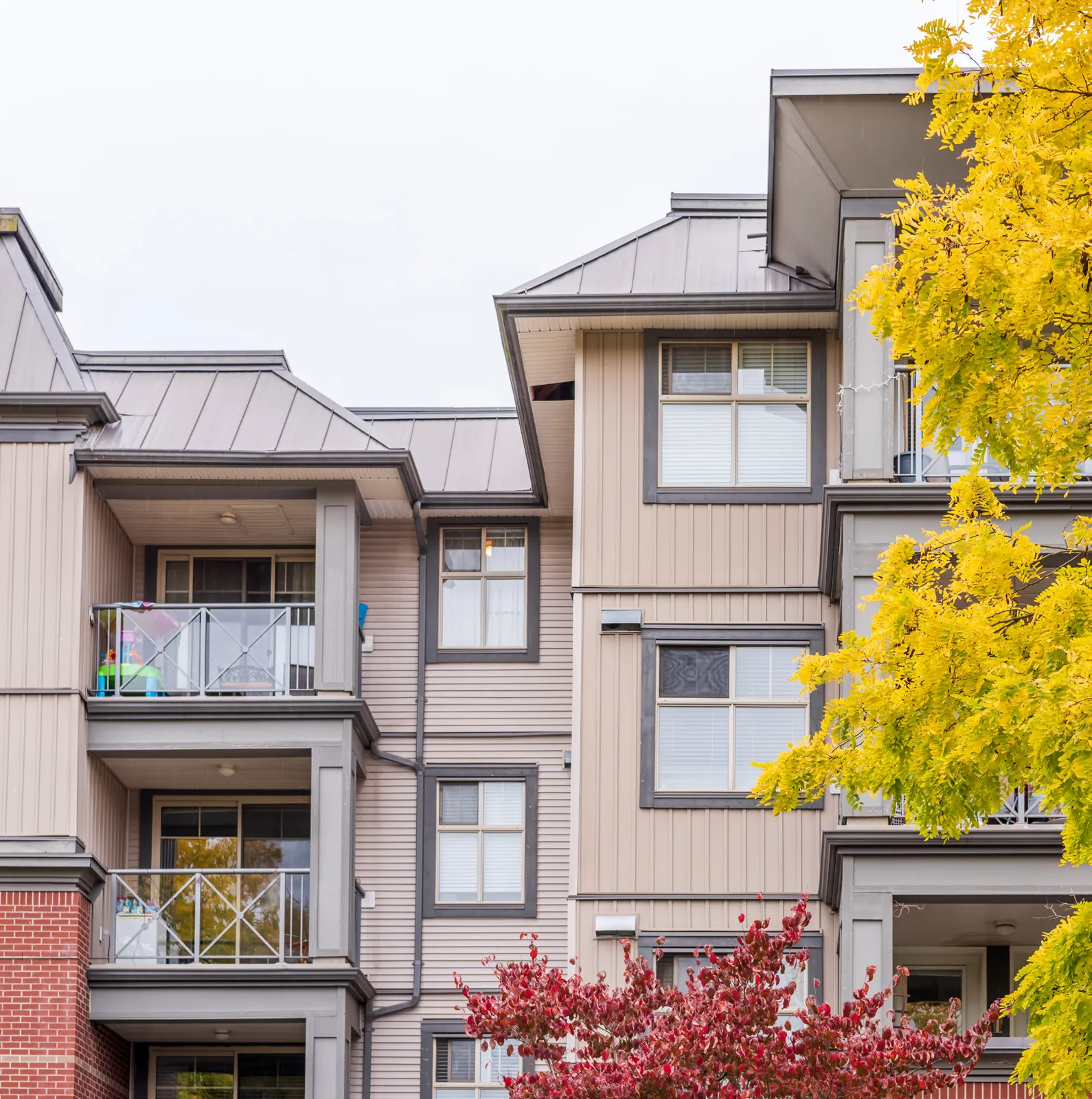
Table of Contents
- DPA Process — 1
- Introduction — 7
- Site Planning Guidelines — 11
- Architecture Guidelines — 15
- Landscape Architecture Guidelines — 19
- Special Considerations Guidelines — 23
- Design in Practice — 27
DPA Process
This section outlines how the Development Permit Area (DPA) for Form & Character (i.e. “Design Guidelines”) are applied as part of the DPA process; and identifies submission requirements.
1. Procedure
1.1 Where land has been designated in the Official Community Plan as a “Development Permit Area”, the landowner must obtain a Development Permit, authorized for issuance by a resolution of Council, before developing the land.
1.2 A Development Permit may not vary use, density or floodplain provisions. Where an area is designated as a Development Permit area, the following apply unless the owner first obtains a Development Permit:
a. The land within the area shall not be subdivided;
b. Construction of, or addition to, a building or structure shall not be commenced;
c. Land must not be altered (including site clearing, tree/vegetation removal, blasting, and/or landscaping) when it is within an area designated for:
i. Protection of the natural environment, its ecosystems and biological diversity; or
ii. Protection of development from hazardous conditions;
d. Land, or a building or structure, on a Provincial or municipal heritage site shall not be altered; and
e. Land, or a building or structure on that land, must not be altered when it is within an area designated for:
i. Revitalization of an area in which a commercial use is permitted; or
ii. Establishment of objectives to promote: energy conservation, water conservation, or reduction of greenhouse gas emissions.
1.3 A Development Permit must not vary the application of a zoning bylaw in relation to residential rental tenure.
1.4 A Development Permit issued must be in accordance with the stated guidelines. However, all guidelines may not be applicable in every permit. In situations where a guideline is not appropriate to the particular circumstances, Council may deem the guideline not applicable. Council may also issue a Development Permit which varies or supplements a regulation of the Zoning Bylaw.
1.5 The Director of Community Planning and Development may consider minor variances to the regulations of the Zoning Bylaw as part of a Development Permit application when the proposed variance optimizes the site’s functionality and results in a built form that demonstrably fulfills the intent of the Form and Character Design Guidelines.
2. DPA Application Submission Requirements
2.1 Applicants are required to provide a checklist or statement of intent to indicate how their proposal complies with these guidelines. Where some element of the design does not comply, a justification stating the divergence and reason shall be made. Council may diverge from these guidelines where a compelling rationale that preserves the qualitative intent of the guidelines is supplied.
2.2 Pursuant to the City of Langford Development Approval Information Bylaw, every application for a Development Permit should be accompanied by plans dimensioned in metric units, indicating the following, as applicable, as well as the information noted in the Guidelines:
a. Location of all buildings and structures;
b. Siting of parking areas, driveways, and loading bays;
c. Extent and nature of landscaping, including details of trees to be removed, retained or proposed to be planted in accordance with the City of Langford Landscape Policy;
d. The exterior finish, materials, and colour of buildings and roofs;
e. Location, number, and type of signage;
f. Professional reports/studies prepared by the appropriate qualified professional;
g. Lot grading plan; and
h. Preliminary engineered frontage drawings.
2.3 The City may require security in accordance with Section 502 of the Local Government Act to ensure the installation and maintenance of landscaping or environmental restoration/compensation is in compliance with these guidelines.
2.4 Evaluation of an application—including all technical review and referral stages—will only commence once full payment of applicable fees, as prescribed by Development Procedures Bylaw No. 209, is received by the City. Review will remain pending until such payment is satisfied.
3. Exemptions
3.1 Notwithstanding the designation of an area as a Development Permit Area, the Local Government Act provides that conditions may be specified under which a Development Permit is not required.
a. A Development Permit may not be required for the subdivision of land, provided that the Approving Officer for the City of Langford and the Director of Community Planning and Development are satisfied that there will be no alteration of the land associated with, or directly resulting from, the plan of subdivision unless a Development Permit is subsequently applied for and obtained;
b. A Development Permit is not required for subdivisions that are lot line adjustments, subdivisions for park purposes, or for lot consolidation;
c. A Development Permit is not required for Institutional development within any revitalization area.
d. For any multi-family residential (including two-family), intensive residential, commercial, and industrial/business park use, a Development Permit is not required in the case of:
i. Minor alterations to the exterior of a building or structure that do not change the form or character of the development;
ii. Minor accessory buildings (excluding carriage and garden suites) and additions that are consistent with the architectural theme (form, character, materials, and colour scheme) of the proposed or existing building, provided that they are not in an Environmental Protection or Hazardous Area Development Permit Area (unless eligible for an exemption);
For the purpose of this Section, “minor” is defined as a change which does not do any of the following:
- Alter the site coverage by more than 5% of the approved amount (based on the site coverage of all buildings);
- Comprise more than 10% of the total gross floor area of all buildings on the site or more than 185.8 m2 (2,000 ft2) of gross floor area, whichever is less;
- Change the colour scheme or materials of building exteriors; and
- Increase any bylaw non-conformities.
iii. Changes to landscaping, such as the removal and replacement of shrubs or the removal and replacement of hazardous trees in accordance with the Tree Protection Bylaw;
iv. Intensive Residential subdivisions where 3 or fewer lots smaller than 400 m2 are created;
v. Temporary buildings or structures that are erected as offices for construction or marketing purposes for a period that is not expected to exceed the duration of such construction;
vi. The erection of temporary tent structures, provided:
a. That a building permit has been issued with respect to the tent structure, where required;
b. That the tent structure is accessory to a commercial, business park, or industrial use occurring on the same property;
c. That the applicant has deposited with the City of Langford a bond, to the satisfaction of the Director of Community Planning and Development, sufficient to allow for the removal of the structure; and
d. That the structure does not remain in use for a period of more than 14 days.
e. For areas designated within a revitalization area, a Development Permit is not required for alterations or demolition of existing one- or two-family dwellings.
Introduction
This section explains the organization of the Development Permit Area (DPA) Guidelines for Form & Character – a.k.a. “Design Guidelines” – and how they are intended to be used in concert with other municipal land use planning documents, including: the Official Community Plan (vision and policy); the Zoning Bylaw (development regulation); and other DPA requirements (guidelines).
The following pages outline how the DPA Guidelines for Form & Character are structured, how different sections relate to one another, and how applicants, staff, and decision-makers should navigate the document.
Four placemaking principles give direction to the interpretation of guidelines and provide the foundation for future design decisions across Langford.

About Langford
Langford is a rapidly growing and evolving city, shaped by its natural setting, emerging urban centres, and strong connections to the surrounding region. As one of the fastest-growing communities in British Columbia, Langford is experiencing significant change in the scale, form, and diversity of new development.
These Design Guidelines are intended to support that growth by providing clear direction on how development can contribute positively to Langford’s character, livability, and long-term vision. They help ensure that as the city grows, new buildings and neighbourhoods reflect local values, respond to context, and contribute to well-designed, connected places.
Relationship to Other Regulations
Development in Langford is guided by a series of municipal documents that work together to shape growth and change. Understanding how these documents relate to one another will help applicants navigate the approvals process more clearly and efficiently.
The Official Community Plan (OCP) is Langford’s primary visioning document. It sets out the long-term vision for the city and establishes policies related to land use, growth, housing, transportation, sustainability, and community character. All development in Langford is expected to align with the direction and intent of the OCP.
The Zoning Bylaw translates this vision into regulations that determine what can be built on a specific site. Zoning identifies permitted uses, density, height, setbacks, and other quantitative standards. Applicants should first confirm that a proposed development complies with the applicable zoning or determine whether a rezoning is required.
The Form and Character Design Guidelines build on both the OCP and zoning by providing direction on how development should be designed. The guidelines address site planning, building design, landscape treatment, and other considerations that influence how development fits within its context and contributes to the public realm. While zoning establishes the parameters of development, the guidelines shape its quality, character, and relationship to surrounding areas.
The Environmental Protection and Hazardous Area Guidelines also build on both the OCP and zoning by providing direction on how development should be designed and laid out to integrate natural features into the site and to avoid or mitigate potential impacts from natural hazards. The guidelines address site planning and layout, measures to prevent encroachment or adverse impacts during construction, and considerations to ensure the long-term protection and function of retained natural features.
Together, these documents are intended to support a coordinated and predictable approvals process, helping applicants design proposals that align with Langford’s vision with flexibility in how that vision is achieved.
Principles for Placemaking
Design guidelines play an important role in shaping how places look, feel, and function. In Langford, the guidelines are informed by four placemaking principles that reflect the community’s aspirations for growth and development:
HONOURING PLACE
Growth that builds with, not over, what already exists.
Langford’s character is shaped by its land, water, forest, and layers of recent and ongoing change. Placemaking recognizes and reveals these underlying conditions—natural systems, topography, history, and everyday patterns of use—and requires that development respond to place in order to avoid more generic results.
BUILDING RESILIENCE
Growth that creates lasting value.
Sustainable development means thinking beyond current constraints, individual site boundaries and limited project timelines. It prioritizes opportunities for repair and lasting value beyond efficiency and fixed solutions. Placemaking supports a resilient city that responds to climate, growth, and changing community needs.
FOSTERING CREATIVITY
Development that makes room for expression, experimentation, and adaptability.
Langford’s evolving identity benefits from creative approaches that are rooted in authenticity and a ‘can-do’ attitude. Placemaking encourages art, architecture, and interim conditions that explore new ideas, celebrate local culture, and embrace creativity and adaptability as a civic asset.
CREATING CONNECTION
Development that brings people and places together.
As Langford grows incrementally, placemaking should strengthen physical, social, and visual connections—linking streets to landscapes, buildings to public life, and new development to what surrounds it. Each project contributes a thread to a larger urban fabric that becomes more legible, walkable, and cohesive over time.
How To Use This Document
Applicants should review each section early in the design process and consider how the Design Guidelines (“Guidelines”) apply to their specific site and proposal. Guidelines apply city-wide under a single Development Permit Area (DPA). DPA applications should clearly demonstrate how proposals respond to the guidelines.
This document is intended to be used as a helpful and practical guide to inform the design of development proposals.
The Guidelines are organized into the following four sections, organized according to logical sequence (that considers place, context, built form and quality):
- Site Planning
- Architecture
- Landscape Architecture
- Special Considerations
Throughout the document, visual examples and citations to additional sources are provided to help explain the intent of the guidelines and show how they may be applied in different development contexts.
The final section, Design in Practice, illustrates how the guidelines are considered holistically, in context and applied across a diversity of land uses and locations. Illustrations and images are intended to support understanding and interpretation and do not prescribe design outcomes or replace regulatory requirements.
Site Planning Guidelines
Site planning shapes how development is experienced at the ground level—how buildings relate to streets, how people move through a site, and how private development contributes to the public realm. Rather than focusing on use or density, these considerations influence everyday qualities such as safety, comfort, and access as Langford continues to grow and evolve.
OBJECTIVES
The guidelines that follow are organized around the following site planning objectives:
- Respecting relationships
- Organizing space
- Prioritizing people
- Integrating spaces, access and circulation
S.1 Respecting relationships (across space and time)
INTENT: Designs should reflect an understanding of context within—and relationship among—natural, cultural and built environment, including consideration for the incremental phasing of development over time.
S1.1. Respond to historical patterns of use, movement, and naming by integrating nomenclature and interpretive design elements—such as architectural or landscape references—that reflect the site’s evolution and strengthen its unique character and sense of place.
S1.2. Design site planning to respond to adjacent activities, land uses, and physical constraints, reinforcing positive relationships while mitigating potential conflicts.
S1.3. Locate development and open space in a manner consistent with future growth management and/or conservation priorities.
S1.4. Preserve and incorporate defining natural features—such as landforms, watercourses, mature trees, and vegetation—into site planning and open space design.
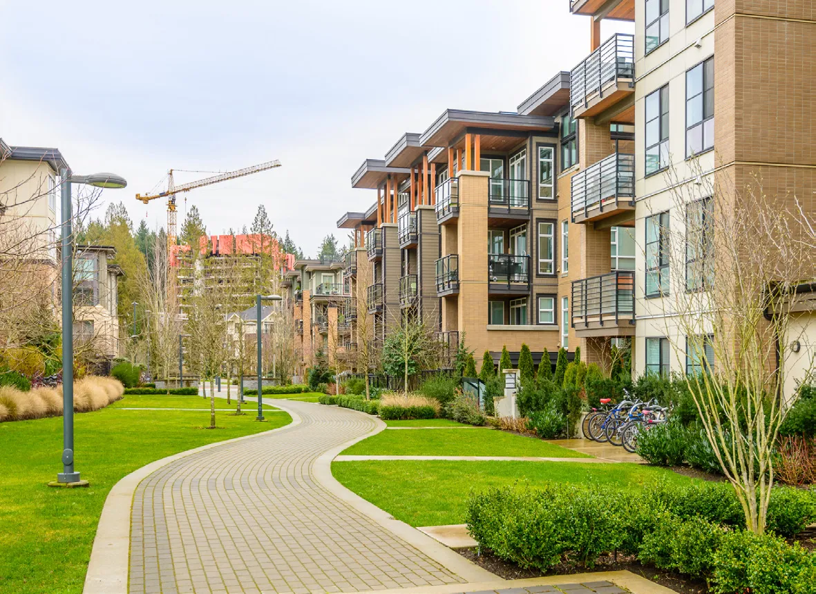
S1.5. Organize development and open space to provide meaningful, safe, and equitable access to nature.
S1.6. Promote long-term site integration by ensuring that development infrastructure and phasing do not create physical, ecological, or functional barriers to future connectivity, through the incorporation of strategic utility extensions, street connections, and coordinated landscape corridors.
S.2 Organizing Space
INTENT: Designs should demonstrate consideration for how built forms and proposed uses shape open space.
S2.1. Consider views to defining natural landmarks, including ridgelines, mountain and hilltops, and water, in the placement, orientation and massing of buildings.
S2.2. Use building placement and orientation to define, frame, and activate public spaces such as streets, parks, and plazas, reinforcing their role as primary public gathering areas.
S2.3. Locate small-scale commercial frontages along streets and public spaces to support activity, transparency, and frequent pedestrian interaction.
S2.4. Locate surface parking, storage, loading, and service functions away from primary streets and public spaces, integrating them discreetly into building and site design to minimize visual and functional impacts.
S.3 Prioritizing people
INTENT: Designs should feel welcoming, safe, accessible, and comfortable.
S3.1. Position gathering spaces to maximize accessibility, visibility, solar access, appropriate shading, and clear wayfinding. Where feasible, prioritize universal access to share open spaces.
S3.2. Establish publicly accessible open spaces as primary organizing elements of site design, prior to building siting and form.
S3.3. Configure development blocks to include interior open spaces that function as private amenities for occupants, including courtyards, landscaped areas, and shared outdoor spaces.
S3.4. Design pathways and trails to strengthen visual and physical linkages to regional landmarks and destination public spaces.
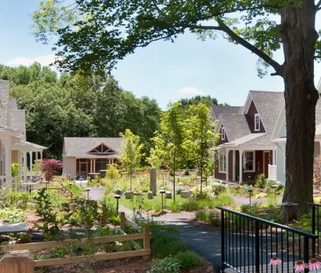
S3.5. Ensure safe, continuous and accessible pedestrian movement through site design and grading, including mid-block connections where appropriate.
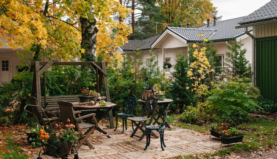
S3.6. Provide level rear yard areas, where practical, to enhance usability and support every day outdoor use.
S.4 Integrating spaces, access and circulation
INTENT: Designs should facilitate intuitive, clear and logical navigation of the built environment.
S4.1. Delineate transitions between the public and private realm with subtle changes in physical design elements, including but not limited to: material shifts, landscaping or minor grade changes.
S4.2. Design site layout, building orientation, and signage to support clear and intuitive wayfinding, ensuring that building entrances, addresses, and circulation routes are legible, visible, and easy to navigate.
S4.3. Locate and design vehicle access, servicing, and parking to minimize conflicts with pedestrian routes and primary public spaces.
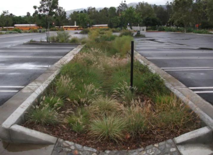
S4.4. Divide parking areas in excess of 10 spaces into smaller groups with landscaping strips capable of holding trees for shading (see landscape guidelines for more information).
Architecture Guidelines
Architecture shapes the visual character and identity of buildings and the places they help define. It influences how streets and neighbourhoods are experienced through building form, facade design, materials and detailing. In Langford, where a wide range of building types and scales are emerging, architectural guidance ensures new development contributes positively to the city’s evolving identity.
OBJECTIVES
The guidelines that follow are organized around the following site planning objectives:
- Design for our climate
- Good neighbours
- Friendly faces
- Appropriate finishes
A.1 Design for our climate
INTENT: Building design should respond to our local climate and support comfort and performance year-round.
A1.1. Incorporate passive solar strategies to optimize building placement, orientation and physical design – including facade articulation, glazing and shading – to enhance energy efficiency and occupant comfort.
A1.2. Integrate weather protection into building design—through canopies, overhangs, recesses, and facade articulation—to enhance pedestrian comfort, support year-round usability, and contribute positively to the public realm.
Refer to BC Housing’s BC Energy Step Code Design Guide for more information on energy efficient design.
A.2 Good neighbours
INTENT: Building designs should thoughtfully respond to the size, shape and quality of their physical surroundings.
A2.1. Demonstrate neighbourliness in architectural design through thoughtful transitions in height, massing, and setbacks where new development interfaces with existing, smaller-scale built form.
A2.2. Design roof forms and upper building elements to contribute positively to the skyline and surrounding views, particularly in prominent or visible locations.
A2.3. Reflect the prevailing fine-grain or established rhythm of surrounding development including through architectural features such as facade articulation, bay widths, and vertical expression.
A2.4. Thoughtfully consider window and balcony design and placement to minimize overlook of private spaces.
A.3 Friendly Faces
INTENT: Building designs should contribute to an active, visible, and welcoming public realm.
A3.1. Shape buildings – through overall scale, massing and articulation – to create comfortable and active public spaces (i.e. parks and plazas).
A3.2. Enhance the streetscape through architectural design that balances material selection with legibility – with particular attention to uses at grade – to support visual interest and clear public–private relationships.
A3.3. Ensure building entrances, primary uses, and circulation are clearly visible and accessible from the public realm through the use of lighting, architectural detail or other design strategies.
A3.4. Create visual interest through well-proportioned window placement and subtle facade articulation that introduces depth, rhythm, and variation while maintaining overall coherence. For multi-building sites, introduce variation in materiality, color, or architectural detailing between buildings to support intuitive wayfinding. Avoid repetitive or mirrored forms that create visual monotony
A.4 Craft and Character
INTENT: Building designs should reflect thoughtful consideration of scale, composition and quality, prioritizing the use of local, durable materials to express the character of Langford.
A4.1. Select architectural finishes that authentically express the building’s use and program, avoiding applied treatments that obscure function or structure.
A4.2. Avoid blank or inactive facades along streets and public spaces.
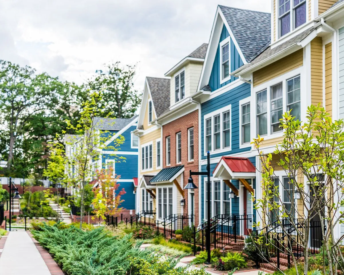
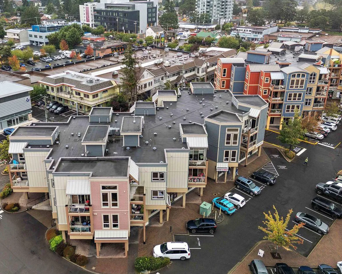
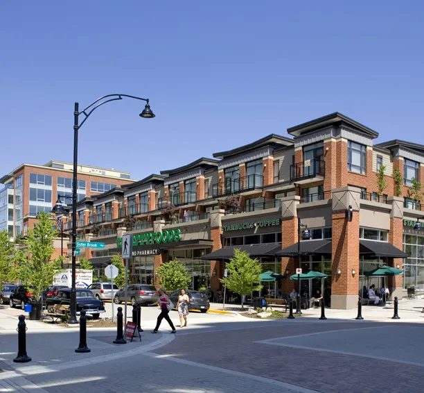
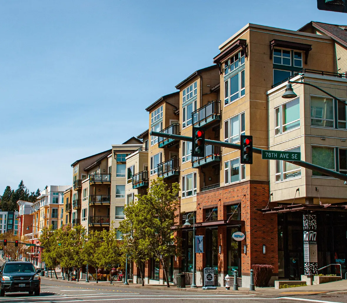
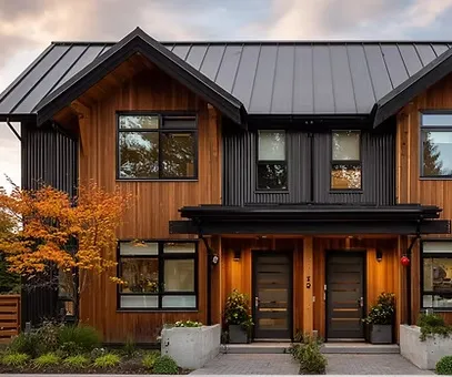
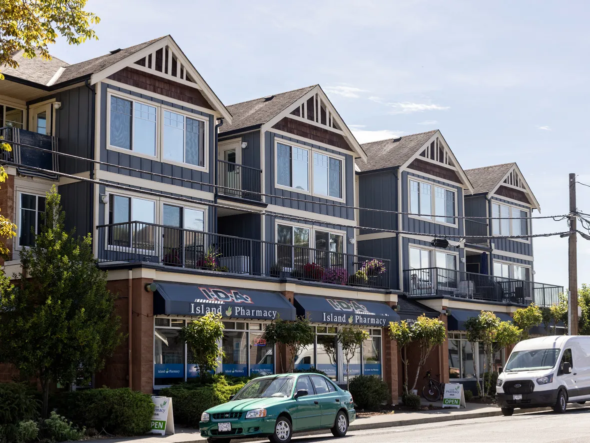
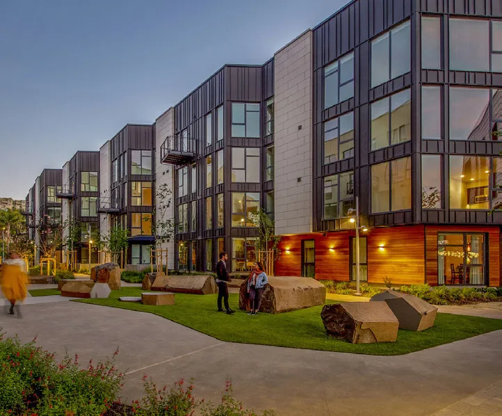
These two images show developments that create visual interest by using changes in colour, massing and materials to break up a large form and present a “friendly face”.
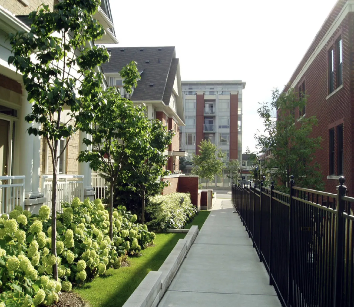
Architecture and landscape design work together to make each unit in this development feel independent from the next. Material changes and plantings add dynamic details.
A4.3. Define a clear base, middle, and top in building design, using setbacks, projections, material variation, and detailing to respond to pedestrian scale at grade and contribute to a coherent overall form.
A4.4. Employ architectural finishes to provide texture, depth and visual interest, particularly at the pedestrian level.
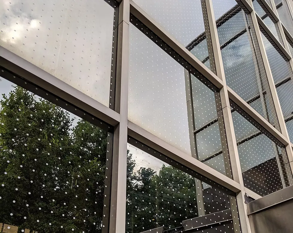
A4.5. Incorporate bird friendly glass and design treatments to minimize bird collisions and minimize light pollution, particularly where continuous expanses of glass are used and/or where glass constitutes a primary exterior finish.
A4.6. Use quality, durable architectural finishes that are appropriate and resilient to local climate conditions and optimize long-term building performance.
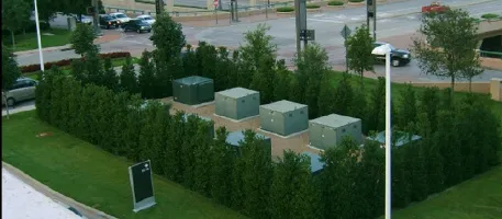
A4.7. Screen rooftop, building-mounted and ground-level mechanical equipment within the overall architectural design to minimize visual impact. Utilize decorative wraps or high-quality architectural enclosures for pad-mounted transformers (PMTs) to ensure these elements are visually integrated into the surrounding landscape and character of the site.
A4.8. Integrate utilities, meters, and service elements into building and site design to minimize visual impact on streets and public spaces.
Landscape Architecture Guidelines
The Landscape Architecture Guidelines focus on the design of outdoor spaces within private realm development sites. It plays a key role in shaping how development contributes to local character, ecological function and creates comfortable outdoor environments for people.
OBJECTIVES
The guidelines that follow are organized around the following landscape architectural objectives:
- Design with nature
- Reveal the beauty of our surroundings
- Protect and enhance our urban forest
- Functional use of landscapes
L.1 Design with nature
INTENT: Landscape designs should seek to improve Langford’s urban ecology.
L1.1. Optimize landscape designs to retain soil, accommodate growth to maturity and reduce heat island effect.
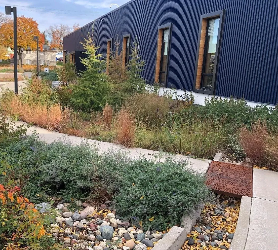
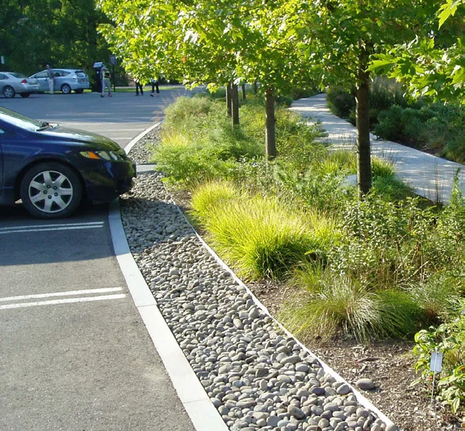
L1.2. Integrate on-site rainwater management strategies that reduce runoff and improve post-development hydrology within and beyond the site boundary.
L1.3. Beyond Provincial Riparian Areas Protection Regulation requirements, enhance adjacent riparian areas through integrated drainage design, increased soil volumes, and ecologically appropriate planting.
L1.4. Prioritize the selection of native and/or similarly well-adapted plants (hardiness and drought tolerance) within planting designs. Artificial turf is discouraged. Invasive species are prohibited.
L.2 Reveal the beauty of our surroundings
INTENT: Landscape design should foster a strong sense of place and streetscape continuity through the creation of context-responsive designs.
L2.1. Celebrate the unique qualities of the site and its surroundings by designing landscape spaces that respond to local context, topography, and views, and that express seasonal change through planting and material selection.
L2.2. Utilize landscape design to enhance sensory experiences through lighting design and planting selection that considers structure, colour and texture.
L2.3. Design landscapes as integrated components of the public realm, contributing to streetscape character, usability, and continuity.
L.3 Protect and enhance our urban forest
INTENT: Landscape designs should protect, retain and grow a healthy urban forest across Langford.
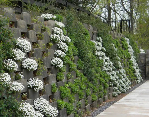
L3.1. Prioritize the retention of existing native soils and healthy trees as a foundational strategy for protecting and enhancing the urban forest.
L3.2. Provide large, contiguous soil volumes to support long-term tree health and the growth of large, mature canopy trees.
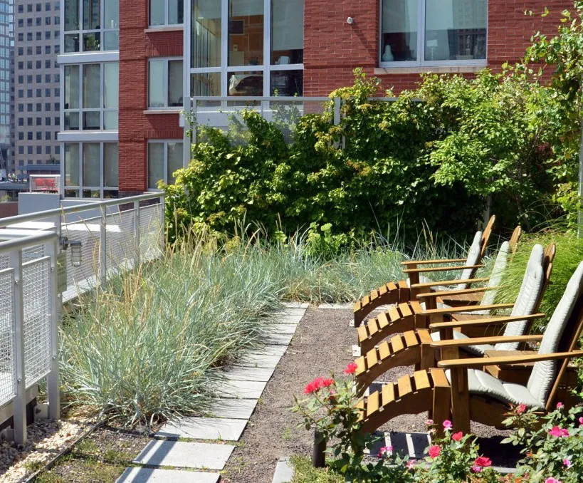
L3.3. Incorporate upper-level outdoor spaces, including terraces, podiums, and rooftops, that are designed to support trees and substantial planting.
L3.4. Where feasible, incorporate structured soil systems (e.g. “Silva Cells” or comparable solutions) to support tree growth in constrained conditions, including bedrock sites and retained hillside environments.
L3.5. Select tree species based on site-specific conditions and long-term suitability, applying a “right tree, right place” approach to ensure resilience, health, and longevity.
L.4 Functional use of landscapes
INTENT: Landscape designs should contribute to community resilience through an emphasis on landscape performance and function.
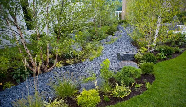
L4.1. Integrate landscape design with on-site rainwater management to support overall site performance, including storage, infiltration, and evapotranspiration.
L4.2. Use landscape design to provide effective screening and buffering between incompatible uses, while maintaining safety, visibility, and overall site legibility.
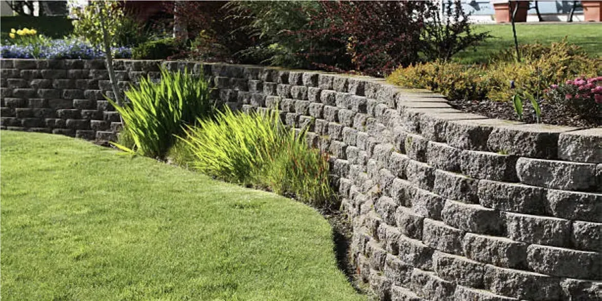
L4.3. Differentiate the public and private realm—without creating visual barriers—by utilizing landscape elements such as:
i. grade transitions / separation;
ii. planting; and,
iii. low screen walls.
L4.4. Design landscape elements to support energy performance (buildings) and comfort (outdoor spaces) by reducing heat gain and wind impacts through buffering and shading.
L4.5. Where appropriate, support designs that accommodate productive, pollinator-friendly landscapes and/or urban agriculture.
L4.6. Mitigate the urban heat island effect and lower ambient site temperatures through the placement of large-canopy trees to maximize shade coverage over expansive heat-absorbent surfaces, such as asphalt parking areas, driveways, and dark hardscapes.
L4.7. Use soil design and composition that supports healthy plant growth, stormwater function, and long-term ecological performance.
L4.8. Design landscapes to be resilient to changing climate conditions, including drought, extreme rainfall, wind and heat.
L4.9. Ensure landscape design considers long-term maintenance, durability, irrigation and lifecycle performance.
Special Considerations Guidelines
This section addresses design elements that cut across site planning, architecture, and landscape architecture, and play an important role in how development functions and is experienced. These elements - such as lighting, signage, parking, and servicing - often have a strong influence on the public realm and usability of development, even when they are not the primary focus.
The Special Considerations guidelines provide direction on how these elements should be integrated thoughtfully and consistently within development sites.
OBJECTIVES
The guidelines that follow are organized around the following objectives:
- Safety first
- Retrofit and repair
- Art in Everyday Life
- Finding Your Way
SC.1 Safety First
INTENT: Designs should create safe, secure, and accessible environments for all users.
SC1.1. Ensure clear, unobstructed emergency access and egress routes are integrated into site and landscape design.
SC1.2. Apply FireSmart principles to building and landscape design to reduce wildfire risk—particularly in interface areas—while maintaining site character and ecological function through:
i. appropriate plant selection;
ii. fuel management;
iii. defensible space; and
iv. fire-resistant materials.
SC1.3. Incorporate Crime Prevention Through Environmental Design (CPTED) principles into site, landscape, and building design by promoting natural surveillance, clear sight lines, clear definition of public vs. private areas, and safe, well-lit pedestrian environments.
SC1.4. Design buildings, landscapes, and public spaces to be universally accessible, with clear, safe, and equitable use for people of all ages and abilities.
SC.2 Retrofit and repair
INTENT: Designs should contribute to the ongoing and incremental evolution of the urban fabric.
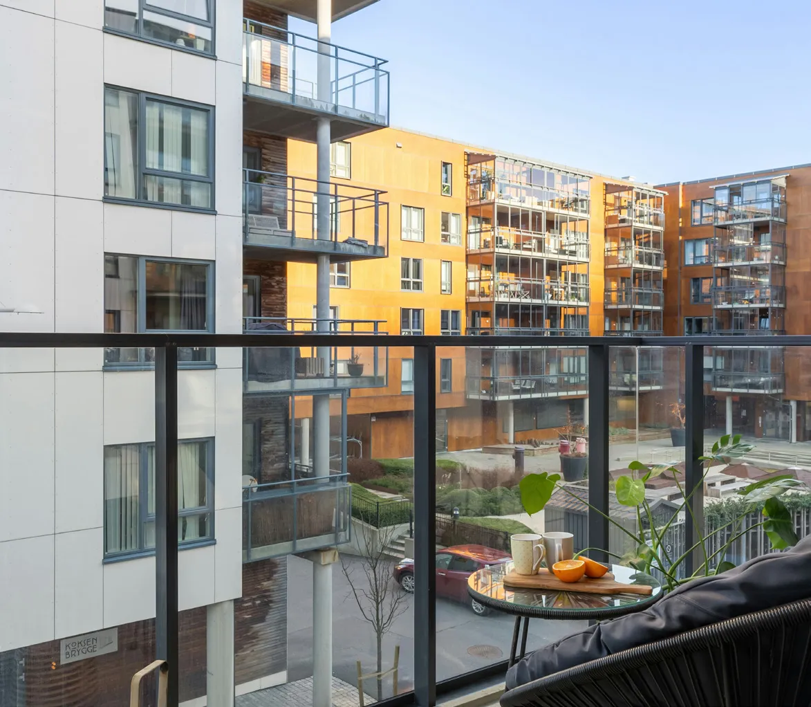
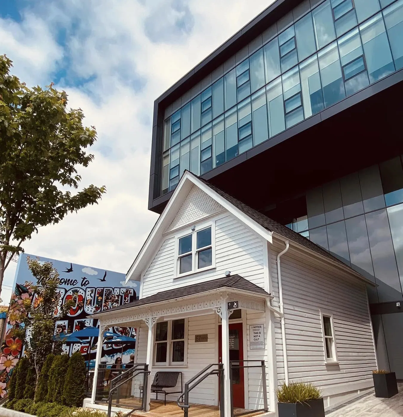
SC2.1. Use redevelopment, renovation, and infill projects to incrementally address legacy conditions and gaps in the urban fabric.
SC2.2. Ensure that transitional, unresolved or undeveloped spaces maintain a basic level of physical and/or visual access and order to support site safety, even where planned improvements have not yet been realized.
SC2.3. Align retrofit and repair interventions with the long-term urban structure, ensuring that short-term improvements reinforce future built form, connectivity and public realm quality.
SC2.4. Design buildings, landscapes, and site edges to accommodate interim conditions, allowing spaces to function safely and legibly while anticipating future build-out and intensification.
SC2.5. Avoid permanent design solutions that respond solely to temporary or transitional conditions in a way that compromises or otherwise encumbers long-term urban form, connectivity, or public realm quality.
SC.3 Art in Everyday Life
INTENT: Designs should accommodate opportunities for public art that reflect local identity and culture.
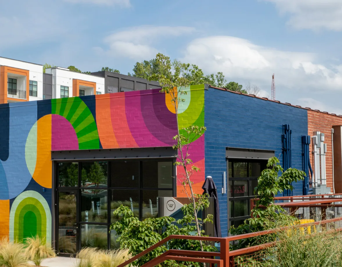
SC3.1. Integrate public art into visible and underutilized areas, including building edges, blank walls, and residual spaces, to enrich the character of the public realm.
SC3.2. Incorporate public art that reinforces and celebrates the unique and authentic qualities of Langford, drawing from local context and culture while avoiding superficial themes or decorative gestures.

SC.4 Finding Your Way
INTENT: Designs should consider day and night-time user needs through lighting and signage to support safety.
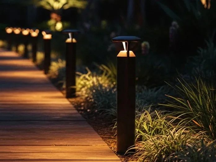
SC4.1. Select and design lighting fixtures as an integrated extension of architectural and landscape expression, ensuring that luminaires contribute to overall form, character, and materiality during both day and night.
SC4.2. Apply Dark Sky lighting principles to minimize light pollution and glare through the use of fully-shielded light fixtures.
SC4.3. Minimize “light trespass” (lighting that negatively impacts adjacent areas) through designs that utilize appropriate light levels, and targeted illumination.
S4.4. Consider signage as an integrated extension of architectural and landscape expression, ensuring that sign scale, placement, materials, and illumination reinforce overall form, character, and legibility rather than distracting from it.
S4.5. Locate community mailboxes, notice boards, and similar shared amenities in visible, convenient locations near primary building entrances.

Design in Practice
This section provides visual examples to demonstrate how the Design Guidelines may be applied holistically, in context and across a diversity of uses, built forms and locations.
Drawings and images are intended to support a broad understanding of the Guidelines through illustration of their application rather than prescribing specific outcomes.
The following examples are for reference only. Illustrations and images do not replace the requirements of the Design Guidelines, Zoning Bylaw, or other applicable regulations.
Ground Oriented Residential
Laneway Access and Infill
Clarity of Public and Private Space
“Friendly” Form & Flexibility
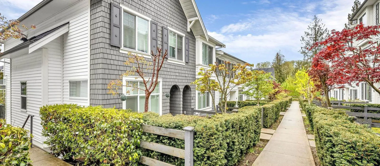
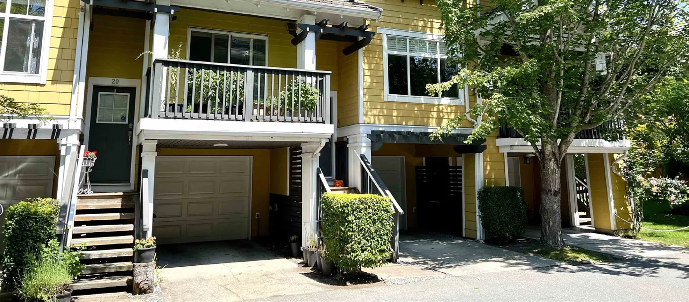
Clarity of Public and Private Spaces
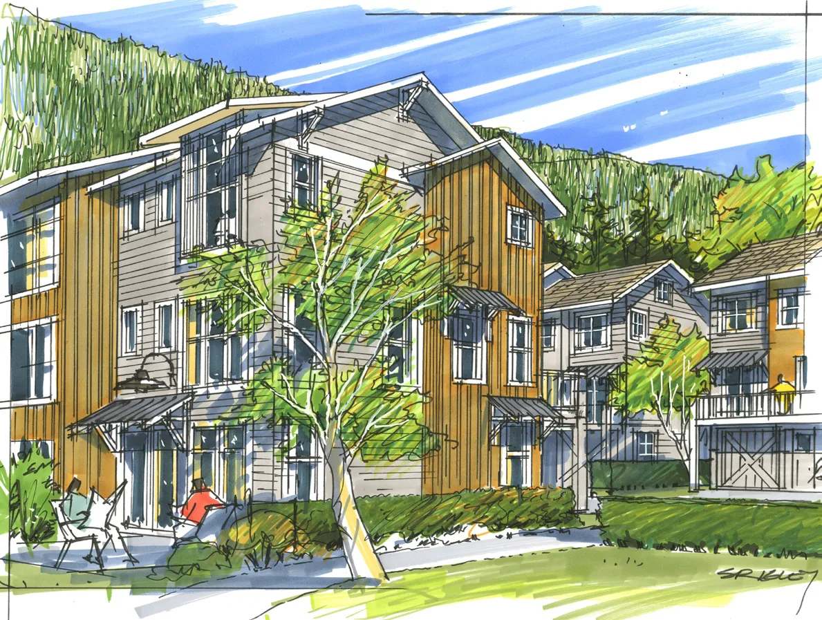
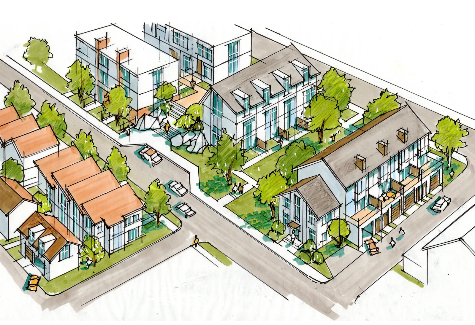
Building and landscape design features – including pathways, changes in grade/elevation, screen walls and plantings – help to more clearly delineate transitions from the public realm (i.e. street) into semi-public /private and private spaces (i.e. residential entryways) while maintaining clear sight lines and supporting natural surveillance.
Laneway Access and Infill
Laneway access offers unique flexibility for urban infill. In the context of ground-oriented residential forms, the thoughtful design of laneway access and infill can support finer-grain pedestrian-oriented circulation (i.e. “woonerfs”) within neighbourhoods. Alternatively, more dense residential forms (i.e. townhouses) can take advantage of laneways to accommodate parking and minimize impacts to public streets.
“Friendly” Form and Flexibility
The form and character of ground oriented residential uses is largely intuitive, defined by the “friendliness” of a front door. Within a general sense of material quality, consistency and continuity of form, the flexibility and adaptability of this form of housing is what also affords its unique individual expression... and ability to engage and contribute to the quality of the adjacent pedestrian realm.
Medium Density Residential
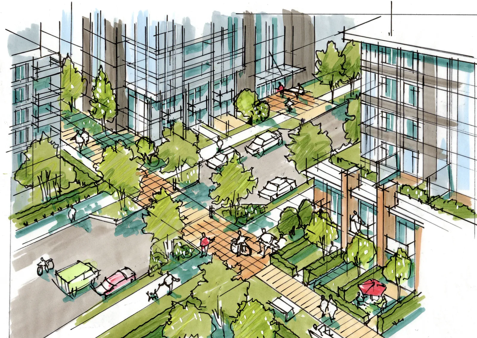
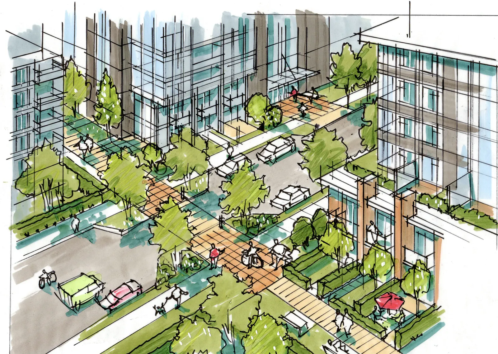
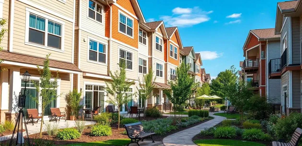
Shared (and Celebrated) Entrances
Human -scale / Street-wall Relationships
Pedestrian Connectivity and Quality
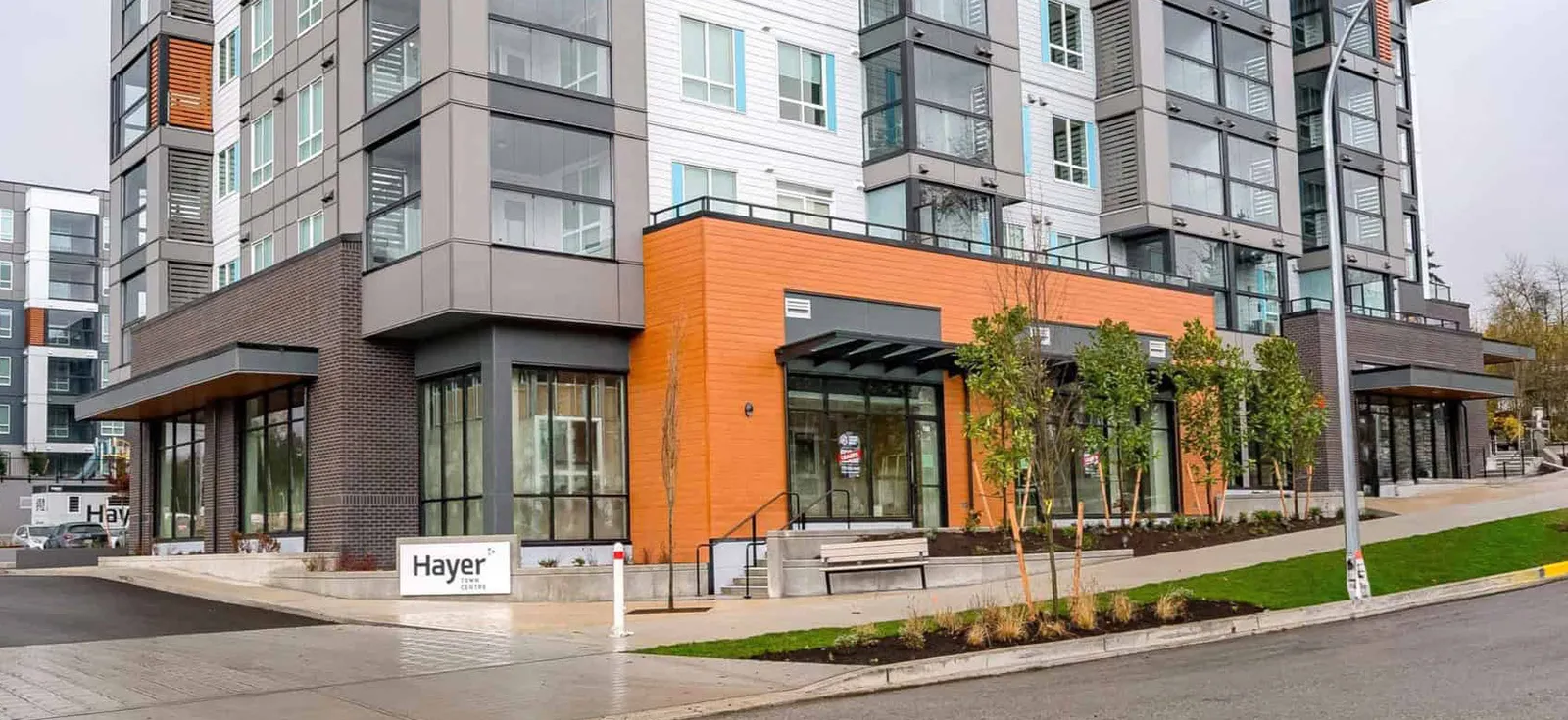
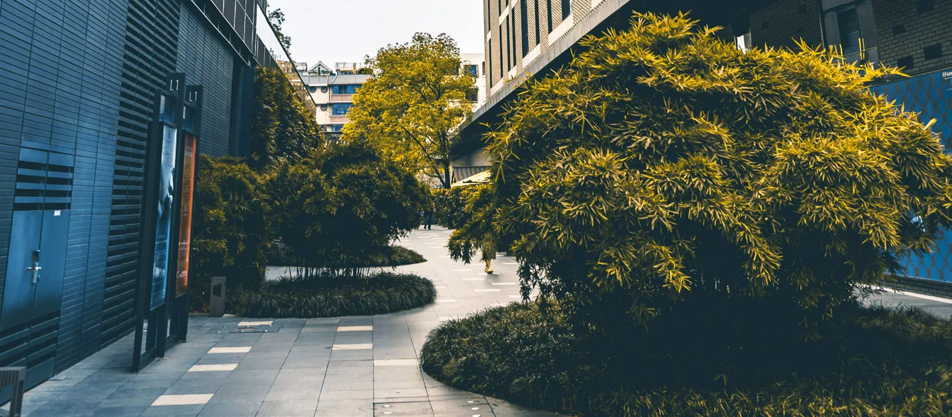
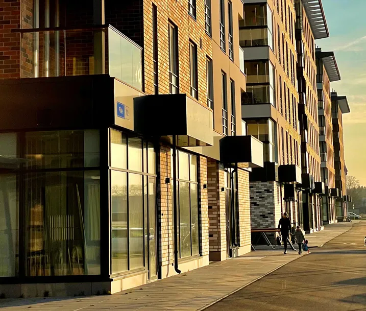
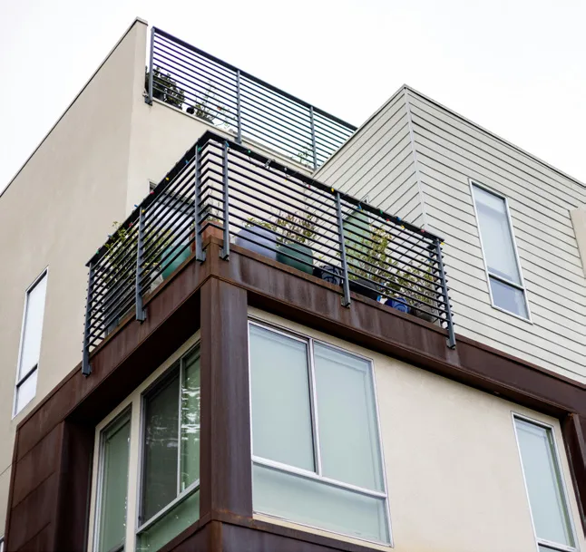
Human-scale / Street-wall Relationships
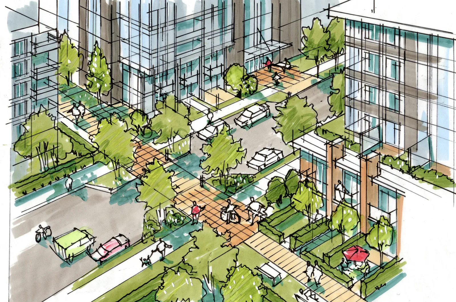
Larger building forms can reinforce the definition of streets while – at the same time – incorporating human-scaled design elements to enhance the quality the adjacent pedestrian environment. Ground-oriented units can be integrated along street edges, while balconies and building step-backs can transition between human scaled elements and upper floors.
Pedestrian Connectivity and Quality
Medium density forms should consider overall intensification of residential uses (at the block scale) and explore opportunities to enhance the connectivity and quality of pedestrian facilities. Mid-block connections, “mews” and landscaped curb extensions can contribute to safe, continuous pedestrian movement while seamlessly linking the primary streetscape to interior open spaces.
Shared (and Celebrated) Entrances
Medium-density residential forms are defined by a combination of individual “front doors” and shared entries with unit access via interior hallways. Specific architectural expressions – including oversized weather protection, facade articulation and integrated lighting and signage designs – can introduce visual interest and clearly demarcate primary building entrances to improve legibility and wayfinding.
Mixed Use Residential
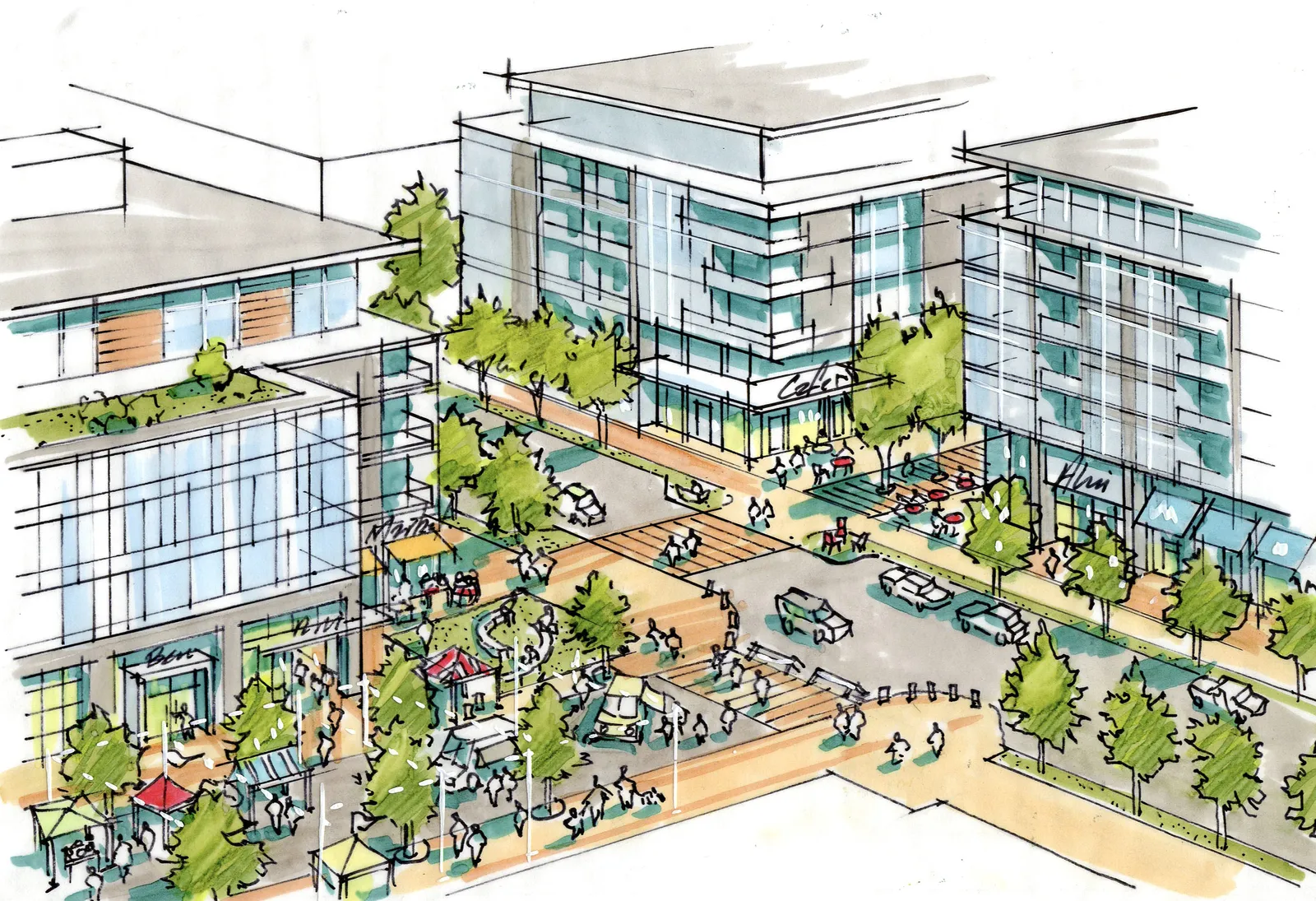
Pedestrian Permeability
Activated Frontages
Integrated Ground Plane
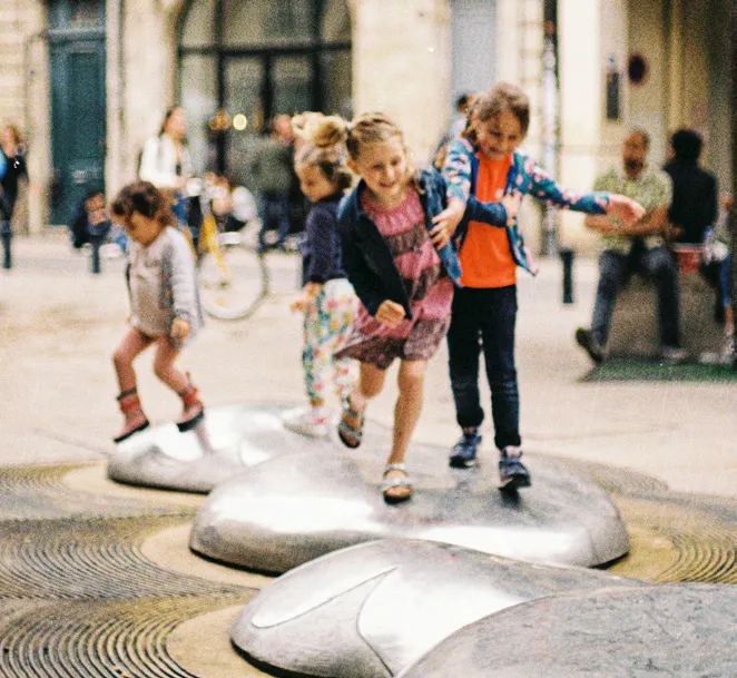
Pedestrian Permeability
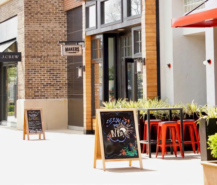
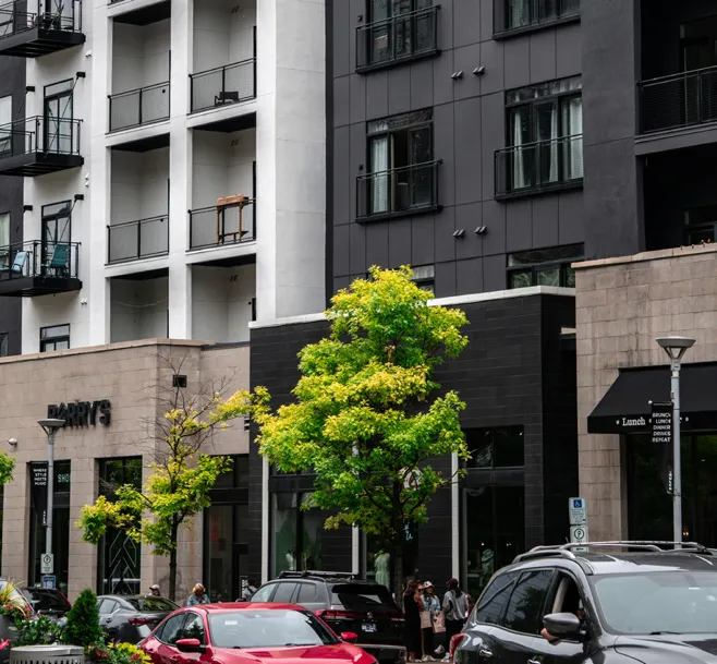
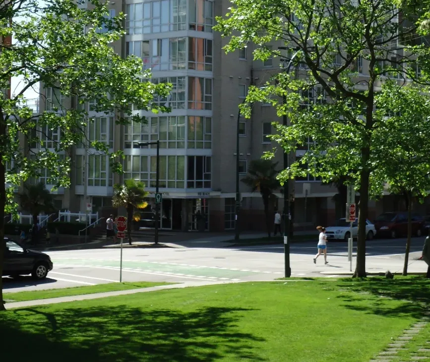
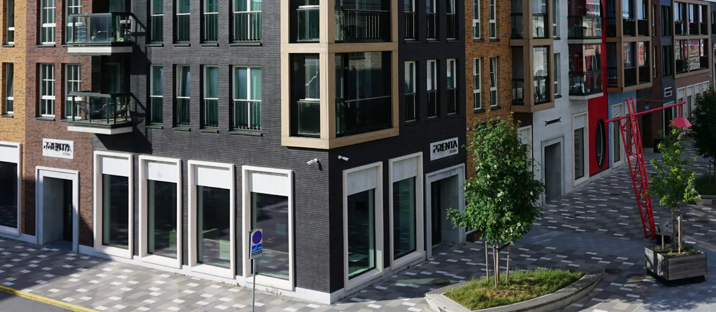
Utilizing a thoughtful mix of high-quality materials, varied textures, and generous glazing breaks down the massing of the ground floor to create a highly permeable building base. By actively avoiding blank walls and integrating generous windows or operable storefronts, the design blurs the physical boundaries between the public sidewalk and the active commercial spaces inside.
Integrating highly visible corner plazas, seating areas, and play structures establishes welcoming public amenities that activate the street corner. Serving as the foundational organizing elements for the site, these spaces are intentionally positioned to ensure clear pedestrian wayfinding, good solar access, and year-round comfort.
Semi-Public Open Spaces
Activated Frontages
Orienting small commercial spaces toward the public sidewalk establishes a friendly, active building face that encourages frequent pedestrian interaction. Thoughtful architectural detailing and material changes are used to break up storefronts and clearly distinguish ground-level retail from the private residential uses above, contributing to the legibility of the streetscape.
High Density Residential
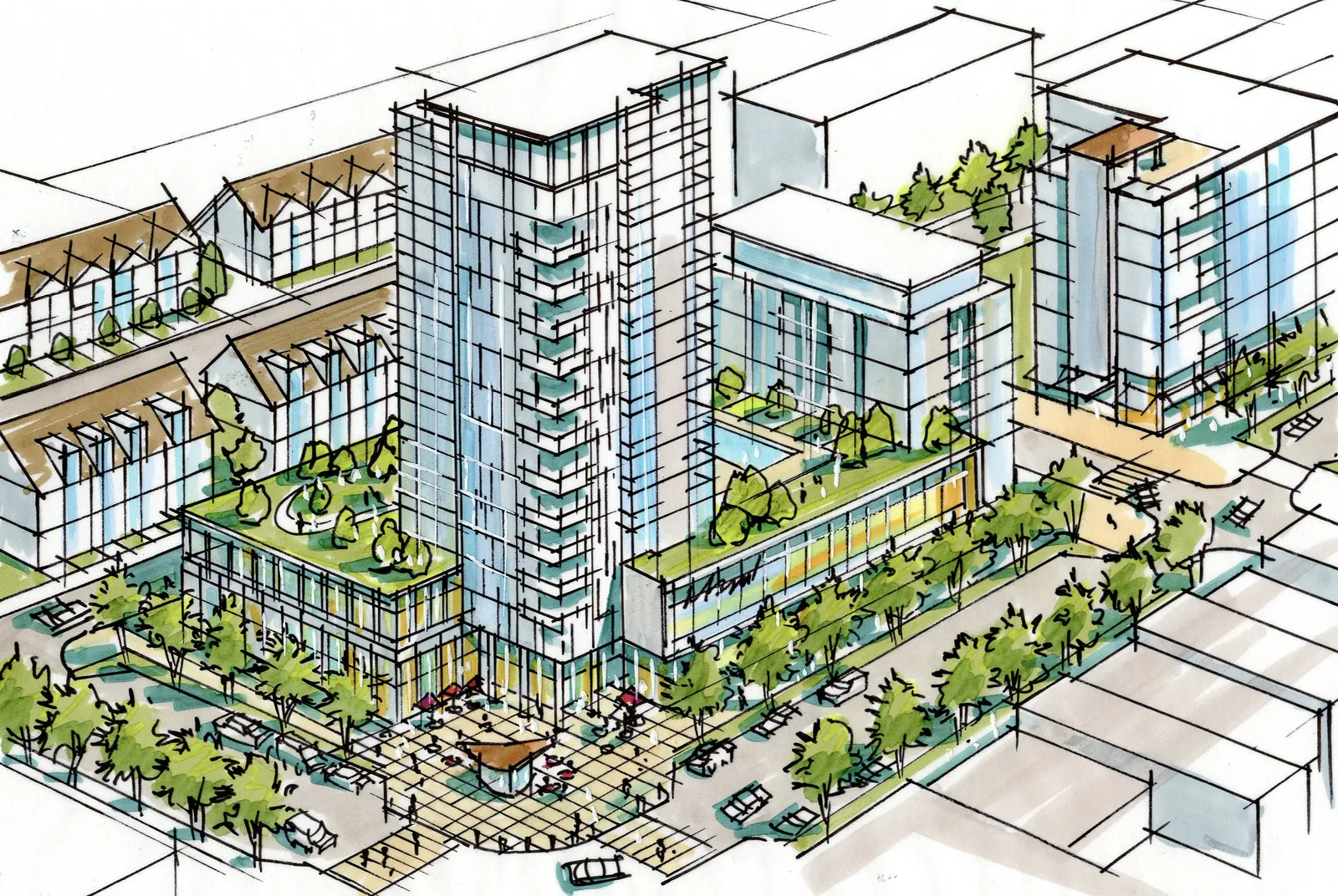
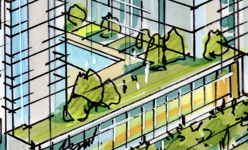
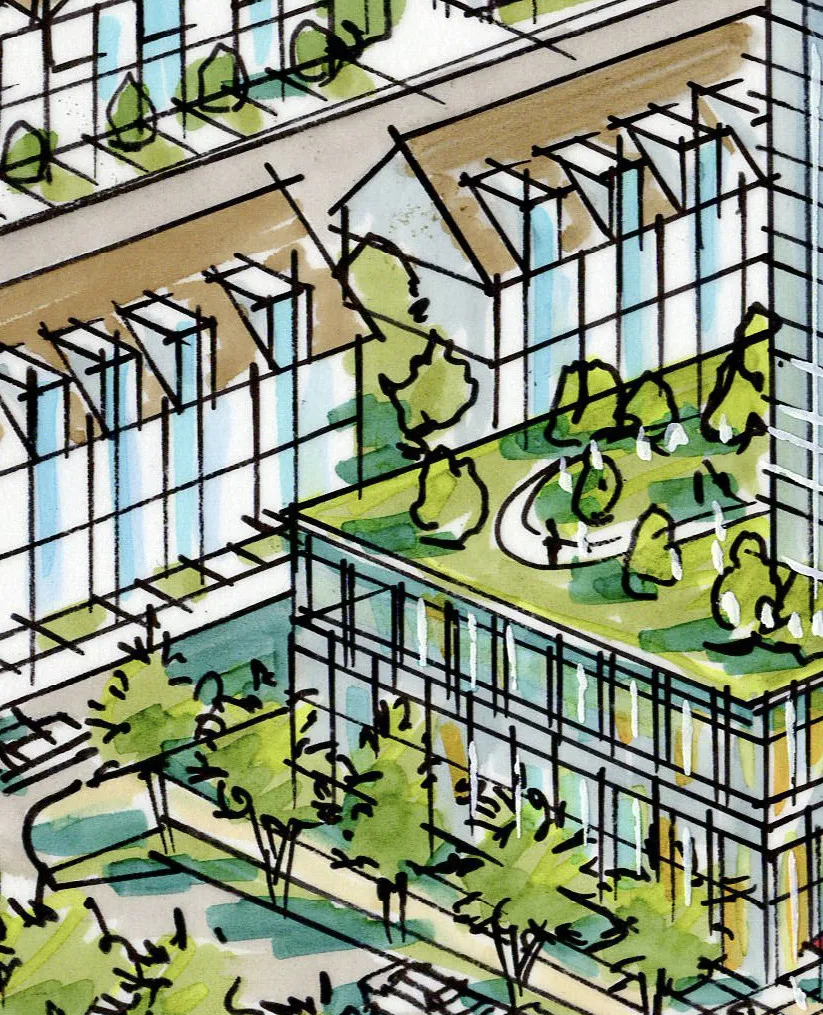
Shared Amenities
Tower Punctuation
Thoughtful Transitions
Thoughtful Transitions
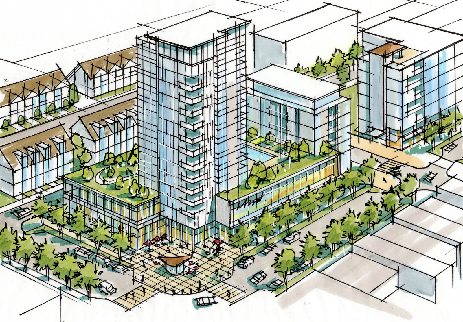
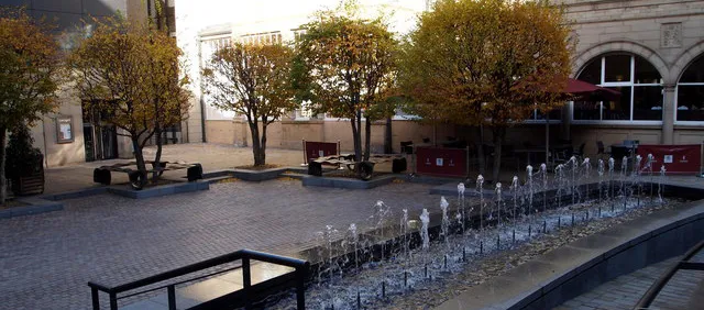
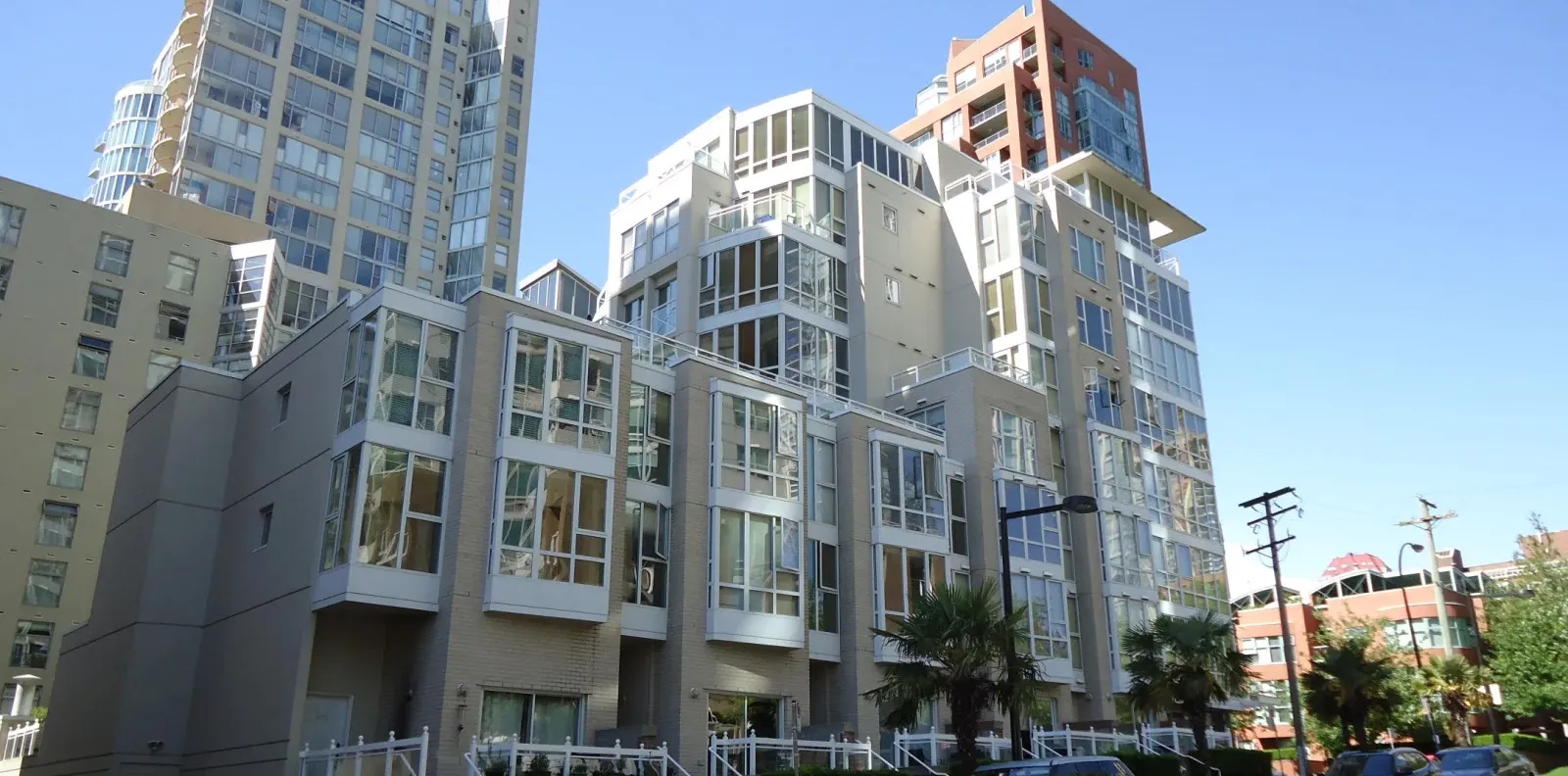
Great urban spaces – defined by the relationship between building architecture and open spaces – feel like a “good conversation” whereby building designs respond to visible physical cues, in service to a comfortable and quality pedestrian environment. High density urban forms should incorporate thoughtful transitions, and consider surrounding use, heights, massing and typologies in context.
Tower Punctuation
Tower design – including location, setbacks and orientation – should reflect certain punctuation within the context of block-scale urban design. Prominent tower placement can anchor a street corner or a mid-block pedestrian passageway. Landscape design further activates the ground plane with integrated street furnishings, public art, trees and varied textures and materials.
Shared Amenities
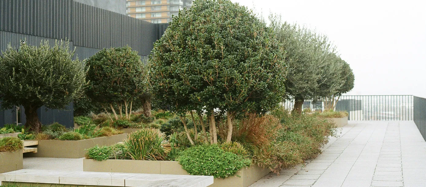
Shared amenity space should be designed as an extension of spaces of social interaction (i.e. entries, stairs, etc.) Landscaped areas (at grade or “rooftops” of podium structures) can: provide high-quality social spaces; support substantial planting and canopy enhancement, actively contributing to Langford’s urban forest; help managing stormwater; and mitigate urban heat island effect.
Mixed Use Commercial in Transition
Commercial / Retail Infill
Mixed-use Buildings
Transforming Large-formats
Mixed-Use Buildings
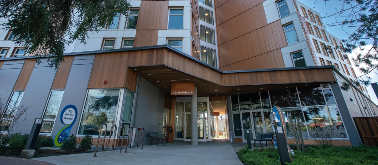
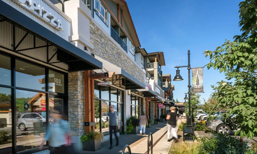
Transitioning from stand-alone commercial uses to mixed-use development – at the building scale – incorporates residential units above ground-floor retail. Enhanced quality and connectivity of ground-level pedestrian spaces incrementally strengthens local urban fabric. Associated residential density holds opportunity for added patronage and vibrancy to existing commercial areas.
Transforming Large-formats
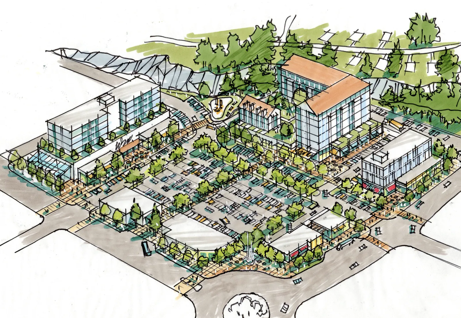
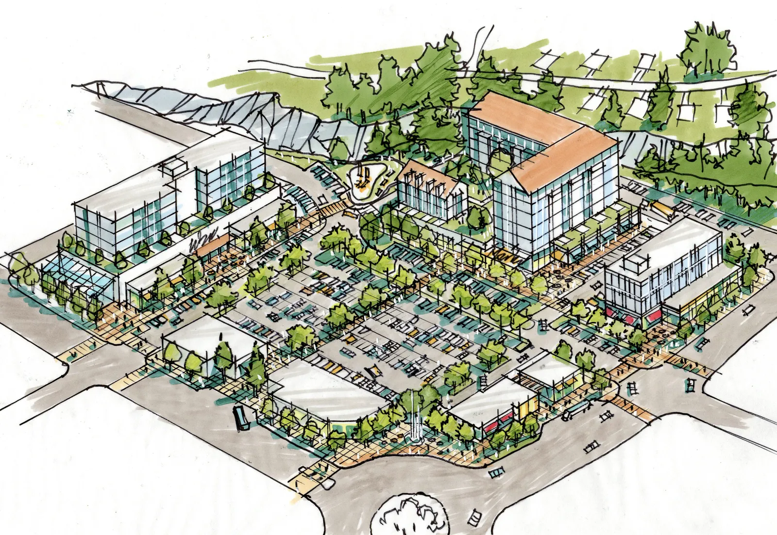
Large format retail is “wrapped” with smaller commercial units along a higher-quality pedestrian perimeter. Residential buildings frame internal shared open space. Surface parking is infilled with safe pedestrian corridors designed to accommodate large soil volumes and trees, provide shade and reduce heat gain. With more intensive redevelopment, parking can be structured underground where feasible to limit surface parking.
Commercial / Retail Infill (Framing Edges)
Large-format (i.e. “big box”) retail sites are often defined by expansive surface parking, where infill opportunities can be configured to strengthen edges and enhance public realm quality. Where residential densities support, shared parking strategies (to reduce parking requirements) should be considered to accommodate stand-alone commercial retail units (“CRUs”).
Industrial
Transition & Screening
Circulation, Access & Storage
Legible Frontages
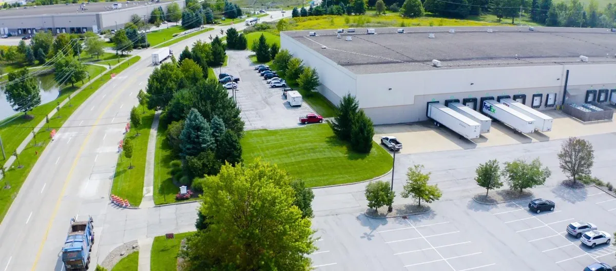
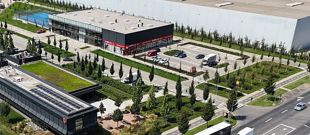
Circulation, Access & Storage
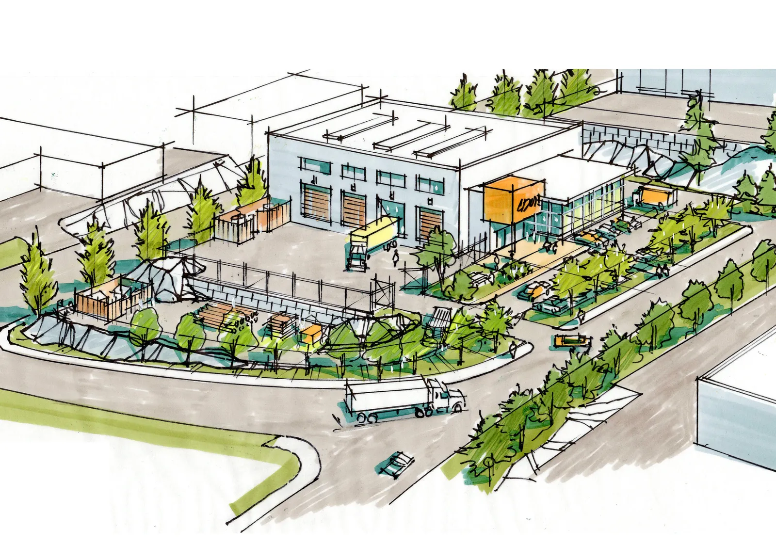
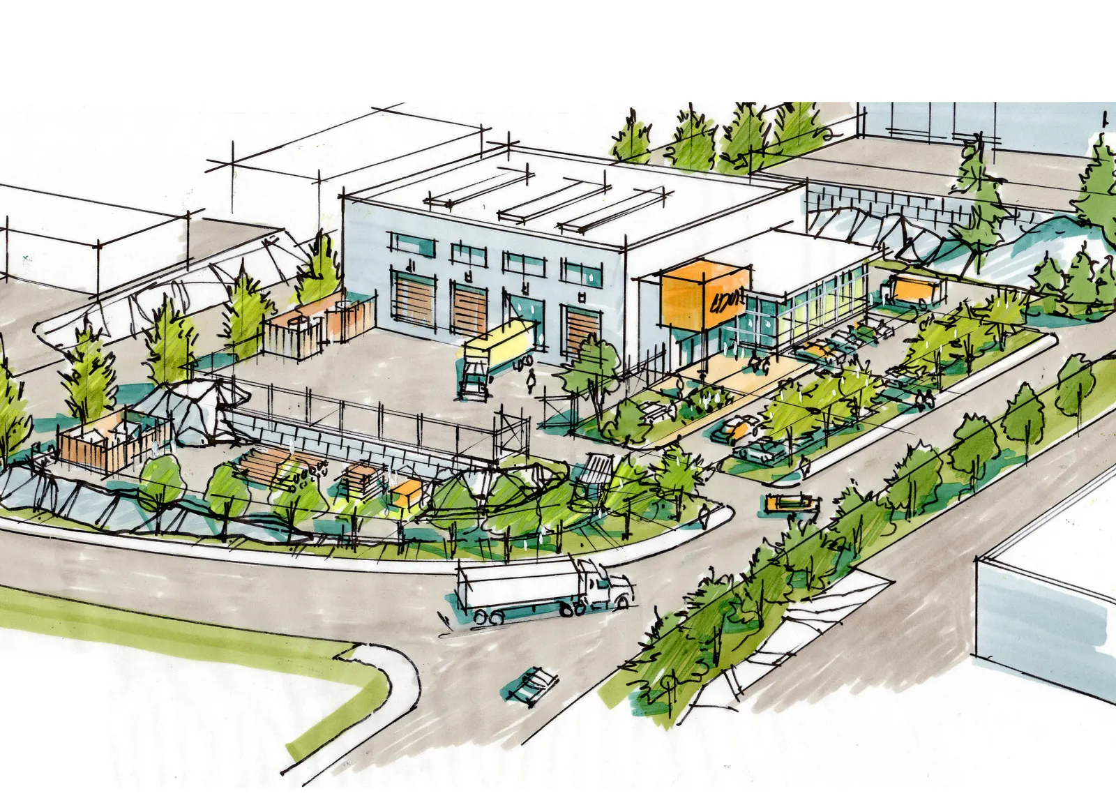
Designing the site to accommodate the internal circulation of materials and large trucks ensures that all industrial operations remain contained within the property. Strategically siting loading bays away from the public street prevents congestion and maintains a clear, safe path for both vehicles and pedestrians.
Siting external storage and work areas at the side or rear of the property keeps industrial activities organized and tucked away from public view. This thoughtful placement ensures that essential business operations are well-managed without detracting from the appearance of the streetscape.
Legible Frontages
Transition & Screening
Dense landscaping and high-quality architectural screening provide an effective buffer between industrial activities and the public realm. These green buffers help mask noise, light, and storage areas, ensuring the development remains a respectful and attractive neighbor within the community.
Institutional
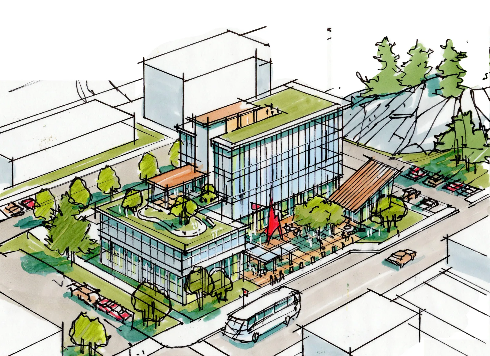
Integrated Gathering
Destination / Civic Landmark
Shared Uses and Placemaking
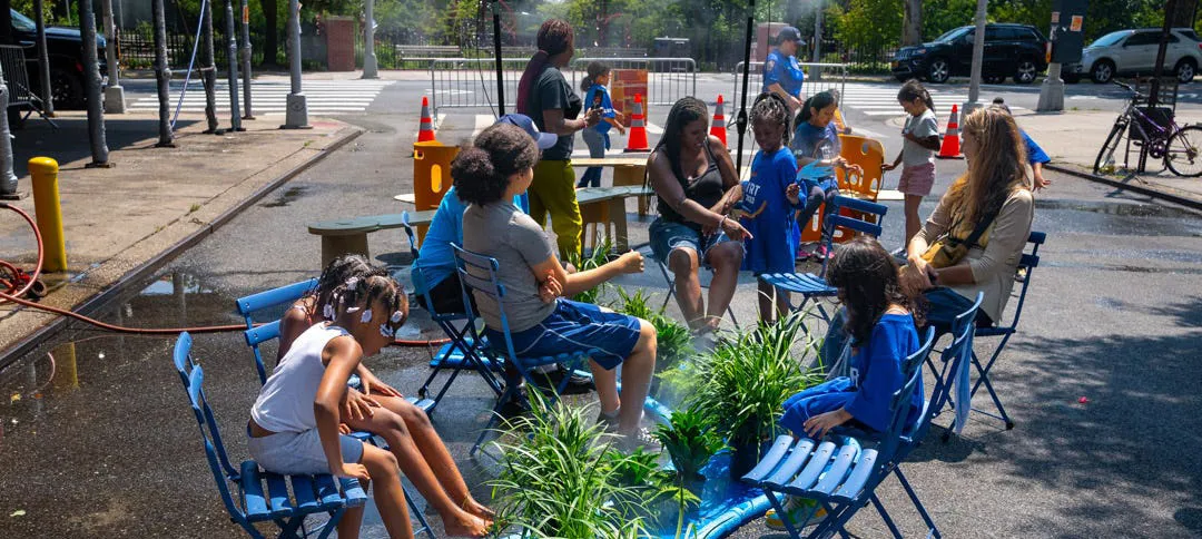
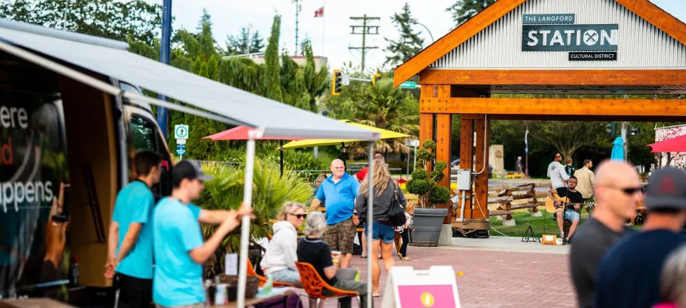
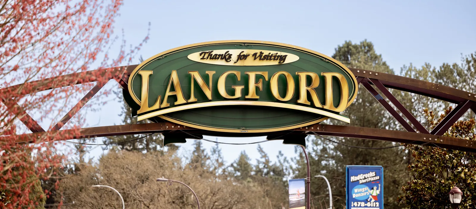
Destination / Civic Landmark
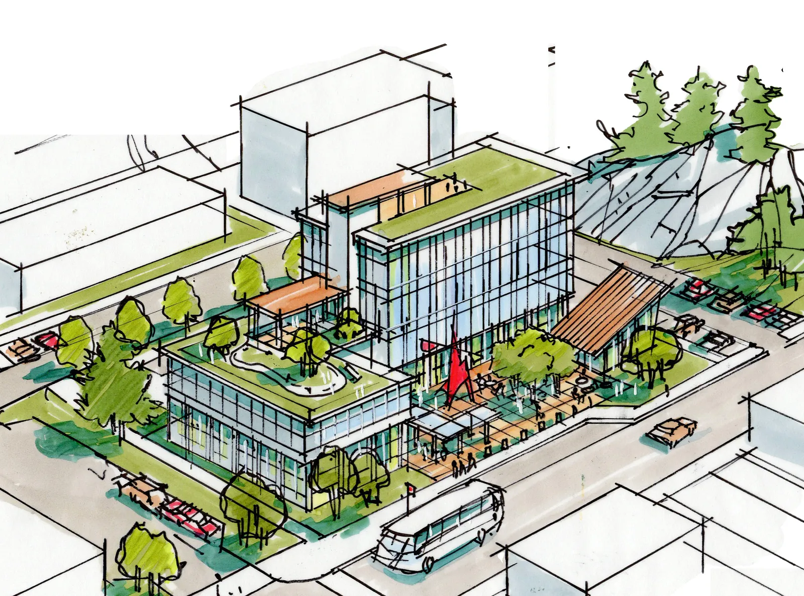
Institutional development should consider opportunities to contribute facilities and spaces – both indoor and outdoor – as part of the broader civic and social fabric of the city. Strategic placement of public art and (public) plaza space can further establish institutional uses as city landmarks, contributing to community health and pride.
Integrated Gathering
Incorporating a variety of gathering spaces ensures a more complimentary relationship between institutional uses (i.e. users and operators) and the surrounding neighbourhood fabric. Thoughtful transitions between arrival plazas and indoor gathering areas foster comfortable and intuitive social interaction while flexible spaces can accommodate community use, where feasible and/or appropriate.
Shared Uses and Placemaking
Institutional sites should consider opportunities to reinforce placemaking opportunities through the shared use of outdoor facilities that reinforce the City’s natural context and relationship to history and geography. Maintaining existing trees and building siting (i.e. naturally within the landscape) can ensure buildings that feel “rooted in place”, balancing institutional programming with the city’s natural identity.
Parks & Plazas
Defining (Natural) Elements
Structures & Furnishings
Borrowed Views
Defining (Natural) Elements of Place
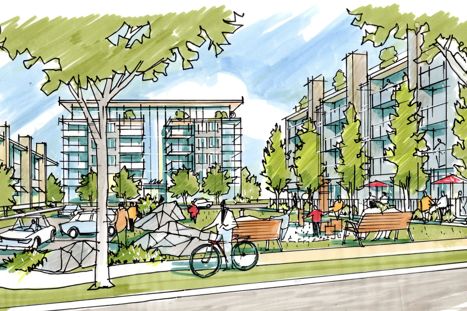
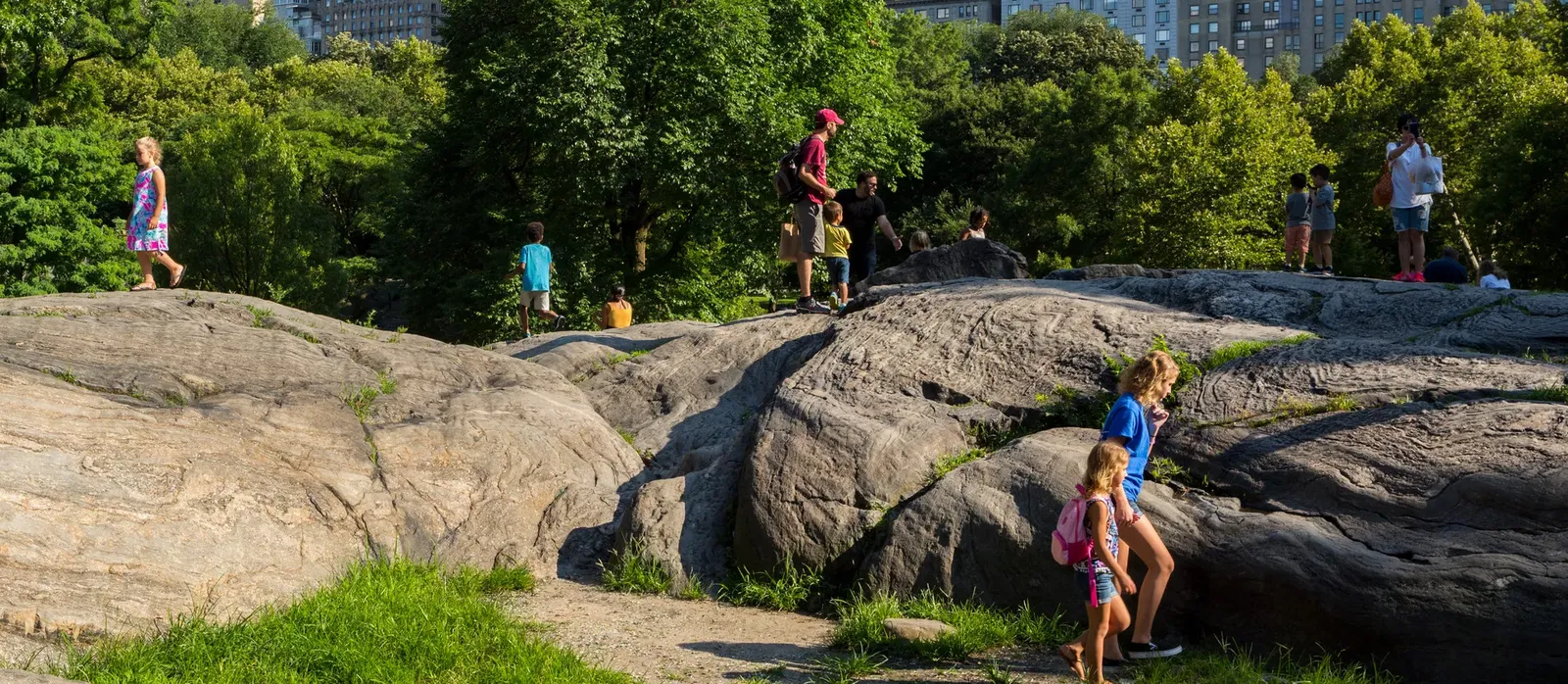
Open space can reveal significant connections to place through the design of views, social connection, natural elements and play. Integrating rock outcrops into open space design grounds the development in Langford’s unique geology and rugged character. Natural features can be designed as part of open space designs, serving as authentic focal points and unique play elements.
Structures & Furnishings
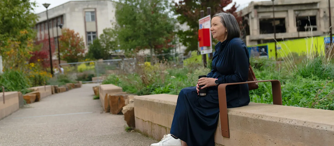
Detailed design should incorporate landscape structures and fixtures to accommodate flexibility of use, including opportunities for rest and play. Integrating durable, accessible furniture transforms public spaces into inviting “outdoor living rooms” that encourage social connection. High-quality, thoughtful design ensures these amenities remain functional and welcoming for all ages and abilities.
Borrowed Views (and Building Elevations)
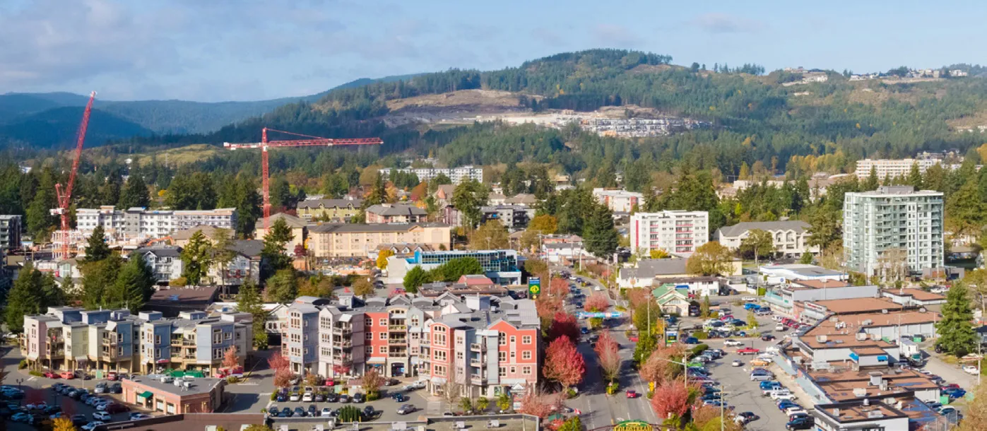
Open space design can “borrow” distant views to capture qualities that are otherwise not present on site. Peek-a-boo vistas of forested ridgelines. Orientation and material design of building elevations further frames and defines the quality of shared open spaces. Taken together, these elements can balance a clear sense of connection, enclosure and safety (i.e. activity and passive surveillance).