DocumentsAppendixJul 20, 2026Pages 97–126
Schedule C
An attached schedule of policies, objectives, or guidelines for the master-planned communities identified in the bylaw. The available extracted text does not show its title or detailed contents.
Key facts
- Schedule C
- Relates to Olympic View, Bear Mountain, and South Skirt Mountain
Schedule C
OLY10. OUTDOOR AREAS
9.4 Chain link fencing is strongly discouraged.
10.1 Buildings shall be sited and oriented to provide usable space for entertaining, utilities, storage, play areas, and views;
10.2 Unsightly storage and utility areas or kiosks shall be screened. Refuse containers, in particular, must be enclosed and fully-screened from the main streets and from other buildings; and
10.3 Accessibility from indoor areas, ability to capture sunlight and summer breezes, aural and visual privacy, and safety shall be considered when providing outdoor private or semi-private space.
OLY11. ENERGY EFFICIENCY
11.1 Siting and orientation of buildings in a manner that will increase the energy efficiency and subsequently reduce the cost required for heating, cooling, and lighting is encouraged;
11.2 Where possible, main living/retail spaces and windows should be located on the south side for natural light, winter warmth and summer shade for energy cost savings. The south side should be the longest side of the building for greatest passive solar gain. Shade the south, east, and west windows with eaves and deciduous plants;
11.3 Openings on the west sides of the building to catch the westerly summer breezes and on the opposite side of the building to assist in cross ventilation area encouraged; and
11.4 Higher openings or roof ventilation designed to expel summer heat is encouraged.
Bear Mountain Estates Area Plan
1.0 Bear Mountain Estates Area Plan
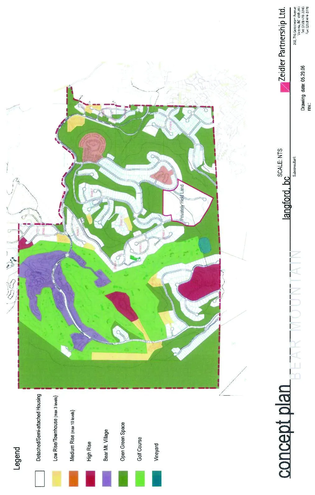
A comprehensive development plan for the Bear Mountain Estates Area was submitted to the City of Langford in 2001. The Bear Mountain Estates Area comprises approximately 220 ha of land. The Bear Mountain Estates Plan proposes to develop the area shown on attached Map 7 as a new neighbourhood within the City of Langford. The neighbourhood is proposed to include a golf course resort, residential community, commercial, and institutional uses.
In designing this new neighbourhood, the plan policies and development permit guidelines will encourage a development pattern that seeks to preserve and enhance existing landforms, wetlands, and vegetation wherever possible. In addition, comprehensive guidelines to protect the neighbourhood from interface fires will be followed.
A mix of housing styles are proposed and will include attached housing, apartment, condominium, single-family residential, two-family residential, secondary suite, and granny flat units for a total of 2 200 dwelling units (not including suites or granny flats). Higher densities will be associated with the proposed village centre. In addition, a comprehensive system of trails and parks will be dedicated and constructed by the owner of the lands. These parks will include linkage trails between neighbourhoods, a perimeter trail and trails connecting to the City of Langford trail network. There will be a combination of natural open space and developed, passive parklands and tot lots as well as a village green within the village centre.
2.0 Planning Principles and Policies
Development of the Bear Mountain Estates Neighbourhood would be based on the following principles.
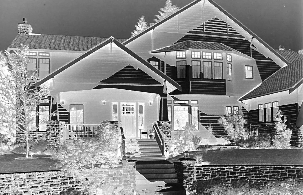
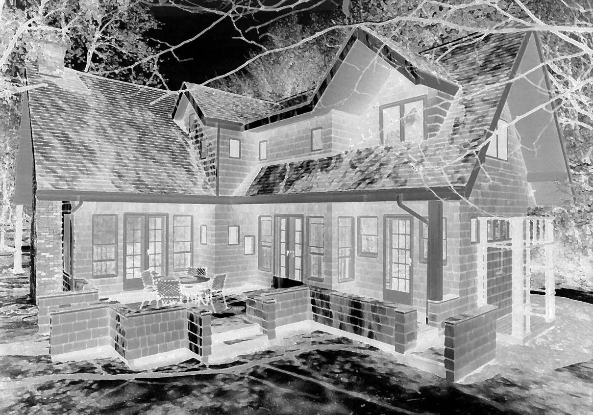
2.1 Development will include a distinct identity, based on an English Arts and Crafts architectural theme.
2.2 The neighbourhood will include a neighbourhood commercial centre, which has a distinct sense of place and opportunities for commercial activities and employment.
2.3 The neighbourhood will include a park and trail network that integrates with Langford's Trail Master Plan and Parks and Recreation Master Plan.
2.4 A comprehensive network of paths, sidewalks, and trails will link neighbourhoods, parks, open spaces, and commercial areas.
2.5 Linkages to existing and future neighbourhoods adjacent to the Bear Mountain Neighbourhood will be provided by way of roads and trails.
2.6 Development will be in accordance with strict environmental standards designed to integrate the development with the natural environment.
2.7 Environmental features will be respected and protected where possible during development and will be maintained. Development will be allowed to occur within a flexible zoning scheme; however, it will be regulated in accordance with development permit guidelines for the following purposes:
- 2.7.1 Protection of the natural environment;
- 2.7.2 Regulation of form and character of intensive residential, multi-family, and commercial development;
- 2.7.3 Protection of development from hazardous conditions; i.e., wildfire and steep slopes.
2.8 Prior to proceeding with development, an overall environmental management plan shall be provided to the City of Langford. Subsequent to acceptance of an overall environmental management plan, each phase of development will require a development permit for form and character, environmental conservation, and protection from hazardous conditions.
2.9 Up to 400 single-family residential units (or up to 700 multi-family units) and an 18-hole golf course and clubhouse will be allowed to be developed with access and egress from Millstream Road. Once this development threshold has been achieved, no further development will be allowed until such time as a comprehensive traffic study with road alignments and interchanges with the Trans Canada Highway are provided to the satisfaction of the City of Langford.
2.10 The Bear Mountain neighbourhood shall be a complete community with opportunities for working, recreating, and living. The intent is to minimize the requirement for automobile trips outside of the neighbourhood and maximize opportunities for walking and cycling within the neighbourhood for many of the neighbourhood's daily requirements.
2.11 The neighbourhood will be subject to the City of Langford's Development Permit Guidelines for Interface Fire Hazards and Steep Slopes.
3.0 Development Permit Areas and Guidelines
In accordance with Section 919.1 of the Local Government Act, all of the lands identified within the Bear Mountain Estates Neighbourhood Plan are designated development permit areas for the following purposes.
3.1 Protection of the natural environment, its ecosystems and biological diversity.
3.2 Protection of development from hazardous conditions.
3.3 Establishment of objectives for the form and character of intensive residential developments.
3.4 Establishment of objectives for the form and character of commercial and multi-family residential developments.
Council's general Development Permit Guidelines for environmental protection, commercial, and multi-family form and character and interface fire hazard protection apply to this area. In the event of a conflict between guidelines, the Bear Mountain Guidelines shall prevail.
The Bear Mountain Neighbourhood Plan provides for multi-family, institutional, single-family, intensive residential, and commercial land uses. Map 7 (Land Use Concept Plan for Bear Mountain) identifies the general layout of open spaces, residential, commercial, and golf club uses. Within the residential designated areas, multi-family and intensive residential uses, in addition to single-family uses, may occur. Further, Map 7 will be established as a development permit guideline, which provides overall direction for the layout of land uses. While this layout is not intended to be inflexible, any deviation from the plan must be supported by substantial compliance with relevant development permit guidelines and an amended concept plan demonstrating that the overall layout concept meets the relevant guidelines and bylaws of the City of Langford.
4.0 Environmental Development Permit Guidelines
4.1 Justification
The Bear Mountain area includes certain hazardous conditions (i.e.: steep slopes, interface fire hazard) as well as sensitive ecosystems identified by the BC Conservation Data Centre. Further, there are many wetland areas and areas which may have potentially significant environmental values which should be protected where possible.
4.2 Objectives
The objectives of this designation are intended to ensure redevelopment will be allowed to occur in a manner that:
4.2.1 Ensures that development in steep slope areas is designed and engineered to proved a high level of protection from ground instability and/or slope failure;
4.2.2 Ensure that development within the interface fire hazard area is managed in a way that minimizes the risk of damage to property or people from interface fire hazards; and managed in a way that mitigates interface fire hazards while still addressing environmental issues.
4.2.3 Significant environmentally sensitive areas are preserved and enhanced where possible;
4.2.4 General habitat and biodiversity values and natural environment regimes are preserved and enhanced;
4.2.5 Riparian values are preserved and enhanced or replaced with more valuable riparian area.
4.3 Steep Slopes
4.3.1. When land is altered, due regard shall be given to maintaining the normal drainage system and regulating storm water run-off. Exposed soil on steep slopes subject to erosion shall be re-vegetated or otherwise protected from run-off erosion.
4.3.2. Development will not be permitted on hillsides of 30% or greater with poor soil stability or susceptibility unless engineered to resolve the hazard.
4.4 Riparian Guidelines
4.4.1 No land clearing or development may occur within the lands until such time as the riparian areas have been identified, leave strips protected, and a development permit issuing any alteration of land is granted. The City may grant variances to setbacks to watercourses if the majority of riparian values are retained in accordance with a report from a registered professional engineer or a professional biologist.
4.4.2 Prior to the development of any golf course, an environmental management plan for the golf course, which ensures that the development and ongoing operation and maintenance of the golf course minimizes incursion and impact into riparian areas and other sensitive ecosystems must be provided to the City of Langford and if required by the City, a Section 219 covenant registered on the lands ensuring that ongoing environmental strategies are adhered to by the owners of the golf course and adjacent properties.
4.4.3 All natural wetlands are encouraged to remain in their current state unless specific plans are presented and accepted by the City of Langford for the relocation and enhancement of wetland areas. The goal is to have the overall value of riparian areas at a higher level than what they were prior to any site disturbance.
4.4.4 Although there are no fish bearing water bodies located on the Bear Mountain property, the watershed drains into fish bearing water bodies downstream. Accordingly, enhancements on-site may be required by the City in order to mitigate any impact caused by the development of the lands and to enhance the values of those water bodies.
4.5 Wildlife Habitat and Biodiversity Guidelines
4.5.1 Rocky outcrops should be preserved and integrated into site design where possible.
4.5.2 Native planting should be used within private landscaping areas and municipal boulevards where appropriate.
4.5.3 Veteran trees and snags should be preserved where their presence does not constitute a hazard.
4.5.4 Natural features should be protected from infrastructure and the City may grant variances to road widths if such variances assist in preserving environmentally significant features.
4.5.5 Sidewalks should meander in order to avoid significant natural features and to add to the neighbourhood aesthetics. Prior to any land clearing or construction, detailed environmental inventories of significant features in areas proposed for development shall be conducted. Site development shall minimize impact on existing sensitive ecosystems. This can be done by either clustering of residential units, varying infrastructure standards, or preserving significant features by way of non-disturbance Section 219 covenants or parkland dedication.
4.5.6 Habitat areas shall be provided with connectivity to allow for the natural migration of wildlife.
4.5.7 Prior to any land clearing or construction, a sediment and erosion control plan must be provided to the satisfaction of the Municipal Engineer and security to ensure compliance may be required.
5.0 Form and Character Development Permit Guidelines
5.1 Justification
The City of Langford designates all commercial, multi-family residential, and intensive residential development areas within the Bear Mountain Estates Plan Area as a development permit area for the purposes of controlling form and character of development. Intensive residential is defined as any lot that is less than 550 m2 in area. The purpose of this designation is to ensure that Council has the ability to secure the necessary information and establish conditions on development such that the form and character of new commercial, multi-family, and intensive residential developments are of a high quality and are well-suited to the surrounding properties and environment.
5.2 Objectives
The objectives of the form and character development permit guidelines are to ensure that development is constructed to high standards in both material and aesthetic qualities, developed within an English Arts and Crafts architectural theme, and that development is compatible with surrounding land uses. Further, as the goal for the Bear Mountain Plan Area is to have a high quality mix of single- and multi-family and commercial uses, the form and character of the intensive residential, multi-family, and commercial areas must be compatible in design theme and site planning to ensure good integration of the mix of land uses. Multi-storey buildings, over five storeys in height, may depart from the English Arts and Crafts design theme, provided that some elements of English Arts and Crafts style architecture are retained, particularly at the first and second storeys.
To facilitate the quality of development and integration of land uses the following guidelines will be used to supplement the City of Langford's general development permit guidelines for commercial and multi-family development.
6.0 Location and Distribution of Uses
6.1 The location and distribution of uses should be generally as illustrated on Map 7.
6.2 Residential density will be high around the resort village centre and country club area.
6.3 A multi-level residential complex may be developed in the eastern portion of the site.
6.4 Within the rest of the residential areas, a mix of attached and detached housing will be provided in a way that minimizes site clearing, road cuts, tree removal, and leaving, where possible, significant topographic and environmental features.
6.5 The proposed hotel may be developed in or adjacent to the village centre.
7.0 Village Centre
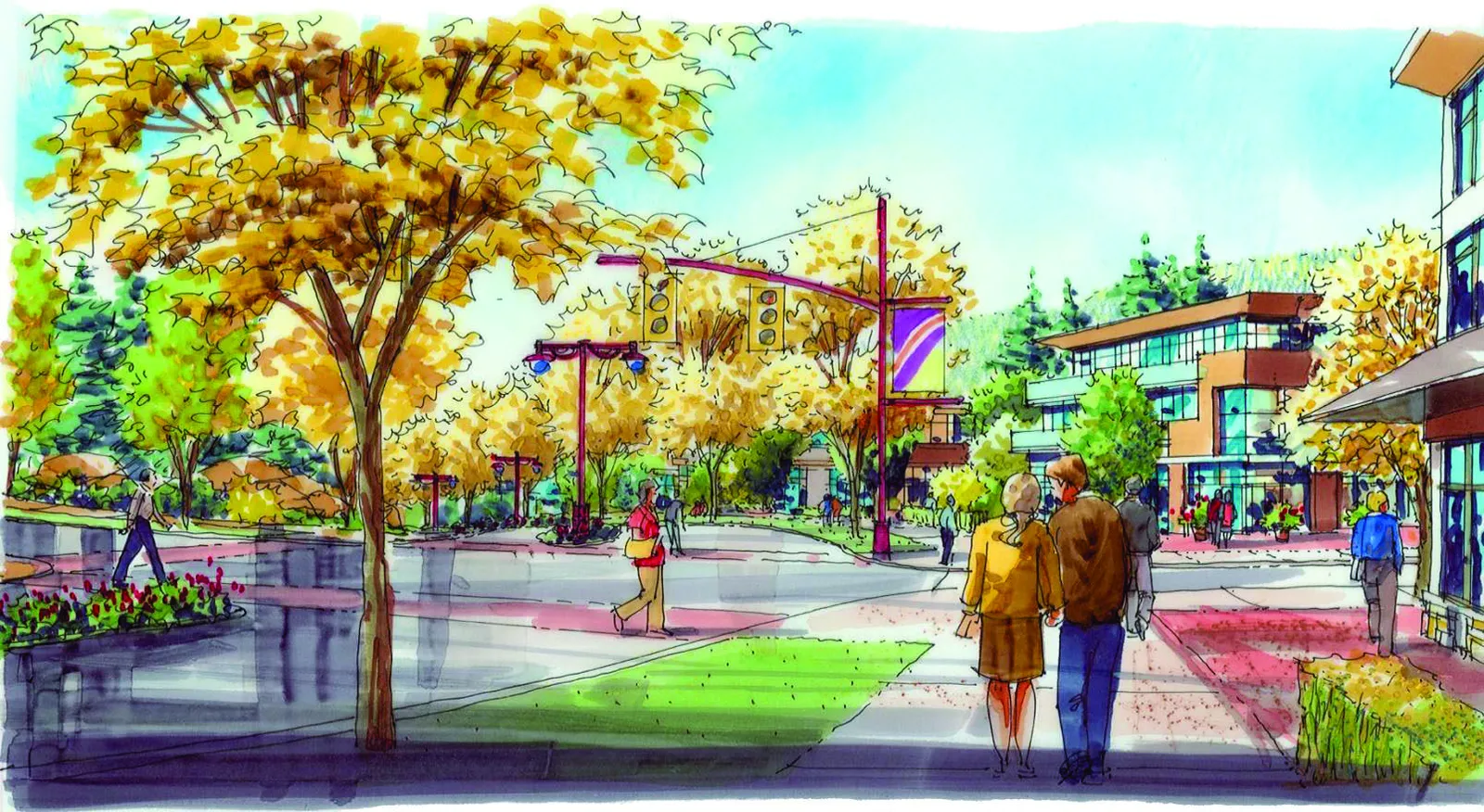
7.1 The Village Centre shall be designed to include and encourage public gatherings.
7.2 Specific features should include an amphitheatre, plazas, and landscaped courtyards.
7.3 The Village Centre should include landscaped water features and have pedestrian only precincts.
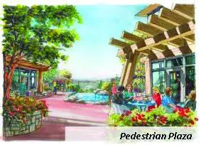
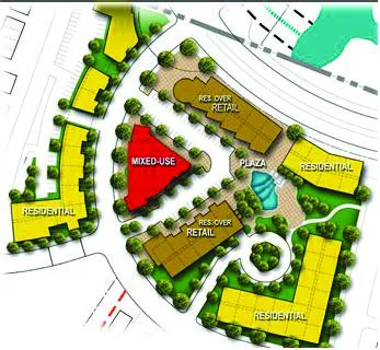
7.4 The Village Centre will include a central pedestrian plaza that has a central water feature.
7.5 A mix of stand-alone commercial and mixed-use buildings will surround the plaza.
7.6 Buildings will be encouraged to have main entrances fronting onto the plaza and, where possible, onto adjacent roads.
7.7 Restaurants and cafes will be encouraged to have outdoor sidewalk dining areas.
7.8 Interim landscaping shall be provided, to the satisfaction of the City Planner, on that part of a comprehensive development site that is intended to be developed for commercial use, and is not immediately developed according to the ultimate landscape plan included within a Development Permit.
8.0 Traditional English Arts and Crafts Architectural Guidelines
The overriding architectural theme of Bear Mountain Estates will be fashioned after an English "Arts and Crafts" style. This will apply to all multi-family residential, intensive residential, and commercial development. Victorian and Edwardian features may be used in adapting the Country theme into the more urban areas of the development. Multi-storey buildings, over five storeys in height, may depart from the “Arts and Crafts” architectural theme, provided that design elements that evoke the “Arts and Crafts” architecture theme are incorporated into the building design. Specific design elements will be as detailed in sections 8.1 to 8.4. Specific design guidelines for the form and character of multi-storey buildings over five storeys in height are as detailed in section 12.0.
8.1 Finishes
In addition to glazing and doorways, a minimum of three exterior finishing treatments are required and may include:
- 8.1.1 Stucco;
- 8.1.2 Rock;
- 8.1.3 Wood siding;
- 8.1.4 Concrete composite siding;
- 8.1.5 Wood shingle; or
- 8.1.6 Brick.
No one treatment may comprise more than 65% of any elevation (exclusive of roofing).
8.2 Roof
8.2.1 Rooflines shall have a minimum 6:12 pitch for major roof elements.
8.2.2 Minor roof elements may have a lesser pitch, but must not exceed 30% of the total roof mass.
8.2.3 Hidden gutter features are encouraged.
8.2.4 Roof materials may include:
- 8.2.4.1 High quality fibreglass;
- 8.2.4.2 Metal profile;
- 8.2.4.3 Wood shingle (subject to wildfire interface guidelines);
- 8.2.4.4 Slate;
- 8.2.4.5 Concrete composite.
8.3 Form
8.3.1 Articulations of building elevations and rooflines are encouraged and are the main architectural element sought by the design guidelines.
8.3.2 Dwelling space inside of articulated rooflines is encouraged.
8.3.3 Use of stone, cultured stone, or brick exterior chimneys is required. Exposed vent pipes for fireplaces or fuel-fired appliances shall only extend vertically from a chimney that is clad in stone, cultured stone, or brick. Chimney enclosures constructed of concrete composite siding, or stucco are not permitted. Lateral vent pipes, or ‘through the wall’ vents for fireplaces and fuel-fired appliances are not permitted.
8.3.4 Use of fieldstones for accents is encouraged.
8.3.5 Use of over hanging eaves, and large front porches with pillars is encouraged.
8.3.6 Extensive use of dormers (gable, eyebrow, hipped, or shed) is encouraged.
8.4
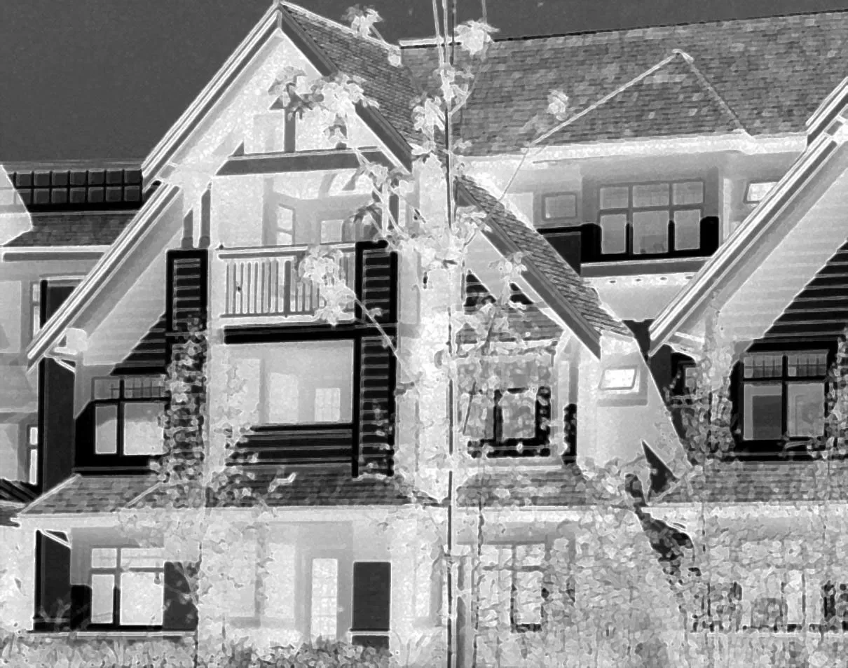
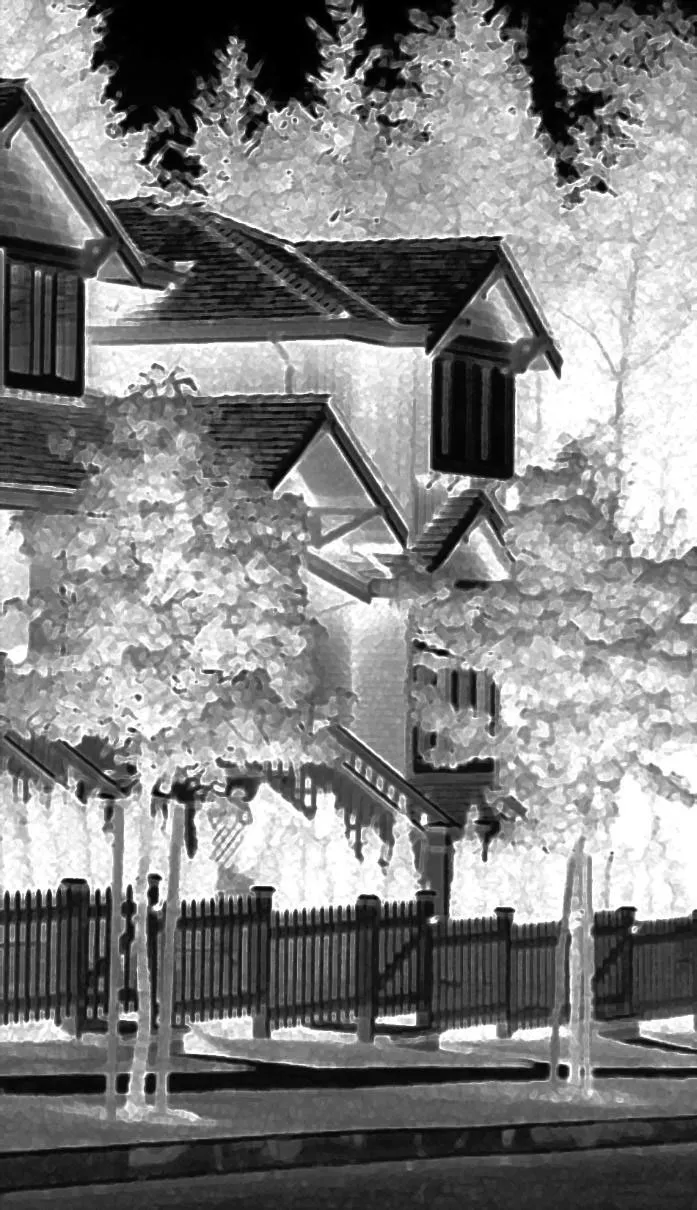
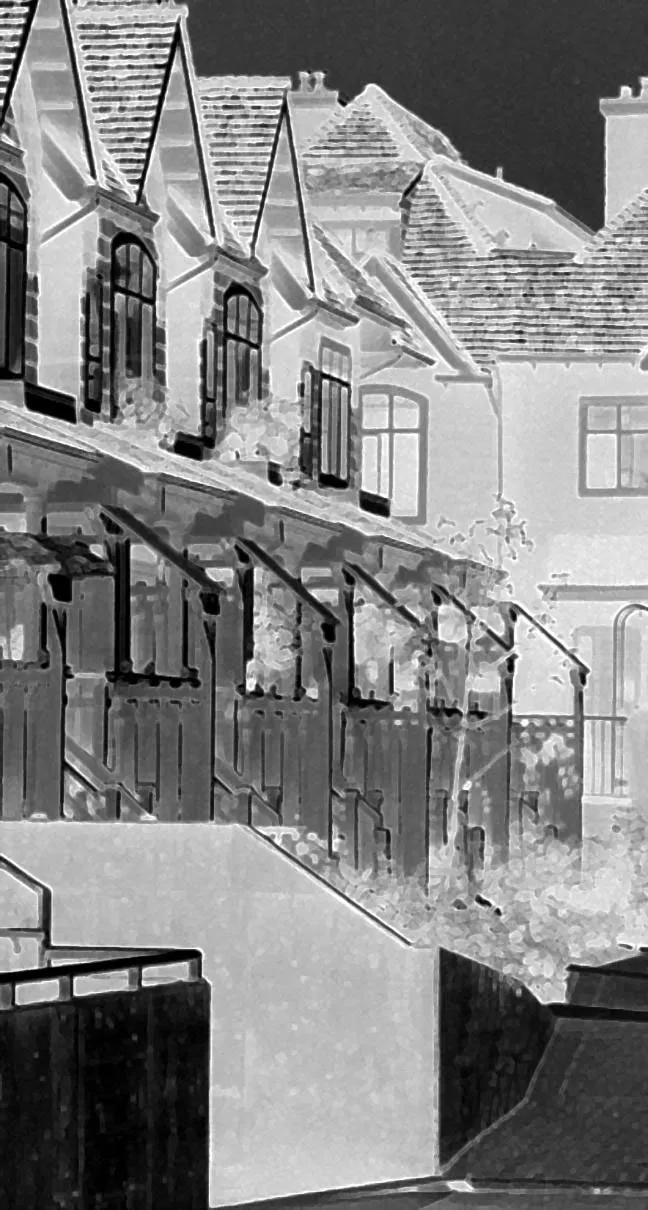
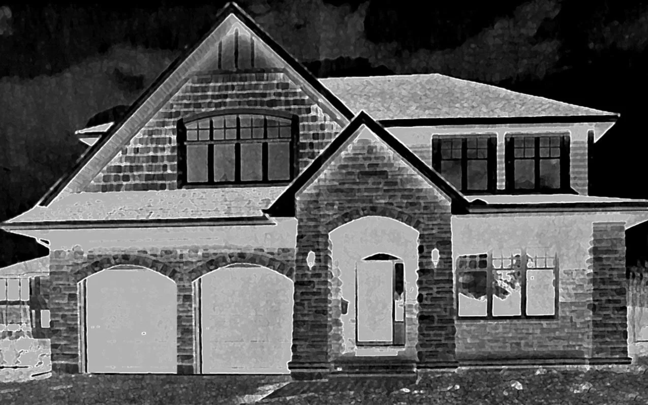
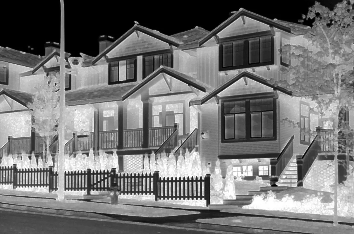
The images shown as figures M1 to M7 are visual guides showing the style of architecture to be used in all multi-family residential, intensive residential, and commercial development except for the golf clubhouse.
9.0 Streetscape
9.1 The overall character of the development will reflect the natural environment and the golf course resort.
9.2 Individual buildings should complement existing building and the streetscape as a whole.
9.3 Buildings will not be identical and will reflect a style identified in the traditional English Arts and Crafts Guidelines. Buildings shall be encouraged to be located close to road frontages and incorporate verandas. Notwithstanding the close proximity to roads, building envelopes will be encouraged to be staggered or building façades will be encouraged to articulate in order to avoid a row housing appearance from the street.
9.4 High walls that overshadow neighbouring yards should be avoided.
9.5 Strata driveways in detached townhouse developments are to be finished to a standard similar to municipal roads in Residential Small Lot zones, and shall include curbs, sidewalks, boulevards, and street trees.
10.0 Building Orientation and Siting
10.1 Orientation and siting for any building should meet the following objectives:
- 10.1.1 Collect summer breezes.
- 10.1.2 Provide protection from winter wind and rain.
- 10.1.3 Incorporate natural topographic features and minimize intrusive or radical site works.
- 10.1.4 Preserve the natural vegetation and significant trees where these are not required to be removed due to wildfire hazard mitigation.
- 10.1.5 Take advantage of distant and local views.
- 10.1.6 Provide for maximum privacy.
- 10.1.7 Allow for some usable yard space.
10.2 Entrances
10.2.1 Entrances or routes to buildings should be clear and accessible from the street frontage.
10.2.2 The front entry of a building should be defined with adequate overhangs for weather protection and wherever possible incorporate verandas.
10.2.3 The design of entrances or routes to buildings should not hinder sight lines or surveillance of visitors and intruders.
10.2.4 Where possible garage doors should not be the dominant feature of a building's front façade, but should be located to one side, slightly behind, or at right angles to the main street frontage.
10.3 Parking
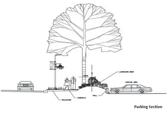
10.3.1 Where possible car parking for residential and non-residential lots is to be visually screened from sidewalks and neighbours and prevented from dominating the streetscape.
10.3.2 In a village centre or cluster housing developments, parking lots should be broken into smaller areas with landscape dividers or other developments. Ideally, an unbroken parking area should be no larger than about six to eight spaces in a village centre, four spaces in residential areas, and 20 spaces in the clubhouse area.
10.3.3 The use of a consistent height of evergreen tree canopy throughout the larger lots is encouraged to help provide weather protection and visual screening from overlooking buildings.
10.3.4 Access driveways should be designed to use a minimum of asphalt paving. Permeable surfaces will be considered.
10.3.5 Desirable materials include brick, concrete pavers, concrete, exposed aggregate, streetprint, asphalt, or combinations of the above to complement the building material requirements and the natural environment.
10.3.6 Estate lots may use gravel or crushed, cemented rock in driveway locations not visible from adjacent roads.
10.3.7 Freestanding parkades will not be allowed.
10.3.8 Provisions for secure bicycle parking must be made in all commercial and multi-family developments.
10.4 Fencing
10.4.1 In order to foster a safer more community-oriented environment, fences, and walls in excess of 4 ft in height that extend forward from the front building face are not permitted.
10.4.2 If a fence or wall is necessary for privacy or noise control, a partially voided articulated fence or wall in combination with planting and natural materials in keeping with the environment and the building will be considered.
10.4.3 Low rock walls and evergreen hedges are encouraged.
10.4.4 Chain link fencing is prohibited unless required for safety along trails at the approval of the City Planner.
10.5 Outdoor Areas
10.5.1 Buildings shall be sited and oriented to provide usable space for entertaining, utilities, storage, play areas, and views.
10.5.2 Unsightly storage and utility areas or kiosks shall be screened.
10.5.3 Garbage containers in particular, must be enclosed and fully screened.
10.5.4 Accessibility from indoor areas, ability to catch sunlight and summer breezes, audio and visual privacy, and safety shall be considered when providing outdoors, private, or semi-private space.
10.6 Energy Efficiency
10.6.1 Site and orientation of buildings should be done in a manner that will increase the energy efficiency and subsequently reduce the cost required for heating, cooling, and lighting.
10.6.2 Openings on the west sides of the buildings should be provided to catch the westerly summer breezes and on the opposite side of the buildings to assist in cross ventilation.
10.6.3 Higher openings or group roof ventilation designed to expel summer heat is encouraged.
11.0 Interface Fire Hazard Guidelines
The development shall be designed in accordance with the City of Langford's Development Permit Guidelines for Interface Fire Hazards. In lieu of an professional engineer's report on Interface Fire Hazards, the City of Langford may accept a registered professional forester's report.
12.0 Multi-Storey Buildings Over Five Storeys in Height
The following guidelines shall apply to all multi-storey buildings over five storeys in height.
12.1 General Form and Character
Multi-storey buildings over five storeys in height are not required to be developed strictly within the “arts and crafts” architectural design theme of Bear Mountain Estates. In addition to the design guidelines contained within sections 8.1, 8.2, and 8.3, the following guidelines are intended to direct the design of multi-storey buildings over five storeys.
12.1.1 The overall architectural design of each building shall consist of heavy articulation, particularly at the main floor, battered foundation walls, dormers, rock or stone clad chimneys, large porches, window boxes and balconies, transomed windows, roofs with wide overhangs, multiple roof planes, trellised porches, columns and piers supporting roof elements and porches, and decorative railings and roof edges.
12.1.2 Buildings over five storeys should have a strong relationship to the street and, in particular, a human or pedestrian scale. This should be accomplished by:
- 12.1.2.1 Including, at the ground level of each building, dwelling units or commercial units with direct pedestrian access to the street;
- 12.1.2.2 Including covered arcades, towers, trellises, roof overhangs, dormers and chimneys into building design at a human scale;
- 12.1.2.3 Using extensive stepping and terracing of the elevations and altering the massing of structures so that the heights of various portions of the building are staggered between two and eight storeys;
- 12.1.2.4 Avoiding any massing or single material that rises vertically more than four storeys, unless the façade is punctuated by articulation, terraces, balconies with towers, pergolas or dormers;
- 12.1.2.5 Including in the building façade dormers, shed roofs and balconies that break up vertical and horizontal planes;
- 12.1.2.6 Including vaulted ceilings on top storeys and glazing in gable ends to add verticality to buildings;
- 12.1.2.7 Ensuring that the majority of any eighth storey or any building is built within the roof gable;
- 12.1.2.8 Limiting the access to underground parking to not more than one entrance per road frontage, and by siting driveways and/or garage doors in discreet ways so that they do not front directly onto the street;
12.1.3 Buildings over five storeys in height are expected to exhibit an “arts and crafts” architectural theme within the first two storeys, and should exhibit a strong relationship to this architectural theme throughout the first four storeys. At storeys above the fourth storey, buildings should incorporate design elements which relate the architectural character of the “arts and crafts” architecture employed at the lower storeys. Figures M1 to M7 of this Appendix are intended to provide a visual guide to the “arts and crafts” architectural theme;
12.1.4 The design of multi-storey buildings over five storeys shall ensure that there is appropriate transition between building levels. The seventh floor may be designed as a horizontal penthouse floor, provided that these dwelling units are multi-storey;
12.1.5 Mechanical equipment shall be fully screened within the roofline of any building;
12.1.6 Buildings over five storeys in height shall not be used as platforms for radio masts, cell phone towers or other telecommunication device, unless these structures are discreetly located within the roofline of the building;
12.1.7 Buildings over five storeys in height may incorporate a single flag pole for one of each of the following: the Canadian Flag, the Province of British Columbia Flag; the City of Langford Flag; and a Bear Mountain Flag.
12.2 Roof and Finishes
12.2.1 Roof design shall be as outlined in section 8.2;
12.2.2 A variety of colours, materials, textures and forms shall be incorporated into the design of multi-storey buildings over five storeys for the purpose of breaking up the massing of the building, while accentuating building lines and patterns;
12.2.3 In addition to the design guidelines contained within sections 8.1, 8.2, and 8.3, exterior finishing treatments may include any combination of smooth, exposed aggregate, scored or patterned concrete as one finishing treatment; and
12.2.4 No one treatment may comprise more than 65% of any elevation (exclusive of roofing).
12.3 Exemptions
12.3.1 The following are exempted from a development permit application. Residential subdivision or intensive residential development of any land controlled by a Section 219 covenant, approved by the City Planner, and registered in favour of the City of Langford, which controls the form and character of intensive residential development on the subject property.
13.1 Multi-Storey Design Guidelines
In addition to the design guidelines contained with Appendix G and H (if applicable), the following guidelines are intended to direct the design of buildings over five storeys in the Bear Mountain Estates Plan Area.
13.2 The overall architectural design of each building shall feature varied articulation, particularly at the lower storeys, decorative railings and roof edges.
13.3 Buildings over 5 storeys in height should be clustered within the Bear Mountain Estates Plan Area to afford a minimum area occupied by streets and provide generous open space.
13.4 To make buildings over 5 storeys in height “pedestrian friendly”, the first two storeys of towers should be strongly articulated through the use of overhangs, signage and other means of stimulating visual interest. Where possible, upper storeys should actually be set back and recede or appear to recede; this can be accomplished by tiering the lower storeys of the tower (i.e., the second and third storeys).
13.5 Balconies should be a minimum of 1 m2 in area.
13.6 Units may include their own “earth balcony” capable of supporting planters with shrubs and small trees.
13.7 Each front entrance to ground-oriented units should be visually distinctive from its neighbours, or capable of becoming distinctive from its neighbours.
13.8 Each doorway and entrance should provide a combination of appropriate entrance transitions through the use of alcoves, seating, direction changes, level changes, and variation in materials.
13.9 In areas where multiple towers are constructed or anticipated, a central common area with intensive landscaping and open areas available for barbeques and picnics should be provided. These areas should be linked to the surrounding towers by pedestrian paths accessible to the disabled. The central common area should also be connected by pedestrian paths to other smaller common areas, service commercial amenities, adjacent parks and the greater neighbourhood trail system.
13.10 Terraced building articulations are encouraged; flat roofs and terraced areas should be accessible and “roof-scaped” with landscaping and patio style recreational amenities.
13.11 Buildings over five storeys in height should have a strong relationship to the street, and in particular should exhibit a human or pedestrian scale at the ground level. This should be accomplished by:
- 13.11.1 Including, at the ground level of each building, dwelling units or commercial units with direct pedestrian access to the street.
- 13.11.2 Using extensive stepping and terracing of the elevations and altering the massing of structures so that the heights of various portions of the building are staggered between higher and lower storeys.
- 13.11.3 Including in the building façade dormers, shed roofs and balconies that break up vertical and horizontal planes where practical; and
- 13.11.4 Limiting the access to underground parking to not more than one entrance per road frontage, and by siting driveways and garage doors in discreet ways so that they do not front directly onto the street where practical.
13.12 Where practical, architectural elements such as intersecting gables and vaulted ceilings should be constructed on top storeys along with glazing in gable ends to add verticality to buildings.
13.13 The top storey of any building should be built within the roof gable where practical.
13.14 The design of buildings over five storeys in height should ensure that there is appropriate transition between building levels. The top floor may be designed as a penthouse floor provided that the penthouse is integrated into gables or peaked intersecting gables where possible.’
13.15 Mechanical equipment should be fully screened within the roofline of any building.
13.16 Buildings over five storeys in height should not be used as platforms for radio masts, cell phone towers or other telecommunication devices, unless these structures are discreetly located with the roofline of the building or visually obstructed with architectural screening.
13.17 Buildings over 5 storeys in height should have a minimum 30 m separation from each other.
13.18 Nearby buildings over 5 storeys in height should be positioned in a manner that helps to define street edge definition while at the same time allowing for gaps in views and sunlight penetration to open spaces.
13.19 Development of buildings over 5 storeys in height should be positioned in a manner that helps to define street edge definition while at the same time allowing for gaps in views and sunlight penetration to open spaces.
13.20 All multi-storey development incorporation buildings with more than 5 storeys should incorporate Crime Prevention Through Environmental Design (CEPTED) design principles.
13.21 Semi-private exterior amenity spaces should be made accessible to a variety of user groups including the disabled.
13.22 Where possible, buildings over 5 storeys in height should have some setback from the boundaries of the lot to allow for ground level landscaped areas and semi-private outdoor space.
13.23 Rooftops that are visible from the windows and balconies of taller buildings should appear attractive and be designed to appear well maintained and attractive over time.
13.24 Rooftop mechanical equipment installed on roofs should be fully screened from the windows and balconies of taller buildings.
13.25 Where a minimum of 200 residential units are proposed within a single development, buildings within the development may create an architectural identify other than that required by the design guidelines of Appendix , H, and M, provided that the following provisions are met to the satisfaction of the City Planner:
a) the buildings and landscaping are designed comprehensively with a unified theme;
b) the buildings consist of high quality building materials; and
c) public art is incorporated into the landscape plan.
14.0 Supplemental Guidelines
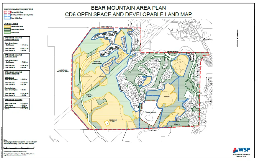
In 2016 the principal land owners in the CD6 (Bear Mountain Comprehensive Development A) zone applied to rezone the remaining development lands in the CD6 Zone to a new CD6A Zone. The guidelines as set out in Appendix M apply in both the CD6 and CD6A zones, and the guidelines in this section are intended to take precedence in the CD6A zone.
Notwithstanding the Bear Mountain Land Use Concept Plan (Map 7) the Bear Mountain Area Plan (Map 7A) shall applied to lands within the CD6A zone. Map 7A is a development permit guideline which provides overall direction for the layout of land uses. While this layout is not intended to be inflexible, and deviation from the plan must be supported by substantial compliance with relevant development permit guidelines and an amended concept plan demonstrating that the overall layout concept meets the relevant guidelines and bylaws of the City of Langford.
In the event of any conflict between the guidelines contained within this section and any other guidelines, these guidelines shall prevail.
14.1 The overall form and character of development in the CD6A zone shall exhibit a blend of a traditional English Arts and Crafts or Craftsman style of architecture that is consistent with the early history of British Columbia and more Modern and Contemporary styles of architecture that have become synonymous with a “West Coast” style of architecture. Architectural types that reflect national “types” (such as: Swiss Chalet or Spanish Hacienda) that are not generally associated with the local climate, geography or architectural pattern of development are discouraged.
14.2 New development is expected to complement and enhance existing development in the Bear Mountain Comprehensive Development and meet the same standards, particularly with respect to finishes, roof and form as outlined in Sec. 8.0.
14.3 In addition to the development of a complete community identified in Sec. 2.10, the Bear Mountain Comprehensive Development will work towards becoming a resort community also, wherein opportunities are created for tourism, active recreation, celebration and exploration.
14.4 Parking areas should be screened from any abutting residential or golf course use by a landscape screen not less than 3 m (9.8 ft) in width and 1.8 m (6 ft) in height, measured at the time of planting, and separated from roads and access routes by boulevards and street trees.
14.5 Landscaping in the form of grass, shrubs, ground cover, native plant communities, plants, trees, or flowers or a combination of them should be incorporated into and maintained in a total of not less than 10% of the site area.
South Skirt Mountain Neighbourhood Design Guidelines
1.0 GENERAL
JUSTIFICATION
The City of Langford has designated all commercial, multi-family residential, and intensive residential development as a Development Permit Area pursuant to the provisions of the Local Government Act. The justification for this designation is to ensure that Council has the ability to secure the necessary information and estabilish conditions on development such that the form and character of new commercial, mulit-family residential and intensive residential development are of a high quality and best suited to both the surrounding land and the vision of Lanford as expressed in the Langford Plan.
OBJECTIVE
The objective of the South Skirt Mountain Design Guidelines is to supplement the Development Permit Guidelines for residential, multi-family, commercial, and hillside development within the City of Langford Development Permit Guidelines, specifically to guide development of properties identified as development areas within the South Skirt Mountain Neighbourhood Area Plan. These guidelines will ensure that the development:
a. encourages a development pattern that seeks to preserve and enhance existing landform, wetlands, and vegetation wherever possible,
b. is constructed to high standards, both material and aesthetic, and
c. is protected from hazardous conditions.
The essential nature of the South Skirt Mountain development is a high-quality mix of single- and multi-family residential and commercial uses. The form and character of the development and the design of the landscaping and pedestrian systems are important means to achieving this.
Where there is a conflict between these guidelines and the General Design Guidelines, the South Skirt Mountain Design Guidelines will take precedence.
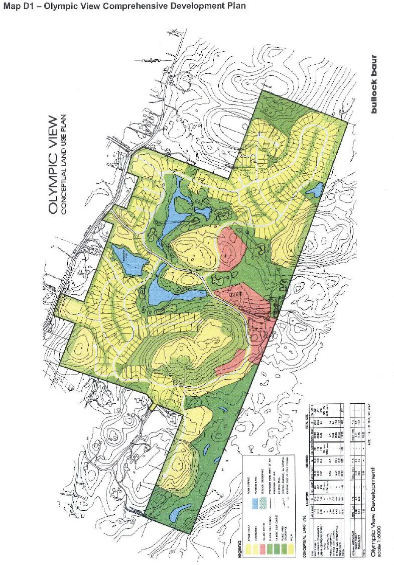
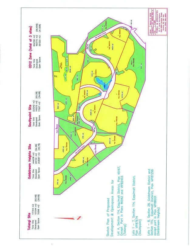
1.1 The South Skirt Mountain Development Neighbourhood Area Plan provides for single family, multi-family, commercial, institutional and recreational land uses. Map A1 identifies the general layout of development sites, mid-high density clustered areas, and dedicated open space areas, which will provide overall direction for the layout of development as a development permit guideline. While this layout is not intended to be inflexible, any deviation from the plan must be supported by substantial compliance with relevant development permit guidelines and an amended concept plan demonstrating that the overall layout concept meets the relevant guidelines and bylaw of the City of Langford;
1.2 The Director of Planning may issue variances with respect to any setback requirement, where the variance being sought supports the objectives of the design guidelines, including but without being limited to the following: respecting existing topography, natural features, areas of sensitive ecosystems, provision of public amenities and special architectural features;
2.0 ENVIRONMENTAL PROTECTION DEVELOPMENT GUIDELINES
2.1 The South Skirt Mountain Neighbourhood Area Development Concept plan that forms part of these guidelines is based on the requirement that 40% of the lands within the CD12 (South Skirt Mountain Comprehensive Development) zone will be preserved either as covenanted open space, amenity land or dedicated park. The highest value sensitive ecosystems have been determined to be generally within the areas shown as Open Space on the map attached, but the true location of these ecosystems is to be determined, phase by phase, through the Development Permit process;
2.2 Land alteration is expected to occur only on a phase by phase basis, and must be preceded by a Development Permit that addresses, in particular: environmentally sensitive ecosystems, wildlife habitat and biodiversity, riparian areas, steep slopes and interface fire hazard, in accordance with the City’s guidelines for environmentally sensitive and hazardous DP areas.
2.3 A Development Permit may limit the scope of land alteration for the sake of mitigating environmental impact, hazardous conditions or aesthetic considerations;
2.4 Development will also be guided by the recommendations within the South Skirt Mountain Wildfire Interface Assessment Plan dated January 29, 2008 prepared by Strathcona Forestry Ltd.
3.0 GENERAL FORM AND CHARACTER GUIDELINES
3.1 Site grading should incorporate natural topography where possible. Where topography is not affected by development, natural features should be retained;
3.2 Building setbacks, orientation, form, density and height, should be designed to minimize the impact of the proposed development on ecosystems and existing topography;
3.3 Natural features or existing trees between clusters of development on hillsides should be retained (where supported by the qualified professional with respect to Interface fire hazard or ecosystem preservation) so as to enhance or protect views from outside of the area and avoid the view of a solid built mass on the hillside. Where retention of trees is not possible, establishing new landscaping with the same purpose is encouraged;
3.4 Site lighting should be designed so as to minimize light pollution. Exterior lights shall be permitted, as required for safety and comfort when installed at a height and angle so as to minimize glare onto adjacent lands. The use of full cut-off and shielded fixtures is encouraged wherever practical;
3.5 Parking may be provided between building entrances and the street frontage in order to minimize disturbance to sensitive ecosystems or natural topography, provided it is screened with suitable landscaping to minimize impact from the street;
3.6 Structured parking above grade should be designed and finished in a manner that is consistent with the overall building character, and designed to create overall architectural interest;
3.7 Parkade structures below grade may extend to the property line, and may be excluded from setback requirements;
3.8 Overall, the form and character of development shall exhibit a blend of a traditional Arts and Crafts or Craftsman style of architecture that is consistent with the early history of British Columbia and more Modern and Contemporary styles of architecture that have become synonymous with a “West Coast” style of architecture. Architectural types that reflect national “types” (such as: Swiss Chalet or Spanish Hacienda) that are not generally associated with the local climate, geography or architectural pattern of development are discouraged. In order to achieve this design theme, individual buildings are encouraged to incorporate any or all of the following elements into their design:
a) large timber framing at feature areas (where permitted from an interface fire hazard management perspective);
b) Characteristic roof overhangs;
c) Stepped building massing;
d) Natural materials;
3.9 Buildings shall be constructed to a high material and architectural standard. Acceptable finishes include:
a) Architectural concrete;
b) Stucco;
c) Wood;
d) Cementitious board;
e) Architecturally finished block;
f) Architectural composite metal panels and pre-finished metal siding;
g) Natural stone;
h) Brick;
i) Cultured stone.
4.0 MULTI-FAMILY and MIXED-USE DESIGN GUIDELINES
4.1 Within multi-building developments, buildings should not be identical, but should exhibit a form and character that is complementary. Buildings should establish the individual character of each building, while maintaining a common architectural theme that is consistent with the overall architecture of the zone;
4.2 Within multi-building, multi-storey developments greater than three storeys, the distance between any 2 buildings should not be less than 3 meters or half the height of the taller building, whichever is less, unless buildings are separated by a firewall in a zero lot line configuration;
4.3 Where ground oriented multi-family development (eg: townhouses) are situated directly adjacent to single-family residential development, the height of multi-family development at the street level should be less than 3 full storeys in height;
4.4 Building massing should step at the parking podium;
4.5 For buildings over six stories in height, the podium should be strongly articulated through:
a. architectural details at human scale,
b. stepping and terracing of the elevations of the podium, and
c. Use of different building massing and primary building materials to that of the upper stories.
4.6 The grade level of buildings should be activated wherever possible, including walk-up residential, commercial, or personal service uses.
4.7 Common amenity space may be provided in the form of common rooms, shared outdoor space, fitness, or other facilities.
4.8 Terraced building articulations are encouraged, wherever possible.
4.9 Separation between buildings or portions of buildings that are more than 6 stories in height should not be less than 25 meters, excluding parking structure and podiums.
5.0 MIXED USE CORE DESIGN GUIDELINES
5.1 In addition to the guidelines contained in this section, the development permit area guidelines for “General Design Guidelines for Langford City Centre” (Bylaw No. 1829) contained in Bylaw No. 300 shall also apply to any Mixed Use Core within the CD12 (South Skirt Mountain Comprehensive Development) zone.
5.2 A Mixed Use Core should be designed to include and encourage public gatherings;
5.3 Specific features should include pedestrian friendly plazas and a landscaped courtyard with a central water feature.
5.4 Buildings surrounding the plaza should have main entrances fronting onto the plaza and, where possible, onto adjacent streets.
5.5 Restaurants and cafes should incorporate opportunities for outdoor sidewalk dining areas.
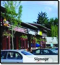
5.6 Store signage in the Mixed Use Core is permitted to have individually illuminated letters, providing they are designed to be consistent with the architectural character of the development.
6.0 COMMERCIAL DESIGN GUIDELINES
6.1 Store signage in the Mixed Use Core is permitted to have individually illuminated letters, providing they are designed to be consistent with the architectural character of the development.
6.2 New buildings should utilize variations in the character of rooflines, sloping roof lines, gables and dormers, or other interesting roof treatments that are complimentary to the design expressed in neighbouring buildings;
6.3 All portions of a site not covered by buildings, structures, and vehicle/pedestrian circulation space should either be retained in a natural condition or landscaped;
6.4 Setbacks from parking to a lot line adjoining a road can be reduced to 2 meters, provided the setback area includes an intensive landscape area adjacent to the street.
6.0 LANDSCAPING
6.1 Emphasize use of species present on-site for all natural areas and the interface to natural areas;
6.2 Trees and major shrub vegetation should be selected in consultation with a registered professional biologist to reflect the vegetation zone characteristics where it is situated i.e. Garry Oak/Rock Outcrop; Forest Upland; adjacent riparian zones, and the production and use of Garry Oak and Arbutus is encouraged.
6.3 Every effort should be made to reinforce, strengthen the edges of the adjacent natural areas. These edges should be blurred and allow the natural habitat to blend and extend into the development zones.
6.4 A limit of disturbance for each development zone shall be established with an evaluation and identification of vegetation areas for preservation. These areas shall be demarcated and protected prior to any clearing or disturbance of the site.
6.5 Ensure the protected and adjacent natural areas are protected from the adverse effects of rock removal, erosion, and changes in the hydrological ground conditions. Within the Garry Oak/ Rock Outcrop areas, evaluate trees and develop a rock removal plan strategy to an arborist’s approval that ensures adverse effects to the protected trees are prevented.
6.6 Topsoil and overburden shall be reclaimed on site, where practical, for re-use and use in natural interface areas.
6.7 Landscape areas are encouraged to use native species for site interface and a mix of native and non-native plants for areas associated with buildings, parking and feature areas.
6.8 Plant material should be arranged to emphasize building entrances, pedestrian and vehicular circulation routes, as well as to soften the appearance of parking areas, mechanical systems, and service areas without blocking visibility of pedestrian and vehicular traffic. Plants should be used to complement the scale of the area or structure.
6.9 Where practical, with respect to interface fire hazard, coniferous trees should be used to screen mechanical equipment and service areas. Space should be provided to allow a natural tree screening as opposed to hedges.
6.10 Landscape islands are to be provided internal to parking areas.
6.11 Landscaping should be arranged in a natural pattern or geometric configurations as designed by a Landscape Architect.