DocumentsAppendixFeb 1, 2016Pages 34–49
Appendix: Traffic Management Plan - Ryder Hesjedal's Tour de Victoria
Comprehensive Traffic Management Plan prepared by Island Traffic Services for the Tour de Victoria (Aug 21, 2016) including traffic control, public notification, emergency response and route-specific timing through Langford.
Key facts
- Event date/time: Sunday, August 21, 2016; start 7:00 am, end approx. 3:30 pm
- Plan requires one lane dedicated to riders with opposing traffic on opposite side; police, traffic control personnel and volunteer marshals at intersections
- Includes emergency response plan, contact lists (tour medical & Island Traffic Services), public notification sample mailout and detailed route/timing through Langford (specific intersection times listed)
- Course-specific condition in Langford: riders on Happy Valley Rd, Glen Lake Rd, Leigh Rd, Goldstream Ave, Atkins Ave with time windows and trail crossing warnings
Traffic Management Plan
Ryder Hesjedal's Tour de Victoria
Bicycle Ride — Greater Victoria Area
Sunday August 21, 2016
Prepared by:
Island Traffic Services Ltd.
112 — 2932 Ed Nixon Terrace
Victoria, BC
V9B 0132
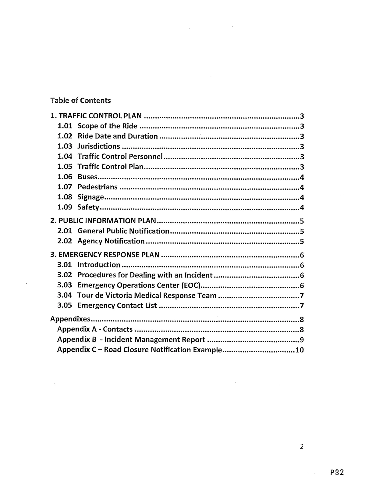
Table of Contents
TRAFFIC CONTROL PLAN ........................................ 3
1.01 Scope of the Ride ........................................ 3
1.02 Ride Date and Duration ................................. 3
1.03 Jurisdictions ............................................. 3
1.04 Traffic Control Personnel ............................ 3
1.05 Traffic Control Plan ................................... 3
1.06 Buses ....................................................... 4
1.07 Pedestrians .............................................. 4
1.08 Signage ................................................... 4
1.09 Safety ..................................................... 4PUBLIC INFORMATION PLAN ................................ 5
2.01 General Public Notification .......................... 5
2.02 Agency Notification ................................... 5EMERGENCY RESPONSE PLAN ............................... 6
3.01 Introduction .............................................. 6
3.02 Procedures for Dealing with an Incident ............. 6
3.03 Emergency Operations Center (EOC) .................. 6
3.04 Tour de Victoria Medical Response Team .......... 7
3.05 Emergency Contact List ................................. 7
Appendixes ...................................................... 8
Appendix A - Contacts ....................................... 8
Appendix B - Incident Management Report .............. 9
Appendix C — Road Closure Notification Example .... 10
1. TRAFFIC CONTROL PLAN
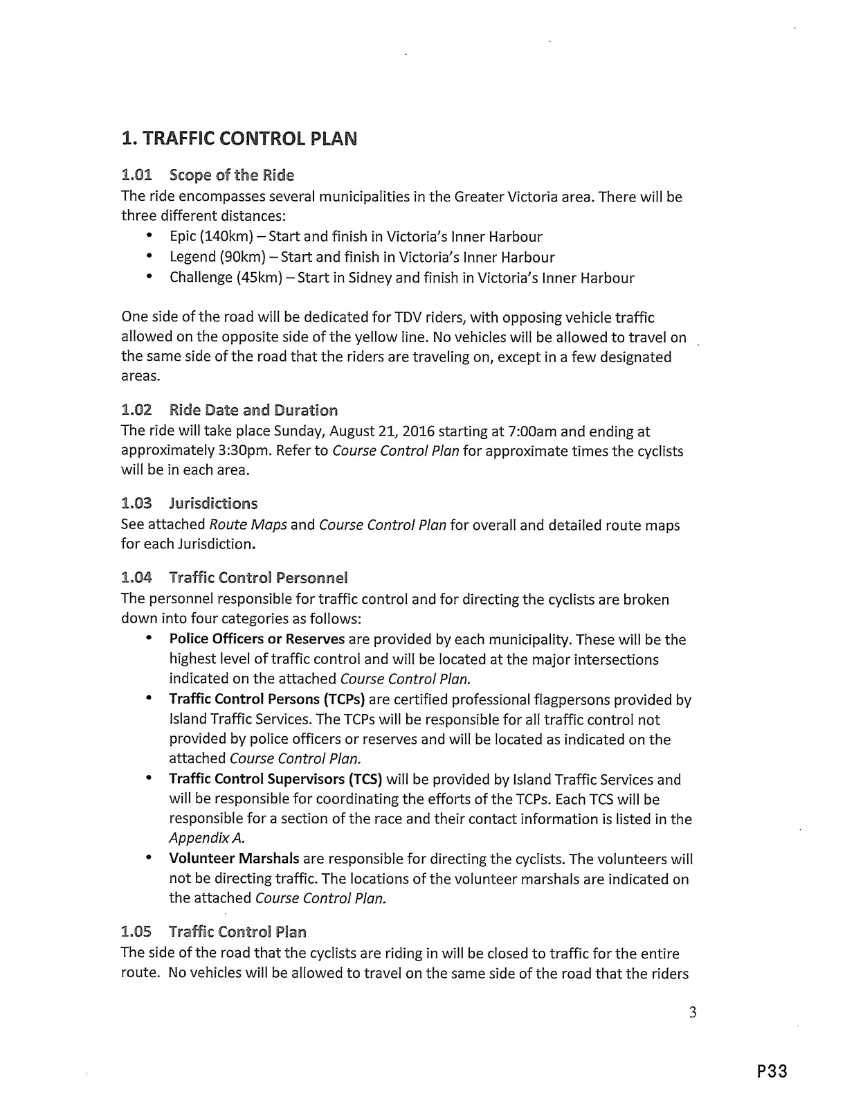
1.01 Scope of the Ride
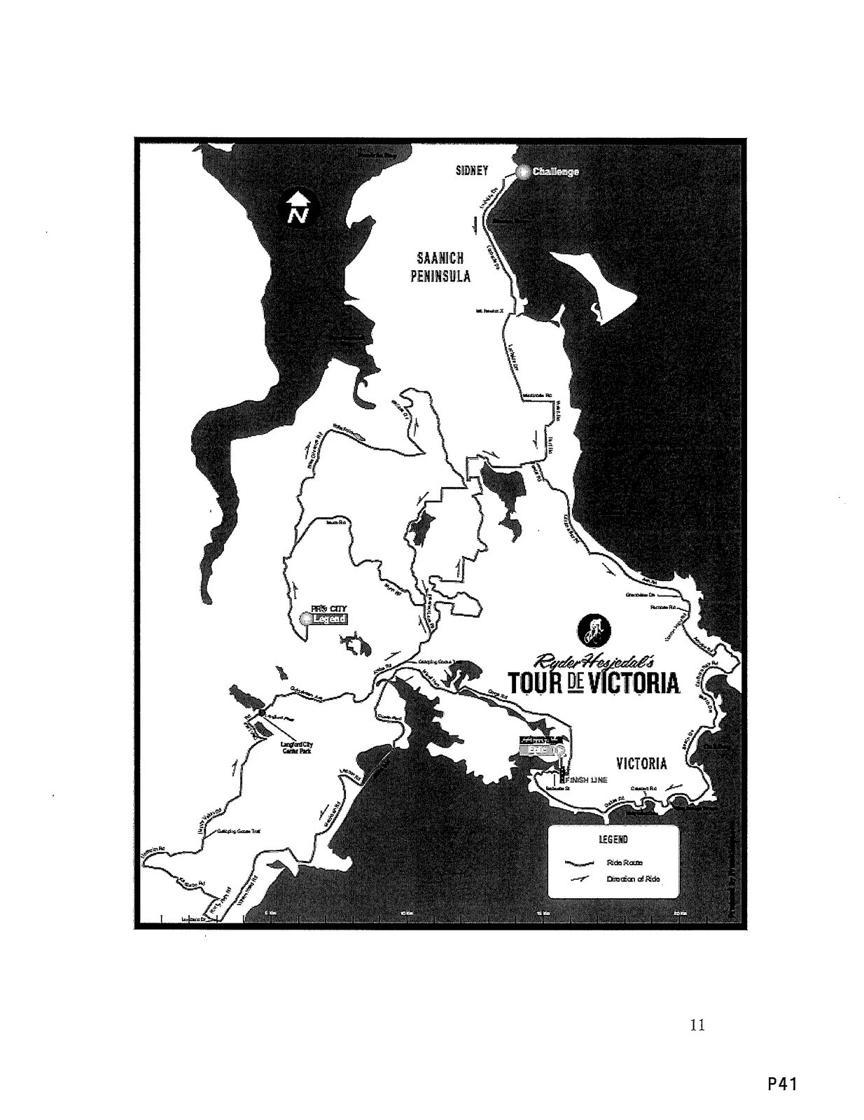
The ride encompasses several municipalities in the Greater Victoria area. There will be three different distances:
- Epic (140km) — Start and finish in Victoria's Inner Harbour
- Legend (90km) — Start and finish in Victoria's Inner Harbour
- Challenge (45km) — Start in Sidney and finish in Victoria's Inner Harbour
One side of the road will be dedicated for TDV riders, with opposing vehicle traffic allowed on the opposite side of the yellow line. No vehicles will be allowed to travel on the same side of the road that the riders are traveling on, except in a few designated areas.
1.02 Ride Date and Duration
The ride will take place Sunday, August 21, 2016 starting at 7:00am and ending at approximately 3:30pm. Refer to Course Control Plan for approximate times the cyclists will be in each area.
1.03 Jurisdictions
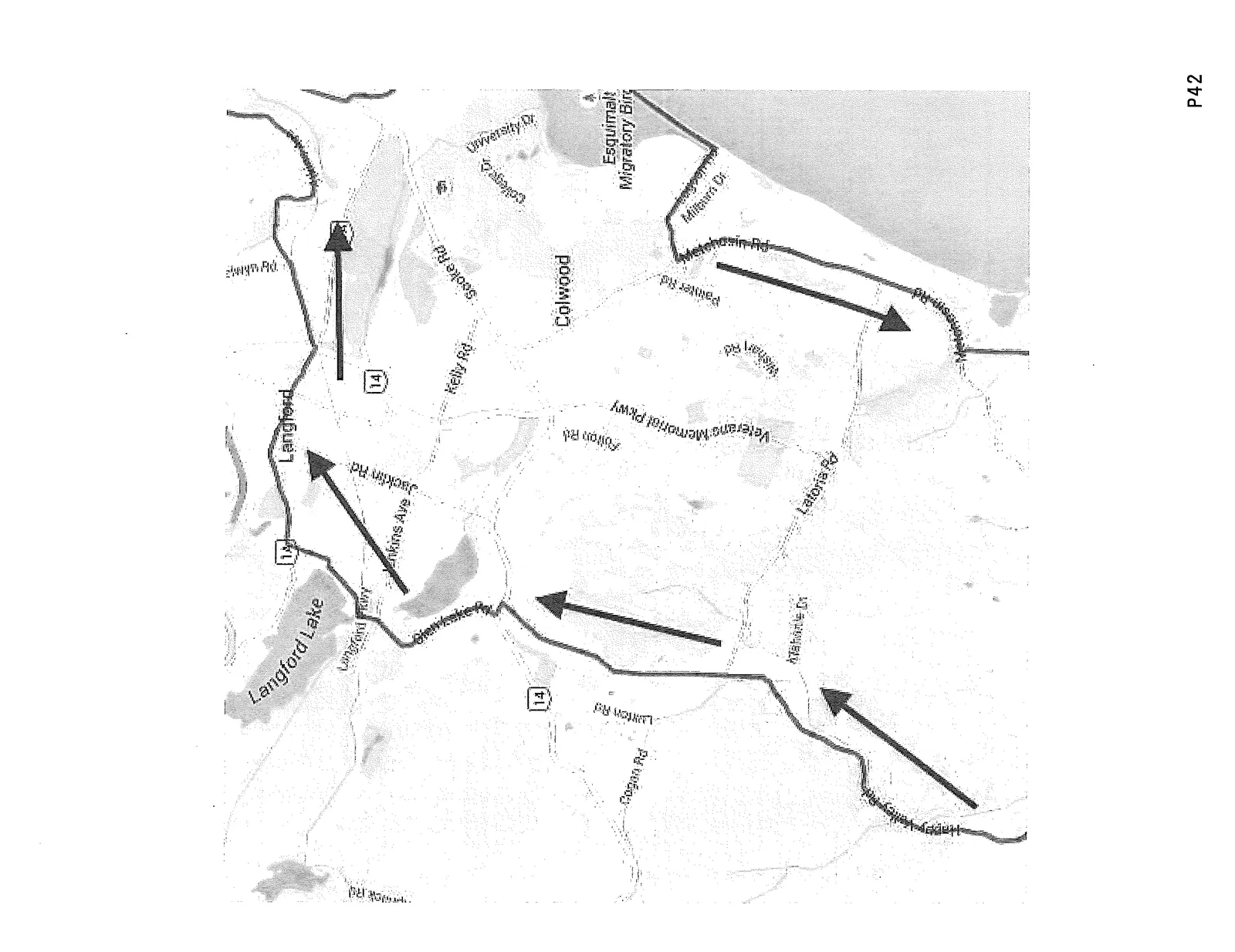
See attached Route Maps and Course Control Plan for overall and detailed route maps for each Jurisdiction.
1.04 Traffic Control Personnel
The personnel responsible for traffic control and for directing the cyclists are broken down into four categories as follows:
- Police Officers or Reserves are provided by each municipality. These will be the highest level of traffic control and will be located at the major intersections indicated on the attached Course Control Plan.
- Traffic Control Persons (TCPs) are certified professional flagpersons provided by Island Traffic Services. The TCPs will be responsible for all traffic control not provided by police officers or reserves and will be located as indicated on the attached Course Control Plan.
- Traffic Control Supervisors (TCS) will be provided by Island Traffic Services and will be responsible for coordinating the efforts of the TCPs. Each TCS will be responsible for a section of the race and their contact information is listed in the Appendix A.
- Volunteer Marshals are responsible for directing the cyclists. The volunteers will not be directing traffic. The locations of the volunteer marshals are indicated on the attached Course Control Plan.
1.05 Traffic Control Plan
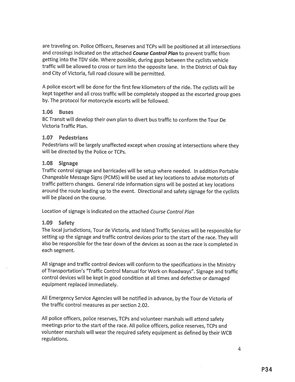
The side of the road that the cyclists are riding in will be closed to traffic for the entire route. No vehicles will be allowed to travel on the same side of the road that the riders are traveling on. Police Officers, Reserves and TCPs will be positioned at all intersections and crossings indicated on the attached Course Control Plan to prevent traffic from getting into the TDV side. Where possible, during gaps between the cyclists vehicle traffic will be allowed to cross or turn into the opposite lane. In the District of Oak Bay and City of Victoria, full road closure will be permitted.
A police escort will be done for the first few kilometers of the ride. The cyclists will be kept together and all cross traffic will be completely stopped as the escorted group goes by. The protocol for motorcycle escorts will be followed.
1.06 Buses
BC Transit will develop their own plan to divert bus traffic to conform the Tour De Victoria Traffic Plan.
1.07 Pedestrians
Pedestrians will be largely unaffected except when crossing at intersections where they will be directed by the Police or TCPs.
1.08 Signage
Traffic control signage and barricades will be setup where needed. In addition Portable Changeable Message Signs (PCMS) will be used at key locations to advise motorists of traffic pattern changes. General ride information signs will be posted at key locations around the route leading up to the event. Directional and safety signage for the cyclists will be placed on the course.
Location of signage is indicated on the attached Course Control Plan.
1.09 Safety
The local jurisdictions, Tour de Victoria, and Island Traffic Services will be responsible for setting up the signage and traffic control devices prior to the start of the race. They will also be responsible for the tear down of the devices as soon as the race is completed in each segment.
All signage and traffic control devices will conform to the specifications in the Ministry of Transportation's "Traffic Control Manual for Work on Roadways". Signage and traffic control devices will be kept in good condition at all times and defective or damaged equipment replaced immediately.
All Emergency Service Agencies will be notified in advance, by the Tour de Victoria of the traffic control measures as per section 2.02.
All police officers, police reserves, TCPs and volunteer marshals will attend safety meetings prior to the start of the race. All police officers, police reserves, TCPs and volunteer marshals will wear the required safety equipment as defined by their WCB regulations.
All hazards to the cyclists, workers and the travelling public will be identified and minimized. Accidents, near misses, and dangerous situations or acts, will be reported the proper authorities as per the Emergency Response Plan.
2. PUBLIC INFORMATION PLAN
2.01 General Public Notification
Residents along the route will be notified in advance by a general mailout, done by postal code, with information regarding the traffic diversions on race day. See Appendix C for an example of the mailout.
The general public will be notified in advance of traffic delays or detours via public service announcements placed in the local media (newspaper, television and radio).
Radio Stations / TV Stations:
- CFAX
- CTV Vancouver Island
- CBC
- CHEK
- Jack-FM 103.1
- 98.5 FM
- 100.3 the O.
- ZONE at 91.3
- 107.3 KOOL FM
Newspapers:
- Times Colonist
- Vic News
- Saanich News
2.02 Agency Notification
The following agencies will also be notified in advance of the traffic pattern changes:
- Police (see Appendix A)
- Fire (see Appendix A)
- BC Ambulance Service — (604) 872-6742 (fax)
- BC Transit — (250) 995-5642 (fax)
3. EMERGENCY RESPONSE PLAN
3.01 Introduction
The primary objective of this plan is to facilitate emergency response to the incident and move traffic safely and expeditiously through or around the incident site. The following types of incidents may be expected to occur around the cycling route:
- Motor vehicle accidents
- Cyclists injured
- Pedestrians and/or spectators injured
- TCPs or volunteers injured
- Traffic jams
3.02 Procedures for Dealing with an Incident
If an incident occurs on the cycle route the nearest police officer, TCP or volunteer marshal will take charge of the scene until relieved by a higher authority. The following general emergency response procedure is to be implemented by the person in charge:
- Respond quickly with emergency traffic control measures to ensure public safety.
- Contact the appropriate emergency response agencies and/or the Tour de Victoria medical team as appropriate (see section 3.05).
- Contact Island Traffic Services for additional traffic control resources as required (see section 3.05).
- Ensure the emergency response agencies have quick access to the incident. If necessary shut down the ride to facilitate this.
- Assist emergency response personnel when required.
- Contact the Emergency Operations Center to make them aware of the incident (see section 3.05).
- Record details of the incident as much as possible and provide a report to the Tour de Victoria and the local jurisdiction within 12 hours. A copy of the incident report is located in Appendix B.
3.03 Emergency Operations Center (EOC)
An Emergency Operations Center will be set up in the Victoria Police Station. A representative from each jurisdiction and all interested parties will be located at the EOC to coordinate the activities of their agency with the others. Each representative in the EOC will have communications with their key personnel.
3.04 Tour de Victoria Medical Response Team
The Tour de Victoria will provide a medical response team to deal with cyclist's medical problems and minor injuries. The Tour de Victoria Medical Response Plan is located in the attachment Medical Plan.pdf. Note that serious cyclist injuries will be treated by the normal emergency response agencies as listed in the Emergency Response Plan above.
3.05 Emergency Contact List
Emergency Services: 911
Emergency Operations Center
Tour de Victoria Rep: Ole Jorgensen — (250) 883-1340
Police (Non-Emergency): (see Appendix A)
Fire (Non-Emergency): (see Appendix A)
BC Transit — 250-590-8630
Victoria General Hospital — 250-727-4212
Royal Jubilee Hospital — 250-370-8000
Saanich Peninsula Hospital — 250-544-7676
Tour de Victoria Emergency Team:
- Medical Director: Dr. Brendan Irvine — 250-896-6009
- Medical Team Coordinator: Craig Gillett — 250-884-4050
- Safety & Operations Manager: Brooks Hogya — 250-857-0600
Island Traffic Services:
- Course Supervisor: Brian Lister — 250-727-8138
Appendixes
Appendix A - Contacts
Tour de Victoria Contacts:
- Seamus McGrath — General Info — (250) 686-1422
- Brooks Hogya — Tour Director — (250) 857-0600
- Craig Gillett — Safety & Operations — (250) 884-4050
- Sheleena Gutierrez — Medical Captain — (250) 508-8363
- Trish Duncan — Event Coordinator — (250) 588-9126
- Tour de Victoria Office — (778) 350-6325
Island Traffic Services Contacts:
- Brian Lister — Overall Course Supervisor — (250) 727-8138
- Ian Lamplugh — General Manager — (250) 896-3272
Email: ian@islandtraffic.com
Zone Supervisors will be assigned leading up to the event.
Jurisdiction Emergency Contact List:
City of Victoria
- Police: (250) 995-7654
- Cathie Jorgensen - cathie.jorgensen@vicpd.ca
- Chris Spargo - chris.spargo@vicpd.ca
- Fire: (250) 920-3350
District of Oak Bay
- Police: (250) 592-2424 — Dave MacMillan
- Fire: (250) 592-9121
District of Saanich
- Police: (250) 475-4321 — Ron Stewart - rstewart@saanichpolice.ca
- Fire: (250) 475-1775
District of Central Saanich
- Police: (250) 652-4441 — Paul Brailey - paul.brailey@csaanich.ca
- Fire: (250) 544-4238
Westshore RCMP: (250) 474-8754 — Steve Wright - stephen.w.wright@rcmp-grc.gc.ca
District of Highlands, Town of View Royal, City Of Langford, District of Metchosin, City of Colwood
- District of Highlands Fire: (250) 474-2633
- Town of View Royal Fire: (250) 479-7322
- City of Langford Fire: (250) 478-9555
- District of Metchosin Fire: (250) 478-1307
- City of Colwood Fire: (250) 478-8321
Sidney/North Saanich RCMP: (250) 656-3931 — Erin Fraser - erin.fraser@rcmp-grc.gc.ca
- Town of Sidney Fire: (250) 656-2121
- District of North Saanich Fire: (250) 656-1931
Appendix B - Incident Management Report
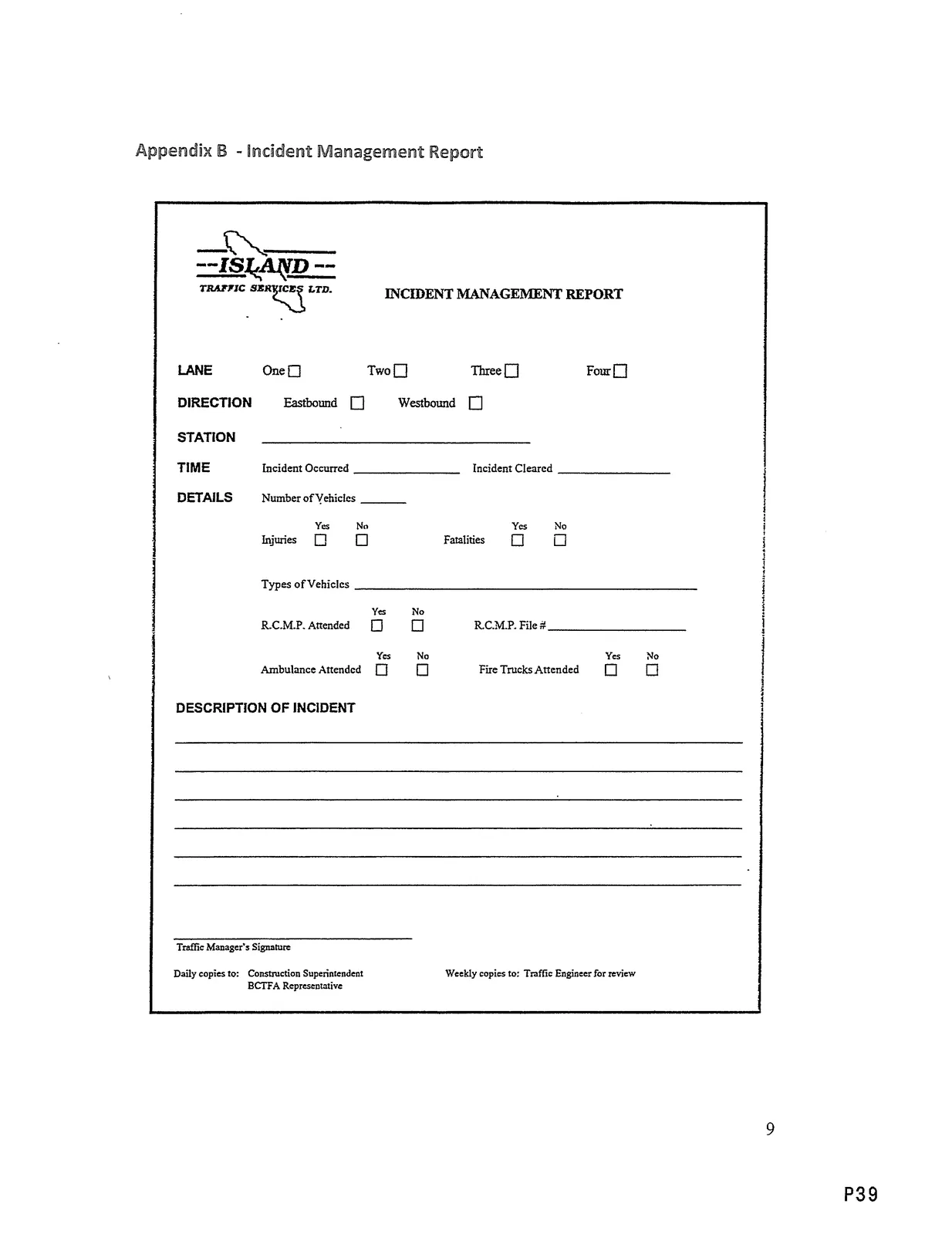
Incident Management Report (form fields as extracted):
- TRAFFIC SERVICES LTD. INCIDENT MANAGEMENT REPORT
- LANE: One / Two / Three / Four
- DIRECTION: Eastbound / Westbound
- STATION
- TIME
- Incident Occurred
- Incident Cleared
- DETAILS
- Number of Vehicles — Yes / No
- Injuries — Yes / No
- Fatalities — Yes / No
- Types of Vehicles — Yes / No
- R.C.M.P. Attended — Yes / No
- R.C.M.P. File #
- Ambulance Attended — Yes / No
- Fire Trucks Attended — Yes / No
- DESCRIPTION OF INCIDENT
- Traffic Manager's Signature
Daily copies to: Construction Superintendent
Weekly copies to: Traffic Engineer for review
BCTFA Representative
Appendix C — Road Closure Notification Example
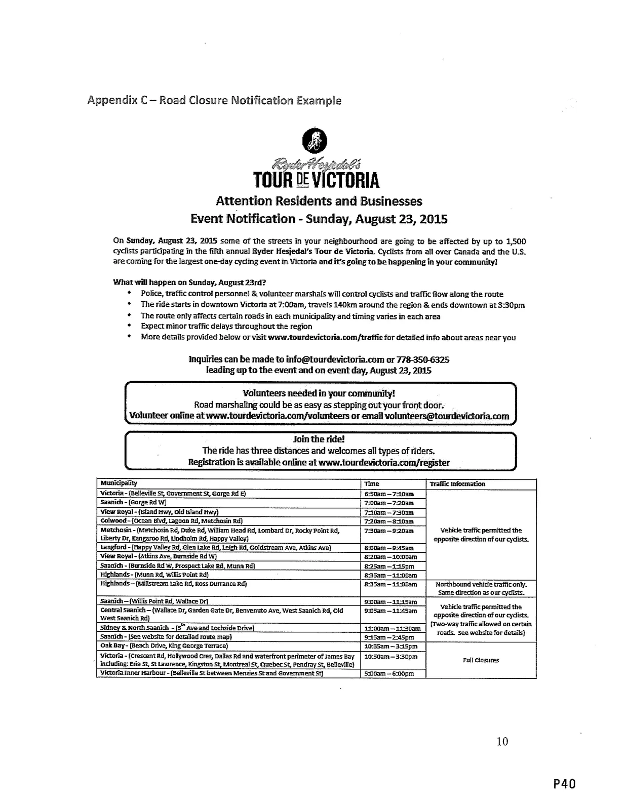
TOUR DE VICTORIA
Attention Residents and Businesses
Event Notification - Sunday, August 23, 2015
On Sunday, August 23, 2015 some of the streets in your neighbourhood are going to be affected by up to 1,500 cyclists participating in the fifth annual Ryder Hesjedal's Tour de Victoria. Cyclists from all over Canada and the US are coming for the largest one-day cycling event in Victoria and it's going to be happening in your community!
What will happen on Sunday, August 23rd?
- Police, traffic control personnel & volunteer marshals will control cyclists and traffic flow along the route
- The ride starts in downtown Victoria at 7:00am, travels 140km around the region & ends downtown at 3:30pm
- The route only affects certain roads in each municipality and timing varies in each area
- Expect minor traffic delays throughout the region
- More details provided below or visit www.tourdevictoria.com/traffic for detailed info about areas near you
Inquiries can be made to info@tourdevictoria.com or 718-393-6325
Leading up to the event and on event day, August 23, 2015
Volunteers needed in your community!
Road marshaling could be as easy as stepping out your front door:
Volunteer online at www.tourdevictoria.com/volunteers or email volunteers@tourdevictoria.com
Join the ride!
The ride has Three distances and welcomes all types of riders. Registration is available online at www.tourdevictoria.com/register
Municipality / Time / Traffic information:
- Victoria (Belleville St, Government St, Gorge Rd E) — 6:50am — 7:00am — Vehicle traffic permitted the opposite direction of our cyclists
- Saanich (Gorge Rd W) — 7:00am — 7:20am
- View Royal (Island Hwy, Old Island Hwy) — 7:10am — 7:30am
- Colwood (Ocean Blvd, Lagoon Rd, Metchosin Rd) — 7:20am — 8:10am
- Metchosin (Metchosin Rd, Duke Rd, William Head Rd, Lombard Dr, Rocky Point Rd, Liberty Dr, Kangaroo Rd, Lindholm Rd, Happy Valley) — 7:30am — 9:20am
- Langford (Happy Valley Rd, Glen Lake Rd, Leigh Rd, Goldstream Ave, Atkins Ave) — 8:00am — 9:45am
- View Royal (Atkins Ave, Burnside Rd W) — 8:20am — 10:00am
- Saanich (Burnside Rd W, Prospect Lake Rd, Munn Rd) — 8:25am — 1:15pm
- Highlands (Munn Rd, Willis Point Rd) — 8:33am — 9:00am
- Highlands (Millstream Lake Rd, Ross Durrance Rd) — 8:35am — 11:30am — Northbound vehicle traffic only. Same direction as our cyclists
- Saanich (Millis Point Rd, Wallace Dr) — 9:00am — 11:45am — Vehicle traffic permitted the opposite direction of our cyclists. (Two-way traffic allowed on certain roads. See website for details)
- Central Saanich (Wallace Dr, Garden Gate Dr, Benvenuto Ave, West Saanich Rd, Old West Saanich Rd) — 9:05am — 11:45am
- Sidney & North Saanich (5th Ave and Lochside Drive) — 9:10am — 11:30am
- Saanich (See website for detailed route map) — 9:15am — 2:45pm
- Oak Bay (Beach Drive, King George Terrace) — 10:35am — 3:15pm — Full Closures
Victoria (Crescent Rd, Hollywood Cil, Dallas Rd and waterfront perimeter of James Bay including: Erie St, St Lawrence, Kingston St, Montreal St, Quebec St, Pendray St, Belleville) — 10:50am — 3:30pm
Victoria Inner Harbour (Belleville St between Menzies St and Government St) — 5A:10am — 5:00pm
(Note: the Road Closure Notification Example contains specific times and local routing details as provided above. See the example image for formatting.)
Route Control / Event Day Schedule (Selected excerpts)
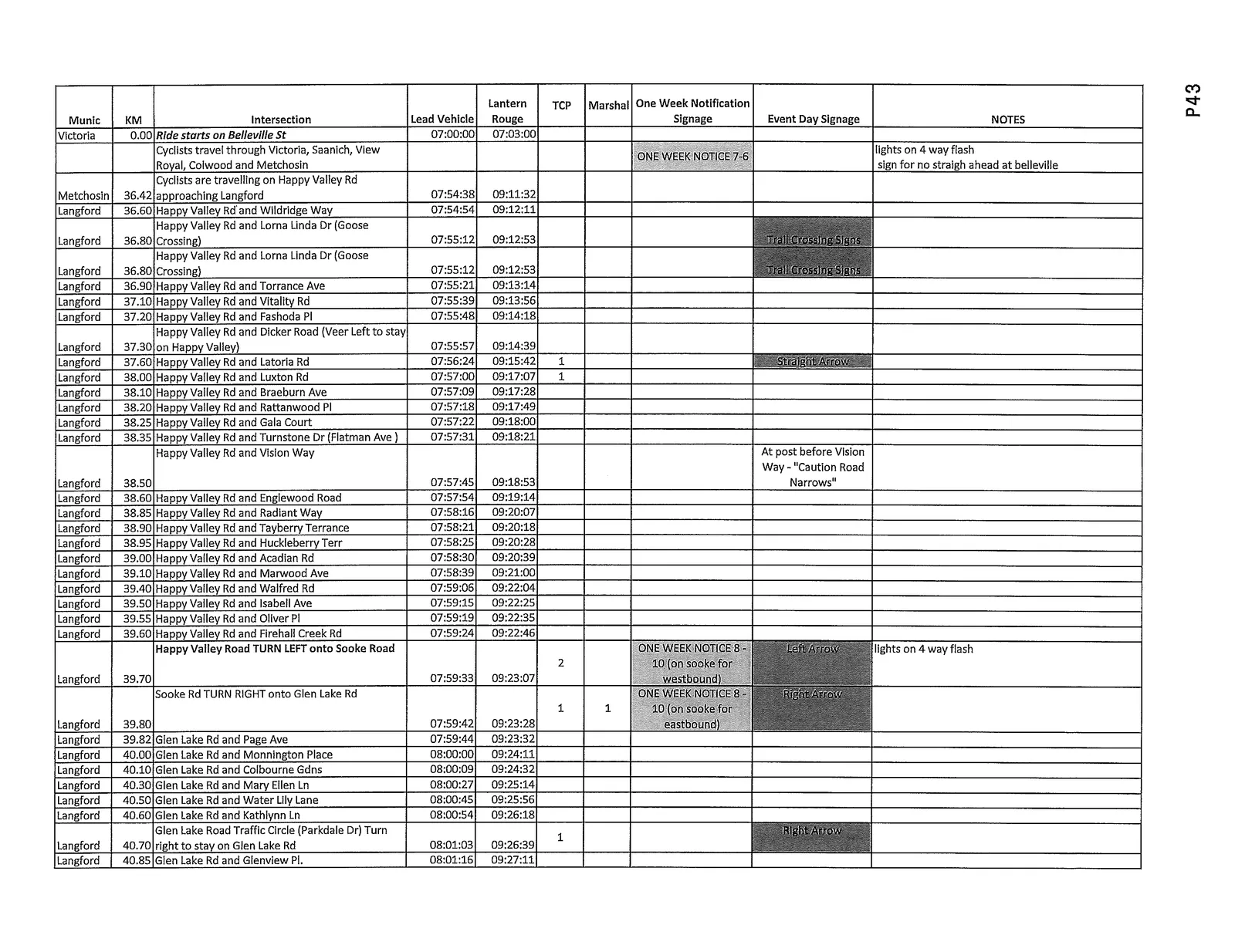
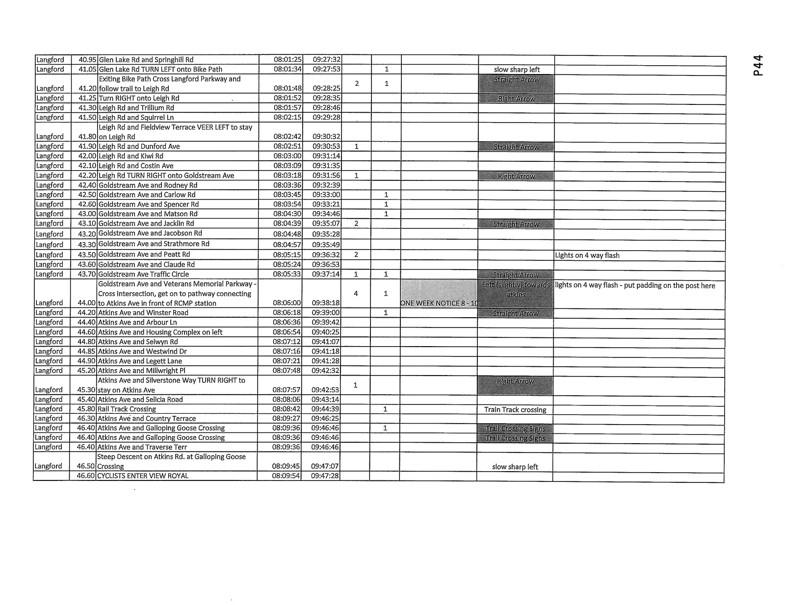
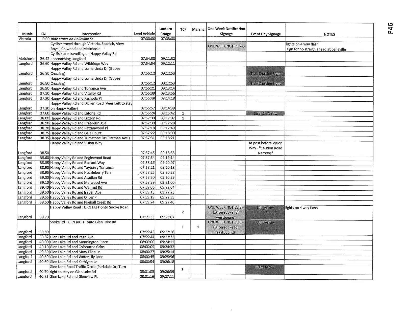
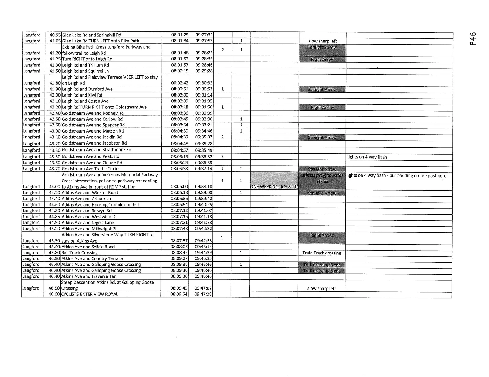
The route control table columns (as provided in the plan) include: Municipality | KM | Intersection | Lead Vehicle | Lantern Rouge | TCP / Marshal | One Week Notification | Signage | Event Day Signage | NOTES
Below is the route schedule rendered to preserve the document's times, intersections, and notes:
| Municipality | KM | Intersection / Instruction | Lead Vehicle | Lantern Rouge | TCP / Marshal | One Week Notification | Signage | Event Day Signage | NOTES |
|---|---|---|---|---|---|---|---|---|---|
| Victoria | 0.00 | Ride starts on Belleville St | 07:00:00 | 07:03:00 | ONE WEEK NOTICE 7-6 | lights on 4 way flash | sign for no straigh ahead at belleville | Cyclists travel through Victoria, Saanich, View Royal, Colwood and Metchosin | |
| Metchosin | 36.42 | Cyclists are travelling on Happy Valley Rd approaching Langford | 07:54:38 | 09:11:32 | |||||
| Langford | 36.60 | Happy Valley Rd and Wildridge Way | 07:54:54 | 09:12:11 | |||||
| Langford | 36.80 | Happy Valley Rd and Lorna Linda Dr (Goose Crossing) | 07:55:12 | 09:12:53 | Trail Crossing Signs | ||||
| Langford | 36.80 | Happy Valley Rd and Lorna Linda Dr (Goose Crossing) | 07:55:12 | 09:12:53 | Trail Crossing Signs | ||||
| Langford | 36.90 | Happy Valley Rd and Torrance Ave | 07:55:21 | 09:13:14 | |||||
| Langford | 37.10 | Happy Valley Rd and Vitality Rd | 07:55:39 | 09:13:56 | |||||
| Langford | 37.20 | Happy Valley Rd and Fashoda Pl | 07:55:48 | 09:14:18 | |||||
| Langford | 37.30 | Happy Valley Rd and Dicker Road (Veer Left to stay on Happy Valley) | 07:55:57 | 09:14:39 | |||||
| Langford | 37.60 | Happy Valley Rd and Latoria Rd | 07:56:24 | 09:15:42 | |||||
| Langford | 38.00 | Happy Valley Rd and Luxton Rd | 07:57:00 | 09:17:07 | |||||
| Langford | 38.10 | Happy Valley Rd and Braeburn Ave | 07:57:09 | 09:17:28 | |||||
| Langford | 38.20 | Happy Valley Rd and Rattanwood Pl | 07:57:18 | 09:17:49 | |||||
| Langford | 38.25 | Happy Valley Rd and Gala Court | 07:57:22 | 09:18:00 | |||||
| Langford | 38.35 | Happy Valley Rd and Turnstone Dr (Flatman Ave) | 07:57:31 | 09:18:21 | |||||
| Langford | 38.50 | Happy Valley Rd and Vision Way | 07:57:45 | 09:18:53 | At post before Vision Way - "Caution Road Narrows" | ||||
| Langford | 38.60 | Happy Valley Rd and Englewood Road | 07:57:54 | 09:19:14 | |||||
| Langford | 38.85 | Happy Valley Rd and Radiant Way | 07:58:16 | 09:20:07 | |||||
| Langford | 38.90 | Happy Valley Rd and Tayberry Terrance | 07:58:21 | 09:20:18 | |||||
| Langford | 38.95 | Happy Valley Rd and Huckleberry Terr | 07:58:25 | 09:20:28 | |||||
| Langford | 39.00 | Happy Valley Rd and Acadian Rd | 07:58:30 | 09:20:39 | |||||
| Langford | 39.10 | Happy Valley Rd and Marwood Ave | 07:58:39 | 09:21:00 | |||||
| Langford | 39.40 | Happy Valley Rd and Walfred Rd | 07:59:06 | 09:22:04 | |||||
| Langford | 39.50 | Happy Valley Rd and Isabell Ave | 07:59:15 | 09:22:25 | |||||
| Langford | 39.55 | Happy Valley Rd and Oliver Pl | 07:59:19 | 09:22:35 | |||||
| Langford | 39.60 | Happy Valley Rd and Firehall Creek Rd | 07:59:24 | 09:22:46 | |||||
| Langford | 39.70 | Happy Valley Road TURN LEFT onto Sooke Road | 07:59:33 | 09:23:07 | ONE WEEK NOTICE 8-10 (on sooke for westbound) | lights on 4 way flash | |||
| Langford | 39.80 | Sooke Rd TURN RIGHT onto Glen Lake Rd | 07:59:42 | 09:23:28 | ONE WEEK NOTICE 8-10 (on sooke for eastbound) | Right Arrow | |||
| Langford | 39.82 | Glen Lake Rd and Page Ave | 07:59:44 | 09:23:32 | |||||
| Langford | 40.00 | Glen Lake Rd and Monnington Place | 08:00:00 | 09:24:11 | |||||
| Langford | 40.10 | Glen Lake Rd and Colbourne Gdns | 08:00:09 | 09:24:32 | |||||
| Langford | 40.30 | Glen Lake Rd and Mary Ellen Ln | 08:00:27 | 09:25:14 | |||||
| Langford | 40.50 | Glen Lake Rd and Water Lily Lane | 08:00:45 | 09:25:56 | |||||
| Langford | 40.60 | Glen Lake Rd and Kathlynn Ln | 08:00:54 | 09:26:18 | |||||
| Langford | 40.70 | Glen Lake Road Traffic Circle (Parkdale Dr) Turn right to stay on Glen Lake Rd | 08:01:03 | 09:26:39 | Right Arrow | ||||
| Langford | 40.85 | Glen Lake Rd and Glenview Pl. | 08:01:16 | 09:27:11 | |||||
| Langford | 40.95 | Glen Lake Rd and Springhill Rd | 08:01:25 | 09:27:32 | |||||
| Langford | 41.05 | Glen Lake Rd TURN LEFT onto Bike Path | 08:01:34 | 09:27:53 | slow sharp left | ||||
| Langford | 41.20 | Exiting Bike Path — Cross Langford Parkway and follow trail to Leigh Rd | 08:01:48 | 09:28:25 | Straight Arrow | ||||
| Langford | 41.25 | Turn RIGHT onto Leigh Rd | 08:01:52 | 09:28:35 | Right Arrow | ||||
| Langford | 41.30 | Leigh Rd and Trillium Rd | 08:01:57 | 09:28:46 | |||||
| Langford | 41.50 | Leigh Rd and Squirrel Ln | 08:02:15 | 09:29:28 | |||||
| Langford | 41.80 | Leigh Rd and Fieldview Terrace — VEER LEFT to stay on Leigh Rd | 08:02:42 | 09:30:32 | |||||
| Langford | 41.90 | Leigh Rd and Dunford Ave | 08:02:51 | 09:30:53 | Straight Arrow | ||||
| Langford | 42.00 | Leigh Rd and Kiwi Rd | 08:03:00 | 09:31:14 | |||||
| Langford | 42.10 | Leigh Rd and Costin Ave | 08:03:09 | 09:31:35 | |||||
| Langford | 42.20 | Leigh Rd TURN RIGHT onto Goldstream Ave | 08:03:18 | 09:31:56 | Right Arrow | ||||
| Langford | 42.40 | Goldstream Ave and Rodney Rd | 08:03:36 | 09:32:39 | |||||
| Langford | 42.50 | Goldstream Ave and Carlow Rd | 08:03:45 | 09:33:00 | |||||
| Langford | 42.60 | Goldstream Ave and Spencer Rd | 08:03:54 | 09:33:21 | |||||
| Langford | 43.00 | Goldstream Ave and Matson Rd | 08:04:30 | 09:34:46 | |||||
| Langford | 43.10 | Goldstream Ave and Jacklin Rd | 08:04:39 | 09:35:07 | Straight Arrow | ||||
| Langford | 43.20 | Goldstream Ave and Jacobson Rd | 08:04:48 | 09:35:28 | |||||
| Langford | 43.30 | Goldstream Ave and Strathmore Rd | 08:04:57 | 09:35:49 | |||||
| Langford | 43.50 | Goldstream Ave and Peatt Rd | 08:05:15 | 09:36:32 | Lights on 4 way flash | ||||
| Langford | 43.60 | Goldstream Ave and Claude Rd | 08:05:24 | 09:36:53 | |||||
| Langford | 43.70 | Goldstream Ave Traffic Circle | 08:05:33 | 09:37:14 | Straight Arrow | ||||
| Langford | 44.00 | Goldstream Ave and Veterans Memorial Parkway — Cross intersection, get on to pathway connecting to Atkins Ave in front of RCMP station | 08:06:00 | 09:38:18 | ONE WEEK NOTICES - 1( | Left (slightly) towards atkins | lights on 4 way flash - put padding on the post here | ||
| Langford | 44.20 | Atkins Ave and Winster Road | 08:06:18 | 09:39:00 | Straight Arrow | ||||
| Langford | 44.40 | Atkins Ave and Arbour Ln | 08:06:36 | 09:39:42 | |||||
| Langford | 44.60 | Atkins Ave and Housing Complex on left | 08:06:54 | 09:40:25 | |||||
| Langford | 44.80 | Atkins Ave and Selwyn Rd | 08:07:12 | 09:41:07 | |||||
| Langford | 44.85 | Atkins Ave and Westwind Dr | 08:07:16 | 09:41:18 | |||||
| Langford | 44.90 | Atkins Ave and Legett Lane | 08:07:21 | 09:41:28 | |||||
| Langford | 45.20 | Atkins Ave and Millwright Pl | 08:07:48 | 09:42:32 | |||||
| Langford | 45.30 | Atkins Ave and Silverstone Way — TURN RIGHT to stay on Atkins Ave | 08:07:57 | 09:42:53 | Right Arrow | ||||
| Langford | 45.40 | Atkins Ave and Selicia Road | 08:08:06 | 09:43:14 | |||||
| Langford | 45.80 | Rail Track Crossing | 08:08:42 | 09:44:39 | Train Track crossing | ||||
| Langford | 46.30 | Atkins Ave and Country Terrace | 08:09:27 | 09:46:25 | |||||
| Langford | 46.40 | Atkins Ave and Galloping Goose Crossing | 08:09:36 | 09:46:46 | Trail Crossing Signs | ||||
| Langford | 46.40 | Atkins Ave and Traverse Terr | 08:09:36 | 09:46:46 | |||||
| Langford | 46.50 | Steep Descent on Atkins Rd. at Galloping Goose Crossing | 08:09:45 | 09:47:07 | slow sharp left | ||||
| Langford | 46.60 | CYCLISTS ENTER VIEW ROYAL | 08:09:54 | 09:47:28 |
(Where repeated or duplicated rows occur in the original document, they have been presented as preserved items; see attached images for the full formatted original tables.)
Notes: The route control schedule continues across multiple pages; refer to the attached Course Control Plan for a complete map and full table.
End of extracted content for pages 34–49.