DocumentsStaff ReportApr 2, 2024Pages 67–83
Report 10.1 - TUP21-0003 Station Road - Request for Extension
Staff report regarding a request to extend Temporary Use Permit TUP21-0003 for Station Road; provides background, conditions and staff recommendation.
Key facts
- Agenda item: 10.1 (pages start at 67)
- Subject: TUP21-0003 - Station Road Request for Extension
- Contains conditions and recommended motions for Council consideration
- Specific extension period and conditions detailed in the report (see pages 67–83)
Report 10.1 - TUP21-0003 Station Road - Request for Extension
DATE: Tuesday, April 2, 2024
DEPARTMENT: Planning
APPLICATION NO.: TUP21-0003 (Renewal)
SUBJECT: Renewal of TUP21-0003 to allow for a variety of commercial and tourism-based uses to continue on leased land along Station Avenue.
PURPOSE
In 2021, the City of Langford entered into an agreement with the Island Corridor Foundation to allow the City to occupy and utilize a portion of the rail corridor for an arts and culture hub. A Temporary Use Permit was issued to permit these uses on the land. The City has applied on behalf of the property owner, Island Corridor Foundation (ICF), to renew the temporary use permit TUP21-0003 to allow the use to continue at the subject property for an additional three years. The permit is due to expire on August 17th, 2024, three years from the date of issuance. The original staff report from 2021 is attached with additional background information.
BACKGROUND
At their regular meeting held on Monday, August 16th, 2021, Council issued TUP21-0003 to allow for an array of commercial, tourism based, and recreational uses to facilitate the revitalization of this portion of the E&N rail corridor and creation of a cultural precinct known as The Langford Station Cultural District.
The following uses were permitted through the temporary use permit issued in 2021:
- Artist or craftsperson studio
- Cultural facility
- Licensed premise
- Office
- Parking facility
- Public Assembly and Entertainment uses
- Recreation facility, outdoor
- Restaurant
- Retail store
- Tourist information centre
- Transportation terminal
In addition to uses listed above, the following uses are permitted in all zones in accordance with Zoning Bylaw 300:
- Parks
- Accessory uses
COMMENTARY
As noted above, the City of Langford has applied on behalf of ICF to maintain a number of recreational, commercial, cultural and tourism-based uses at The Langford Station Cultural District. All the required infrastructure upgrades, installation, construction, and beautification, have been completed, and the site has been in operation since May 2022.
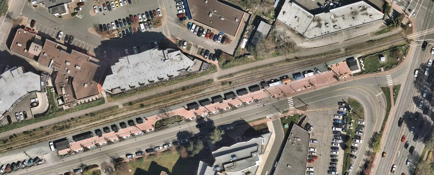
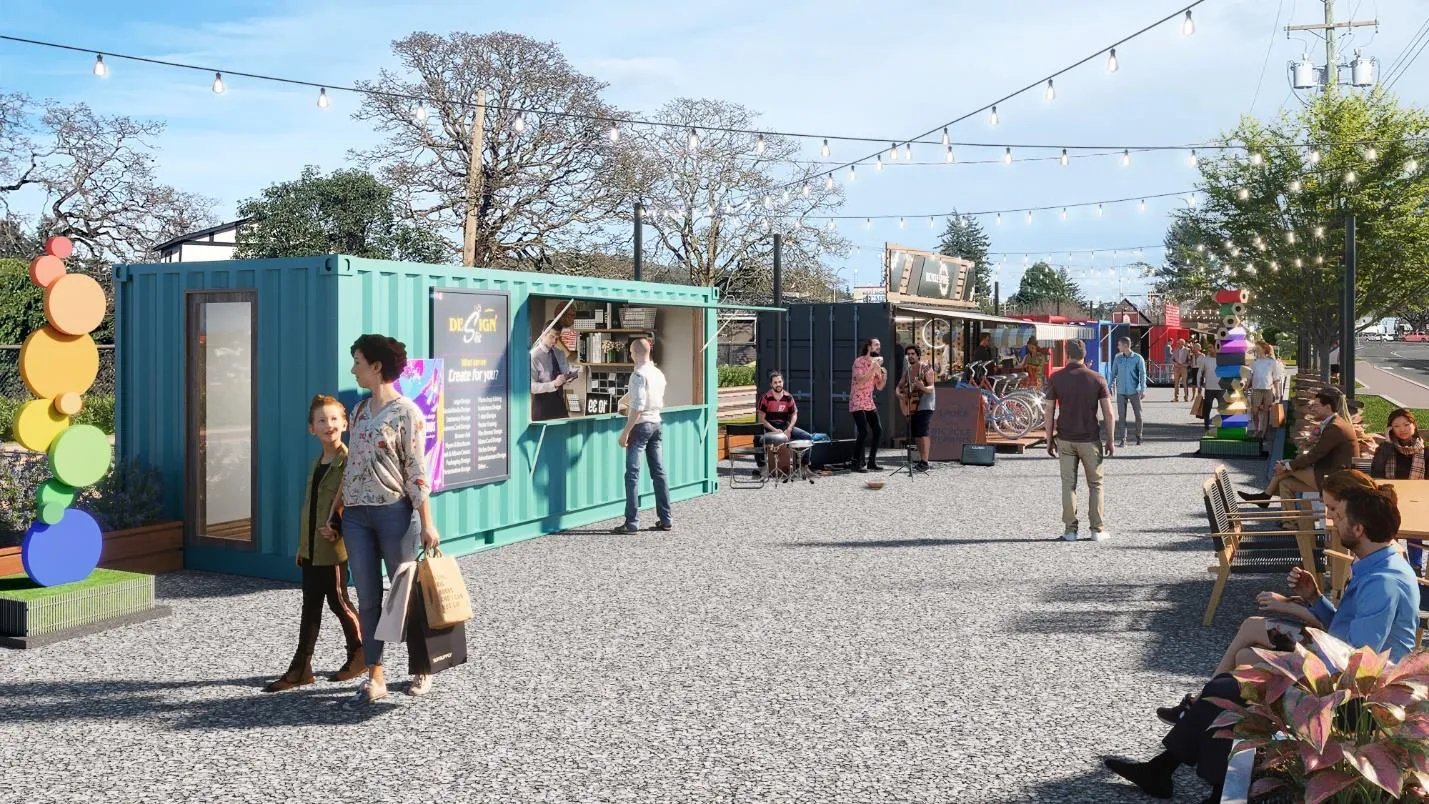
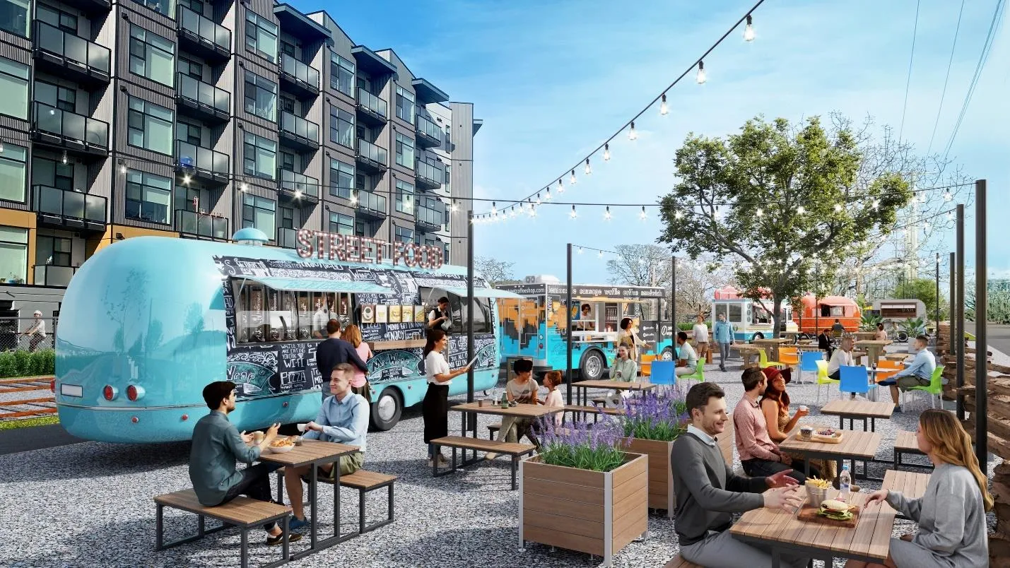
Currently, the subject site hosts a number of vendors and artists, occupying 13 retrofitted shipping containers of various sizes, as well as a numberer of food truck vendors in the designated gravel parking space. The location provides an opportunity for local artists and small-scale retailers to demonstrate their craft as well as try out their business model before committing to a permanent brick and mortar location. The Langford Station is also home to a number of community activities and events throughout the year including Fridays at the Station featuring live music and a beer garden, artisan markets hosted by local vendors, Show and Shine car show in August, food truck festival in September, an array of winter festival activities in December, and more.

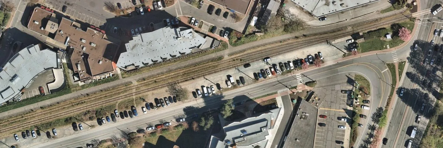
With the creation of The Langford Station, and a designated space for food truck vendors, the City has treated food trucks as a separate distinct use from that of a restaurant and have stopped categorizing food trucks under the restaurant definition in Zoning Bylaw No. 300. The original temporary use permit for The Langford Station includes “restaurant” as a permitted use. Council may wish to expand the list of permitted uses to specifically allow food trucks as a permitted use at the subject site. Expanding the list of the permitted uses to include food trucks will not introduce any new uses to the subject site, but rather provide further clarity and allow City Hall to regulate land use more effectively and ensure businesses operate in appropriate locations. To complete this, Council should also direct staff to bring forward a bylaw to amend Zoning Bylaw No. 300 by including “food truck” in the definitions found in Section 1.01 of Part 1 of the Bylaw.
Not all terms must be defined in the Zoning Bylaw to have effect. In this instance a clear definition could be helpful to create a distinction between “restaurant” and “food truck”.
The TUP21-0003 was issued with the condition that the requirement of a Form and Character Development Permit be waived provided that the site is developed is substantial accordance with the renderings provided. Council may wish to retain this condition as part of the renewal. Although the required infrastructure upgrades and site development and beautification has occurred, Council may wish to maintain this condition to allow City of Langford and its employees, contractors, and agents to carry out site modifications, if such are required.
This use has been operating at the location for nearly two years. Over this time, the City’s Bylaw Enforcement Department has not received any complaints with regards to the operation, and staff are not aware of any instances of non-compliance with the conditions outlined in the TUP or Zoning Bylaw 300.
Transforming an underutilized area into a vibrant cultural precinct attracts visitors, tourists, and businesses. Increased foot traffic can lead to higher spending at local businesses, fostering commercial activity in the area. Additionally, as mentioned earlier in the report, The Langford Station provides a space for small businesses to test their business model before securing a permanent commercial location, thus stimulating local commerce and contributing to the vitality and sustainability of the local economy.
FINANCIAL IMPLICATIONS
There is no cost to the City associated with the extension of the TUP as the operations will continue as they have been.
LEGAL IMPLICATIONS
Pursuant to S. 497 of the Local Government Act, the City may issue a TUP for a period of up to three years. The Local Government Act also allows a temporary use permit to be extended for a maximum of an additional three years. If the holder of a TUP wishes to conduct the temporary use beyond 6 years, they are required to make a new application to Council for a TUP or apply for rezoning of the subject site.
OPTIONS
Option 1
THAT Council:
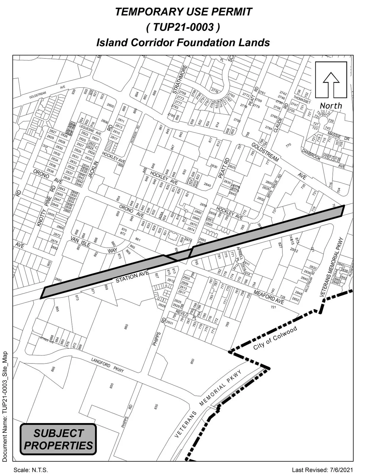
- Direct staff to provide notice that Council will consider renewing Temporary Use Permit TUP21-0003 for a period of three years for the lands identified on the site map attached as Appendix A, to allow for the following uses:
a. Artist or craftsperson studio
b. Cultural facility
c. Licensed premises
d. Office
e. Parking facility
f. Public assembly and entertainment uses
g. Recreation facility, outdoor
h. Restaurant
i. Retail store
j. Tourist information centre
k. Transportation terminal
l. Food trucks
Subject to the following conditions:
i. Waive the requirement for a Form and Character Development Permit provided that site remains in substantial accordance with form and character previously approved by Council.
AND
- Direct staff to prepare the amendment to Zoning Bylaw No. 300 to include a definition of “food truck”.
OR Option 2
THAT Council take no action with respect to renewing a Temporary Use Permit TUP21-0003 on the lands identified on a site map attached as Appendix A, until such time as the following items are addressed and reviewed by the Sustainable Development Advisory Committee:
a. _____________;
b. _____________;
c. _____________.
SUBMITTED BY
Anastasiya Mysak, Planner I
Concurrence:
Leah Stohmann, MCIP, RPP, Director of Community Planning and Climate Change
Concurrence:
Matthew Baldwin, MCIP, RPP, Director of Planning and Subdivision
Concurrence:
Donna Petrie, Senior Manager of Communications & Economic Development
Concurrence:
Yari Nielsen, Director of Parks, Recreation and Facilities
Concurrence:
Katelyn Balzer, P.Eng., Director of Engineering and Public Works
Concurrence:
Michael Dillabaugh, CPA, CA, Director of Finance
Concurrence:
Marie Watmough, Director of Legislative & Protective Services
Concurrence: Braden Hutchins, Deputy Chief Administrative Officer
Concurrence:
Darren Kiedyk, Chief Administrative Officer
Attachment(s): TUP21-0003 Original Report
Appendices:
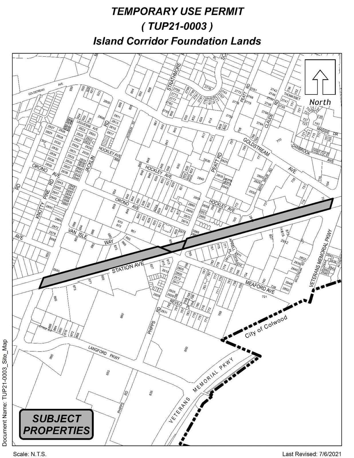
- Appendix A: Site Map
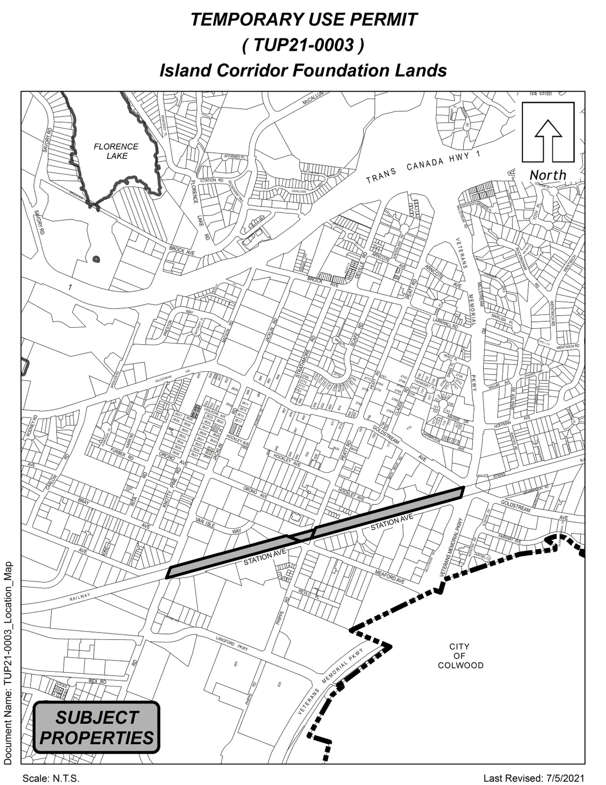
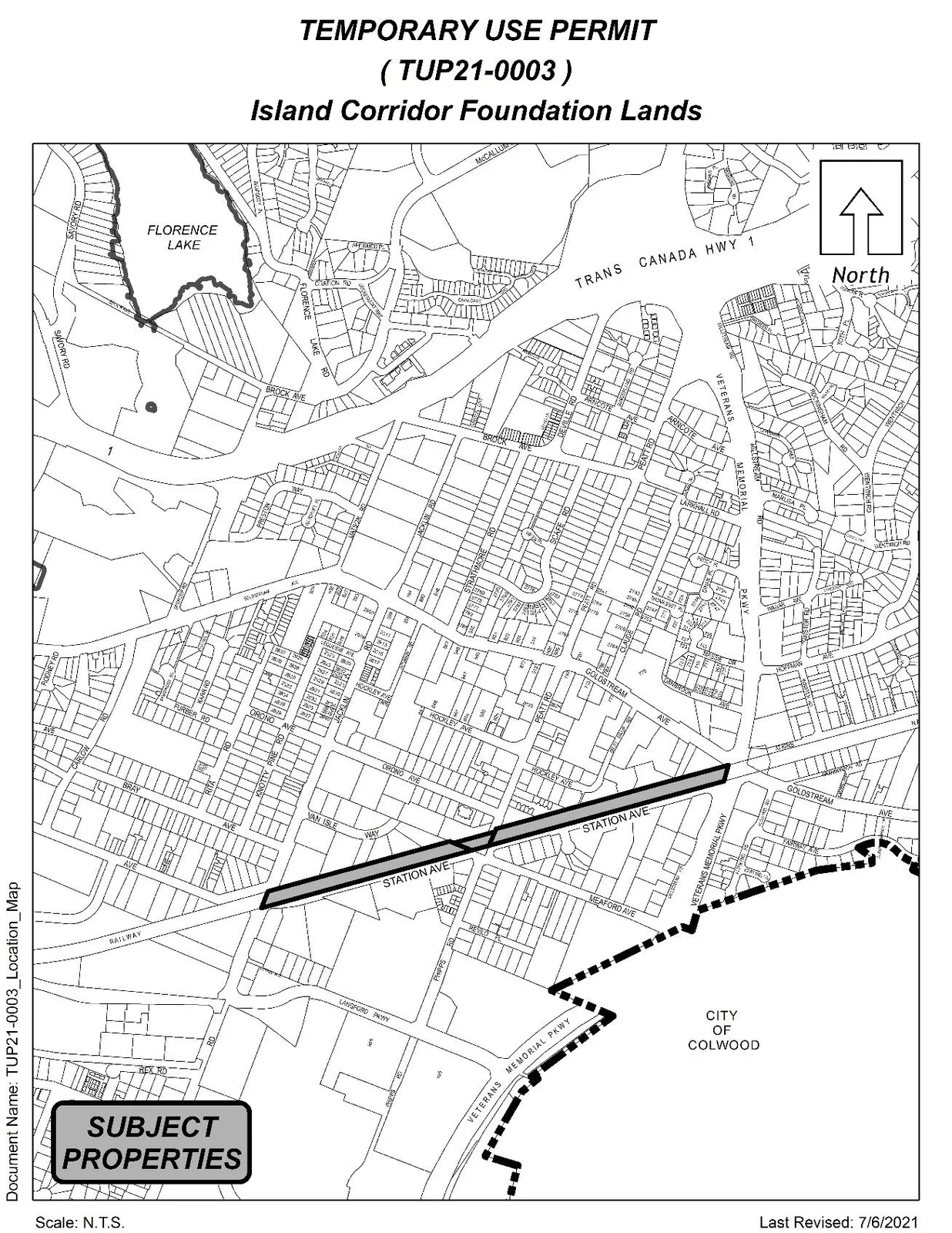
- Appendix B: Location Map
Staff Report to Planning, Zoning and Affordable Housing Committee (Original Report)
Date: July 12, 2021
Department: Planning
Application No.: TUP21-0003
Subject: Application to allow for Commercial and Tourism based uses on leased land along Station Ave.
PURPOSE
City of Langford staff have been working with the Island Corridor Foundation (ICF) on the Station Avenue Revitalization Project (SARP) to repurpose and beautify a stretch of the E&N rail corridor running through Langford’s City Centre. This project will focus on the creation of a Cultural Precinct for residents and tourists to discover local businesses, artists and eateries. Additionally, the informal parking between Jacklin Rd. and Veterans Memorial Parkway will see a reorganization and restructuring, resulting in formal stalls, site grading, servicing upgrades and general beautification. As this is a unique undertaking and the current lands have numerous zoning designations (as identified in Table 1), the purpose of this TUP on the properties described as; Lot 2, Section 73, Esquimalt District, Plan VIP86164, PID No. 009-019-898; Lot 1, Section 5, Esquimalt District, Plan VIP86164, PID No. 024-749-478; and Lot A, Section 72, Esquimalt District, Plan VIP65130, PID No.023-825-600, is to allow for the following uses:
- Artist or craftsperson studio
- Cultural facility
- Licensed Premise
- Office
- Parking facility
- Public Assembly and Entertainment uses
- Recreation facility, outdoor
- Restaurant
- Retail Store
- Tourist information centre
- Transportation terminal
Additional uses already permitted within every zone as per the Zoning Bylaw No. 300 include:
- Parks
- Accessory uses
BACKGROUND
The City of Langford was approached by the ICF regarding the revitalization of a significant portion of lands adjacent to the E&N Railway corridor between Jacklin Rd. and Veterans Memorial Parkway in Langford City Centre that for many years has been used as informal parking for residents, construction and business employees, recreation and second vehicles and unfortunately derelict vehicles. The City of Langford has recently agreed upon a 30-year lease with the ICF for use of these lands.
The Provincially established Gas Tax Fund (GTF) is available to the City to fund this project. This fund is subject to provincial auditing and therefore the use of these funds must meet specific criteria. City Staff have engaged the Province to ensure that the proposed works are a justified use of the GTF, and can confirm that the proposed project falls under and meets the criteria for a “Cultural Precinct” and shall be developed as such.
In order to prove out this Cultural Precinct, City Staff are proposing this TUP prior to an official rezoning of the lands in perpetuity. Should this project thrive and manage to be sustainable in the long term, an official rezoning of the lands may occur in the future. Staff anticipate that construction work on this project could be completed by Spring 2022.
Should Council approve the TUP, staff will research the appropriate mechanism in which to enact and uphold City of Langford regulations for Public and Open Space use.
Table 1: Site Data
| Item | Details |
|---|---|
| Applicant | City of Langford |
| Owner | Island Corridor Foundation |
| Civic Address | 860 Station Avenue |
| Legal Description | Lot 2, Section 73, Esquimalt District, Plan VIP86164, PID No. 009-019-898; Lot 1, Section 5, Esquimalt District, Plan VIP86164, PID No. 024-749-478; Lot A, Section 72, Esquimalt District, Plan VIP65130, PID No.023-825-600 |
| Size of Property | 33,120m2 approximate |
| DP Areas | City Centre DPA |
| Zoning | Existing: C3, C8A, C8, CS1, M2, MU1, MU1A, MU2, R2, RM2, RM4, RM7 Proposed: Maintain zoning designations, with permission to operate uses listed in the proposed. |
| OCP Designation | Existing: City Centre Proposed: N/A |
SITE AND SURROUNDING AREA
The site is a long corridor running through the City Centre, stretching from Veterans Memorial Parkway to Jacklin Road along Station Avenue. Due to the length and location of this site, the subject site adjoins many properties and a wide variety of uses including Commercial, Service Commercial, Light Industrial, Multi-Family Residential, and Residential. The proposed uses shall be complementary and not competitive to existing uses and businesses of the surrounding properties.
Table 2: Surrounding Land Uses
| Adjacent Zonings | Use |
|---|---|
| C8 (Community Town Centre Pedestrian) | Mixed Multi-family and Commercial |
| C8A (Community Town Centre Pedestrian A) | Commercial |
| C3 (District Commercial) | Commercial |
| CS1 (Service Commercial) | Commercial-Light Industrial |
| M2 (General Industrial) | Commercial- Light Industrial |
| MU1 (Mixed Use Residential Commercial) | Mixed Multi-family and Commercial |
| MU1A (Mixed Use Residential Commercial A) | Mixed Multi-family and Commercial |
| R2 (One- and Two-Family Residential) | Residential |
| RM2 (Attached Housing) | Multi-family Residential |
| RM4 (Apartment) | Multi-family Residential |
| RM7 (Medium-Density Apartment) | Multi-family Residential |
OFFICIAL COMMUNITY PLAN
The City Centre as defined by the Official Community Plan (OCP) includes:
- A major regional growth and employment centre that supports a wide range of high-density housing, including affordable and rental housing, in conjunction with commercial, office, institutional and light industrial uses;
- A place with the highest degree of inter-city connection through a regional transportation network and transportation hubs;
- A place where a wide range of public squares, parks, and open spaces are integrated throughout;
- A place of community gathering and celebration where civic uses and public buildings are key landmarks; and
- A place of interactive and animated streetscapes where public art and public space are employed to celebrate local cultural and natural history.
This proposal incorporates a number of the City Centre goals through the creation of this Cultural Precinct.
DEVELOPMENT PERMIT AREAS
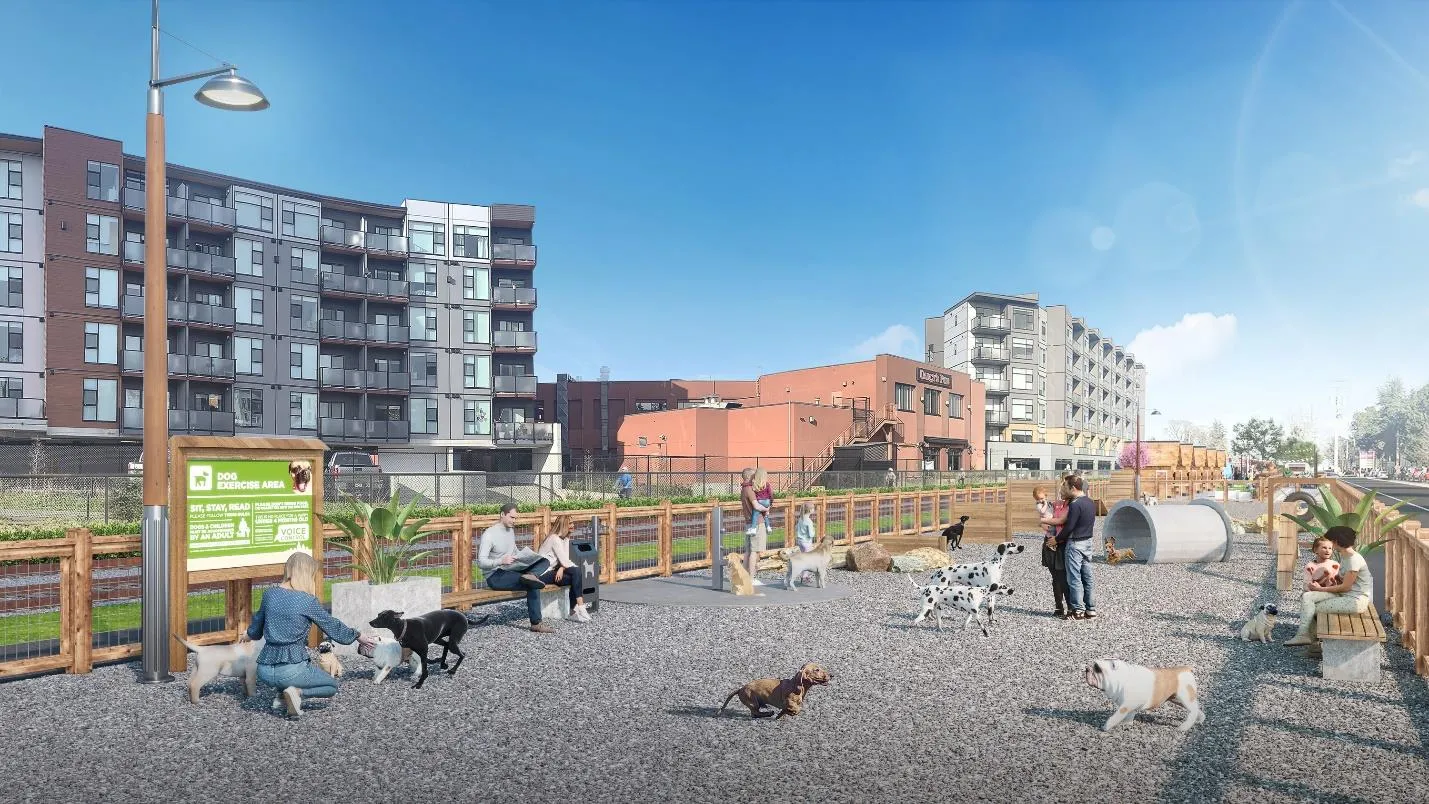
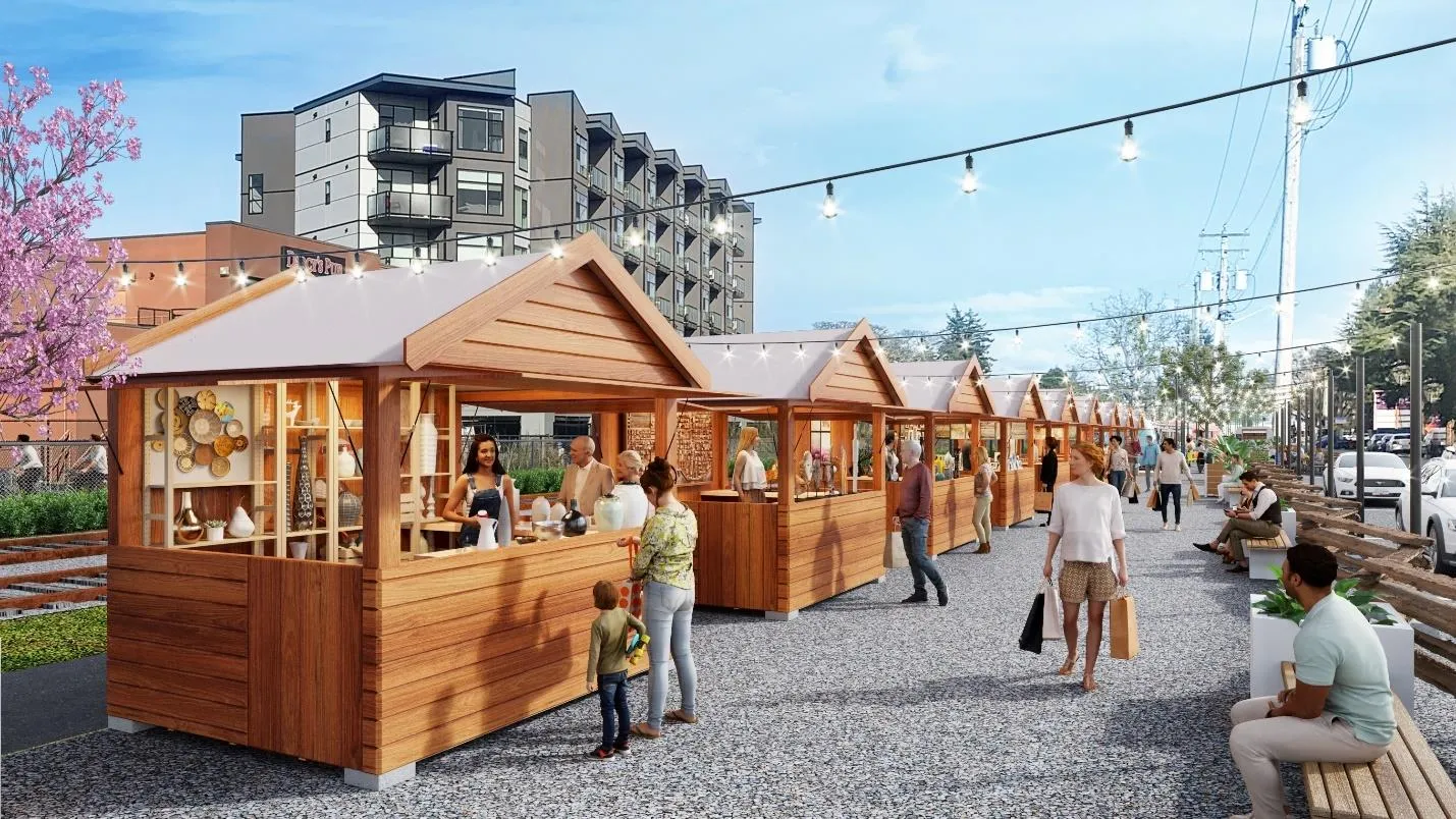
This site is located entirely within the City Centre Development Permit Area. Therefore, the development of these lands would typically require a development permit. City Staff are proposing that Council waive the requirement of a Development Permit for the Form and Character of this Commercial area provided that this site is developed in accordance with the renderings attached as Appendix A.
It is noted that the renderings include constructed wood kiosk structures, food trucks, converted shipping containers, and perhaps other types of structures. Exterior design elements will be added to the structures as much as possible to make the space attractive, and to encourage residents to use the public spaces. The shipping containers in particular may not entirely fit into the Design Guidelines; however, Council may agree that this range of structure types is appropriate in this case due to the new and innovative nature of the proposal, as well as the temporary time frame. Converting some of the temporary or mobile structures into permanent structures could be considered should this Cultural Precinct become a permanent use of the lands.
PEDESTRIAN, CYCLING AND MOTORIST NETWORK
The proposed project looks to add value and infrastructure upgrades to the existing transportation network. With a regional trail located on the other side of the E&N tracks, and bike lanes nearby, pedestrians and cyclists will have a new Langford destination to target by way of safe and environmentally friendly methods. Additionally, the formalization of park and ride and commuter parking will provide additional opportunities for alternative transportation methods as BC transit is quite established on Station Ave.
INFRASTRUCTURE
The Engineering department is overseeing the infrastructure upgrades that will be necessary to serve the proposed land uses and site development. The following upgrades for the Station Avenue site can be implemented through the Gas Tax Fund:
- Hydro and water servicing upgrades
- Sewer connection
- Frontage and accessibility improvements
- Drainage (grading and stormwater management)
NEIGHBOURHOOD CONSULTATION
City staff have established a direct line of communication for residents to communicate concerns and questions regarding the project and how it is anticipated to integrate within the neighbourhood. Information and stakeholder sessions are being held to incorporate the needs and concerns of the communities that are anticipated to be utilizing business and artisan spaces.
FINANCIAL CONTRIBUTIONS
There are no financial contributions required as part of the TUP application and process. As noted, the majority of the Station Avenue Revitalization Project will be funded by the GTF as a under the heading of “Cultural Precinct”.
Impacts on municipal revenue and expenses are anticipated to be minimal. Revenue through the leasing of business spaces and studios is anticipated to cover the maintenance expenses.
OPTIONS
Option 1
That the Planning, Zoning and Affordable Housing Committee recommend that Council:
- Direct staff to provide notice that Council will consider issuing a Temporary Use Permit for a period of three years for the lands identified on Appendix B, to allow for the following uses:
a. Artist or craftsperson studio
b. Cultural facility
c. Licensed Premise
d. Office
e. Parking facility
f. Public Assembly and Entertainment uses
g. Recreation facility, outdoor
h. Restaurant
i. Retail Store
j. Tourist information centre
k. Transportation terminal
- That Council waive the requirement of a Form and Character Development Permit provided that the site is developed in substantial accordance with the renderings attached as Appendix A.
OR Option 2
- Recommend that Council reject this application for temporary use permit.
Respectfully submitted,
Submitted by:
Wolfgang Schoenefuhs, Planning Technician – Approved
Concurrence:
Donna Petrie, Manager of Business Development and Events - Approved
Concurrence:
Marie Watmough, Manager of Legislative Services – Approved
Concurrence:
Chris Aubrey, Fire Chief – Approved
Concurrence:
Lorne Fletcher, Manager of Community Safety and Municipal Enforcement - Approved
Concurrence:
Yari Nielsen, Manager of Parks and Recreation - Approved
Concurrence:
Michelle Mahovlich, P.Eng, P.Geo, Director of Engineering – Approved
Concurrence:
Leah Stohmann, MCIP, RPP, Acting Director of Planning - Approved
Concurrence:
Michael Dillabaugh, CPA, CA, Director of Finance - Approved
Concurrence:
Braden Hutchins, Director of Corporate Services - Approved
Concurrence:
Darren Kiedyk, Chief Administrative Officer - Approved
Appendices (Original Report)
- Appendix A (renderings / plan):
Appendix A rendering - plan/visual - Appendix A (additional):
Appendix A rendering - perspective - Appendix A (additional):
Appendix A rendering - kiosk / container detail - Appendix B (site plan/map):
Appendix B site map - Appendix C (additional materials):
Appendix C materials
(Additional supporting maps referenced in the April 2, 2024 package)