DocumentsOtherJul 20, 2026Pages 1–102
Transportation Master Plan
The City of Langford’s long-term plan for developing a safer, more connected and efficient transportation network while supporting mobility choices for all users. It assesses existing conditions and future growth needs, and sets out street, transit, walking, rolling, cycling and implementation strategies.
Key facts
- City of Langford
- July 2026
- Plans for a future population of 100,000
- Sets a target for 42% of trips to be made by walking, rolling, cycling or public transit
- Developed through a 20-month process from Fall 2024 to Summer 2026
Transportation Master Plan
Page 1
Transportation Master Plan JULY 2026 City of Langford
Page 2
Land Acknowledgement The City of Langford acknowledges and honours the traditional territories of the Coast Salish, specifically Xwsepsum (Esquimalt), Lekwungen (Songhees), Sc’ianew (Beecher Bay), and the WSÁNEĆ Peoples represented by the Tsartlip, Pauquachin, Tsawout, Tseycum, and Malahat Nations. We thank them for sharing this beautiful land. The City of Langford acknowledges and honours the importance of listening, understanding, and engaging meaningfully and intentionally with local First Nations. The City is committed to building strong relationships with the local Nations and is committed to ensuring this work is a priority and approached in a good way. While there is much work to do, and will be an ongoing evolving process, the City is going to start by understanding the priorities of all local First Nations on a one-on-one basis. This Plan may be enhanced to honour what we learn and will keep the City accountable to our commitments. This approach to building relationships with local First Nations will be applied to all City projects and initiatives with the commitment of being accountable partners, and strong allies to the Indigenous community.
Page 3
Table of Contents PART 1 / Introduction
1
PART 2 / Community Profile
9 PART 3 / Community Engagement
25 PART 4 / Plan Framework
30 PART 5 / Street Network
34 PART 6 / Transit Network
67 PART 7 / Walking and Rolling Network
72 PART 8 / Cycling and Micromobility Network
75 PART 9 / Implementation Strategy
78 1.1 Plan Overview
3 1.2 Why Does Langford Need Transportation Master Plan?
3 1.3 How the TMP and ATP are Equal, and Work Together
4 1.4 The TMP and ATP as Communications and Advocacy Documents
4 1.5 Addressing the “Five Crises” Facing Cities Through More Transportation Choices 5 1.6 Achieving Mobility Choice and Accessibility
6 1.7 Plan Process
8 2.1 Location
10 2.2 Demographic and Household Summary
15 2.3 How We Move Today
15 2.4 Emerging Transportation Trends
18 2.5 Land Use and Key Destinations
19 2.6 Policy and Planning Context
22 3.1 Overview
26 3.2 How We Engaged
26 3.3 What We Heard
29 5.1 Network Today
35 5.2 Long-Term Street Network
47 5.3 Supportive Policies and Programs
66 6.1 Transit Service and Routing
68 6.2 Bus Stops
70 9.1 Timelines, Partnerships, and Project Cost
79 9.2 Funding Opportunities
83 9.3 Monitoring and Evaluation
85
Page 4
Figure 1: Project Timeline
8 Figure 2: City of Langford Location within the CRD
10 Figure 3: Langford Neighbourhoods
14 Figure 4: Langford Mode Split by Travel Mode (2022)
16 Figure 5: Langford Trip Generators
20 Figure 6: Existing Average Daily Traffic Volumes
36 Figure 7: Existing Intersection Performance Issues
38 Figure 8: City of Langford Speed Limit Map
40 Figure 9: Total Collisions in Langford (2019 to 2023)
43 Figure 10: Collision Rates in Langford (2019 to 2023)
44 Figure 11: Truck Route Map
46 Figure 12: Business-As-Usual Future Average Daily Traffic Volumes
48 Figure 13: Proposed New Road Connections
50 Figure 14: Future Average Daily Traffic Volumes
52 Figure 15: Future Intersection and Street Network Improvements
57 Figure 16: Future Road Classifications
61 Figure 17: PR-01 Local Cross Section
64 Figure 18: PR-02 Local Cross Section
64 Figure 19: PR-03 Collector Cross Section
65 Figure 20: PR-04 Collector Cross Section
65 Figure 21: Future Transit Improvements
69 Figure 22: Transit Stop Review
72 Figure 23: Long-Term Walking and Rolling Network
74 Figure 24: Long-Term Cycling and Micromobility Network
77 A Future Street Network
88 B Future Walking and Rolling Network
89 C Future Cycling and Micromobility Network
90 D Cross Sections
91
FIGURES
SCHEDULES
Page 5
PART 1 Introduction
Page 6
CITY OF LANGFORD | TRANSPORTATION MASTER PLAN 2 PART 1 Introduction Introduction The City of Langford Transportation Master Plan (TMP) is a foundational document that provides a strategic, long-term roadmap for advancing a safe, efficient, and sustainable transportation network. As Langford continues to be one of the fastest growing communities in Canada — with a dynamic mix of urban, urbanizing, and suburban neighbourhoods and a high proportion of young families — there is a pressing need to diversify and strengthen the transportation network to better serve all users. Since incorporation in 1992, Langford has prioritized road infrastructure to support residential and commercial growth, as well as regional connectivity to Highways 1 and 14. As streets approach capacity and land use patterns evolve with densification and increased commercial activity, there is an imminent need to improve traffic flow and therefore reduce traffic congestion, idling, and emissions. The role of the automobile in the transportation network remains important, as many commuters continue to rely on vehicle travel; however, the need for safe, comfortable, and connected walking and cycling infrastructure has become increasingly evident. Providing a variety of travel options is essential to support mobility choice and meet the diverse needs of the community. Recognizing these challenges and opportunities, the City of Langford developed its TMP to improve the transportation network and help address predominant issues found in the street network, including congestion, road safety, car dependency, and access for people of all ages and abilities. The Active Transportation Plan (ATP), in conjunction with the TMP, guides the planning, design, and development of a more inclusive and sustainable multimodal transportation system through improvements to the city’s active transportation network. The overarching goal of the TMP is to create a safer, more connected, and efficient road network that improves traffic flow while supporting mobility choice for all. The TMP and ATP were developed in parallel, and they reflect Langford’s broader objectives under its new Official Community Plan (OCP). The OCP highlights the importance of aligning land use with transportation planning—particularly through the development of high- density, mixed-use nodes that encourage shorter trips and support modal shift toward active and sustainable transportation. The OCP also sets specific goals and targets for the transportation network, including a mode shift objective of 42%, meaning that 42% of all trips are to be made by walking, rolling, cycling, or public transit by the time Langford reaches 100,000 residents.
Page 7
CITY OF LANGFORD | TRANSPORTATION MASTER PLAN 3 PART 1 Introduction 1.1 Plan Overview To guide the development of the TMP, the City undertook a comprehensive and collaborative planning process that combined technical analysis, public engagement, and strategic visioning. The overarching goal of the TMP is to create a safer, more connected, and efficient street network that improves traffic flow while supporting mobility choice for all users. This Plan delivers: • A snapshot of current conditions for the street network performance in Langford. • A strategic framework for improving the transportation network to support current users and accommodate growth. • A clear picture of Langford’s future transportation network, including the proposed road connections, intersection upgrades, and policies/programs needed to support these changes. • An implementation strategy that provides a roadmap for the recommended transportation infrastructure projects, including phasing and prioritization. The TMP will serve as a guiding document for developing a safe, efficient, and equitable transportation system that supports mobility choice, improves traffic flow, and advances environmental and sustainability goals. 1.2 Why Does Langford Need a
Transportation Master Plan? Langford needs a TMP to guide the strategic development and improvement of streets, intersections, and transportation infrastructure as the city continues to grow. A TMP provides residents and City Hall with a comprehensive, long-term framework for setting transportation priorities and strategizing investments. Without such a framework, population growth and worsening traffic conditions are more likely to be addressed reactively, rather than through proactive planning that anticipates future needs of the transportation network. The TMP provides a long-term framework for prioritizing investments, improving traffic flow, and supporting safe, efficient, and comfortable travel for vehicles and transit users, while walking, cycling, and rolling are primarily addressed through the ATP. The TMP also tests the mode shift targets and objectives outlined in the OCP, ensuring that mobility choice is a reality for residents and visitors. By aligning infrastructure improvements with growth projections and OCP goals, the TMP supports a connected, multi-modal transportation system that reduces congestion, enhances mobility options, and contributes to a livable, climate-resilient city.
Page 8
CITY OF LANGFORD | TRANSPORTATION MASTER PLAN 4 PART 1 Introduction 1.3 How the TMP and ATP are Equal,
and Work Together There is significant connection and overlap between the Transportation Master Plan and the Active Transportation Plan; hence they are best read together to achieve the complete picture of transportation-related policy and intentions for Langford. However, given that each plan is a stand-alone document and that any one person may be only reading one plan at a particular moment, it should be noted that there is unavoidable duplication of text across the two plans. To make it clear which text is the same across both plans, the identical text is highlighted with a line indicator, while text unique to each plan is presented in normal text. Both the TMP and ATP are of equal importance and authority as transportation-related City policy. Neither takes precedence over the other; instead, they work together to present Langford’s complete transportation policy. This is important to clarify given that the Transportation Master Plan addresses larger vehicle movement, and in some cities such plans have been positioned, intentionally or unintentionally, as ”the real transportation plan”, with an active transportation plan seen as “less serious policy”. That is specifically not the case in Langford – in fact, the Official Community Plan’s transportation policy, reflected in both the TMP and ATP, prioritizes active transportation modes including walking, rolling, cycling, and public transit. It is understood that such prioritization should not be interpreted as being opposed to driving. Rather, it reflects the understanding that providing people with more mobility choices helps the transportation network function more effectively. In a growing city, mobility choices that move more people using less space can improve mobility and safety for everyone – including those who drive. 1.4 The TMP and ATP as
Communications and Advocacy
Documents The Transportation Master Plan and Active Transportation Plan together represent Council-approved transportation planning and policy for the City of Langford. While they are first and foremost, planning documents, they are also specifically intended to serve as long-term communication tools for the broader community, landowners, rights-holders and stakeholders, and future Council members and staff. As such, the plans are designed not only to outline the City’s transportation policies and actions, but also to explain the intentions, considerations, and aspirations to assist future readers in better understanding the policies and their contexts. In other words, they communicate not only what the City intends to do, but also why and how. Providing this context helps future readers understand the policies and their contexts, which supports the successful implementation of the plans over time. The plans are also intended to support public and community advocacy by clearly articulating the City’s long-term commitments and objectives. In doing so, they help future readers hold decision-makers accountable for progress toward the plans’ goals. They also provide Councillors and staff with a foundation to advocate for consistent support and action from other levels of government, partner organizations, the private sector, and the community itself, helping ensure that future decisions remain informed by the plans’ long-term vision and objectives.
Page 9
CITY OF LANGFORD | TRANSPORTATION MASTER PLAN 5 PART 1 Introduction
3 - Equity Crisis: The extent to which our city and its opportunities are equitable and accessible for all citizens, now and in the future, is strongly influenced by our transportation practices and policies. In particular, true support for more attractive mobility choices is a critical cornerstone for the achievement of a more equitable, accessible and fair city.
4 - Public Health Crisis: The way we build cities and suburbs dramatically affects our individual health, as well as the overall public health system and its associated public costs. This reality is driven by the significant health implications of designing opportunities for regular activity, as well as health- related environmental quality, into our communities. Better land-use and transportation policies and actions will be the foundation for a healthier city as we grow.
5 - Infrastructure Cost Crisis: Where and how we grow, and the choices we support in how to get around, have a powerful effect on overall urban economics, and particularly the infrastructure, services, amenities, and municipal taxes that residents can afford. Growth and infrastructure approaches that positively contribute to the local economy, as opposed to those that need to be heavily subsidized by better planned areas, will be emphasized. 1.5 Addressing the “Five Crises” Facing Cities Through More
Transportation Choices As should be expected with the word “crises”, there must be a clear intention around true urgency in the realization of all the City’s plans, including the Transportation Master Plan and the Active Transportation Plan. This is particularly true given that certain crises, such as the Climate Crisis, are subject to science and natural laws/consequences that aren’t governed by what we afford or what our usual approaches and timeframes might be. There are immovable deadlines and unavoidable consequences that we face, whether we are ready or not. The following are the Five Crises that are facing all cities and how they are related to transportation: 1 – The Climate Crisis: The way we plan and build our cities and suburbs, and the infrastructure that supports them, will determine much of our success or failure in mitigating the climate crisis. How far and fast we go with decisions and implementation relating to the interconnection between land-use and transportation, will be the most important step our community will take toward this goal.
2 - Housing and Affordability Crisis: Housing and transportation represent the two biggest costs in determining how affordable or unaffordable our city will be as we grow. How new land-use and transportation decisions align, and in particular decisions affecting better transportation choices rather than more car dependency, will dramatically affect our cost-of-living realities. Photo credits to (1) Peter McCabe (2) City of Langford, (3) EveryPixel, (4) Adrian Lam, (5) Journal of Commerce.
Page 10
CITY OF LANGFORD | TRANSPORTATION MASTER PLAN 6 PART 1 Introduction 1.6 Achieving Mobility Choice and
Accessibility The OCP envisions the City of Langford as a place where residents are provided with many attractive mobility choices and are significantly less reliant on cars. To achieve this vision, the OCP sets out a comprehensive vision for enhancing active transportation as a cornerstone of a sustainable, inclusive, and efficient mobility network to achieve mobility choice. A central component of this vision is the development of a multi-modal transportation system that reflects Langford’s Modal Hierarchy, which prioritizes pedestrians and mobility aid users first, followed by cyclists and micro-mobility users, public transit, shared vehicles, commercial vehicles, and single-occupant vehicles. By following this hierarchy, Langford aims to significantly reduce car dependency and support healthier, more environmentally friendly modes of transportation, while still accommodating the needs of single-occupant vehicles. Rather than being “anti-driver,” this approach is well established to improve safety and mobility for everyone, including drivers, by helping growing cities move more people efficiently within limited space. Public Transit Ridership Versus Coverage Increasing transit ridership requires important service decisions, including prioritizing direct routes along corridors with strong demand and major destinations in both directions, while minimizing the number of required transfers. It also requires frequent service, generally with buses arriving every 15 minutes or less, so riders experience shorter and more reliable wait times. By comparison, prioritizing (or even “balancing”) coverage over ridership often results in long, more circuitous routes with infrequent service. While this approach aims to ensure that most people are within a short walk of a transit stop, it can require multiple transfers and indirect travel paths to reach common destinations. Although this model may appear equitable, the nearest stop is often not served by routes that directly connect to where people need to go. As a result, trips take longer, require more transfers, and tend to discourage use, leading to lower ridership. Bus service may be infrequent, with arrivals every 30 to 45 minutes or longer. In order to significantly increase ridership to meet mode shift targets, the public has indicated that they would only be willing to use public transit if the service was more frequent, direct, and reliable. Langford Modal Hierarchy Another key priority is the creation of an integrated transportation network that serves all ages and abilities. This means building infrastructure that is accessible and intuitive for children, seniors, and people with disabilities. Roads, trails, and crossings will be designed or retrofitted to include All Ages and Abilities principles, as highlighted in the BC Active Transportation Design Guide, to ensure safety, comfort, and usability for everyone. Lastly, but very importantly, Langford seeks to ensure that all development-related policies and bylaws demonstrate a strong synergy between land use and mobility. Higher density development will be focused in the City Centre, Urban Centres, and along Corridors, where residents will have safe, direct access to walking, cycling, and public transit infrastructure, providing convenient connections to nearby amenities such as shops, services, parks, and community facilities. This integrated approach will reduce reliance on single occupied automobiles, lower emissions, and improve quality of life for current and future residents. In lower- density areas, the City aims to support practical car travel while strategically and progressively improving connections for walking, cycling, and transit.
Page 11
CITY OF LANGFORD | TRANSPORTATION MASTER PLAN 7 PART 1 Introduction If “equity” is defined as ensuring that everyone is reasonably close to a level of public transit service that they would only use if they had no other choice, then it would come at the expense of frequent, reliable service and potentially decreasing ridership percentages across the city, given the finite number of buses and drivers available. In practice, experience has shown that a thoughtful focus on ridership and service quality can also improve overall coverage too. In addition, providing effective first- and last-mile connections to transit routes may be better achieved through complementary, service-oriented solutions such as on- demand shuttles, conveniently located micromobility or car share programs, and other supportive end-user facilities throughout the city. Our Most Important Transportation Goal – Mode Shift – and How We Could Fail To Achieve It Langford’s recently adopted Official Community Plan carries forward a critically important goal from the previous OCP: achieving a significant “mode shift” by the time the city reaches 100,000 residents. Mode shift refers to a substantial increase in the number of trips made using lower-impact transportation options—including walking, rolling, cycling, and public transit—in place of private vehicle trips. The OCP’s target is for 42% of all trips to be made by walking, rolling, cycling, and public transit by the time the city reaches that population milestone, compared to 13% today. Achieving this target would require that 29% of current total trips shift from private vehicles to active transportation and public transit. This is understood to be a very ambitious target for Langford, and one that will only be achievable if it is made a high priority in all relevant decision-making. This includes capital budgets, project phasing and timing, allocation of public space, urban design, infrastructure design, construction scheduling and strategies, and perhaps most importantly, land-use decisions that influence how people move throughout the city. Although all of these elements are critically important, particular emphasis must be placed on the pace and timing of implementation in order to reflect the sense of urgency discussed earlier. Transportation plans such as these often succeed in identifying the right actions needed to achieve their goals, but those actions can be implemented too slowly to adequately respond to the science-based timelines associated with many of the crises we face. The slow implementation can often be justified by ordinary realities such as conflicting priorities on limited capital budgets, a desire to coordinate improvements with other infrastructure work to reduce costs, or efforts to minimize construction-related disruption. However, slow implementation is also one of the most common reasons transportation plans fall short of their intended outcomes. The issue is often not a lack of good solutions, but rather the pace at which those solutions are delivered relative to the urgency of the problems they are intended to address. Slow implementation also has the added challenge of delaying observable progress and tangible benefits, making it more difficult to sustain public and political support over time. As a result, initiatives may be criticized as ineffective or even cancelled before they have had sufficient opportunity to achieve their intended goals. Realization of the mode shift goal, particularly the significant increase in public transit ridership required to meet the 42% goal, will also depend on proactive action in areas outside the City’s direct control. This will require ambitious advocacy and partnerships with all levels of government, the private sector, and other relevant stakeholders. Without an equally ambitious approach from these external partners, the likelihood of achieving this mode shift target is slim. However, this dependency is not intended as an excuse for inaction or failure; rather, it serves as a call to action for the City to do everything within its influence to support and advance collective, multi-jurisdictional success. It was well understood that setting (or in this case, maintaining) the ambitious mode shift target is the easy part, as illustrated by the fact that the target existed in the previous OCP without serious enough prioritization of action and implementation. In carrying it forward into the new OCP, a clear decision was made to emphasize the importance of “making it real this time”. Achieving this will require new approaches that go beyond “business as usual”, along with a willingness to rethink traditional approaches and comfort levels.
Page 12
CITY OF LANGFORD | TRANSPORTATION MASTER PLAN 8 PART 1 Introduction 1.7 Plan Process The TMP and ATP were developed over a 20-month process that kicked-off in Fall 2024 and wrapped up in Summer 2026. They were developed in a parallel five-phase process, as shown below: Figure 1: Project Timeline PHASE 1 Project Initiation and Baseline Conditions September to December 2024 PHASE 3 Transportation Network Development April to September 2025 PHASE 4 Public Engagement and Consultation - Round 2 October to November 2025 PHASE 2 Public Engagement and Consultation - Round 1 March to April 2025 PHASE 5 Draft and Finalize the TMP and ATP September 2025 to July 2026
Page 13
PART 2 Community Profile
Page 14
CITY OF LANGFORD | TRANSPORTATION MASTER PLAN 10 10 PART 2 Community Profile 2.1 Location The City of Langford is situated on the traditional territories of the Coast Salish Peoples, specifically the Xwsepsum (Esquimalt), Lekwungen (Songhees), Sc’ianew (Beecher Bay) Nations, and the W̱SÁNEĆ Peoples represented by the Tsartlip, Pauquachin, Tsawout, Tseycum, and Malahat Nations. Per the 2021 census, the City of Langford is now home to over 46,000 people, a 31.8% increase from 2016, making it the fastest growing municipality in British Columbia. Langford is a 41.43 km2 community with access to nature, parks, and many natural amenities, and multiple major commercial hubs scattered throughout the city including the downtown, Millstream Village, and West Shore Town Centre. Langford serves as a vital gateway into the Capital Regional District (CRD), with major transportation corridors, including Highway 1 (Trans-Canada) which provides access to Victoria, Saanich, and the Peninsula, and Highway 14 (Sooke Road) connecting to Sooke and the West Coast. The City of Langford plays a significant role in the regional transportation network, acting as both a major destination for tourism and commercial shopping in the region, and a key generator of commuter trips. Figure 2 illustrates the City of Langford’s location within the CRD. Community Profile Figure 2: City of Langford Location within the CRD
Page 15
CITY OF LANGFORD | TRANSPORTATION MASTER PLAN 1111 PART 2 Community Profile 2.1.1 Neighbouring Municipalities The City of Langford is bordered by four distinct municipalities within the CRD: Highlands, View Royal, Colwood, and Metchosin, each contributing a unique transportation context to the area. Highlands The District of Highlands borders Langford to the north and is home to approximately 2,500 residents. As one of the less developed areas in the region, the Highlands is renowned for its natural beauty, featuring numerous parks, lakes, and other outdoor attractions. At the boundary between the Highlands and Langford sits a shared industrial area. View Royal The Town of View Royal lies to the northeast of Langford and is home to a population of over 11,500 residents. A large portion of Langford’s border with View Royal belongs to the Thetis Lake Park area, while the remainder is predominantly residential. Although there are some commercial hubs and larger employers like Island Health, most residents commute to other municipalities for work. Colwood Langford’s largest neighbour is the City of Colwood to the southeast. As a rapidly growing community of approximately 19,000 residents, Colwood’s transportation context is most comparable to that of Langford. Historically characterized by low-density single-family development, Colwood’s planned growth has introduced a range of transportation challenges that requires local and regional planning coordination. Metchosin The District of Metchosin falls to the south of Langford, with over 5,000 residents. This municipality is characterized by a predominantly rural environment with no plans to add any density. Metchosin’s primary transportation facility is the Highway 14 corridor, connecting the rest of the CRD to the District of Sooke.
Page 16
CITY OF LANGFORD | TRANSPORTATION MASTER PLAN 12 12 PART 2 Community Profile Thetis and Millstream The Thetis and Millstream neighbourhood mirrors North Langford and is located on the east side of Millstream Road north of Highway 1, sharing similar transportation patterns, destinations, and land use characteristics. Millstream Village Shopping Centre is the area’s primary attraction, with Thetis Lake Regional Park located to the north and east. The northwest portion of this neighbourhood features an industrial area, along with a planned redevelopment on the former Western Speedway site. The residential area to the east consists mainly of single- family homes, and has limited access, with essentially a single entry and exit route shaping local travel patterns and connectivity. Mill Hill Mill Hill is the easternmost neighbourhood in the city, nestled between Highway 1 to the north, Veterans Memorial Parkway (VMP) to the west, Colwood to the south, and View Royal to the east. Mill Hill Regional Park stands at the heart of the neighbourhood, summiting above the single-family homes in the area. Small parks are sprinkled throughout the neighbourhood, with minimal commercial amenities nearby. Connections to adjacent neighbourhoods and commercial attractions can be challenging, with the bordering high- traffic roadways acting as barriers. Goldstream Meadows The Goldstream Meadows neighbourhood is located between the western border of Langford and Highway 1 to the north. This neighbourhood is predominantly residential, including the new Kettle Creek neighbourhood, and is home to multiple recreational hiking trails south of the Goldstream Provincial Park, general light industrial, and minimal commercial destinations. Most of the neighbourhood experiences access constraints, with each residential cluster served by a single entry and exit point onto West Shore Parkway. 2.1.2 Langford Neighbourhoods Langford is split into nine distinct neighbourhoods, all bringing their own unique contexts, challenges, and opportunities. While the uniqueness of each neighbourhood is recognized, these plans take a city- wide approach for equity and consistency, while creating space for placemaking policy implementation within the public road right-of-way as a separate City initiative. The following sections provide a high-level description of each neighbourhood (from northwest to southeast) as they relate to land-use, traffic destinations, and key connections or access characteristics. Figure 3 illustrates the location of each neighbourhood within Langford. Bear Mountain Located in northwest Langford, Bear Mountain is a master planned resort-style neighbourhood centred on a commercial ‘village’ at the top of the mountain which includes a hotel, two golf courses, a recreation centre, restaurants, and multi-family (condominium) housing. The remainder of the neighbourhood is a mixture of townhouse style multi-family and single-family lots. Most residents travel down the mountain to access groceries and other services daily. Skirt Mountain, located on the southern side of Bear Mountain, is another master planned neighborhood featuring major residential developments. The area currently includes a mix of condominiums, townhouses, and single-family homes. North Langford North Langford is located north of Highway 1 and west of Millstream Road. The area is home to several key destinations, including Florence Lake, grocery stores, and multiple big box stores, including Costco and Home Depot, making it an important commercial hub for residents of Langford and the CRD. Most travel to/from this neighbourhood is by private vehicle, with noticeable congestion during peak periods along Millstream Road (off Highway 1) and McCallum Road. The neighbourhood features a large suburban residential area to the west.
Page 17
CITY OF LANGFORD | TRANSPORTATION MASTER PLAN 13 13 PART 2 Community Profile Langford Lake and Glen Lake Situated north and east of Westhills, the Langford and Glen Lake neighbourhood provides easy access to major recreational attractions at both lakes and City Centre Park, featuring a bowling alley, mini-golf course, ice rink, and Starlight Stadium with adjacent fields for soccer, football, and rugby. The area also features a variety of commercial businesses, grocery stores, and light industrial buildings along Langford Parkway, one of the major roads through the neighbourhood. Also in this neighbourhood, east of Jacklin Road, are Belmont Market and the West Shore Town Centre, both of which are major shopping centres, plus surrounding big box stores (Superstore, Canadian Tire, etc.) and mid-rise condominiums. South Langford Located along the south border of Langford, adjacent to Westhills and Glen Lake, South Langford showcases the more rural character of the city. The main roadways in the area are Sooke Road (Highway 14) and Happy Valley Road, which connect into Sooke and Metchosin, respectively. Latoria Roads serves as an east-west connection into Colwood, and acts as the primary access to Olympic View, a master planned resort-style development. General industrial and agricultural land uses are common in the area, with the neighbourhood having the potential to become a major industrial centre through planned business parks. Other areas within South Langford feature large areas of undeveloped land, that are situated between suburban single-family homes and some pockets of more closely spaced homes. The area is also planned for higher-density development through the Sooke Road Revitalization Area. City Centre Langford’s City Centre is a denser residential area, with a high proportion of apartment and condominium buildings, townhouses, and single-family lots along with ground floor commercial and stand-alone businesses. The main north-south roadways in the area include: Veterans Memorial Parkway (Highway 14), Peatt Road, Jacklin Road, and Leigh Road. The main east-west road is Goldstream Avenue, which runs through the City Centre and into Colwood. Key attractions in the area include the John Horgan Campus, the Langford Station Cultural District, and Goldstream Village, plus surrounding big box stores (Walmart, Rona, etc.). Westhills Westhills is another master planned neighbourhood with a large mix of housing types and a planned mixed- use high-rise area that will provide residents access to amenities as well as housing. The high-rise area features a transit exchange, the YMCA-YWCA, and access to Langford Lake for swimming. Recreational attractions in the area include Mount Wells Regional Park and the Jordie Lunn Bike Park. One of the major potential corridors serving the neighbourhood is the Island Corridor Foundation (ICF) corridor, which runs along the northern boundary of the neighbourhood. This former rail line is currently being considered for transportation revitalization, including potential rail transit and an extension of the E&N Rail Trail into West Langford. West Shore Parkway, completed in 2017, provides a direct road connection down to Sooke Road and up to Highway 1.
Page 18
CITY OF LANGFORD | TRANSPORTATION MASTER PLAN 14 14 PART 2 Community Profile Figure 3: Langford Neighbourhoods
Page 19
CITY OF LANGFORD | TRANSPORTATION MASTER PLAN 15 15 PART 2 Community Profile 2.2 Demographic and Household
Summary As of the 2021 Census, the City of Langford had a population of over 46,000 citizens, representing an increase of 31.8% since the 2016 census. When compared to the regional average growth over 5 years of 8.4%, the City of Langford is well- established as one of the most rapidly growing municipalities in British Columbia and Canada. This rapid growth is emphasized by a 34.4% increase in the number of private dwellings from 2016, highlighting Langford’s commitment to residential development. Single-family homes account for only 35.1% of residences in Langford, which is more than 5% lower than the regional average of 40.3% and the provincial average of 42.4%. The city has a larger proportion of townhouses and duplexes compared to the region but falls short when comparing proportions of low- and high-rise apartment buildings. Homeownership in the city has declined 4.8% since 2016, with 64.8% of residents owning their homes. For the remaining 35.2% who are renters, average monthly shelter costs (across all rental types) have risen by 32% since 2016, reaching approximately $1,650 per month in 2021. Meanwhile, the median after-tax household income in Langford sits at $82,000, an 18% increase from 2016. The city’s median age is 38.4 years, which is significantly younger than the regional median of 45.2. The working-age population, including residents aged 15 to 64, accounts for 69.1% of the total population; this demographic is most likely to utilize active transportation facilities and is better positioned to transition from single-occupancy vehicles towards alternative modes of transportation. Currently, per the 2022 CRD Origin Destination Household Travel Survey, active transportation mode shares are highest in the 35 to 44 age group.1 2.3 How We Move Today Commuting Patterns According to the 2021 Census, most residents in Langford use a vehicle to commute to work, either as driver or passenger (84.3%). Active transportation (i.e. walking and biking) made up 8.0% of commuter trips, while public transit made up 5.1%. Other modes, such as school bus or taxi, showcased the lowest mode share split (2.6%). Of these commuters, 35.4% of residents work within the City of Langford, while the remaining 64.6% are employed outside the city limits. This indicates that there is a strong potential for active transportation commuting within the City of Langford, while improved regional trail connections and transit options could better serve out-of-town commuters. Almost 70% of commutes for City of Langford residents are less than 30 minutes, which increases to 92% for commutes less than 45 minutes. The most common time to leave for work is between 6AM and 8AM (46%). 1 R.A. Malatest & Associates Ltd & David Kriger Consultants (2022). 2022 CRD Origin-Destination Survey. 2022 Capital Regional District Origin Destination Household Travel Survey. Available online at: https://www.crd.bc.ca/project/regional-transportation/origin-destination-household-travel-survey
Page 20
CITY OF LANGFORD | TRANSPORTATION MASTER PLAN 16 16 PART 2 Community Profile Figure 4: Langford Mode Split by Travel Mode (2022) Travel Patterns The 2022 Capital Regional District Origin Destination Household Travel Survey provides data on resident travel patterns throughout the CRD. The survey reported that approximately 164,870 trips are made in Langford on a typical weekday. Of those trips, 33% are within the city, while the remaining 67% are going to or coming from other municipalities. Figure 4 provides a summary of the mode split for all trips taken to, from, and within the City of Langford. A summary of Langford’s mode share trends from the CRD’s 2021 Origin-Destination Household Travel Survey are as follows: • Vehicle (and passenger in vehicle) mode share is the highest among all modes, but is noticeably lower for trips within the city. • Transit mode share is steady for trips to and from Langford, but low for trips within the city. • Bicycle and micromobility mode share is consistent at 3% for all travel destinations (to/ from/within the city). • Walking rates are substantially higher for trips within the city at 17%, which is tied for second highest mode share after ‘auto driver’. Table 1 summarizes Langford residents’ overall daily trips to, from, and within Langford by mode. Mode From City To City Within City Auto Driver 38,100 (69%) 38,180 (69%) 31,950 (58%) Auto Passenger 10,540 (19%) 10,780 (20%) 9,410 (17%) Transit 2,600 (5%) 2,550 (5%) 800 (1%) Bicycle and Micromobility 1,570 (3%) 1,460 (3%) 1,630 (3%) Pedestrian 580 (1%) 600 (1%) 9,220 (17%) Other 1,580 (3%) 1,470 (3%) 1,830 (3%) Total 54,970 55,060 54,840 Table 1: Daily Trips by Travel Mode From, To, and Within Langford Most trips out of the city in the AM peak period are commuters destined for Colwood, Saanich, Esquimalt, and Downtown Victoria. Most trips entering the city originate from Colwood, Sooke, Saanich East and View Royal. A significant portion of all trips to/from Langford are either auto drivers or passengers at approximately 89%, which decreases to 75% for trips within the city. Given that approximately half of all daily trips originating in Langford remain local, there is a significant opportunity to incentivize a mode split shift from motor vehicles towards sustainable modes of transportation such as transit, walking, and bicycling.
Page 21
CITY OF LANGFORD | TRANSPORTATION MASTER PLAN 17 17 PART 2 Community Profile Jurisdiction Daily Trips per Household2 Vehicles per Household2 Adult Bicycles per Household2 Average Annual Household Transportation Cost3 Core Victoria 4.66 1.02 1.28 $7,921 View Royal 5.68 1.76 1.6 $11,808 Saanich 5.74 1.72 1.69 $12,294 West Shore Langford 5.42 1.78 1.32 $13,444 Colwood 5.77 1.89 1.49 $14,230 Metchosin 5.13 2.3 1.81 $18,350 Core (Average) 5.22 1.38 1.49 $10,573 West Shore (Average) 5.38 1.9 1.41 $16,375 Table 2: CRD Household Transportation Profiles Transportation Costs The CRD 2020 Housing and Transportation Cost Estimate Study found that the average household in Langford spends $13,444 on transportation per year, which is the lowest of all West Shore municipalities, but higher than all core municipalities. A com parison of Langford to other jurisdictions and regions in the CRD is provided in Table 2. As concluded in the CRD study, higher transportation costs are largely a product of vehicle ownership and costs that are lower in core areas where a broader choice of transportation options are available. The data shows that the number of vehicles owned has a proportionate impact on transportation costs. Even though there does not appear to be a correlation between household bicycle ownership and transportation costs, developing a robust active transportation network with connected routes can make it easier for residents to be less reliant on their vehicles.
Page 22
CITY OF LANGFORD | TRANSPORTATION MASTER PLAN 18 18 PART 2 Community Profile 2.4 Emerging Transportation Trends New technologies and systems are transforming transportation by disrupting the status quo and reshaping how we plan our transportation networks. Over the past decade, advances in technology and shifts in social behaviour have led to the emergence of numerous new mobility options. These innovations offer potential greater convenience and may encourage people to move away from personal vehicle ownership, thereby reducing dependency on automobiles. At the same time, these innovations may also lead to increased driving, particularly for optional trips, as improved convenience can encourage more frequent or longer travel. This is consistent with the concept of induced demand, where increased ease or capacity of travel can result in higher overall use. Examples of new mobility options across North America include carsharing services (e.g., Evo, Modo), ride-hailing platforms (e.g., Uber, Lyft), micromobility vehicles (e.g., e-bikes, e-scooters), shared micromobility programs (e.g., Evolve, Lime). Additionally, there has been significant interest and progress in the electrification of transportation, spanning from electric vehicles to e-bikes and e-scooters. These modes can reduce greenhouse gas (GHG) emissions, provided they do not lead to increased overall vehicle use; this risk can be mitigated through proactive reallocation of space to support other mobility options. Together, these innovations are transforming how people move and must be considered when planning future transportation networks. As new transportation trends continue to emerge, it is essential to continuously monitor and adapt policies and elements of the transportation network to ensure safe mobility is prioritized for all users, providing residents of Langford with improved mobility choices. Carsharing Services Carsharing services, such as Evo or Modo, offer residents access to a motor vehicle without the need for ownership. Within the City of Langford, BCAA’s Evo Car Share program operates in the Greater Victoria Evo Home Zone, giving Langford residents access to a fleet of Evo-owned vehicles. Evo Car Share users can start or end their trip anywhere within the expanded Evo zone in the city. Modo also operates a fleet in designated parking stalls in Langford, offering residents membership-based access to round-trip carsharing across British Columbia. Electric Vehicles Electric vehicles (EVs) present an opportunity to reduce operational GHG emissions for individuals who continue to rely on personal vehicles, if they do not lead to more driving overall. A key factor in supporting the adoption of EVs is the availability and convenience of public charging infrastructure, which is essential in making them a practical alternative to gasoline or diesel-powered cars. While EVs play an important role in reducing emissions, they are just one piece of the larger puzzle in developing a sustainable transportation network. Complementary efforts, such as investing in public transit and active transportation infrastructure, are essential to achieving long-term environmental and societal benefits as EVs can reduce emissions, but do not reduce the number of vehicles on the road. Low Speed Vehicles Low speed vehicles (LSVs) are street-legal, four-wheeled vehicles designed for short-distance travel. They are typically electric, lightweight, and limited to a top speed of 40 km/h. Golf carts are a common example of an LSV. In Langford, the use of LSVs could be supported by lowering the regulatory speed limit to 40km/hr within resort-style communities only (such as Bear Mountain), allowing these vehicles to operate safely on public streets. Evo Car Share
Page 23
CITY OF LANGFORD | TRANSPORTATION MASTER PLAN 19 19 PART 2 Community Profile Autonomous Vehicles and Artificial Intelligence Autonomous vehicles (AVs) are vehicles that can operate and navigate without a human driver. There are different levels of automation, including driver assistance technology such as adaptive cruise control to help maintain a safe speed behind the vehicle ahead, or lane assist to steer and keep a car centered in its lane. Fully autonomous, or “self-driving”, cars, are still being developed, as they face challenges related to limited technology, real-time decision making, and ethical considerations. The potential benefits of AVs include improved safety by reducing human error on the road, smoother traffic flow, and better efficiency through optimized spacing and routing, and greater mobility choices for people who are unable to drive themselves. These benefits depend significantly on whether the vehicles are networked: networked systems may improve traffic flow but raise cybersecurity risks, while non-networked systems may not deliver the same efficiency gains often cited in support of the technology. In addition to helping make AVs a reality, Artificial Intelligence (AI) is also an emerging technology in other areas of transportation. For example, AI can work with traffic sensors and cameras to optimize traffic flow through adaptive signal timing. It can support safety analyses by examining crash data, traffic patterns, and video footage to help identify high-risk locations and make suggestions to prevent vehicle collisions. There are many other ways AI can be applied in transportation to improve safety, efficiency, and mobility across the network, and its potential will continue to grow as the technology evolves. However, there are also emerging ethical considerations, including the significant energy use and carbon footprint of these systems, questions around reliability and accuracy, and broader safety and governance concerns where appropriate regulatory frameworks are not yet in place. 2.5 Land Use and Key Destinations Identifying the various land uses and key destinations around Langford helps to understand the neighbourhoods and areas that generate and attract the most trips by various modes. By investigating the geographic distribution of these land uses and key destinations, travel patterns can be estimated. This information supports the prioritization of infrastructure and network improvements that enhance traffic flow, reduce congestion, improve overall vehicle mobility, and optimize mode shift achievement. Targeted upgrades to streets, intersections, and connections between major destinations can help optimize travel efficiency and strengthen the performance of Langford’s multi-modal transportation network. Commercial Hubs Commercial land uses are spread around Langford, with pockets of high-density destinations focused around the City Centre at the Goldstream Village and West Shore Town Centre / Belmont Market areas, and in the north around Millstream Village Shopping Centre and Costco / Home Depot. A future high-rise mixed-use commercial hub is planned for Westhills. As shown in Figure 5, Goldstream Village provides the highest density commercial destinations, with a variety of retail stores, cafes, restaurants, banks, and other services. These commercial hubs are typically vehicle oriented and supported by sufficient parking facilities that accommodate vehicle trips to the area, along with transit hubs/connections located along adjacent roadways. Employment Hubs Employment hubs are significant generators of trips. Morning traffic in Langford moves in both directions: 61% of trips that begin in the city head elsewhere in the region, while 42% of trips into Langford come from outside the city. In addition to the previously mentioned commercial hubs, which also serve as major employment centres, other key locations include SD62 schools, the John Horgan Campus, the West Shore Urgent Care Centre, the YMCA-YWCA, City Centre Park, and Bear Mountain Resort just to name a few. Industrial areas can also contribute to trip generation for work, with hotspots in South Langford and west of Langford Lake being two examples, and planned industrial expansion around South Langford and North Langford. These areas host industrial destinations such as automobile dealerships, building material suppliers, and shipping services, many of which are integrated with the City’s designated truck route network. Waymo Self-Driving Car in Austin, Texas (KVUE)
Page 24
CITY OF LANGFORD | TRANSPORTATION MASTER PLAN 20 20 PART 2 Community Profile Figure 5: Langford Trip Generators
Page 25
CITY OF LANGFORD | TRANSPORTATION MASTER PLAN 21 21 PART 2 Community Profile Education / Child Care Schools and educational / childcare facilities generate a significant number of trips and can be located close to home or work for many and therefore can provide a multitude of transportation mode choices if facilities for all user groups are provided. The list of schools in Langford are provided below: • Ruth King Elementary • Crystal View Elementary • Millstream Elementary • Willway Elementary • Lakewood Elementary • PEXSISEṈ Elementary • Savory Elementary • SĆIȺNEW̱ SṮEȽIṮḴEȽ Elementary • Spencer Middle • Centre Mountain Lellum Middle • QELEṈSEN Á, LEṈ Secondary • Belmont Secondary • Brookes Westshore (Private) • Lighthouse Christian Academy (Private) Culture Langford’s Cultural District is located at Langford Station, highlighting local artists, retailers, murals, sculptures, food trucks, live music, events, and more that draw a large number of people. There are several additional venues which may host cultural events within Langford. These venues include, but are not limited to, the following: • Luxton Fairgrounds • Goldstream Avenue • Isabelle Reader Theater • Starlight Stadium • Veterans Memorial Park • Langford Public Library • Victoria Conservatory of Music • Eagle Ridge Community Centre Recreation The City of Langford is home to a number of recreational destinations and activities. The City of Langford hosts various facilities and programs including access to weight rooms, swimming pools, playing fields, playgrounds, and more. For those interested in a more natural recreation activity, Langford is home to over 2,400 acres of green space and parks to explore, and the lakes are key attractions for swimming, boating, and fishing for locals and visitors of the region. Additionally, Langford provides facilities for Rugby Canada, Pacific Football Club, and the Westshore Rebels, providing residents and visitors with plenty of live sports entertainment. Some of the recreational attractions and facilities include: • Starlight Stadium • City Centre Park • Eagle Ridge Community Centre • Jordie Lunn Bike Park • Westhills YMCA-YWCA • Bear Mountain Resort Community and Activity Centre • Goldstream Provincial Park • Mill Hill Regional Park • Lakes – Langford – Glen – Florence The Langford Station Cultural District
Page 26
CITY OF LANGFORD | TRANSPORTATION MASTER PLAN 22 22 PART 2 Community Profile 2.6 Policy and Planning Context Several existing policies and planning documents have relevance and implications for both the TMP and ATP. These include the City’s own policies and plans, as well as those developed by neighbouring municipalities, the Capital Regional District (CRD), and the Province. A high-level summary of these plans and policies is provided in this section. Plan / Policy / Bylaw Description and Relevance CITY OF LANGFORD Official Community Plan The OCP lays out the groundwork for future development by strategically aligning community objectives with best practices in city planning and prioritizing the direction of future growth. Relevance to TMP: The OCP is relevant for several reasons: 1. It directly speaks to the first plan objective “integrate land use planning with transportation planning”. 2. Its strategic transportation focus is on mobility choice, not car dependency. “Mobility choice” is foundational to both the TMP and ATP and is reflected in the vision statement and the recommendations. 3. It provides several relevant transportation targets, which have been incorporated into the TMP and ATP. Subdivision and Development Servicing Bylaw No. 1000 This bylaw regulates the standards for subdivisions and development servicing and sets standards for new public infrastructure including water, roads, and sewer connections. Bylaw No. 1000 is scheduled to be updated in 2026. Relevance to TMP: The bylaw is relevant for three reasons: 1. There are over 30 road cross-sections in Bylaw No. 1000, which creates confusion and ambiguity. The TMP includes recommendations to consolidate and remove several road cross-sections. 2. The bylaw needs to be updated in accordance with this plan. For example, currently there are no standards for protected bikes lanes or multi-use pathways within road cross-sections. 3. The bylaw also dictates specific sidewalk widths and types, street light colours and types, etc. for different areas of the city. Streets and Traffic Bylaw No. 2233 The Streets and Traffic Bylaw regulates traffic and the use of streets, including curbside management and parking, as enabled by the Community Charter. Relevance to TMP: The bylaw is relevant for three reasons: 1. Provides direction on where bicycles, micromobility, and other devices (e.g., skate boarder, rollerbladers, etc.) are permitted to operate within the road right-of-way. 2. Provides six (6) permits and three (3) licenses related to public street use for con struction, special events, and more. 3. Includes regulations on parking including restricting vehicles to park in areas that encroach active transportation infrastructure (e.g., sidewalks, bike lanes).
Page 27
CITY OF LANGFORD | TRANSPORTATION MASTER PLAN 23 23 PART 2 Community Profile Plan / Policy / Bylaw Description and Relevance Traffic Calming Policy The Traffic Calming Policy outlines the process for implementing traffic calming measures throughout the city. The policy specifies the criteria used to evaluate corridors for such measures, including proximity to school or park zones, traffic speeds, sidewalk and bike route availability, traffic volumes, and ICBC collision history. Relevance to TMP: The future active transportation network will include new facilities that may warrant traffic calming. Parking Regulations By law No. 2272 The Parking Regulations Bylaw outlines the requirements for off-street parking ratios and parking design standards in Langford. The bylaw was updated in 2026 to reflect current parking conditions, as well as emerging trend and best practices in parking management and design. Relevance to TMP: Bylaw No. 2272 is relevant for two key reasons: 1. It establishes vehicle and bicycle parking ratios by land use, along with best prac tice design standards that will help guide future parking provisions in Langford. These standards support the vision of the TMP and ATP by promoting greater mo bility choice to residents and visitors. 2. It identifies transportation demand management strategies to encourage sustain able transportation choices in new developments. Off-street Parking Requirements (Section 4 of Zoning Bylaw) Section 4 of the Zoning Bylaw outlines the requirements for vehicle parking ratios and design standards. It also outlines the requirements for bicycle parking ratios. Relevance to TMP: Section 4 of the Zoning Bylaw is relevant for two reasons: 1. It is currently being updated to modernize the vehicle parking ratios and design standards with current trends and best practices. 2. It will include transportation demand management strategies to support sustainable transportation choices in new developments. It will also include modernized bicycle parking requirements. The updated parking requirements will support Langford’s future active transportation network and generally aligns with the vision of the TMP and ATP—to provide greater mobility choice to residents and visitors. NEIGHBOURING MUNICIPALITIES City of Colwood Active Transportation Network Plan Colwood’s Active Transportation Network Plan provides direction on how to achieve improved active transportation conditions in Colwood to align with the policy goals, objectives, and targets this important to the community. Relevance to TMP: This document is primarily relevant to Langford’s future active transportation network through the coordination and collaboration of active transportation routes between the neighbouring municipalities. Key connections include Goldstream Avenue, Kelly Road, and Latoria Road, which help support regional travel and connectivity in the West Shore.
Page 28
CITY OF LANGFORD | TRANSPORTATION MASTER PLAN 24 24 PART 2 Community Profile Plan / Policy / Bylaw Description and Relevance View Royal Active Transportation Network Plan The Town of View Royal Active Transportation Network Plan provides a 10-year roadmap outlining the short-term infrastructure improvements, policies, and programs needed to prioritize active transportation in the View Royal. Relevance to TMP: This document is relevant to Langford’s future active transportation network in two specific ways: 1. The View Royal ATNP identifies a future active transportation overpass over Highway 1 to connect Mill Hill Regional Park with Thetis Lake. Coordination between the municipalities should be undertaken to determine the most suitable crossing location to serve both communities effectively. 2. The ATNP includes direction on the importance of user separation on regional trails. Both municipalities can work together to coordinate advocacy and improvement efforts. Metchosin Active Transportation Network Plan Metchosin’s Active Transportation Network Plan identifies priority network improvements to support cyclists, pedestrians, equestrians, and people with disabilities to improve road safety, remove and prevent barriers, and create connectivity across the community. Relevance to TMP: This document is relevant to Langford’s future transportation network. For example, the plan includes a recommendation for a roadside multi-use pathway on Happy Valley Road, which could tie into Langford’s future network. REGIONAL and SUB-REGIONAL West Shore Local Area Transit Plan The 2022 West Shore Local Area Transit Plan (LATP) aims to better align the transit network with rapidly changing land use and density within the West Shore region. One of its key objectives is to prepare for the West Shore RapidBus Line, which was successfully implemented in 2024. It also provides direction on prioritizing routing and service changes within the West Shore over the next 5 years (2022 to 2027) including a new Frequent Transit route. Relevance to TMP: This document is relevant to Langford’s future active transportation network, as it will help guide municipal decision-making through BC Transit’s identified service priorities, routing changes, and recommendations that will shape the future of transit travel throughout the West Shore. Victoria Regional Transit Plan Update The Victoria Regional Transit Plan will update and modernize the 2011 Victoria Regional Transit Future Plan. The plan will incorporate updated local, regional, and provincial plans and policies and respond to development that has occurred in the region. The plan will develop comprehensive Route and Network Guidelines and identify key priorities for infrastructure and service improvements. Relevance to TMP: This document is relevant to the future transit network in Langford. It will help support and guide future transit improvements in Langford, the West Shore, and the rest of the Capital Regional District to help accommodate the growing population. Improvements identified in the TMP should align with the directions provided on future bus routing and service, which is scheduled to be released in late 2026. PROVINCIAL BC Active Transportation Design Guide The British Columbia Active Transportation Design Guide is a comprehensive set of planning and engineering guidelines outlining recommendations for the planning, design, and implementation of active transportation infrastructure. It establishes provincial standards and best practices for creating safe, accessible, and integrated transportation networks for all users. Relevance to TMP: This document is directly relevant to the ATP, as its analysis and recommendations are informed by the standards and best practices outlined in the BC Active Transportation Design Guide.
Page 29
PART 3 Community Engagement
Page 30
CITY OF LANGFORD | TRANSPORTATION MASTER PLAN 26 26 PART 3 Community Engagement Both the TMP and ATP would not have been complete without the valuable input received from the Langford community. As both plans were undertaken simultaneously, one engagement process was facilitated to maximize input on the TMP and ATP. There were two rounds of engagement held over the 20-month project process, summarized as follows: • Through the Round 1 engagement process, the community was invited to share their ideas, insights, and general preferences for what they wanted to see in their future transportation network. The community had a chance to learn about both the TMP and ATP, share their detailed feedback on the key barriers they experience using transportation today, and outline opportunities for the improvements that should be considered in both plan documents. • Round 2 engagement was focused on inviting the community back to share their feedback on the vision, plan objectives, and overall recommendations in the draft TMP and ATP. The feedback heard through this round helped refine, strengthen, and prioritize the recommendations in both plans. The following sections outline the specific engagement activities that were undertaken in both rounds of engagement, followed by a summary of what we heard. 3.1 Overview Community Engagement 3.2 How We Engaged The Langford community was invited to participate in the engagement process through a combination of online and in-person activities. 3.2.1 Round 1 Engagement Ideas Fair #1 To kick off the engagement process for both plans, an ‘Ideas Fair’ was held at the Langford Legion on Saturday, March 15, 2025 from 11am to 2pm. Event attendance was approximately 150 people. This was a family-friendly event for all ages that included multiple engagement opportunities, including: • Informational and interactive poster boards were presented during the Ideas Fair to provide attendees with information on existing infrastructure and to gather feedback using sticky notes and dots, to share their transportation experiences and challenges. • “Map It” activity where people identified places in Langford that work well; that are more problematic; and general ideas and aspirations. • “Be a Transportation Engineer for a Day” involved participants deciding where to place five tokens (representing a limited ‘budget’) in jars that were their biggest priority. • Children’s drawing station A drawing station for children was set up to allow youth to share their often underrepresented perspectives in a fun and creative way. Ideas Fair #1
Page 31
CITY OF LANGFORD | TRANSPORTATION MASTER PLAN 27 27 PART 3 Community Engagement Online Survey #1 To extend the reach of the Ideas Fair, an online survey was launched on the City’s Let’s Chat Langford website and was live from March 13 to April 9, 2025. A total of 375 responses were received. Survey respondents were asked about their current travel patterns, mobility challenges, and desired improvements to Langford’s transportation infrastructure. Interviews with Hard-to-Reach and Equity Seeking Groups Interviews were conducted with organizations that work with, serve, or advocate for hard-to-reach and equity- seeking communities. These conversations helped identify transportation challenges and opportunities specific to diverse people and interests in Langford. The groups interviewed include urban Indigenous people; children and youth, including at-risk youth; older seniors; persons with disabilities; newcomers; and people living in poverty or with low incomes. 3.2.2 Round 2 Engagement Interest Holder Workshop As part of the second round of engagement, on September 18th, 2025, an interest holder workshop was held with neighbouring municipalities, the Ministry of Transportation and Transit, CRD, Island Corridor Foundation, and BC Transit to gather feedback on the proposed infrastructure improvements and connections for Langford’s road and active transportation network. Email Feedback from the Community As part of the second round of engagement, the City received 122 emails from members of the community about the proposed recommendations in the TMP and ATP. The feedback was reviewed in detail and informed the changes that were made to the plan framework, active transportation network, and the street network— particularly the feedback concerning the proposed changes to the VMP and Peatt Road / Strandlund Avenue intersection. Round 1 Engagement: At a Glance 111 1,600 total visits to the project website 150+ Ideas Fair attendees 375 survey responses 12 interviews with community organizations community-mapped points of interest LetsChatLangford.ca/Transportation
Page 32
CITY OF LANGFORD | TRANSPORTATION MASTER PLAN 28 28 PART 3 Community Engagement Ideas Fair #2 (Plan your Network) A second Ideas Fair was held with the Langford community at the RRU John Horgan campus on October 18, 2025. The event included a mix of interactive engagement activities to help the community better understand and contextualize the recommendations. The event featured informational poster boards, a “Making it Work” interactive activity of the Peatt Road Transit Corridor concept, and “Next Stop: Priorities”, which featured a voting system using three tokens for attendees to provide feedback on what projects should be prioritized. The second Ideas Fair also included a bike tour, where participants had a chance to ride around Langford using a shared e-bike and/or their own bike to point out areas where the existing network could be improved, draft recommendations and solutions that are being explored. Online Survey #2 A second online survey was launched to gather feedback on the draft plan vision, objectives, and key recommendations. The survey was open from October 29 to November 21, 2025, and received 1,333 responses. Meeting with Capital West Accessibility Advisory Committee The project team also attended a meeting with the Capital West Accessibility Advisory Committee (CWAAC) on Wednesday November 27, 2025. The purpose of attending the meeting was to provide an update on the City’s existing transportation plans and initiatives (e.g., TMP, ATP, and Downtown On-street Parking Strategy) and how accessibility is being considered in each of those plans. The CWAAC was specifically asked to provide feedback on the following topics: • Tactile Walking Surface Indicators • Audible Pedestrian Signs, Push Buttons, and Leading Pedestrian Interval • On-street Accessible Parking A summary of the CWAAC feedback is provided in Section 5.7 of the ATP (Crossings and Accessibility). Ideas Fair #2
Page 33
CITY OF LANGFORD | TRANSPORTATION MASTER PLAN 29 29 PART 3 Community Engagement 3.3 What We Heard A high-level summary of what we heard in the first round of engagement is presented below. The summary includes findings that are specific to the barriers and challenges that Langford residents experience using different transportation modes. Sections 4 to 6 include findings from the second round of engagement. 3.3.1 Driving When asked about challenges and barriers in the street network today, participants identified the following: • Significant vehicle traffic congestion during peak hours • Issues with sightlines (at Galloping Goose trail crossings) • Faded street markings • Narrow driving lanes • Difficulties turning right when protected bike lanes are present • Poorly timed traffic signals • Not enough traffic- and speed-calming measures • Difficulty finding parking downtown and in busy areas 3.3.2 Transit When asked about what would encourage them to use public transit more, participants identified the following: • Frequent and reliable service • Routes near where residents live 3.3.3 Walking and Mobility Devices When asked about challenges and barriers in the pedestrian network today, participants identified the following: • A lack of crosswalks (especially near the highway) • Worn and inconsistent pathways (no sidewalk between Leigh Road and the City Centre Park roundabout) • Poorly-lit sidewalks and crosswalks • Inaccessible design (narrow paths; insufficient walking time at crosswalks; gate barriers on E&N Rail Trail at Station-Dunford pose a barrier for wheelchair users) • Poor connections to destinations, and feelings of discomfort due to high vehicle speeds and drivers ignoring road signs. 3.3.4 Cycling When asked about challenges and barriers in the cycling network today, participants identified the following: • A need for more bike lanes (especially protected lanes) • A lack of safe north-south bike paths • Unsafe crossings (such as near the Millstream overpass) • Bike path discontinuity • Insufficient bike path connections to other communities • A lack of secure bike parking and/or valet services at destinations • Unsafe bike routes to and around schools
Page 34
PART 4 Plan Framework
Page 35
CITY OF LANGFORD | TRANSPORTATION MASTER PLAN 31 31 PART 4 Plan Framework Plan Framework As outlined in the Official Community Plan (OCP), Langford envisions transportation in the city to be safe, comfortable, and focused on providing mobility choice. A strategic framework is essential for the TMP and ATP because it provides clear direction, structure, and alignment with broader community goals. It helps define a shared vision, prioritize investments, and guide decision-making to ensure resources are used effectively. By integrating land use and transportation planning, the framework supports a connected, accessible, and sustainable network. It also facilitates consistent public and stakeholder engagement, aligns with funding opportunities, and establishes performance metrics to track progress. Ultimately, a strategic framework ensures the TMP and ATP are actionable, adaptable, and reflective of Langford’s long- term mobility and sustainability objectives. WHAT WE HEARD FROM THE COMMUNwITY A total of 1,313 residents responded to question about the proposed vision statement in online survey no. 2. About 32% of survey respondents indicated that the vision statement aligns with what they would like Langford’s transportation system to look like going forward. This compares to 31% who said it does not align with their vision, and 27% who are unsure. Those more supportive of the vision statement indicated that they like how the future transportation system needs to consider multiple transportation options and not just cars. Those against it indicated that Langford has and will continue to be a car-oriented community and that the transportation system needs to be designed to support that reality. Vision Statement Langford is a community of evolving mobility choices. Transportation and land use are interwoven and work together to create a connected, multi-modal transportation system that is climate resilient and accessible to all ages and abilities. Greater mobility choices will result in a more efficient transportation system for all.
Page 36
CITY OF LANGFORD | TRANSPORTATION MASTER PLAN 32 32 PART 4 Plan Framework Plan Objective Targets Integrate land use planning with transportation planning. By taking a holistic approach to planning in the City of Langford, the connection between land use and transportation can be prioritized. This approach can help shorten travel distances and reduce congestion, while also promoting sustainable transportation choices such as walking, cycling, and transit – ultimately fostering more vibrant and accessible communities.
• Ensure all areas of Langford’s City Centre and Urban Centers have a Walk Score of 70 or higher. • Achieve 42% of all trips made by walking, rolling, cycling, and/or public transit. Design the transportation network to provide safe mobility options and general accessibility that serve all ages and abilities. Creating a safe, accessible, and reliable active transportation network for people of all ages and abilities is critical for providing residents of Langford with mobility choice. • Zero serious injuries and/or fatalities for those who use active transportation modes. • All intersections and roundabouts within the City Centre are retrofitted with accessibility improvements. Develop a transit network that emphasizes ridership in collaboration with our key partners. Transit will play a key role in achieving a 42% mode share for the City of Langford. Prioritizing improved ridership, service levels, and reliability will encourage transit use, while upgrading infrastructure will make first- and last-mile connections safer and more comfortable for pedestrians. • Double transit ridership from the 6,500 average daily riders that Langford sees today. • In partnership with BC Transit, provide at least two Rapid Transit routes serving Langford residents. • All bus stops are designed for accessibility that meet BC Transit’s Infrastructure Design Guidelines. The TMP and ATP are guided by five strategic objectives that reflect the City’s vision. Each objective includes clear, measurable targets that support OCP goals and guides implementation. The targets are intended to be achieved by the time Langford achieves a population of 100,000 people, which could occur within the next 15 to 20 years based on past projections. However, some targets may be achieved faster than that depending on the progress of implementation for the projects identified within the plans. A description of each objective is provided below, along with some example targets that can guide implementation monitoring. Plan Objectives
Page 37
CITY OF LANGFORD | TRANSPORTATION MASTER PLAN 33 33 PART 4 Plan Framework WHAT WE HEARD FROM THE COMMUNITY About 35% of survey respondents from online survey no. 2 indicated that the draft objectives cover what is important to them compared to 25% who said it does not, and 33% who are unsure. The key themes from this survey are summarized as follows: • Overall, the objectives are balanced recognizing Langford’s multiple competing priorities. • Some feel that the objectives do not stress the importance of improving / enhancing existing infrastructure such as roads and traffic signals, which require greater attention now. • Strong support for Objective #5 (Maximize the economic productivity of the transportation system by emphasizing movement and efficiency), recognizing that vehicle movement has and will continue to be a high priority for Langford residents and businesses. Plan Objective Targets Minimize the climate impact of the transportation network. As a major source of greenhouse gas emissions, transportation is central to a successful climate action strategy. Reducing the climate impact of the transportation network requires prioritizing sustainable, low-emission modes of travel, which may include electric vehicles or active transportation. • Achieve 42% of all trips made by walking, rolling, cycling, and/or public transit. • Provide electric vehicle charging stations in all major commercial, institutional, and recreational parking lots. • Reduce the City’s corporate emissions by 50% by 2030; achieve net zero by 2050. Maximize the economic productivity of the transportation system by emphasizing movement and efficiency. The efficient movement of people and goods is vital to the economic productivity of the transportation network. By reducing delays and providing convenient, reliable routes for trucks and other vehicles, the system supports local businesses, trade, and overall economic growth. • Provide at least one general loading stall for each block in the City Centre. • Achieve an overall reduction in vehicle delay at the intersections for the city’s major corridors. • Achieve an average year-by-year increase of 2% for pedestrian traffic within the City Centre.
Page 38
PART 5 Street Network
Page 39
CITY OF LANGFORD | TRANSPORTATION MASTER PLAN 35 35 PART 5 Street Network Street Network This section provides an overview of the current state of Langford’s street network and projects the future network needs based on the expected growth to 100,000 people. It also outlines traffic volumes, traffic conditions, and safety. One of the primary objectives for Langford’s street network is to prioritize safety and accessibility for all road users through targeted upgrades and improvements, while also enhancing traffic efficiency, optimizing flow, and reducing congestion. 5.1 Network Today The City of Langford is home to approximately 425km of roadway. Although most roads are local, there are two significant high-volume provincially owned highways (Highway 1 and Highway 14) that bisect the city in three areas without adequate connections. This can create congestion hot spots where lower-class roads feed directly into the highways. 5.1.1 Existing Traffic Volumes Morning (AM) and afternoon (PM) peak hour traffic count data (2021 to 2024) was collected at 45 intersections throughout Langford to allow for assessment of the intersections during the two peak hours of the day. Daily traffic, as shown in Figure 6, was estimated using the PM peak hour data and standard factors in order to evaluate road classification. 5.1.2 Existing Traffic Volumes Motor vehicle use is a vital consideration when planning a transportation network. Although many objectives, strategies, and initiatives exist to improve alternative modes of transportation, the dominant mode of transportation in Langford, and across North America, is the automobile. Vehicle congestion can lead to longer commute times and time loss, increased stress levels for drivers, and higher fuel consumption and emissions, highlighting the importance of analyzing vehicle traffic conditions to identify hotspots that can be targeted to improve efficiency and optimize traffic flow. Micro-level traffic models to assess the key intersection operations at the intersection level were prepared for the two peak hours. The peak hours within the city were found to occur between 8:00AM to 9:00AM and 4:00PM to 5:00PM. The intersections were reviewed to identify the congestion hotspots using a Level-of-service (LOS) approach. LOS provides a letter grade for the overall performance (representing the vehicle delay) at signalized intersections, and by movement for unsignalized intersections. LOS A represents excellent operation, while LOS F represents unstable operations, which is represented by long queues and congestion due to unpredictable nature of the intersection’s operation. It should be noted that in multi-modal transportation systems, relying solely on vehicle LOS as a measure of performance or success in decision-making can result in an over-emphasis on vehicle moment at the expense of other modes. Such an approach would be inconsistent with the priorities established in the OCP, TMP, and ATP. Accordingly, while LOS is used in this analysis to help identify potential congestion hotspots, it will not be used as the sole basis for evaluating transportation system performance or informing recommendations. In the AM and PM peak hour, the majority of the signalized intersections around the city are operating with an acceptable LOS in the A to C range. However, there are a few intersections movements operating at poor conditions (LOS E/F) in the peak hour. For signalized intersections, the location failing to meet the thresholds are typically found along the major, high traffic roadways. At unsignalized intersections, poor performance is typically a result of long delays for vehicles waiting to turn onto a main road. While the AM period operates better on average than the PM period, some of the intersection-specific issues are consistent across both peak hours, as shown in Table 3 and illustrated in Figure 7.
Page 40
CITY OF LANGFORD | TRANSPORTATION MASTER PLAN 36 36 PART 5 Street Network Figure 6: Existing Average Daily Traffic Volumes vpd = vehicles per day
Page 41
CITY OF LANGFORD | TRANSPORTATION MASTER PLAN 37 37 PART 5 Street Network Table 3: Existing Intersection Performance Issues Location Intersection Level of Service (AM / PM) Critical Movement3 Key Issue Highway 1 / West Shore Parkway1 F / F NBL Long delays and queues from West Shore Parkway Jacklin Road / Orono Avenue2 D/ F WBL / EBL Difficult to find a gap in traffic on Jacklin Road Happy Valley Road / Walfred Road2 E / F WBL / EBL Difficult to find a gap in traffic on Happy Valley Road Leigh Road / Dunford Avenue2 F/ F WBL Difficult to find gap in traffic on Leigh Road VMP / Peatt Road / Strandlund Avenue1 E EBL Oversaturated intersection with split phasing and priority to VMP Sooke Road / Jacklin Road1 D / E EBL / SB High eastbound left in AM and southbound in PM Peatt Road / Phipps Road / Station Avenue / Meaford Avenue D / E NB High volumes of traffic on Peatt Road / Phipps Road Peatt Road / Goldstream Avenue D PM only WBT High volume of westbound traffic in afternoon along with high volume of left turners on all approaches VMP / Goldstream Avenue1 D PM only WBT High volume of southbound and westbound traffic and high left turners on all approaches VMP / Kelly Road1 D PM only SBL High volume of southbound left and through traffic Millstream Road / McCallum Road D PM only NBL / SBL Oversaturated intersection Jacklin Road / Walfred Road D AM only NB / SB High volume of left turns conflicting with other approaches ¹ Under jurisdiction of the BC Ministry of Transportation and Transit (MOTT) 2 Unsignalized, two-way stop intersections results reported for the worst movement at the intersection 3 Refers to the direction of the worst movement at the intersection. NB = Northbound, SB = Southbound, WB = Westbound, EB = Westbound. L / T / R = Left turn / Through / Right turn
Page 42
CITY OF LANGFORD | TRANSPORTATION MASTER PLAN 38 38 PART 5 Street Network Figure 7: Existing Intersection Performance Issues LOS = Level of Service
Page 43
CITY OF LANGFORD | TRANSPORTATION MASTER PLAN 39 39 PART 5 Street Network 5.1.3 Existing Road Classification Langford’s Subdivision and Development Servicing Bylaw (No. 1000) outlines the design elements used for each road classification in the city based on anticipated daily traffic volumes. The current road classifications in the bylaw are arterial, collector, and local streets; however, the City currently does not have any roads with an arterial designation. Local streets typically carry lower traffic volumes and prioritize direct access over vehicle flow. These streets are often within residential neighbourhoods that feature closely spaced driveways where frequent backing vehicles and left turns are expected. At the other end of the spectrum, arterial roads are wider, carry higher volumes, and prioritize vehicle flow over direct access – these generally feature two or more travel lanes per direction, and allow very few, if any, driveways. These ‘major’ road corridors are designed to move traffic between regional locations or across the municipality. Collector streets try to find a balance between volume and driveway access, tend to accommodate on-street parking, and bridge the gap between local streets and arterials. Collectors and arterials form the major corridors within a community. Highways, which fall under provincial jurisdiction, sit above arterials in the hierarchy and are designed to prioritize mobility over accessibility, with the primary goal of moving vehicles quickly and efficiently over long distances. Many of the existing streets operate at a higher classification than their current designations, suggesting that many roads are not functioning as they are currently classified. 5.1.4 Existing Road Cross Sections Road cross sections are a fundamental tool in street design, as they illustrate how space within the public right-of-way is distributed among different transportation and public realm needs. They set the expectation for the elements within the road right-of-way including vehicle travel lanes, parking lanes, bicycle facilities, sidewalks, and landscaping/ buffers. Cross sections guide consistent, predictable, and context- sensitive road design. Currently, road cross sections in Langford are governed by the City’s Subdivision and Development Servicing Bylaw (No. 1000). There are 14 cross sections to be used for roads around Langford, with a further 11 used for roads within Bear Mountain Estates. These cross sections include urban collectors, industrial collectors, urban locals, residential locals, and rural locals. The large number of cross sections, along with multiple variations for each road type, can create confusion for developers and the public regarding expectations for road design and standards. 5.1.5 Existing Traffic Speeds Vehicle speed limits are important to understand, as they directly and significantly impact the comfort and safety of drivers and other road users, particularly those using active modes. Within the City of Langford, a default speed limit of 50 km/h is applied where posted speeds are not provided. Many cities have been reconsidering speed limits, particularly on local streets and near schools, for public safety reasons. Within the City of Langford, posted speed limits are regulated by the Speed Limit Bylaw No. 1175. The default speed limit is 50 km/h on all roads, however, the bylaw identifies 15 specific road sections where the speed limit is reduced to 30 km/h, and one at 40 km/h, as shown in Figure 8.
Page 44
CITY OF LANGFORD | TRANSPORTATION MASTER PLAN 40 40 PART 5 Street Network Figure 8: City of Langford Speed Limit Map
Page 45
CITY OF LANGFORD | TRANSPORTATION MASTER PLAN 41 41 PART 5 Street Network 5.1.6 Traffic Collisions and Safety Vehicle traffic collision data is a tool for assessing the safety performance of a street network. By analyzing collision patterns and trends, factors contributing to collisions can be identified, allowing for targeted treatments to improve safety for all road users. The data also supports evidence-based decision-making, prioritizing resources to enhance safety around the network. Locations with higher traffic volumes will generally experience more collisions than lower volume locations. While the total number of collisions is important for identifying locations with the greatest number of incidents, collision rate is an equally important metric. Collision rate normalizes the total number of collisions over the 5-year period by the total entering traffic volumes at the intersection, in this case represented as ‘million entering vehicles’ (MEV), in vehicles per year. This rate provides a more accurate measure of risk and can help highlight locations in the network that have a high collision risk regardless of traffic volume. Table 4: Top 10 Collision Prone Locations in Langford (Total Collisions 2019 to 2023) Rank Location 5-Year Total Collisions 1 Goldstream Avenue / Veterans Memorial Parkway1 205 2 McCallum Road / Millstream Road 194 3 Kelly Road / Veterans Memorial Parkway1 190 4 Glen Lake Road / Happy Valley Road / Sooke Road1 179 5 Highway 1 / West Shore Parkway1 152 6 Jacklin Road / Sooke Road1 126 7 Veterans Memorial Parkway / Peatt Road / Strandlund Avenue1 125 8 Leigh Road Interchange (both intersections and ramps) 1 123 9 Jacklin Road / Langford Parkway 108 10 Langford Parkway / West Shore Parkway 102 Using ICBC collision data from 2019 to 2023 the top 10 locations by total collisions and collision rate were identified and are listed in Table 4 and Table 5, respectively. ¹ Under jurisdiction of the BC Ministry of Transportation and Transit (MOTT) McCallum Road / Millstream Road Intersection
Page 46
CITY OF LANGFORD | TRANSPORTATION MASTER PLAN 42 42 PART 5 Street Network Figure 9 and Figure 10 illustrate the 5-year collision totals and collision rate in Langford for 2019 to 2023, respectively. Rank Location 5-Year Collision Rate (collisions per MEV) 1 Glen Lake Road / Happy Valley Road / Sooke Road1 21.3 2 Kelly Road / Veterans Memorial Parkway1 14.9 3 Jacklin Road / Sooke Road1 14.2 4 McCallum Road / Millstream Road 13.1 5 Goldstream Avenue / Veterans Memorial Parkway1 12.8 6 Highway 1 / West Shore Parkway1 11.7 7 Millstream Road / Treanor Avenue 11.5 8 Goldstream Avenue / Peatt Road 11.2 9 West Shore Parkway / Langford Parkway 11 10 Jacklin Road / Jenkins Avenue / Kelly Road 10.6 Table 5: Top 10 Collision Prone Locations in Langford (Collision Rate) ¹ Under jurisdiction of the BC Ministry of Transportation and Transit (MOTT) Millstream Road / Treanor Avenue
Page 47
CITY OF LANGFORD | TRANSPORTATION MASTER PLAN 43 43 PART 5 Street Network Figure 9: Total Collisions in Langford (2019 to 2023)
Page 48
CITY OF LANGFORD | TRANSPORTATION MASTER PLAN 44 44 PART 5 Street Network Figure 10: Collision Rates in Langford (2019 to 2023)
Page 49
CITY OF LANGFORD | TRANSPORTATION MASTER PLAN 45 45 PART 5 Street Network 5.1.7 Goods Movement Langford’s Truck Route Bylaw, which has been incorporated into the updated Streets and Traffic Bylaw No. 2233, designates truck routes and dangerous goods routes for goods movement around the city. All the roads in the Truck Route Bylaw are collectors, aside from certain sections of Leigh Road and Dunford Avenue, which are classified as local roads. Jacklin Road, Station Avenue, and sections of Goldstream Avenue are the only collectors in the network where truck movement is not permitted. Highway 1, Veterans Memorial Parkway (Highway 14), and Sooke Road (Highway 14) are also permitted truck routes in Langford as part of MoTT’s network. As a part of the consolidation with the Streets and Traffic Bylaw, Bear Mountain Parkway was added as a truck route. It should be noted that heavy trucks can operate on any corridor in the city, as trucks are permitted to deviate from the designated routes if it is the shortest route to their destination. Truck routes near schools or parks can pose safety risks due to potential for collisions involving children and pedestrians, as these routes are expected to have higher truck volumes than surrounding streets. However, many of the schools are located on collector roadways within the city and relocating schools and / or truck routes can be challenging. The City of Langford has received approval from MoTT to differentiate between truck routes and dangerous goods routes, in order to discourage dangerous goods vehicles from travelling by schools. A map illustrating truck routes within the City of Langford is provided in Figure 11.
Page 50
CITY OF LANGFORD | TRANSPORTATION MASTER PLAN 46 46 PART 5 Street Network Figure 11: Truck Route Map
Page 51
CITY OF LANGFORD | TRANSPORTATION MASTER PLAN 47 47 PART 5 Street Network 5.2 Long-Term Street Network 5.2.1 Projection of Future Land Uses Projected future land uses around the City of Langford are based on expected population and employment growth, as well as the adopted planning policies, such as the Official Community Plan². The City is planning a future population of 100,000 people which is expected to require 16,942 additional homes and associated commercial land uses. The distribution of these homes is estimated to be split 40% to the pre-committed (zoned) areas (South Skirt Mountain, Bear Mountain, Westhills, Centre Mountain, Olympic View, and Eagle Ridge) and 60% in new growth around the city, with approximately half of the new growth being focused in the City Centre. Commercial, industrial, and recreational land uses were estimated based on pre‑committed areas, while ground‑floor commercial uses in the City Centre were also assessed. Additionally, the locations of known future schools were included in the analysis. 5.2.2 Model Scenario Summary and Traffic
Volumes The City of Langford’s long-term travel model was updated to reflect the OCP population and land use. The model represents weekday PM peak hour conditions and assumes vehicle travel occurs at current rates. Business-As-Usual The base long-term model combines today’s street network with the projected future land use and the resulting traffic volumes at the same trip rates as today. It serves as a baseline for comparison with other future scenarios, showing what would happen if no changes to travel behaviour or the street network are made while the population in Langford continues to grow. Projected average daily traffic volumes around Langford for the future business-as-usual scenario are illustrated in Figure 12. Traffic volumes in the business-as-usual scenario significantly increase, expanding the severe congestion experienced along Highway 1 and VMP. With traffic growing on the major roads and exceeding capacities, such as on Jacklin Road and Langford Parkway, drivers begin looking for new routes to avoid the heavily congested areas. This behaviour is known as “shortcutting” and typically involves drivers using local roads as alternative routes. However, these local roads are not designed to accommodate high traffic volumes, since they feature multiple accesses or driveways that favour access over traffic flow. This can lead to reduced comfort through increased noise and air pollution, increased safety concerns from more traffic and higher speeds, additional wear-and- tear on the local road infrastructure, and a general sense of unease for people looking to walk, bike, or roll. ² City of Langford (2025). City of Langford Official Community Plan Bylaw No. 2200.
Page 52
CITY OF LANGFORD | TRANSPORTATION MASTER PLAN 48 48 PART 5 Street Network Figure 12: Business-As-Usual Future Average Daily Traffic Volumes vpd = vehicles per day
Page 53
CITY OF LANGFORD | TRANSPORTATION MASTER PLAN 49 49 PART 5 Street Network Mode Split This scenario builds on the business-as-usual network by incorporating the City’s mode shift target of 42% of trips using alternative modes of transportation, such as transit, walking, or bicycling. With the current mode split at only 13% (based on 2022 data), this scenario assumes a shift in 29% of total trips from motor vehicle trips to walking, biking or public transit. This scenario sees a reduction in overall motor vehicle trips, therefore, improvements to the transportation network are expected. Shortcutting becomes less severe, and traffic on certain major roads, such as Jacklin Road and Goldstream Avenue, become less congested compared to the business- as-usual case. Future Road Connections This scenario builds on the mode split model by adding in the planned future road connections around Langford. Some of the new road connections considered in this model include the Parkdale Road, Finney Road, Echo Valley Drive, and Delem Drive (Centre Mountain) connectors. It also includes new neighbourhood roads that are provided within new developments such as Westhills. The proposed future road connections planned for Langford are illustrated in Figure 13. Adding in the proposed new road connections to the model, alongside the mode split target identified in the OCP, further improves traffic congestion around the city. The two proposed connections, Finney Road and Delem Drive (Centre Mountain) off Highway 14 (Sooke Road) towards Happy Valley Road, help alleviate congestion along segments of both major corridors. By providing drivers with more options, the spread of congestion can be more evenly distributed, resulting in traffic improvements along certain corridors. Additional road connections can improve neighbourhood connectivity by providing multiple access points, enhancing network resilience and supporting emergency access and evacuation during events such as wildfires.
Page 54
CITY OF LANGFORD | TRANSPORTATION MASTER PLAN 50 50 PART 5 Street Network Figure 13: Proposed New Road Connections
Page 55
CITY OF LANGFORD | TRANSPORTATION MASTER PLAN 51 51 PART 5 Street Network Final Future Street Network Model This scenario represents the transportation network, land use, population, and travel behaviours that are expected long term. The model includes road closures and new connections, including the conversion of Peatt Road north of Brock Avenue to southbound traffic only, restricting northbound to buses only, as well as the lower trip rates due to densification and use of alternative modes. These network changes help address one of the most significant pinch points in the street network at Highway 1 northbound on-ramp from Veterans Memorial Parkway. Projected average daily traffic volumes around Langford for the final future street network scenario are illustrated in Figure 14. In comparing the final model to the business-as-usual model, the main roadways of Highway 1 and Veterans Memorial Parkway (Highway 14), are generally consistent in both models: high traffic and high congestion. However, notable differences appear in other parts of the network, where supporting roadways such as Langford Parkway, West Shore Parkway, Jacklin Road, and Goldstream Avenue experience improvements and reduced congestion. The final future model also shows a reduction in shortcutting compared to the business-as-usual scenario.
Page 56
CITY OF LANGFORD | TRANSPORTATION MASTER PLAN 52 52 PART 5 Street Network Figure 14: Future Average Daily Traffic Volumes vpd = vehicles per day
Page 57
CITY OF LANGFORD | TRANSPORTATION MASTER PLAN 53 53 PART 5 Street Network 5.2.3 Street Network and Intersection Upgrades This section highlights key intersections where improvements are recommended to provide efficient traffic flow and keep road users safe as the community in Langford continues to grow. Improvements may include adjustments to the signal timing (such as adding a left turn phase, or reallocating green time to the main roads), additional lanes at intersections (such as new right or left turn lanes), or traffic control upgrades (such as converting a two-way stop to a signal or roundabout). The intersections identified for improvement are outlined in Table 6 and illustrated in Figure 15. Apart from the new road connections identified previously, there is no proposed road widening for existing streets within Langford, apart from the 5-lane road widening of Leigh Road from the Highway 1 interchange down to Goldstream Avenue (through the intersection). The Ministry of Transportation and Transit is acquiring additional right-of-way width along Sooke Road (Highway 14) from Jacklin Road to Happy Valley Road. This additional right-of-way would accommodate any future road widening by MoTT; however, there is no timeline for when or if MoTT would widen Sooke Road along this segment. Induced Demand Across Langford, as traffic congestion continues to increase, there are requests for wider roads and more travel lanes to allow drivers to move ‘freely’; however, making it easier to drive by adding lanes can actually have the inverse effect in the long run. While adding lanes can alleviate congestion in the short-term, the extra space encourages more driving in the medium- to long-term, often leading to more traffic congestion within just a few years. This concept is known as ‘induced traffic’ or ‘induced demand’ and is based on the principle that if something is made easier, more people will use it. For example, drivers who previously avoided rush hour may start driving at those times again because the new lane makes the road appear less crowded. However, as more and more people make the same decision, the added capacity is quickly used up, and congestion returns. All in all, the new lanes often fill up quickly, leading to congestion that can be worse than it was initially. Providing residents with modal choice is important because it gives people viable alternatives to driving that use less space per person, helping reduce overall traffic demand and improve long-term travel conditions for everyone - including drivers, cyclists, transit users, and pedestrians - without relying on costly road widening that is often ineffective over time. Wider roads, with more lanes, also have a major impact on pedestrian and bicycle safety. Adding lanes increases crossing distances for pedestrians, while higher traffic volumes and vehicle speeds reduce comfort for those walking or cycling along the roadway. Together, these factors can create substantial barriers to pedestrians and cyclists being safe and feeling comfortable.
Page 58
CITY OF LANGFORD | TRANSPORTATION MASTER PLAN 54 54 PART 5 Street Network Table 6: Future Intersection Improvements Intersection Traffic Control Upgrade Laning Improvements Signal Timing Adjustments Highway 14 (Sooke Road) / Delem Drive Signal
Highway 14 (Sooke Road) / Anders Road Signal / Roundabout
Veterans Memorial Parkway / Larkhall Road Signal West Shore Parkway / Kettle Lake Drive Signal / Roundabout West Shore Parkway / Parkdale Drive Roundabout
West Shore Parkway / Meridian Avenue Signal / Roundabout
Goldstream Avenue / Carlow Road Roundabout
Jacklin Road / Orono Avenue Signal
Leigh Road / Dunford Avenue Signal
Leigh Road / Mantle Heights Access Signal
McCallum Road / Savory Road Signal / Roundabout
City Gate Boulevard / Gateway Road Signal / Roundabout
Happy Valley Road / Centre Mountain Terrace Signal / Roundabout
Happy Valley Road / Walfred Road Signal / Roundabout
Highway 1 / West Shore Parkway Future Overpass ‘Flyover’ a Peatt Road / Brock Avenue
Bus Only Northbound
Veterans Memorial Parkway / Peatt Road / Strandlund Avenue
Strandlund (Westbound) Right- In / Right-Out a Veterans Memorial Parkway / Langford Parkway
Dual Northbound Left Lanes a Veterans Memorial Parkway / Hoffman Avenue
Eastbound Left Lane a Jacklin Road / Goldstream Avenue
Southbound Left Lane a Leigh Road / Goldstream Avenue
Leigh Road Widening a
Page 59
CITY OF LANGFORD | TRANSPORTATION MASTER PLAN 55 55 PART 5 Street Network Intersection Traffic Control Upgrade Laning Improvements Signal Timing Adjustments Highway 1 / Millstream Road (Northbound On-Ramp)
a Highway 1 / Veterans Memorial Parkway / Millstream Road (Southbound On- Ramp)
a Highway 14 (Sooke Road) / Glen Lake Road / Happy Valley Road
a Highway 14 (Sooke Road) / Jacklin Road
a Veterans Memorial Parkway / Goldstream Avenue
a Veterans Memorial Parkway / Meaford Avenue
a Veterans Memorial Parkway / Kelly Road
a Langford Parkway / Phipps Road
a Langford Parkway / Jacklin Road
a Millstream Road / McCallum Road
a Goldstream Avenue / Grainger Road
a Jacklin Road / Dunford Avenue
a Jacklin Road / Jenkins Avenue
a Peatt Road / Goldstream Avenue
a The primary road connections include Parkdale Drive (connecting Parkdale Drive to West Shore Parkway), Echo Valley Connector (connecting Echo Valley Drive to Bear Mountain Parkway), Finney Road (from Highway 14 to Luxton Road), and Delem Drive / Centre Mountain Terrace (from Highway 14 to Happy Valley Road). The Parkdale Drive connector will allow for the Glen Lake area to connect directly to West Shore Parkway without having to go through the Alouette area of Westhills. Several of these connections offer parallel routes to Highway 14 (Sooke Road), helping Sooke Road function more like a highway rather than a city collector. Upgrades to roundabouts or traffic signals at key locations throughout the city are proposed to improve traffic flow and safety. These improvements help address long delays experienced on side streets, such as at Meridian Avenue / West Shore Parkway, or at Orono Avenue / Jacklin Road. Additional roundabouts or signal are planned where new road connections intersect the existing street network, including the Parkdale Drive connector at West Shore Parkway, or Delem Drive at Sooke Road. While roundabouts are the preferred option for higher levels of traffic control, certain site constraints at some intersections may prevent their construction, making traffic signals a necessary alternative.
Page 60
CITY OF LANGFORD | TRANSPORTATION MASTER PLAN 56 56 PART 5 Street Network WHAT WE HEARD FROM THE COMMUNITY In online survey no. 2, respondents were asked if they would be supportive of seeing a new traffic signal at West Shore Parkway / Meridian Avenue to improve the left out of Westhills onto West Shore Parkway. Most respondents are supportive with about 76% indicating that the City of Langford should consider this change with 13% ‘opposed’, 7% ‘neutral’, and 5% ‘unsure’. While most are supportive of this change, the key themes for those who are somewhat supportive and/or opposed is summarized as follows: • People prefer to see a roundabout in this location instead of a traffic signal as the area is already accustomed to roundabouts. • The existing intersection is not safe for active transportation users. Any proposed changes must therefore improve crossings for people walking, cycling, and rolling. Roundabouts First The City should adopt a “Roundabouts First” Policy. Under this policy, roundabouts would be the preferred option whenever upgrades to traffic control are required, unless a valid rationale is provided and approved at the discretion of the City Engineer. Reasons for not implementing a roundabout may include: • Lack of right-of-way on multiple corners • Vertical / horizontal curves limit sight lines to roundabout • Exceptionally high traffic volumes or extreme imbalance in volumes • Proximity to adjacent signals within a network • Inability to accommodate a specific design vehicle Signal timing optimization has been proposed across Langford to allow traffic signals to adapt to changing conditions and evolving travel patterns. Coordinating signals along major corridors should be explored to create smoother traffic flow and minimize stops and delays. Signal coordination can reduce congestion, improve travel times, and enhance the efficient movement of vehicles by synchronizing adjacent signals based on traffic volumes, speeds, and direction of travel. It is particularly effective during peak periods when traffic flows predominantly in one direction but can be less effective in areas with long distances between intersections, frequent turning traffic, busy pedestrian activity, or highly variable traffic patterns. The City should continue to explore new and emerging technologies (such as real-time monitoring, adaptive control, etc.) to improve signal timing (per intersection) and coordination of the signal network.
Page 61
CITY OF LANGFORD | TRANSPORTATION MASTER PLAN 57 57 PART 5 Street Network Figure 15: Future Intersection and Street Network Improvements
Page 62
CITY OF LANGFORD | TRANSPORTATION MASTER PLAN 58 58 PART 5 Street Network Addressing Congestion at the Millstream Interchange One of the major pinch points in the street network occurs along Veterans Memorial Parkway at the Millstream Interchange and Peatt Road / Strandlund Avenue immediately south of the interchange. The spacing of Peatt Road / Strandlund Avenue to the interchange is very close, which limits the storage between the intersections. There are also four signals within 400m which is below the recommended signal spacing along an arterial or highway corridor. A planned improvement targets the intersection of Veterans Memorial Parkway and Peatt Road/Strandlund Avenue, alongside transit changes in the area. Currently, dual left turn lanes from Peatt Road requires ‘split phasing’, which reduces the amount of green time for traffic on Veterans Memorial Parkway, increasing vehicle delay. The intersection’s proximity to the Highway 1 on-ramp, combined with signal timing that allows traffic from Peatt Road to enter the space between signals, frequently causes vehicles to block the intersection and disrupt traffic flow on Veterans Memorial Parkway. Many drivers also use Peatt Road as an alternative route to access the highway interchange and North Langford from West Shore Town Centre and the City Centre. These proposed changes ultimately depend on Peatt Road being designated as a transit corridor, which would only be feasible if planned bus shoulder lanes on Highway 1 are extended to the Millstream interchange, and BC Transit introduces a rapid bus service directly to Langford from Highway 1 The planned intersection changes are linked to improvements on Peatt Road that will enhance transit reliability for access to Highway 1 from the Station Exchange. Converting the eastbound movement on Peatt Road to transit-only allows the removal of the eastbound dual left/through lanes and split phasing, enabling a short (10-second) transit-only phase. The westbound movement from Strandlund Road would be limited to right-out only. Northbound and southbound left-turn phases on Veterans Memorial Parkway would remain to maintain access to Mill Hill from Langford North and Highway 1, and to Peatt Road southbound. Vehicles would still be able to turn right from VMP onto Peatt Road and Strandlund Road. These changes could be piloted or implemented in stages before becoming permanent. Adjustments to permitted movements and signal timing would prioritize traffic on Veterans Memorial Parkway, improving traffic flow and efficiency. With these changes, VMP could operate at near free-flow conditions, with only brief stops for the bus phase from Peatt Road (typically less than 10 seconds), and a short southbound left turn phase into the Mill Hill neighbourhood via Strandlund Avenue. To further support access for the Mill Hill neighbourhood, Langford and MoTT should explore additional entry and exit options for vehicles to provide convenient and safe access for residents. One option is a connection from Millstream Road onto Veterans Memorial Parkway between Strandlund Avenue and Hoffman Avenue (such as at Larkhall Road). Another option would be a new connection from Atkins Road to Goldstream Avenue across the railway. This link could be located between Granderson Road and Grainger Road, subject to feasibility of crossing the railway and securing the necessary right-of-way. This connection would provide an alternative route to access VMP and the City Centre area. VMP / Peatt Road Intersection
Page 63
CITY OF LANGFORD | TRANSPORTATION MASTER PLAN 59 59 PART 5 Street Network WHAT WE HEARD FROM THE COMMUNITY ON THE PROPOSED INTERSECTION CHANGES TO VETERANS MEMORIAL PARKWAY / PEATT ROAD / STRANDLUND AVENUE In online survey no. 2, respondents were asked if they support the proposed intersection improvements at VMP and Peatt Road / Strandlund Avenue. Approximately 68% said ‘no’, compared to just 17% that said ‘yes’. About 11% said ‘somewhat’, compared to 3% who were ‘unsure’, and just under 2% as ‘neutral’. A total of 1,051 qualitative responses were received for this question, with the following key themes summarized: • There is significant concern, particularly from Mill Hill residents, that the proposed changes will limit access to and from their neighbourhood. • Many expressed sentiment that they feel “the changes will make things worse, not better”. • Mill Hill residents indicated they cannot support the changes unless there are more accesses added to their neighbourhood. • Some expressed concern that the proposed change would result in congestion being added to local roads as vehicles get diverted away from Peatt Road. • Residents explained how many of the roads that traffic could be diverted to—including Hoffman Avenue, Winster Road, Atkins Avenue, and Selwyn Road- frequently include children playing. • Some questioned if a transit only lane will help attract people to transit with many households in the area owning several vehicles. • Others suggested that the City should consider other options first, including working with MoTT to improve signal timing along VMP, maintaining the left-turn from VMP to Strandlund Avenue, and/ or piloting the bus-only lane before making it any permanent decisions. Based on community feedback, the recommended approach for the proposed changes to the Veterans Memorial Parkway / Peatt Road / Strandlund Avenue intersection has been updated from the draft option presented in the round 2 engagement process. Changes include: • Keeping the existing southbound left turn into the Mill Hill neighbourhood at VMP / Peatt / Strandlund. • Traffic signal timing improvements are recommended as a first step before implementing the transit only and turn restrictions understanding that these potential changes are dependent on MOTT and BC Transit investment. • Additional engagement with residents prior to any turn restrictions including consideration of testing (piloting) the proposed intersection changes at VMP / Peatt / Strandlund on a trial basis before considering permanent installation. • Exploring additional access options for the Mill Hill neighbourhood to mitigate the restricted turns at Strandlund / Peatt. Potential options include a new intersection at VMP / Larkhall Road and/ or a new road connection from Atkins Avenue to Goldstream Avenue across the railway. A map showing potential future access options into Mill Hill, along with a diagram illustrating the permitted turning movements for general traffic after the VMP / Peatt / Strandlund intersection redesign, are provided below.
Page 64
CITY OF LANGFORD | TRANSPORTATION MASTER PLAN 60 60 PART 5 Street Network 5.2.4 Road Classification Currently, there are multiple sources for road classifications in Langford including the Subdivision and Development Servicing Bylaw No. 1000, the Street Atlas, and the Speed Limit Bylaw No. 1175, which can lead to confusion. After reviewing the different classification systems, it is recommended that the City of Langford implement a Local, Collector, and Arterial classification system, creating consistency with other municipalities in the CRD and to align with best practices. Based on the results of the long-term model scenario, average daily traffic volumes were determined for each road in Langford, and each road was subsequently assigned a classification according to the following thresholds: • Local Road: Up to 2,000 vehicles per day • Collector Road: Between 2,000 and 10,000 vehicles per day • Arterial Road: Greater than 10,000 vehicles per day The future road classifications within the City of Langford are illustrated in Figure 16.
Page 65
CITY OF LANGFORD | TRANSPORTATION MASTER PLAN 61 61 PART 5 Street Network Figure 16: Future Road Classifications
Page 66
CITY OF LANGFORD | TRANSPORTATION MASTER PLAN 62 62 PART 5 Street Network 5.2.5 Road Cross Sections The road cross sections in the City’s Subdivision and Development Servicing Bylaw (No. 1000) have been consolidated, superseded, and summarized into four standard cross sections, shown in Figure 17 (PR-01) through Figure 20 (PR-04) representing local and collector roads. These typical cross sections are intended to serve as the minimum requirements for new roads within the city only, with separate retrofit cross-sections prepared for existing major roads. The minimum right-of-way for future roads is 20m, to permit the implementation of sidewalks, bicycle facilities (as needed), street trees, and adequate landscaped buffers. Cross sections narrower than 20m may be considered under constrained conditions (steep slopes, geotechnical challenges), but only with prior approval from the City Engineer. The final design of roadway cross sections remains at the discretion of the City Engineer. Retrofit arterial cross-section designs have been developed for specific segments of selected major corridors. These corridor cross sections provide ideal cross sections and guidance on how to retrofit the proposed corridors to upgrade the active transportation and landscaping on the routes identified in this TMP and the accompanying ATP. Retrofit cross sections are provided in Appendix A. These retrofit cross sections are subject to change at the discretion of the City Engineer, and may require adjustments for right- of-way pinch points and other constraints. Road cross sections include details on total right-of-way width, road structure, lane widths, buffers, parking, bicycle facilities, sidewalks, curbs, and streetlighting. Desirable and constrained minimum widths for specific cross-sectional elements are discussed below and are based on guidance provided in the BC Active Transportation Design Guide for pedestrian and bicycle facilities. Minimum landscaping widths are based on City of Langford policies. Vehicle Travel Lanes A minimum vehicle travel lane width of 3.3m is to be provided to accommodate BC Transit vehicles and routes with heavy truck traffic (truck routes). On streets with multiple lanes in one direction, the curbside lane must be 3.3m wide, whereas the adjacent lane can be reduced to a minimum of 3.0m. Where feasible, landscape boulevards with left turn lane bays are preferred over two-way left turn lanes or travel lane alignment shifts for painted left turn bays. The minimum left- turn lane width is 3.0m. Parking Lanes The minimum designated parking lane width is 2.4m, while the typical parking lane width is 2.6m. One key trade-off when providing on-street parking is the adequate provision of landscaping between the vehicle travel lanes and off-street facilities, such as sidewalks and bicycle facilities. In most cases, on-street parking should be limited to one side of the roadway, and alternating segments of parking and landscaping should be considered if the right-of-way is constrained. The specific lengths of these alternating parking and landscaping segments will depend on the context of the proposed roadway and are ultimately subject to final approval by the City Engineer. Landscaping A minimum of 1.2m is required for landscaping, whereas 2.0m is required for the inclusion of street trees. Providing a wider buffer between the roadway and bicycle or pedestrian facilities, to implement street trees, should be prioritized. Sidewalks Sidewalks must be provided on at least one side of the roadway on local roads, and on both sides for collector and arterial roads. Where possible, sidewalks should be provided adjacent to property lines and should be physically separated from the roadway. The minimum sidewalk width is 1.8m. The desirable sidewalk width depends on the expected pedestrian activity but is typically 2.0 to 2.2m. Where sidewalks are located adjacent to raised, protected bike lanes, the desirable sidewalk width is 2.4 to 3.0 m with a minimum buffer of 0.2 m provided between the sidewalk and the raised bike lane.
Page 67
CITY OF LANGFORD | TRANSPORTATION MASTER PLAN 63 63 PART 5 Street Network Bicycle Lanes Where possible, bicycle lanes should be fully separated, and physically protected, from vehicle travel lanes. This includes having bicycle facilities raised behind parking lanes, adjacent to the sidewalk. The desirable on-street bicycle lane width is 1.8m, while the constrained minimum is 1.5m when reasonable consideration has been given to alternate design. The desirable protected bicycle lane width is 2.5m, while the constrained minimum is 1.8m. For a bi-directional bicycle lane, the desirable width is 4.0m, while the constrained minimum is 3.0m. Buffers Buffers with landscaping should be the priority for all protected bicycle lanes. In constrained conditions, the minimum buffer width is 0.6m, with no landscaping. Where possible, a buffer should be provided between the vehicle travel or parking lane and the bicycle lane, ideally grade separated, but painted at a minimum. Where separated bike lanes are provided, a 2.0m landscaped buffer is preferred to allow for street trees. If an on-street bicycle lane is provided between the vehicle travel lane and the parking lane, a 0.6m painted buffer should be provided between the parking lane and the bicycle lane to reduce the risk of ‘car-dooring’. Multi-Use Pathways The desirable multi-use pathway width is 4.0m, while the constrained minimum is 3.0m. Multi-use pathways should always be physically separated from the roadway. The ideal buffer width is 2.0m to allow for landscaping and street trees, but the constrained minimum is 0.6m. Additional Available Right-of-Way Where additional right-of-way is available, after accommodating the minimum required components, the following hierarchy should guide the allocation of the extra width: • Widen pedestrian and bicycle infrastructure widths to the desirable thresholds per the latest edition of the BC Active Transportation Design Guide. • Increase landscaped buffers between travel/parking lanes and bike lanes / sidewalks (at least 2m is ideal for the provision of street trees). • Larger separation between sidewalks and bike lanes when fully separated from motor vehicle travel lanes. • Wider parking lanes, to a maximum of 2.6m. Sidewalk Buffer on Bear Mountain Parkway
Page 68
CITY OF LANGFORD | TRANSPORTATION MASTER PLAN 64 64 PART 5 Street Network Figure 17: PR-01 Local Cross Section Figure 18: PR-02 Local Cross Section
Page 69
CITY OF LANGFORD | TRANSPORTATION MASTER PLAN 65 65 PART 5 Street Network Figure 19: PR-03 Collector Cross Section Figure 20: PR-04 Collector Cross Section If the available right-of-way is under 24.0m, the elements in this cross section that may be removed or adjusted include: elimination of parking on one or both sides, reduction of the planting strip width to 1.2m, or elimination of landscaping on one side. Alternating planting strips and on-street parking may also be provided. The removal or adjustment of elements in all typical cross sections remain at the discretion of the City Engineer.
Page 70
CITY OF LANGFORD | TRANSPORTATION MASTER PLAN 66 66 PART 5 Street Network 5.2.6 Goods Movement The addition of new road connections will lead to the designation of several new truck routes. The proposed expansions to the truck route network include: • Delem Drive • Finney Road • Chidlow Connector • Luxton Road (between Finney and Chidlow) 5.3 Supportive Policies and Programs Subdivision Bylaw No. 1000 Amendments The City of Langford’s Subdivision and Development Servicing Bylaw (No. 1000) will need to be updated to reflect the proposed changes in the TMP and ATP. Updates will include: • Updated cross sections • Updated road classifications and design table • Updates to the Street Atlas, including revised cross sections Traffic Calming Policy The City of Langford has a Traffic Calming Policy that outlines the process for implementing traffic calming measures throughout the city. The policy specifies the criteria used to evaluate corridors for such measures, including proximity to school or park zones, traffic speeds, sidewalk and bike route availability, traffic volumes, and ICBC collision history. It also details the inventory of traffic calming measures applicable for each road classification, for example, vertical deflection is only considered suitable for local roads. The City of Langford will need to update their Traffic Calming Policy to reflect the updated cross-sections presented in the TMP and ATP. Once updated, the City should continue to implement traffic calming throughout the city in accordance with the policy. Speed Limit Policy While Speed Limit Bylaw No. 1175 establishes the legally enforceable speed limits across the city, the process for determining these limits is currently unclear. To provide a consistent and transparent framework, it is recommended that the City adopt a new Speed Limit Policy to identify how speed limits are set. This policy would define criteria for setting appropriate speeds based on factors such as road classification, land use context, traffic characteristics, collision history, road geometry, and the presence of active transportation facilities. The new Speed Limit Policy would also complement the existing Traffic Calming Policy by providing clear, context- sensitive speed targets that guide where and what type of traffic calming measures are needed. For example, lower speed limits school zones can be reinforced with vertical deflections, curb extensions, or other traffic calming treatments. Together, the two policies would provide the City of Langford with a coordinated framework for managing speeds and improving road safety. Signal Timing Monitoring Program The City of Langford is experiencing rapid growth, which can lead to frequent changes in traffic patterns, leading to existing signal timings not accommodating the future patterns. Therefore, the City should implement a signal timing monitoring program that proactively adjusts traffic signal timing at all signalized intersections within the city over a 3- to 5-year period. Where possible, each signal should be reviewed at least once every five years. Major corridors, such as Goldstream Avenue, Jacklin Road, and Langford Parkway, as well as areas experiencing recent growth, should be prioritized. Additionally, the City should continue to explore new technology, such as Adaptive Signal Timing and Monitoring technology, which can adjust to changing traffic conditions in the field or remotely and be monitored from City Hall. These systems can also provide the City with real-time data on traffic volumes, patterns, and overall performance, and adjust signing timing in real-time helping the City make data-driven decisions for road management and future infrastructure projects. Potential candidates for adaptive signal timing or traffic signal coordination are along major roads such as Goldstream Avenue, Happy Valley Road, Langford Parkway, West Shore Parkway, or McCallum Road. Other major Ministry-owned corridors may also be suitable candidates, subject to coordination with the Ministry of Transportation and Transit (MoTT).
Page 71
PART 6 Transit Network
Page 72
CITY OF LANGFORD | TRANSPORTATION MASTER PLAN 68 68 PART 6 Transit Network Transit Network The City of Langford is within BC Transit’s Victoria Regional Transit System. While decision making and general direction for the overall system are set by BC Transit and the CRD’s Regional Transportation Service, the City of Langford is active in transit planning discussions and decisions within the city limits. Under this partnership model, the City of Langford does not have direct control over service route planning; however, the City can influence overall transit planning through communicating service and transit infrastructure priorities to the CRD, elected officials, and BC Transit for consideration. Importantly, the decisions that the City makes around location of key destinations, density, and active transportation improvements, such as sidewalks or multi-use path connections, also influence and help make the case for improved transit within its jurisdiction. Ultimately, the City is responsible for providing and maintaining the bus stop infrastructure across Langford. Transit is expected to contribute a significant portion of the 42% future mode share target for the City of Langford, as identified in the Official Community Plan (2025). As the city’s population continues to grow, some corridors have already exceeded their road capacity, making transit the more practical alternative to driving for longer trips that are not feasible by walking or cycling. Based on the CRD’s 2022 Household Travel Survey, transit accounts for less than 10% of trips into, out of, and within the City of Langford, highlighting the need for strategies to increase transit ridership to alleviate congestion on the street network. 6.1 Transit Service and Routing The operation of public transportation, which can include service frequency, bus routing, and connections between key destinations, plays a critical role in making transit convenient and reliable. Effective service and well-planned routes make transit convenient, reliable, and accessible, which encourages more people to consider transit as a mobility choice, which helps increase overall ridership. Future transit improvements in the City of Langford will include a range of strategies, such as reviving the existing rail corridor between Langford and Victoria, implementing bus priority measures along city streets to enhance bus speed and reliability, and developing planned transit exchanges and mobility hubs where multiple transportation modes converge at strategic locations. One of the key improvements is the designation of Peatt Road as a transit corridor, connecting the existing Station Exchange north to Highway 1. This includes a northbound bus-only section between Brock Avenue and VMP, and proposed routing changes for the Blink RapidBus fleet, allowing some buses to use Peatt Road to access Highway 1 directly instead of traveling along Goldstream Avenue into Colwood. This transit corridor could provide significant local and regional service improvements by offering rapid, reliable access via a dedicated bus route from Langford to Highway 1, expanding mobility options for residents. This transit corridor is reliant on an extension of the Highway 1 shoulder bus lanes into Langford. Another primary strategy for the transit network is the role of the existing rail corridor within Langford and the CRD. Owned by the Island Corridor Foundation across Vancouver Island, the revival of the rail corridor has been discussed as a significant economic, cultural, and social benefit to the region. Within this TMP, the two primary train stops along the corridor have been identified as Westhills Exchange and Station Exchange, providing connections between major residential and commercial developments to the west and the City Centre. Additional train stops within Langford, as well as the type of train service for the corridor, will both be determined as planning progresses. Although final transit route planning and the potential use of the existing rail corridor are still under review and subject to stakeholder input, the transit improvements identified in this TMP are intended to guide future transit network decisions within the City of Langford and strengthen connections to the rest of the Capital Regional District. The map of future transit improvements, along with high-level routing that illustrates connections between proposed transit hubs, is provided in Figure 21.
Page 73
CITY OF LANGFORD | TRANSPORTATION MASTER PLAN 69 69 PART 6 Transit Network Figure 21: Future Transit Improvements
Page 74
CITY OF LANGFORD | TRANSPORTATION MASTER PLAN 70 70 PART 6 Transit Network WHAT WE HEARD FROM THE COMMUNITY ON WHERE TRANSIT FEQUENCY IS NEEDED MOST In online survey no. 2, respondents were asked where transit frequency is needed most in Langford. A total of 1,069 responses were received for this question. The top three responses are summarized as follows:: • To/from the Millstream Village (53%) • Downtown Langford (43%) • Westhills (27%) WHAT WE HEARD FROM THE COMMUNITY ON THE TRANSIT NETWORK In online survey no. 2, respondents were asked if the City of Langford should advocate to the Ministry of Transportation and Transit to extend the bus-only lanes on Highway 1 from the Six Mile overpass to the Millstream overpass. Most respondents are supportive with about 50% indicating ‘yes’ or ‘somewhat’. Respondents were also asked if the E&N Rail Trail / ICF corridor should be considered for future light-rail transit to connect Langford with rest of the Capital Regional District. Almost 80% respondents indicated ‘yes’ with only 8% indicating ‘no’. 6.2 Bus Stops Bus stop improvements, including shelters, seating, lighting, signage, and accessible boarding areas, all play a key role in enhancing the transit experience. Well-designed stops improve safety, comfort, and accessibility for passengers, making transit more attractive and convenient. By reducing barriers to use, these improvements can help increase ridership and support more efficient, reliable transit service. A high-level assessment of bus stops within Langford was conducted to investigate the existing inventory and identify locations that could be improved, as shown in Figure 22. The majority of transit stops within Langford are “basic” stops, which only include bus stop signage, with no passenger amenities such as benches or shelters. The upgraded bus stop facilities tend to be found along higher frequency routes, such as along Jacklin Road and Goldstream Avenue. Bus stop improvements should be prioritized based on route ridership and proximity to existing or planned active transportation infrastructure, as safe and convenient connections to and from stops are critical for encouraging transit use. Updated Bus Stop with Shelter and Bench Basic Bus Stop
Page 75
CITY OF LANGFORD | TRANSPORTATION MASTER PLAN 71 71 PART 6 Transit Network Figure 22: Transit Stop Review
Page 76
PART 7 Walking and Rolling Network
Page 77
CITY OF LANGFORD | TRANSPORTATION MASTER PLAN 73 73 PART 7 Walking and Rolling Network Walking and Rolling Network As of 2022, walking makes up most of the sustainable mode share (transit, walk, bike), accounting for 9% of all daily trips in Langford according to the CRD Regional Travel Survey. Given the size and geography of Langford, walking for utilitarian or commuting purposes can be challenging for many residents. However, the city offers a variety of recreational walking attractions that are connected through a mix of multi- use pathways, local trails, and sidewalks. The advantages of active transportation are well-documented, offering direct enhancements to public health and environmental sustainability while also delivering societal and economic benefits. Even though Langford is, for the most part, a walkable community, there are still a number of barriers in the current network that make it challenging for people of all ages and abilities to move around. This includes those with mobility impairments (e.g., walkers, wheelchair users), parents with young children and strollers, or older people that may require more crossing time or prefer separated facilities to feel comfortable. Some of these barriers to walking include insufficient sidewalk widths, gaps in the sidewalk network, and poor accessibility at intersections and crossings, which may include insufficient lighting, deficient curb ramps, a lack of tactile walking surface indicators, or missing audible pedestrian signals. The long-term network, as shown in Figure 23, aims to enhance connectivity across the City of Langford, particularly linking residential neighbourhoods with schools, commercial hubs, recreational facilities, and other key destinations. Key projects include improved sidewalk connectivity in Thetis Heights, Langford Lake, Mill Hill, and along Latoria Road. While most of the future network will be delivered through new sidewalk installations, the multi-use path and regional trail network also plays a critical role in the walking and rolling network. Accessibility improvements around the city, particularly at intersections, have also been proposed. For additional details on the walking and rolling network, including a description of the proposed facilities, please refer to the City of Langford’s Active Transportation Plan.
Page 78
CITY OF LANGFORD | TRANSPORTATION MASTER PLAN 74 74 PART 7 Walking and Rolling Network Figure 23: Long-Term Walking and Rolling Network
Page 79
PART 8 Cycling and Micromobility Network
Page 80
CITY OF LANGFORD | TRANSPORTATION MASTER PLAN 76 76 PART 8 Cycling and Micromobillity Network Cycling and Micromobility Network As of 2022, cycling and other micromobility devices account for just 3% of all daily trips in Langford according to the CRD Regional Travel Survey, a 2% increase since 2017. Given that a large proportion of daily trips occur within the city, there is an opportunity to further increase this mode share through improved bicycle and micromobility infrastructure. Such investments can help overcome the city’s size and geographical constraints, which currently limit active transportation. Emerging micromobility options, such as e-bikes, can also help bridge longer distances, making it easier for residents to choose active travel for a wider range of trips. For cycling, the type of infrastructure is crucial in attracting potential users to the network. Well-designed connections are essential, not only for efficiency and safety, but also to make routes feel comfortable and easy-to-use. By developing a comprehensive cycling network that integrates new infrastructure with existing routes, users have increased access to cycling as a mode of transportation, encouraging physical activity, improving public health, enhancing environmental sustainability, and providing societal and economic benefits. When it comes to cycling, Langford benefits from having a strong core of ‘All Ages and Abilities’ Regional multi- use paths in the E&N Rail Trail and the Galloping Goose Regional Trail. However, the on-street cycling network could be improved to attract more cycling trips and better service to the core network. The general fragmentation of the network and lack of protected facilities is a recurring issue throughout the city, with the design and type of cycling infrastructure being inconsistent across the system. This inconsistency creates gaps in the network, making it challenging for cyclists to navigate safely and comfortably. Another predominant barrier in the network is the relationship between on-street bicycle lanes and on-street parking, which often lack adequate buffer space which creates higher collision risks between bicyclists and drivers. Multi-use path and bicycle infrastructure crossings at intersections also present significant challenges, as inconsistent treatments and inadequate safety measures further reduce comfort and connectivity for cyclists around Langford. The long-term cycling and micromobility network, as shown in Figure 24, will rely on a balanced mix of dedicated bicycle facilities, as well as multi-use paths and regional trail connections. Over 13 kilometres of new protected bike lanes across the city form the foundation of the long-term network, running along key corridors such as Jacklin Road, Goldstream Avenue, and Treanor Avenue. These protected routes are complemented by the multi-use network, with supporting facilities, such as neighbourhood bikeways and painted bicycle lanes, provided and maintained to ensure connectivity across more areas of Langford. Two active transportation overpasses have been identified to address key barriers to walking, rolling, and cycling in Langford. The first would span Highway 1 and connect to the proposed Jacklin Road Active Transportation Corridor, creating a continuous active transportation link across the city’s primary highway barrier. The second would grade- separate the Galloping Goose Regional Trail at Highway 14 (Sooke Road), improving safety and connectivity for active transportation users travelling to and from South Langford. For additional details on the cycling and micromobility network, including a description of the proposed facilities, please refer to the City of Langford’s Active Transportation Plan.
Page 81
CITY OF LANGFORD | TRANSPORTATION MASTER PLAN 77 77 PART 8 Cycling and Micromobility Network Figure 24: Long-Term Cycling and Micromobility Network
Page 82
PART 9 Implementation Strategy
Page 83
CITY OF LANGFORD | TRANSPORTATION MASTER PLAN 79 79 PART 9 Implementation Strategy Implementation Strategy The implementation strategy identified in this TMP provides a description of the project phasing and costing for each of the projects identified for the long-term street network, walking and rolling network, and cycling and micromobility network. The construction of most new road connections is typically phased to align with the developments they serve, as these roads function as internal streets within those developments. For new road connections outside of planned developments, phasing and timing are determined by factors such as right- of-way availability, progress on existing corridors, benefits to the surrounding network, safety concerns, the City’s budget, grant availability, and the road’s location within a designated growth area. The phasing of intersection upgrades is determined by anticipated growth areas, feasibility of implementation (for example, updating signal timing can be completed more quickly than acquiring right-of-way and designing a roundabout), and the projected timing for when the upgrade is required. 9.1 Timelines, Partnerships, and
Project Cost All identified street network projects have been assigned timelines corresponding to short-term (1 to 5 years), medium-term (6 to 10 years), and long-term (10+ years) horizons. Descriptions of the potential interest holders and partnerships for each project are also included, as these relationships can influence the timing and implementation of certain projects. The list of street network projects, including traffic control upgrades, laning improvements, signal timing adjustments, new road connections, and transit upgrades, is provided in Table 7. Projects are categorized as either capital projects (primarily funded by the City of Langford’s capital and/or operating budgets) or development-related projects (primarily funded by developers). This distinction is to clarify the potential funding sources for each project. Some projects may require cooperation, funding, or approval from external agencies such as MoTT, CRD, ICF, and adjacent municipalities. The City of Langford will need to work with these partners to implement these projects. Some projects are dependent on other infrastructure improvements or development activities before they can be effectively implemented. For example, the proposed intersection upgrade at West Shore Parkway / Parkdale Drive is dependent on the construction of the Parkdale Drive Connector. Similarly, development-related projects, such as the intersection upgrade at Leigh Road / Mantle Heights, are dependent on adjacent development being completed. Some projects are dependent on other infrastructure improvements or development activities before they can be effectively implemented. For example, the proposed intersection upgrade at West Shore Parkway / Parkdale Drive is dependent on the construction of the Parkdale Drive Connector. Similarly, development-related projects, such as the intersection upgrade at Leigh Road / Mantle Heights, are dependent on adjacent development being completed. High-level cost estimates were prepared for all proposed street network projects. The total estimated capital cost for the select facilities is approximately $8.7 million, with an additional $51.9 million associated with development- related or externally funded projects. Combined, these projects represent an estimated investment of more than $60 million. The implementation timeline for some projects may be extended if funding from external sources is not secured or becomes unavailable. While all projects are listed individually, some may be completed concurrently, creating opportunities for cost savings by coordinating related work. The implementation timeline for some projects may be extended if funding from external sources is not secured or becomes unavailable. While all projects are listed individually, some may be completed concurrently, creating opportunities for cost savings by coordinating related work. Note: Cost estimates are Level D and based on concept-level information using unit rates for linear works. These estimates include 20% for engineering, 15% for inflation, and a 10% contingency. Costs do not include property acquisition or other significant impacts. Actual implementation costs for each project may vary and will be confirmed through detailed design, procurement, and construction. For a full list of active transportation projects, including additional details, refer to the ATP provided under separate cover.
Page 84
CITY OF LANGFORD | TRANSPORTATION MASTER PLAN 80 80 PART 9 Implementation Strategy Project / Location Project Type Timeline Funding Source(s) Cost Capital Projects Goldstream Avenue / Peatt Road Signal Timing Short Operating $10,000 Millstream Road / McCallum Road Signal Timing Short Operating $10,000 Highway 1 / Millstream Road (Northbound On- Ramp) Signal Timing Short Operating + MoTT $10,000 Highway 1 / Veterans Memorial Parkway / Mill stream Road (Southbound On-Ramp) Signal Timing Short Operating + MoTT $10,000 Veterans Memorial Parkway / Goldstream Avenue Signal Timing Short Operating + MoTT $10,000 Veterans Memorial Parkway / Kelly Road Signal Timing Short Operating + MoTT $10,000 Veterans Memorial Parkway / Meaford Avenue Signal Timing Short Operating + MoTT $10,000 Bus Stop Improvements Transit Short Capital $300,000 Jacklin Road / Goldstream Avenue Laning Improvements / Signal Timing Medium Capital $275,000 Leigh Road / Goldstream Avenue Laning Improvements / Signal Timing Medium Capital $600,000 Veterans Memorial Parkway / Hoffman Avenue Laning Improvements / Signal Timing Medium Capital + MoTT $275,000 Veterans Memorial Parkway / Langford Parkway Laning Improvements / Signal Timing Medium Capital + MoTT $1,700,000 Veterans Memorial Parkway / Peatt Road / Strandlund Avenue Laning Improvements / Signal Timing Medium Capital + MoTT $105,000 Goldstream Avenue / Grainger Road Signal Timing Medium Operating $10,000 Jacklin Road / Jenkins Avenue Signal Timing Medium Operating $10,000 Langford Parkway / Jacklin Road Signal Timing Medium Operating $10,000 Langford Parkway / Phipps Road Signal Timing Medium Operating $10,000 Highway 14 (Sooke Road) / Glen Lake Road / Happy Valley Road Signal Timing Medium Operating + MoTT $10,000 Highway 14 (Sooke Road) / Jacklin Road Signal Timing Medium Operating + MoTT $10,000 Peatt Road Transit Corridor Transit Medium Capital + BC Transit and MoTT $25,000 Veterans Memorial Parkway / Larkhall Road Traffic Control Upgrade Medium Capital + MoTT $2,000,000 Happy Valley Road / Walfred Road Traffic Control Upgrade Long Capital $3,000,000 Highway 1 / West Shore Parkway Traffic Control Upgrade Long Capital + MoTT $250,000 Table 7: Street Network Project List
Page 85
CITY OF LANGFORD | TRANSPORTATION MASTER PLAN 81 81 PART 9 Implementation Strategy Project / Location Project Type Timeline Funding Source(s) Cost Development-Related or External Funding Projects Finney Road Connector Traffic Control Upgrade Short Development $9,650,000 Jacklin Road / Dunford Avenue / Station Avenue Signal Timing Short Development $10,000 West Shore Parkway / Meridian Avenue Traffic Control Upgrade Short Development $750,000 Leigh Road / Mantle Heights Access Traffic Control Upgrade Short Development $750,000 Jacklin Road / Orono Avenue Traffic Control Upgrade Short Development $750,000 Leigh Road / Dunford Avenue Traffic Control Upgrade Short Development $750,000 Goldstream Avenue / Carlow Road Traffic Control Upgrade Short Development $3,000,000 West Shore Parkway / Kettle Lake Drive Traffic Control Upgrade Short Development $750,000 Anders Road Connector New Road Connection Medium Development $4,100,000 Echo Valley Drive Connector New Road Connection Medium Development $14,800,000 Parkdale Drive Connector New Road Connection Medium Development $5,700,000 Happy Valley Road / Centre Mountain Terrace Traffic Control Upgrade Medium Developement $750,000 McCallum Road / Savory Road Traffic Control Upgrade Medium Development $750,000 Highway 14 (Sooke Road) / Anders Road Traffic Control Upgrade Medium Development $750,000 Highway 14 (Sooke Road) / Delem Drive Traffic Control Upgrade Medium Development $750,000 West Shore Parkway / Parkdale Drive Traffic Control Upgrade Medium Development $3,000,000 Ronald Road Connector New Road Connection Long Development $4,100,000 City Gate Boulevard / Gateway Road Traffic Control Upgrade Long Development $750,000
Page 86
CITY OF LANGFORD | TRANSPORTATION MASTER PLAN 82 82 PART 9 Implementation Strategy Coordinating with other City departments, such as Parks or Public Works, as well as external agencies like BC Transit, MOTT, the Island Corridor Foundation, or the Capital Regional District is critical for the effective delivery of the proposed projects. Aligning priorities and plans across both internal departments and external organizations helps coordinate infrastructure investments, avoid costly rework, and maximize the benefits of shared resources. For example, transportation upgrades can be timed to follow large-scale utility projects or pavement rehabilitation projects along the same corridor, allowing improvements to be incorporated into the restored design and avoiding additional construction that would disrupt the community. Similarly, improvements to regional trails can be coordinated with municipal cycling infrastructure projects to create a more connected network for cyclists. Lastly, transit-related upgrades, such as bus-only lanes or a future light-rail transit corridor, require coordination among multiple organizations and can be coordinated with other infrastructure improvements including active transportation facilities, trail crossings, and even new development. Recent Intersection Upgrades at VMP / Goldstream (ISL)
Page 87
CITY OF LANGFORD | TRANSPORTATION MASTER PLAN 83 83 PART 9 Implementation Strategy 9.2 Funding Opportunities Available funding sources for the projects identified in this TMP and the complementary ATP include both internal and external options for the City of Langford. External funding enables the City to seek financial support from regional and provincial programs, helping to offset the costs of projects that provide transportation benefits beyond Langford’s boundaries. 9.2.1 Internal Funding Sources The following sources are available to help pay for new transportation infrastructure. Development Cost Charge (DCC) Program DCCs are a way for Langford to collect funds to improve infrastructure that will support projected development over a specified time horizon, under the provisions of the Local Government Act. DCCs may be collected by the City for improvements to roads, including traffic control upgrades or new road connections. Capital Works Reserve Fund As part of the 2026 capital budget, Langford has a total of $550,000 in its Capital Works Reserve Fund to pay for traffic signal upgrades and neighbourhood improvements. The Capital Works Reserve Fund is a dedicated fund that finances major capital projects. Direct Development Requirements Some road and active transportation projects are linked to adjacent developments. These projects are required as part of those developments and are funded directly by the nearby developers. 9.2.2 External Grant Funding Sources There are also a range of external funding sources available to help pay for new transportation infrastructure including traffic signal and roadway improvements.They are described as follows. Canada Community-Building Fund (CCBF - Previously Known as Gas Tax) A total of approximately $3,800,000 is available from Langford’s CCBF in 2026. This fund provides predictable, long-term funding for local governments and may be used for a wide range of eligible projects. Council determines how these funds are allocated, including toward roadway improvements. Local Government Climate Action Program The Local Government Climate Action Program (LGCAP), which launched in 2022, provides predictable, long-term funding for communities to support local climate action to reduce emissions and prepare for the impacts of a changing climate. The program has several eligibility requirements including the need for a specific project to be linked to one or more objectives outlined in the CleanBC Roadmap to 2030 and/or the Climate Preparedness and Adaptation Strategy. The CleanBC Roadmap to 2030 is more relevant to the ATP than the TMP; specifically, the LGCAP supports several different transportation infrastructure / policy changes including “active transportation plan or investments, secure bike parking, commute reduction programs, transit/ pedestrian-oriented development regulation, trip reduction programs, mode shift targets in Official Community Plan and/or Regional Growth Strategy.” A total of $24.456 million will be available annually and will be allocated to local governments and Modern Treaty Nations under the new LGCAP program. The annual funding allocation varies depending on the community’s population size. The LGCAP website provides more detail on the eligibility requirements but in general, several of the recommended projects in the ATP would be eligible for funding, especially those that help Langford lower its greenhouse gas emissions.
Page 88
CITY OF LANGFORD | TRANSPORTATION MASTER PLAN 84 84 PART 9 Implementation Strategy The Local Government Climate Action Program could be a strategic funding opportunity for Langford as it undertakes the Climate Action Plan. Both the Climate Action Plan and the ATP could position Langford to receive additional funding from the province. BC Active Transportation Infrastructure Grant Program Langford has previously been successful in securing funding through this grant program. In 2024, a grant was received to help pay for the intersection improvements at Goldstream Avenue and VMP, and in 2025, additional funding was received for active transportation improvements along Latoria Road. The program was paused in fall 2025 as part of a broader review of all CleanBC programs. While it remains uncertain whether the program will be reinstated, the City of Langford is well positioned to build on its past successes and pursue future funding opportunities should the program become available again. Historically, the program has prioritized projects that are “shovel-ready” or nearing implementation. By continuing to advance the planning, design, and public engagement for priority transportation projects, Langford can position itself to pursue future funding opportunities should the program be reinstated. As program requirements and funding levels may change following the provincial review, the City should monitor future announcements and align project development accordingly. Maintaining a pipeline of implementation-ready projects will enable the City to respond quickly if the program is reintroduced in a revised form. Federal Active Transportation Fund The Government of Canada’s Active Transportation Fund supports planning and capital projects that make walking, cycling, rolling, and other forms of active transportation safer, more accessible, and more convenient. The program funds initiatives such as multi-use pathways, cycling infrastructure, pedestrian improvements, accessibility enhancements, and active transportation network planning to help communities reduce emissions, improve public health, and increase transportation options. The fund is intended to support the development of connected active transportation networks that link residents to key destinations including schools, parks, transit hubs, and commercial areas. Funding for capital projects can be obtained with contributions of up to $50 million per project. Vision Zero BC The BC Vision Zero in Road Safety Grant Program offers up to $20,000 per project to enhance the safety of all road users, including pedestrians and cyclists. These funds can be used for infrastructure improvements, policy or enforcement initiatives, educational campaigns, or other innovative projects that promote safer and more equitable travel around the community. ICBC Road Improvements Project ICBC provides funding for road improvements including pedestrian and cycling infrastructure to help to reduce crashes, improve safety, and reduce claims costs to ICBC. Funding is available through the following programs: • ICBC’s Road Improvement Program, • Speed Watch Program (through the Community Policing Centres) • Speed and Intersection Safety Program • Counter Attack Program • Operation Red Nose Program • Road Sense Speaker Program for Schools. Langford has received substantial funding from ICBC in recent years to support transportation safety improvements. One example is the funding provided for the Amy Road / West Shore Parkway roundabout project in 2022.
Page 89
CITY OF LANGFORD | TRANSPORTATION MASTER PLAN 85 85 PART 9 Implementation Strategy 9.3 Monitoring and Evaluation The objectives, goals, and strategies outlined in this TMP and the accompanying ATP can only be achieved if they are effectively measured. The success of these plans depends on regular monitoring and evaluation to help the City assess its progress in implementing the actions identified. Specifically, the plan objectives and targets need to be monitored closely. Ongoing evaluation will also enable the City to track how well it is allocating financial and staffing resources towards implementing the plan’s recommendations, including the infrastructure improvements and policies / programs. Table 9 on the next few pages includes a summary of each plan objective, its associated target, and different indicators that can be used to track progress. The targets and performance indicators are intended to be consistent across both the TMP and the ATP, as the two plans work together to guide the development and improvement of the City’s long- term transportation network. Beyond this monitoring and evaluation framework, it is recommended that the City: 1. Prepare a baseline Transportation Report Card following the adoption of this plan to provide a snapshot of the City’s progress in implementing the TMP. Regular progress updates should be provided to keep the public informed on the status of the plan’s identified priorities. 2. Review the TMP every 5 years as a “check-in” to assess what has been implemented and what remains outstanding, comparing progress against the short-, medium-, and long-term timelines identified in the plan. Example of the CRD’s Regional Transportation Plan Report Card Priority Actions (Capital Regional District)
Page 90
CITY OF LANGFORD | TRANSPORTATION MASTER PLAN 86 86 PART 9 Implementation Strategy Table 8: Monitoring, Measuring, and Evaluating the Success of the TMP Plan Objective Targets Performance Indicator Integrate land use planning with transportation planning. • Ensure all areas of Langford’s City Centre and Urban Centers have a Walk Score of 70 or higher. • Achieve 42% of all trips made by walking, rolling, cycling, and/or public transit. • Commuter mode share percentage for walking, cycling, and transit. • Mode share percentage for all trip purposes for walking, cycling, and transit. • Overall Walk Score within City’s main growth areas including City Centre, Urban Centers, and Corridors. • Average parking stall to unit ratio for new residential developments. • Percentage of new developments providing AAA-rated secure bike parking, on-site maintenance facilities, carshare programs, or participation in the BC Transit EcoPASS program. Design the transportation network to provide safe mobility options and general accessibility that serve all ages and abilities. • Zero serious injuries and/or fatalities for those who use active transportation modes. • All intersections and roundabouts within the City Centre are retrofitted with accessibility improvements. • ICBC reported vehicle collisions involving people walking (5-year average). • ICBC reported vehicle collisions involving people cycling (5-year average). • Percentage of traffic signals with tactile walking surface indicators (TWSIs). • Percentage of traffic signals with audible pedestrian signals. • Number of leading pedestrian intervals installations. • Length of new AAA bicycle and multi- use facilities. Develop a transit network that emphasizes ridership in collaboration with our key partners. • Double transit ridership from the 6,500 average daily boards that Langford sees today. • In partnership with BC Transit, provide at least two Rapid Transit routes serving Langford residents. • All bus stops are designed for accessibility that meet BC Transit’s Infrastructure Design Guidelines. • Commuter mode share percentage taking transit. • Transit mode share percentage for all trip purposes. • Total transit service hours. • On-time performance and service reliability for bus stops within the city. • Boarding/alighting at bus stops. • Percentage of bus stops in Langford equipped with shelter, seating, and wayfinding information.
Page 91
CITY OF LANGFORD | TRANSPORTATION MASTER PLAN 87 87 PART 9 Implementation Strategy Plan Objective Targets Performance Indicator Minimize the climate impact of the transportation network. • Achieve 42% of all trips made by walking, rolling, cycling, and/or public transit. • • Provide electric vehicle charging stations in all major commercial, institutional, and recreational parking lots. • Reduce the City’s corporate emissions by 50% by 2030; achieve net zero by 2050. • Percentage of GHG emissions in the transportation sector (community and corporate). • Queue lengths and delay along major corridors within the city. • Mode share for transit, walking, and cycling within the city. • Number of available electric vehicle chargers throughout the city. • Number of registered carshare and bike/scooter share users in the city. • Average commuter trip vehicle occupancy. Maximize the economic productivity of the transportation system by emphasizing movement and efficiency. • Provide at least one general loading stall for each block in the City Centre. • Achieve an overall reduction in vehicle delay at the intersections for the city’s major corridors. • Achieve an average year-by-year increase of 2% for pedestrian traffic within the City Centre. • Number of loading stalls in the City Centre. • Level of service and vehicle delay at intersections. • On-street parking turnover within the City Centre. • Pedestrian activity within the City Centre and commercial areas. • Total gross floor area (GFA) of ground-floor commercial space in new mixed-use buildings within the downtown core.
Page 92
CITY OF LANGFORD | TRANSPORTATION MASTER PLAN 88 SCHEDULE A Future Street Network
Page 93
CITY OF LANGFORD | TRANSPORTATION MASTER PLAN 89 SCHEDULE B Future Walking and Rolling Network
Page 94
CITY OF LANGFORD | TRANSPORTATION MASTER PLAN 90 SCHEDULE C Future Cycling and Micromobility Network
Page 95
CITY OF LANGFORD | TRANSPORTATION MASTER PLAN 91 Peatt Road (from Brock Road to Veterans Memorial Parkway) SCHEDULE D Cross Sections
Page 96
CITY OF LANGFORD | TRANSPORTATION MASTER PLAN 92 Goldstream Avenue (from Veterans Memorial Parkway to Claude Road) SCHEDULE D Cross Sections
Page 97
CITY OF LANGFORD | TRANSPORTATION MASTER PLAN 93 Goldstream Avenue (from Claude Road to Leigh Road) SCHEDULE D Cross Sections
Page 98
CITY OF LANGFORD | TRANSPORTATION MASTER PLAN 94 Jacklin Road (from Goldstream Avenue to Station Avenue) SCHEDULE D Cross Sections
Page 99
CITY OF LANGFORD | TRANSPORTATION MASTER PLAN 95 Jacklin Road (from Station Avenue to Galloping Goose Trail Crossing) SCHEDULE D Cross Sections
Page 100
CITY OF LANGFORD | TRANSPORTATION MASTER PLAN 96 Happy Valley Road (from Latoria Road to Fashoda Place) SCHEDULE D Cross Sections
Page 101
CITY OF LANGFORD | TRANSPORTATION MASTER PLAN 97 Latoria Road (from Happy Valley Road into Colwood) SCHEDULE D Cross Sections
Page 102
CITY OF LANGFORD | TRANSPORTATION MASTER PLAN 98 Glen Lake Road (from Monnington Place to Parkdale Drive) SCHEDULE D Cross Sections



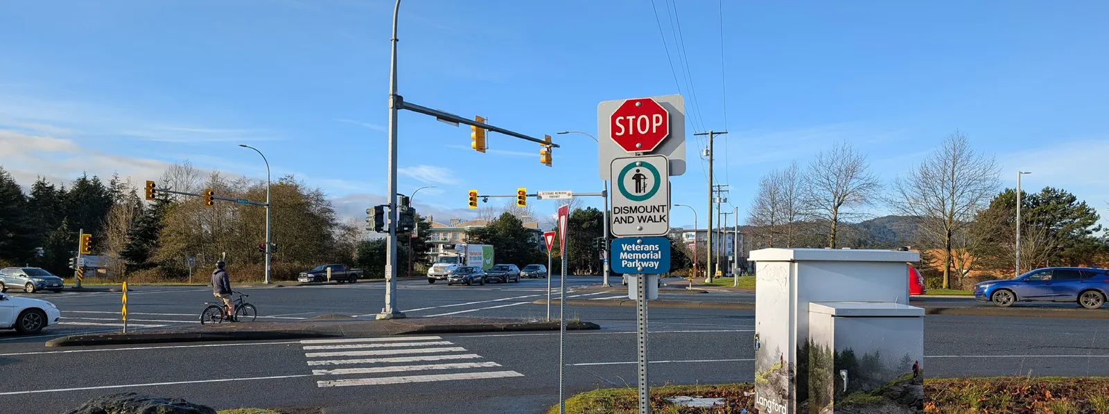
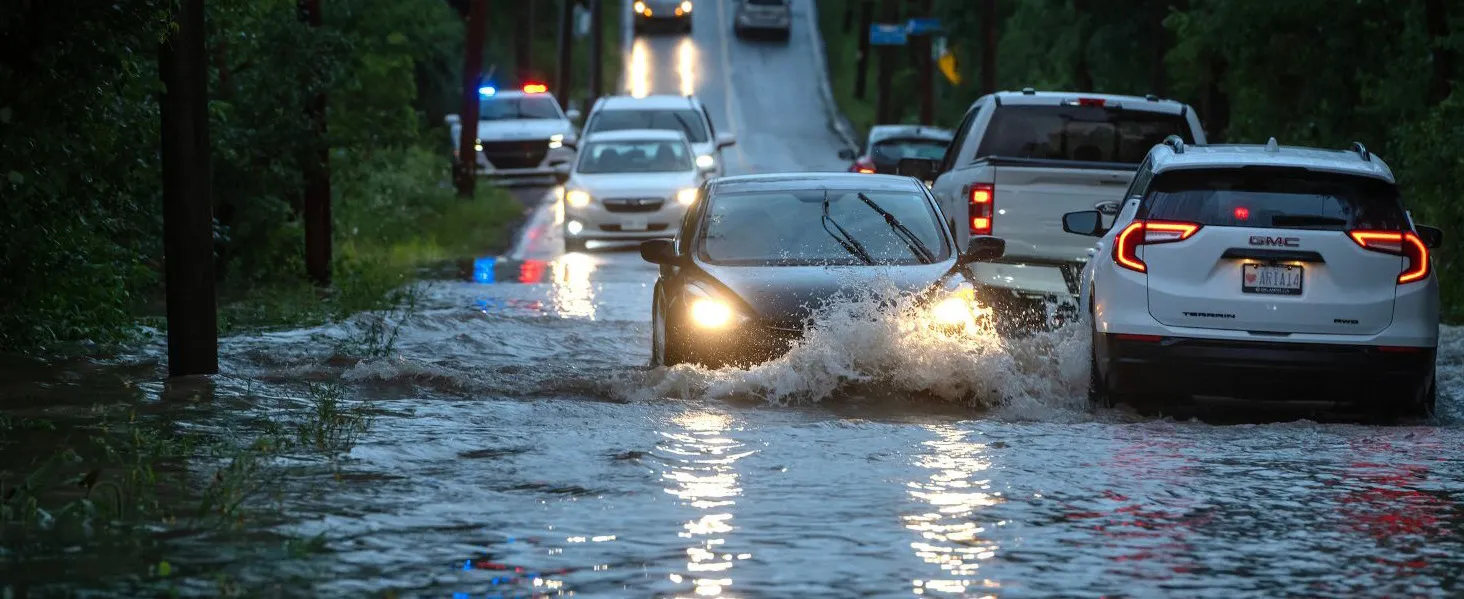
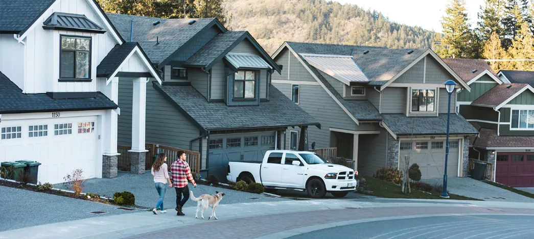
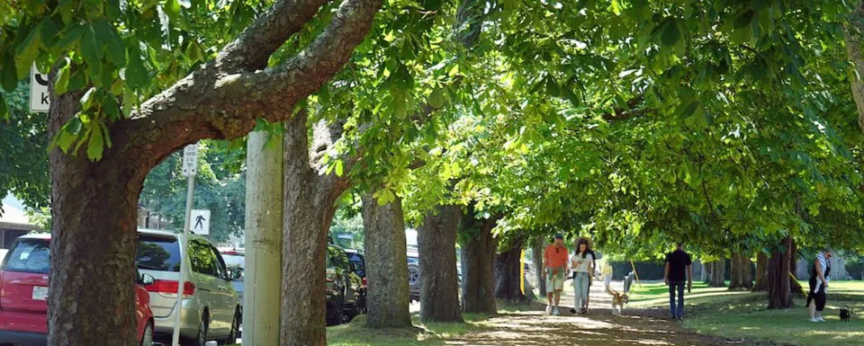
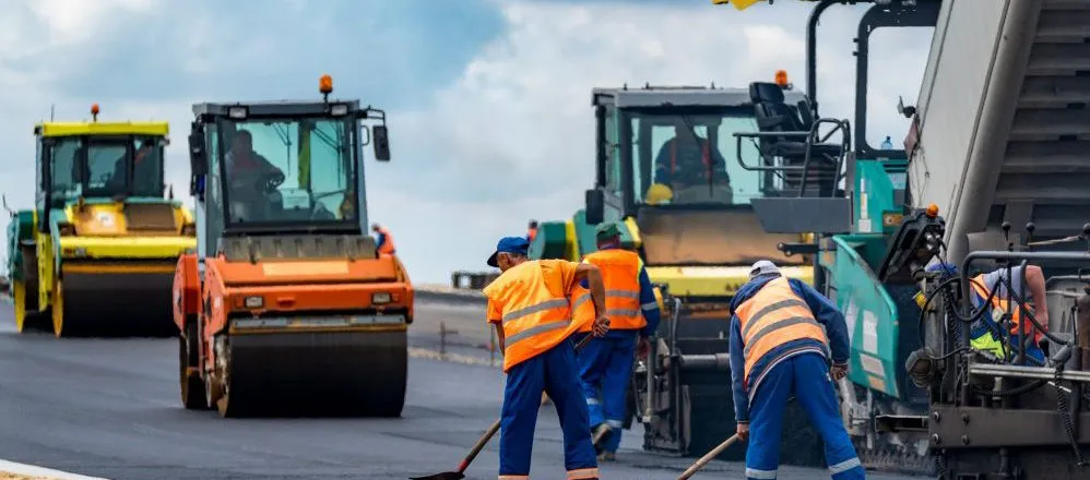

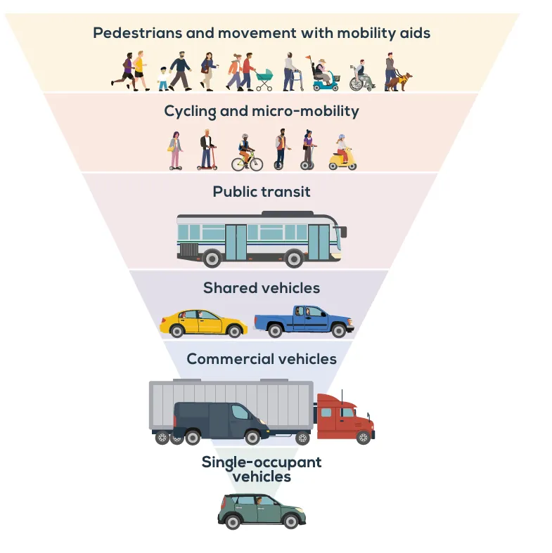


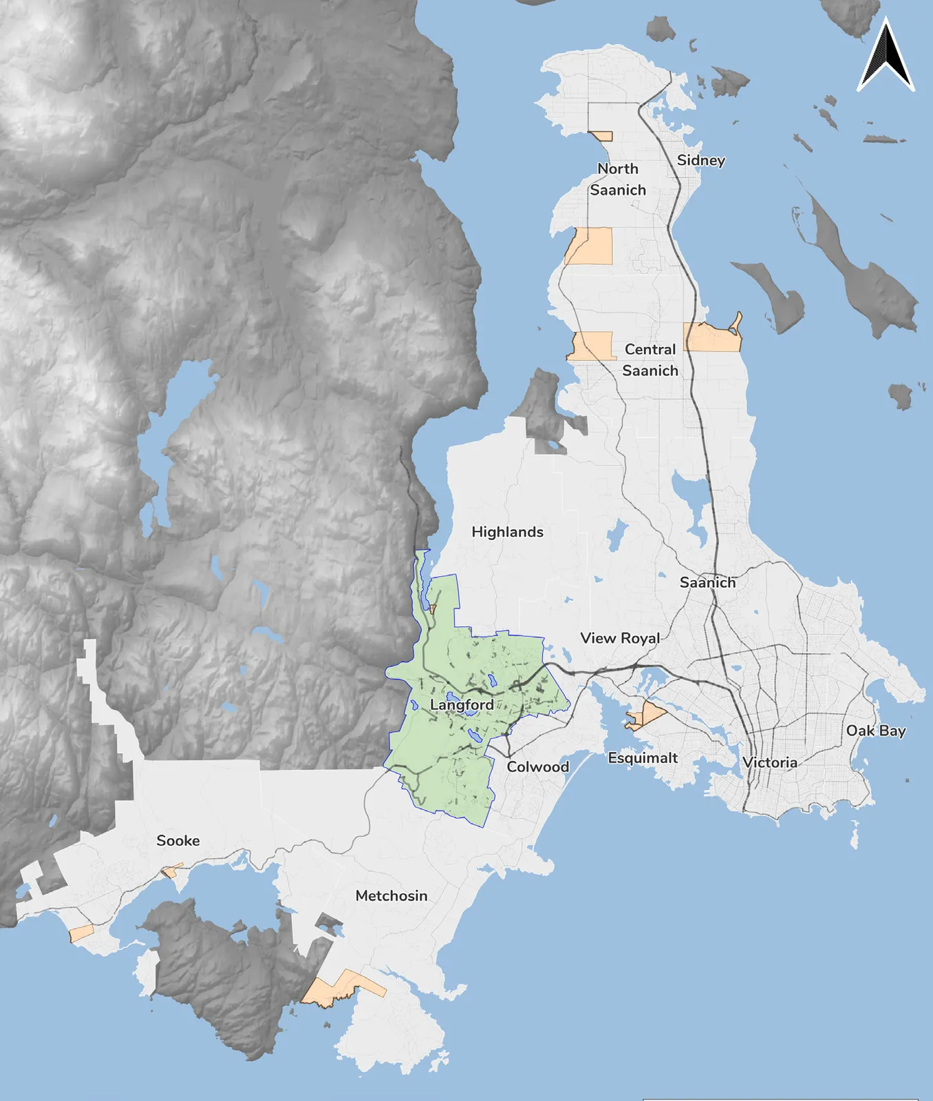
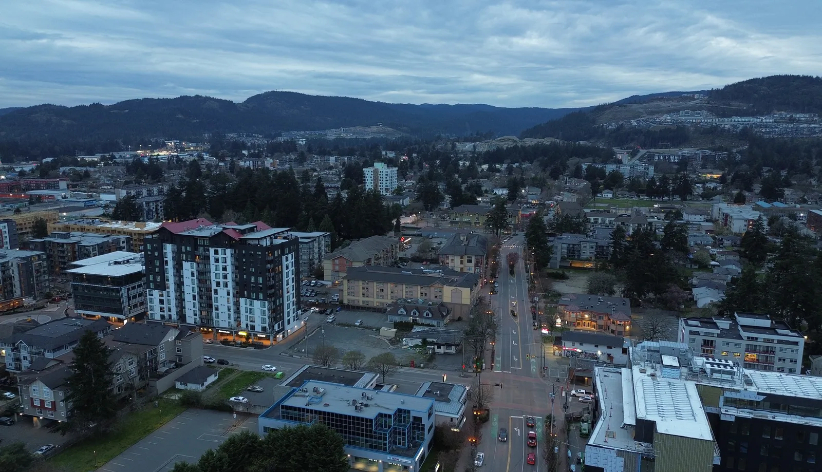
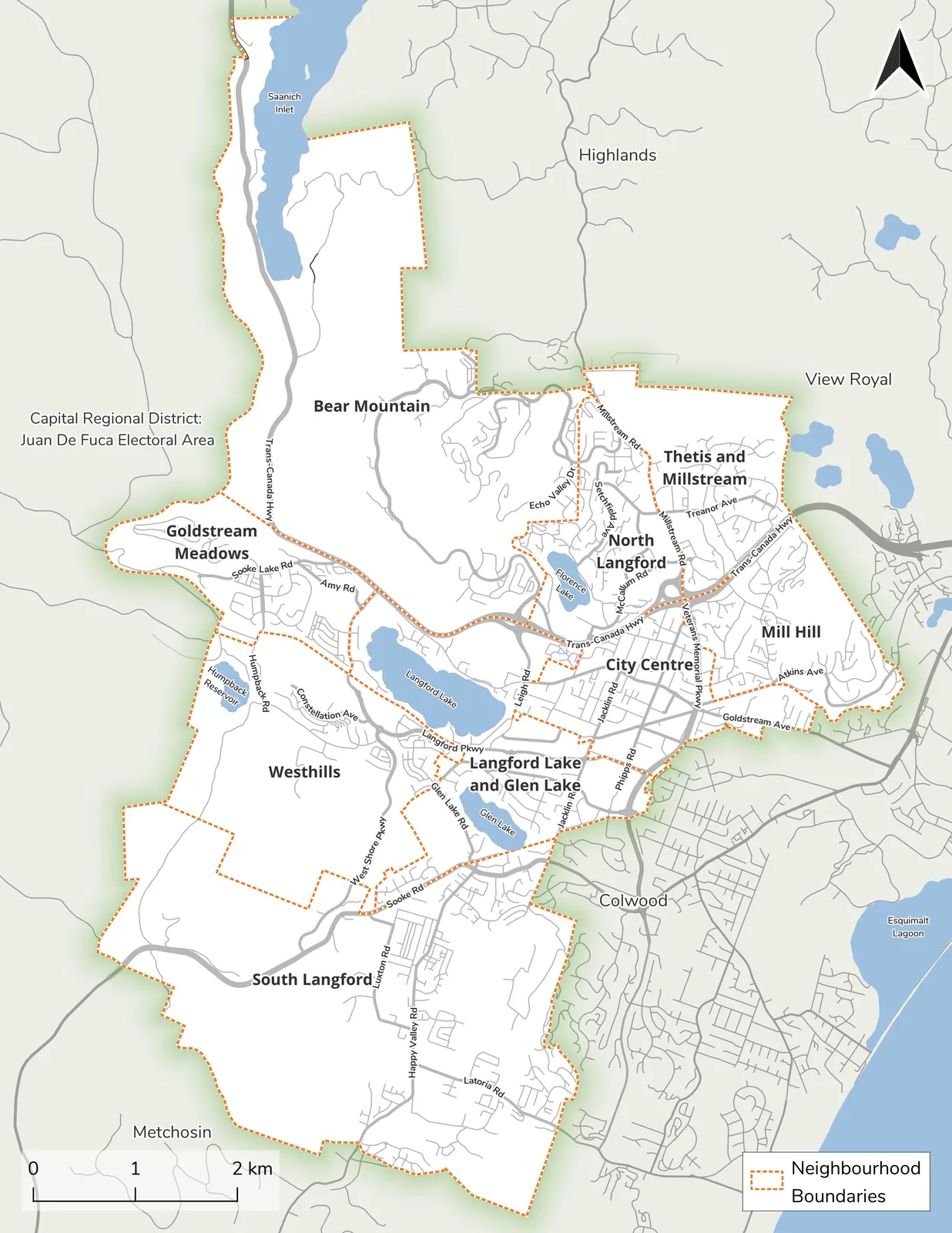

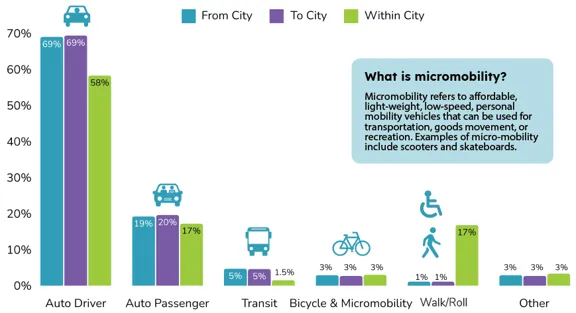

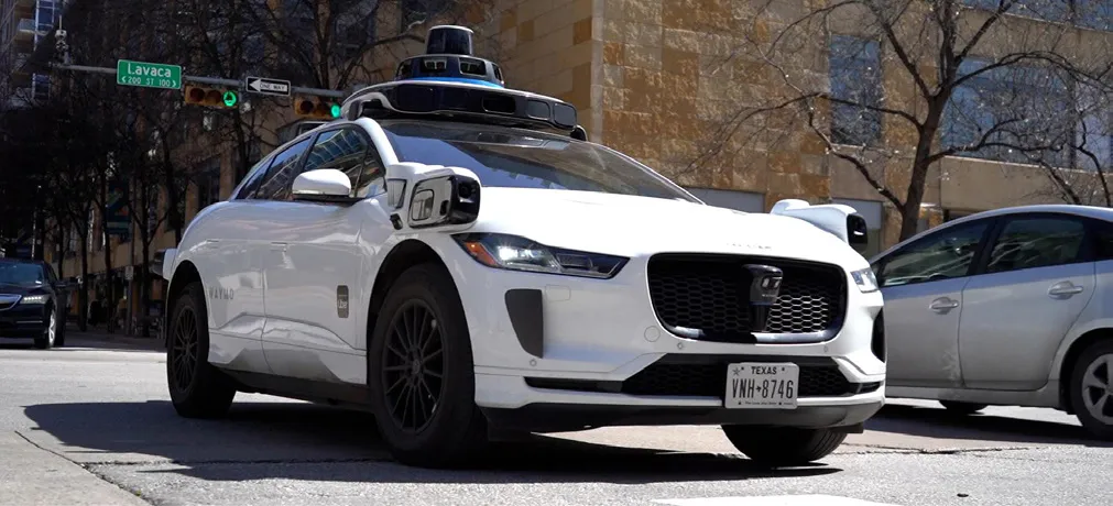
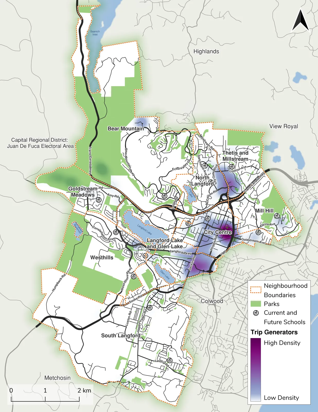
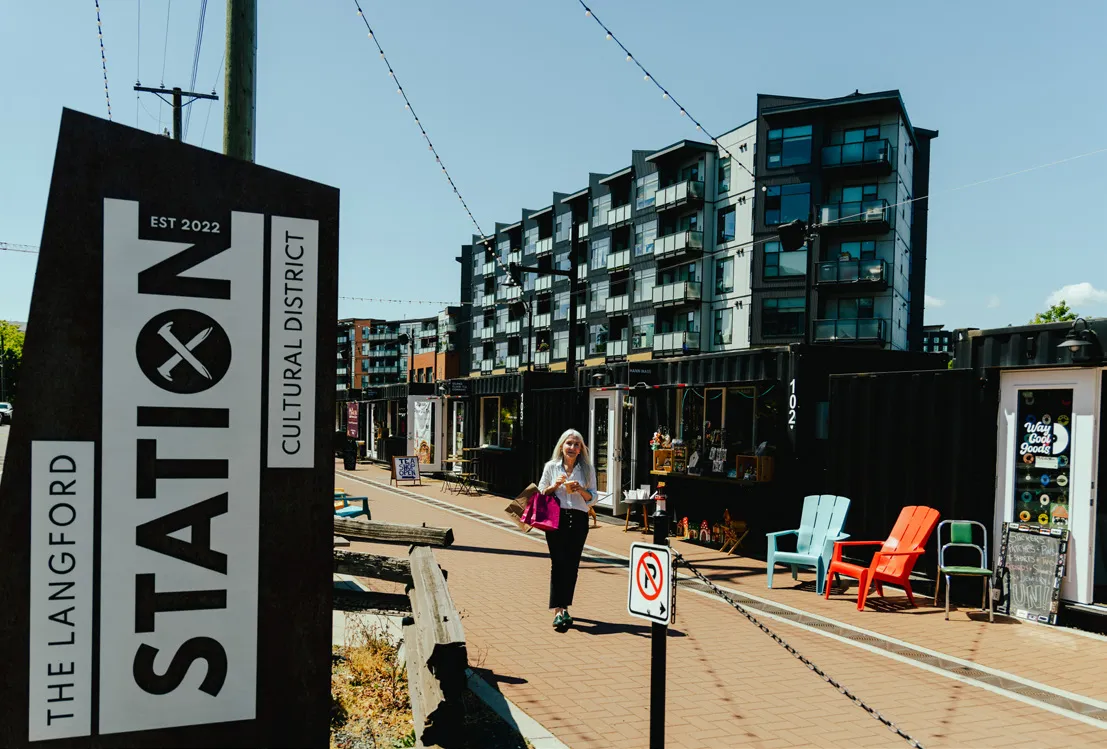
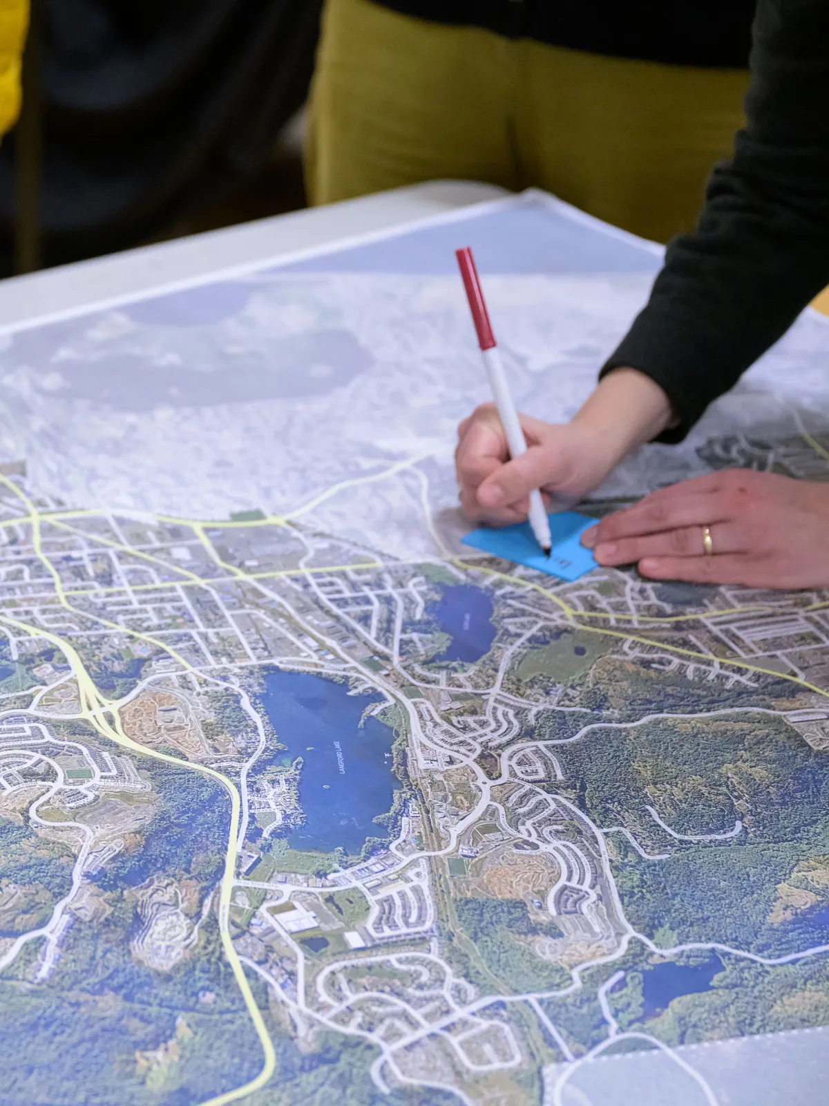

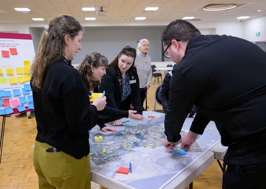
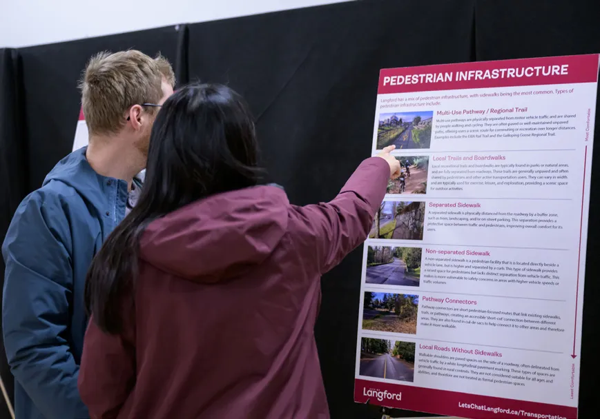







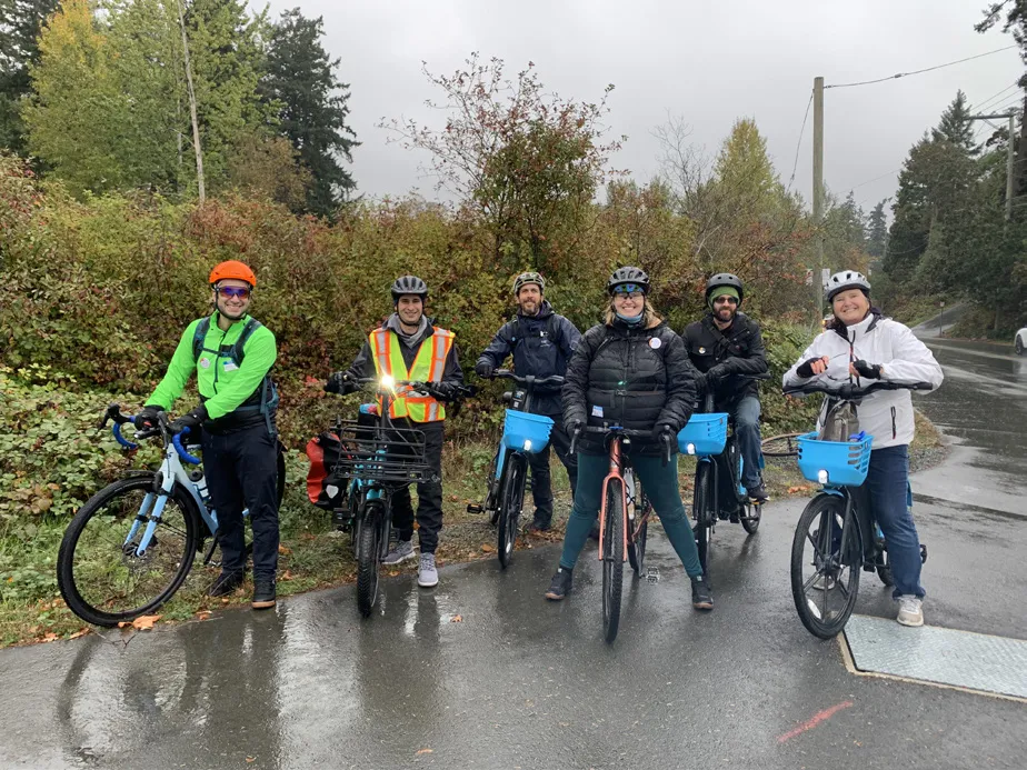
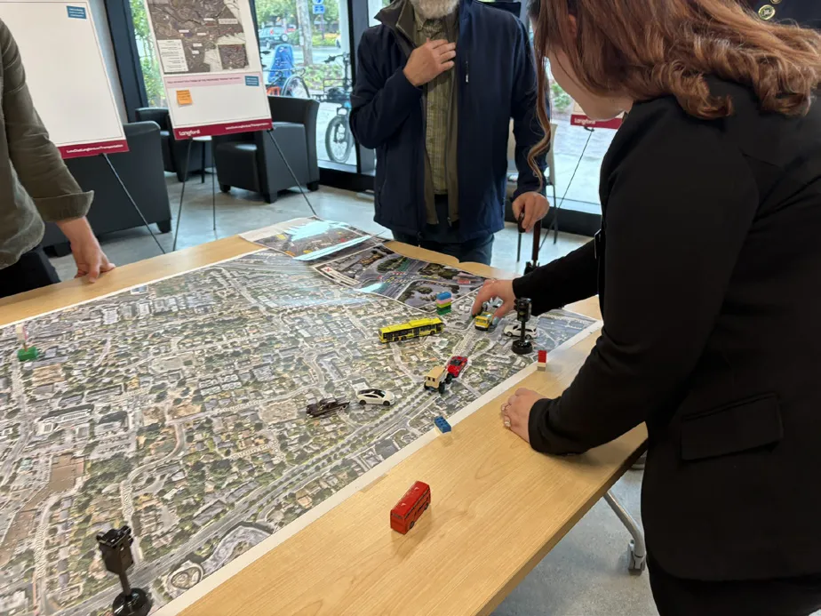
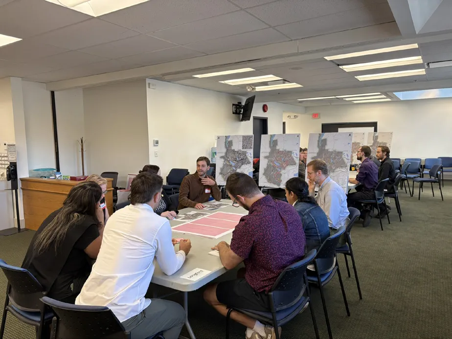
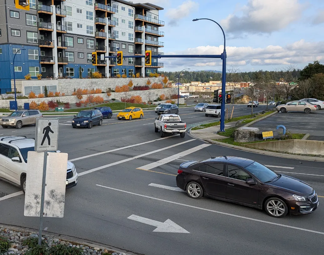
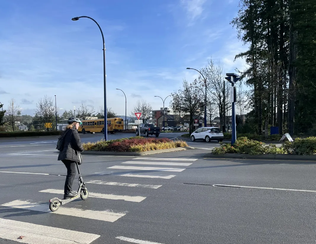



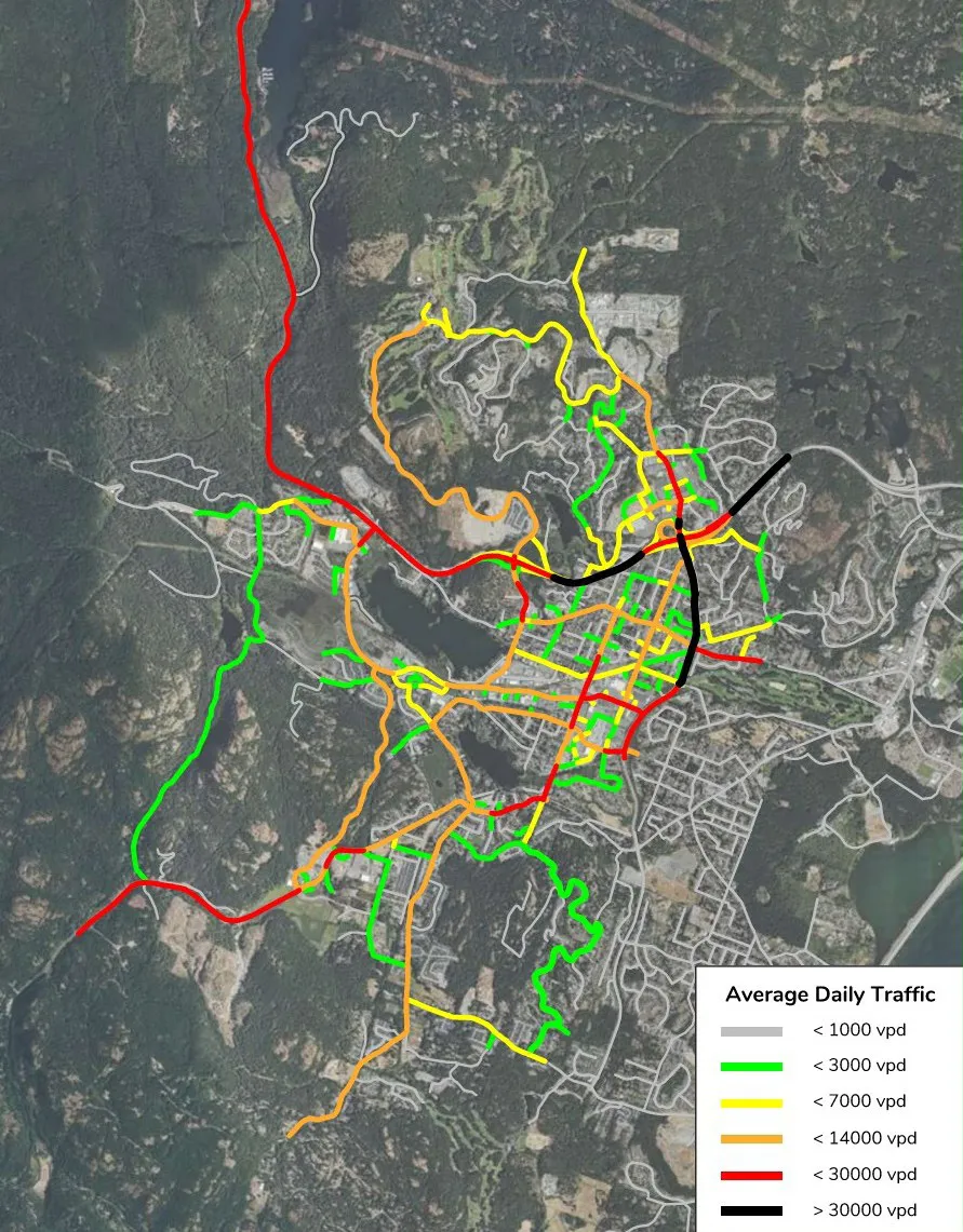
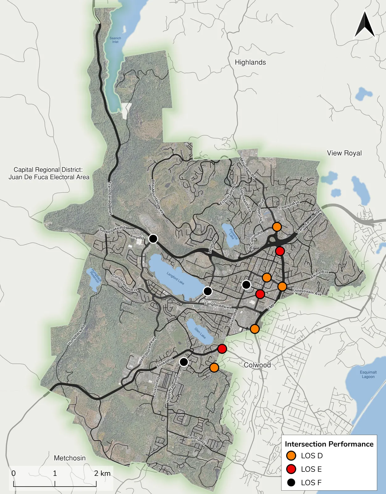
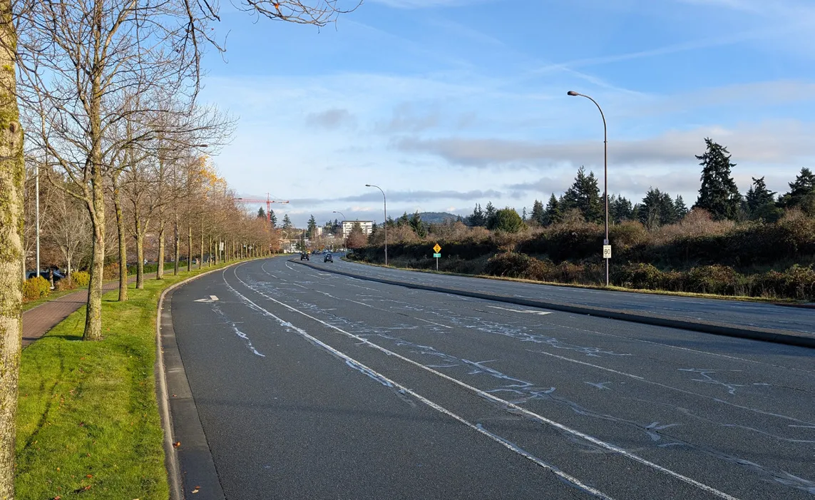
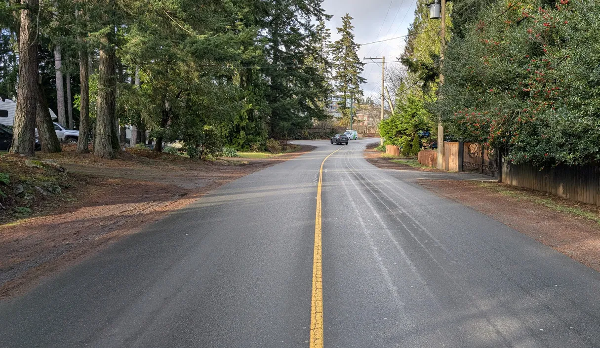
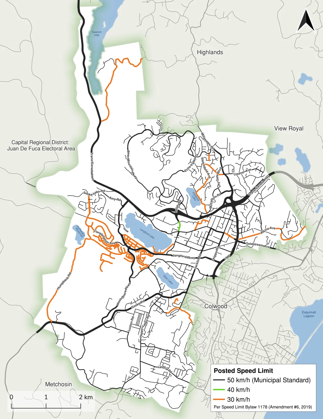
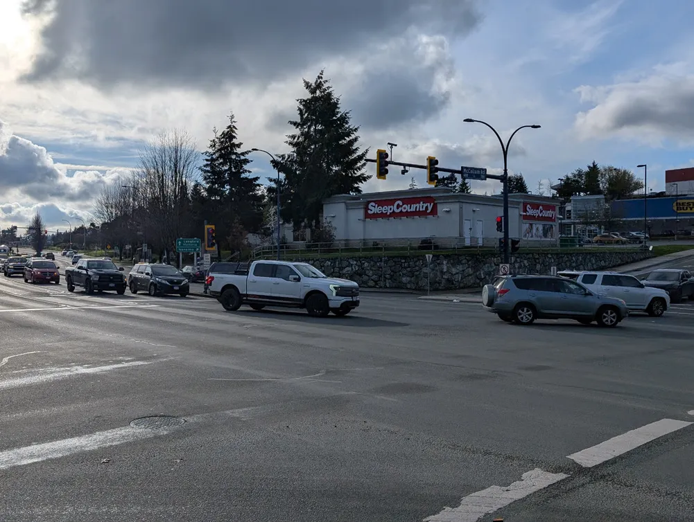
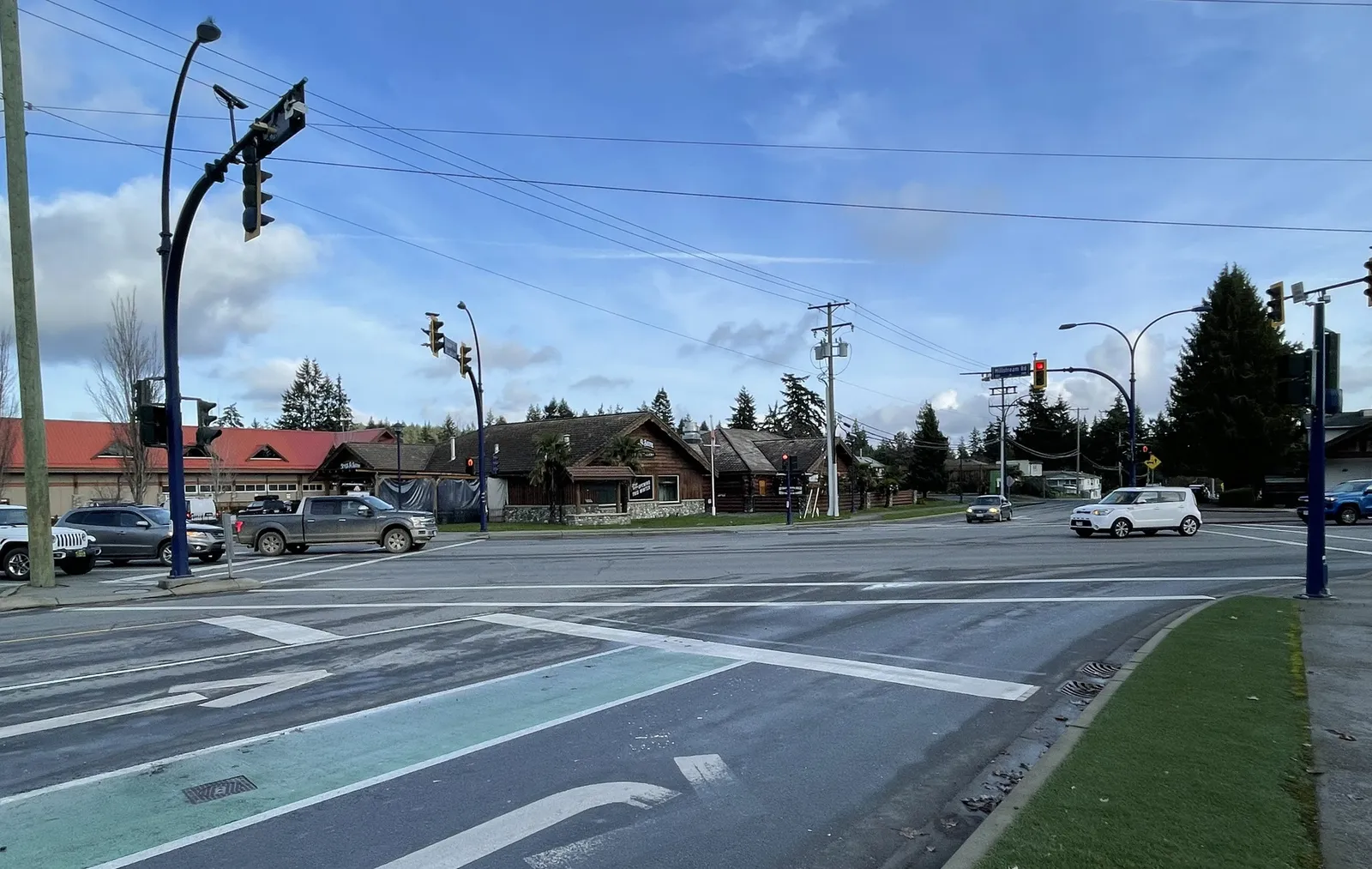
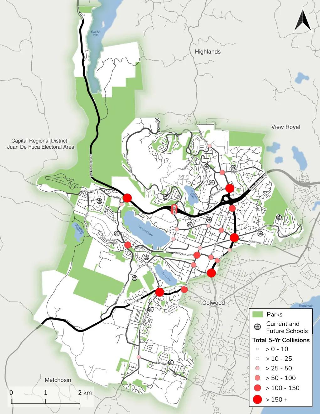
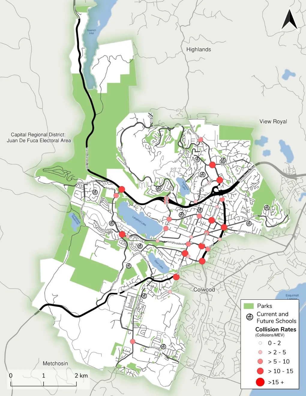
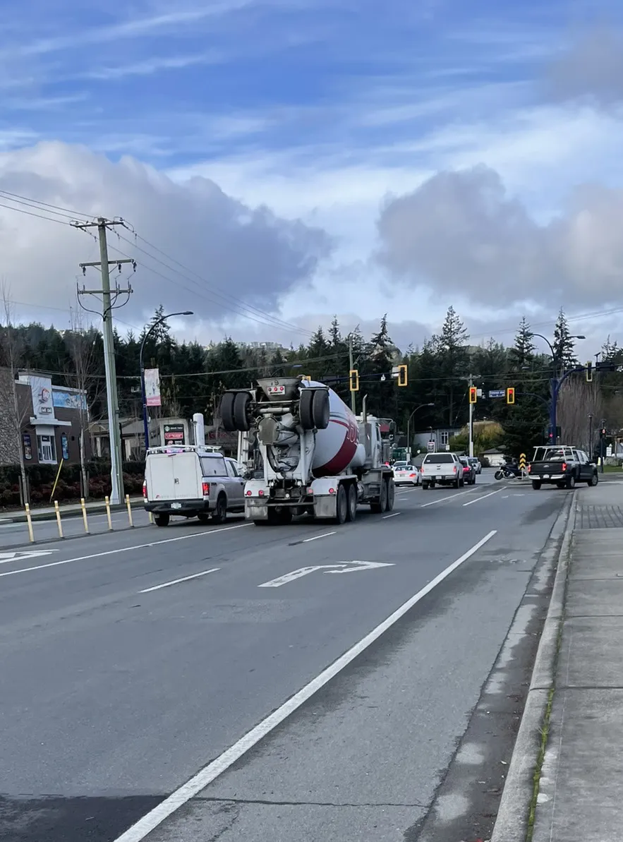
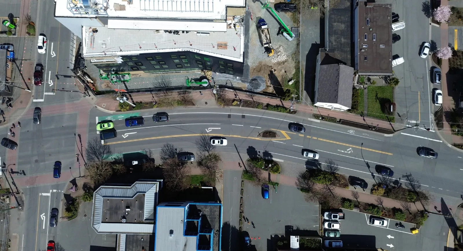
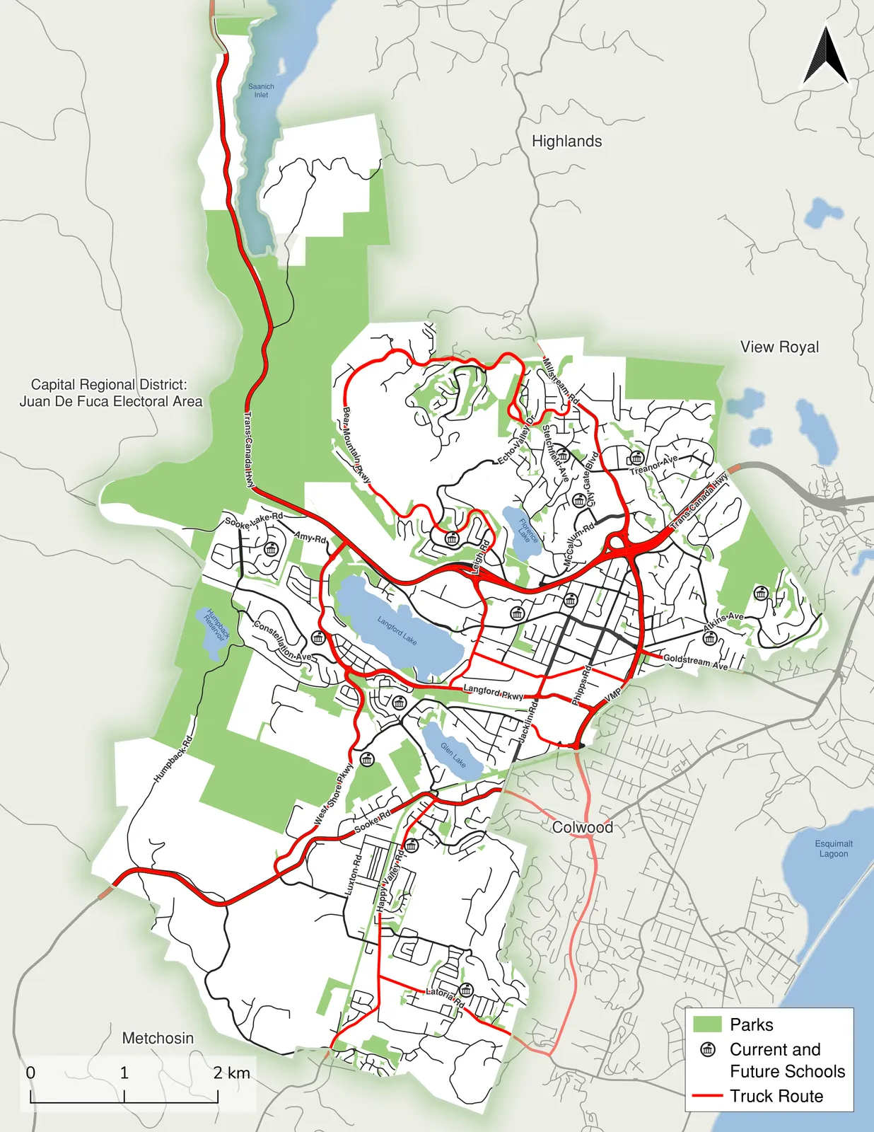
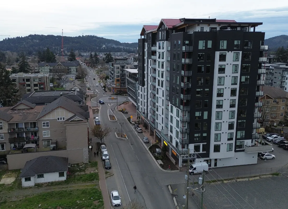
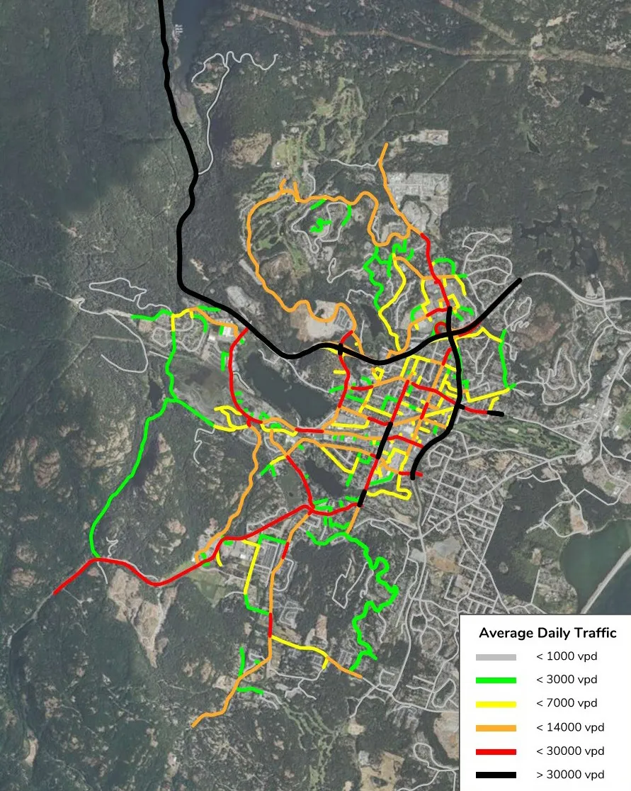
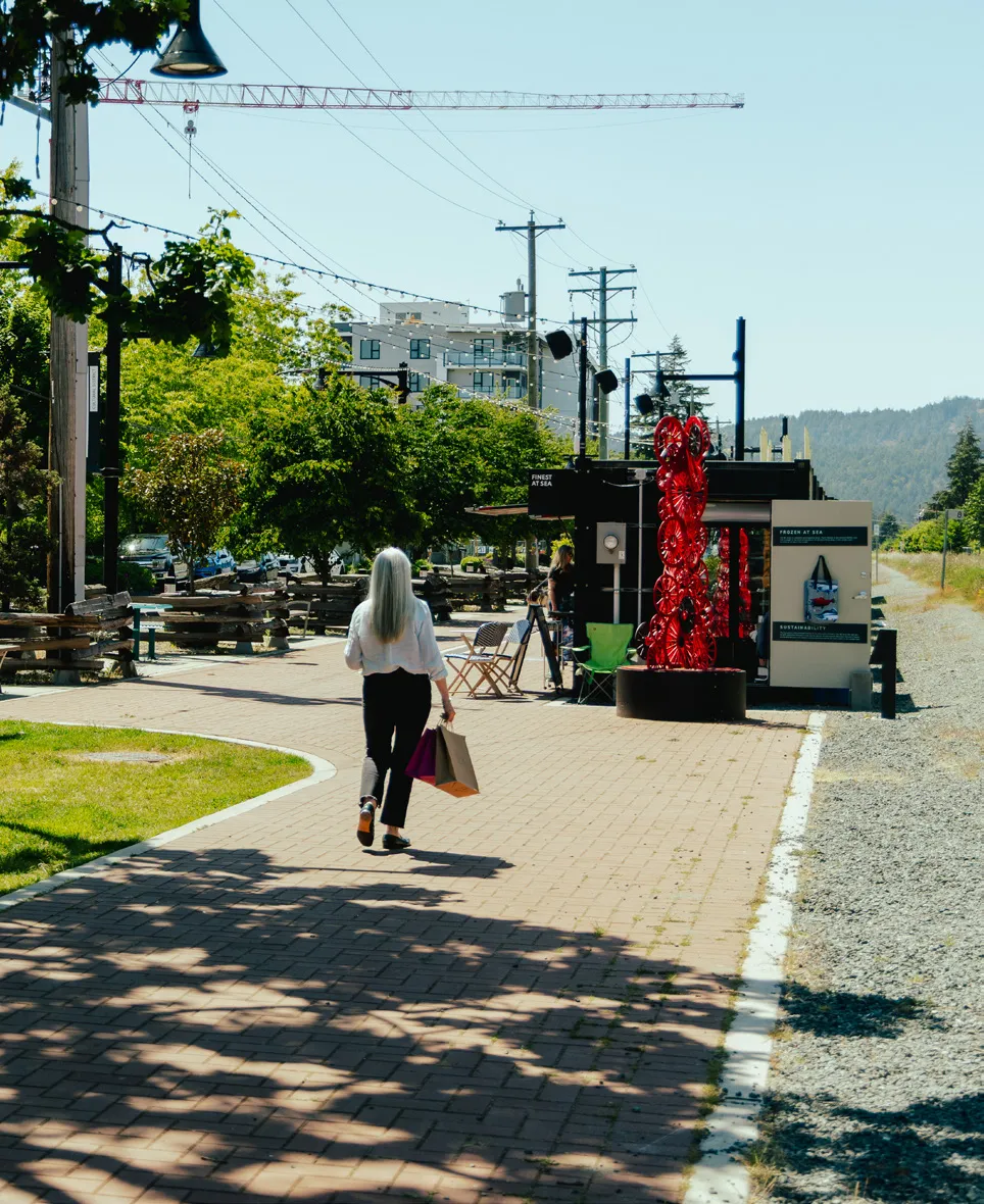
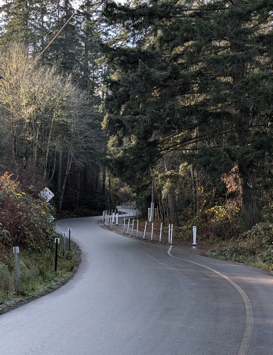
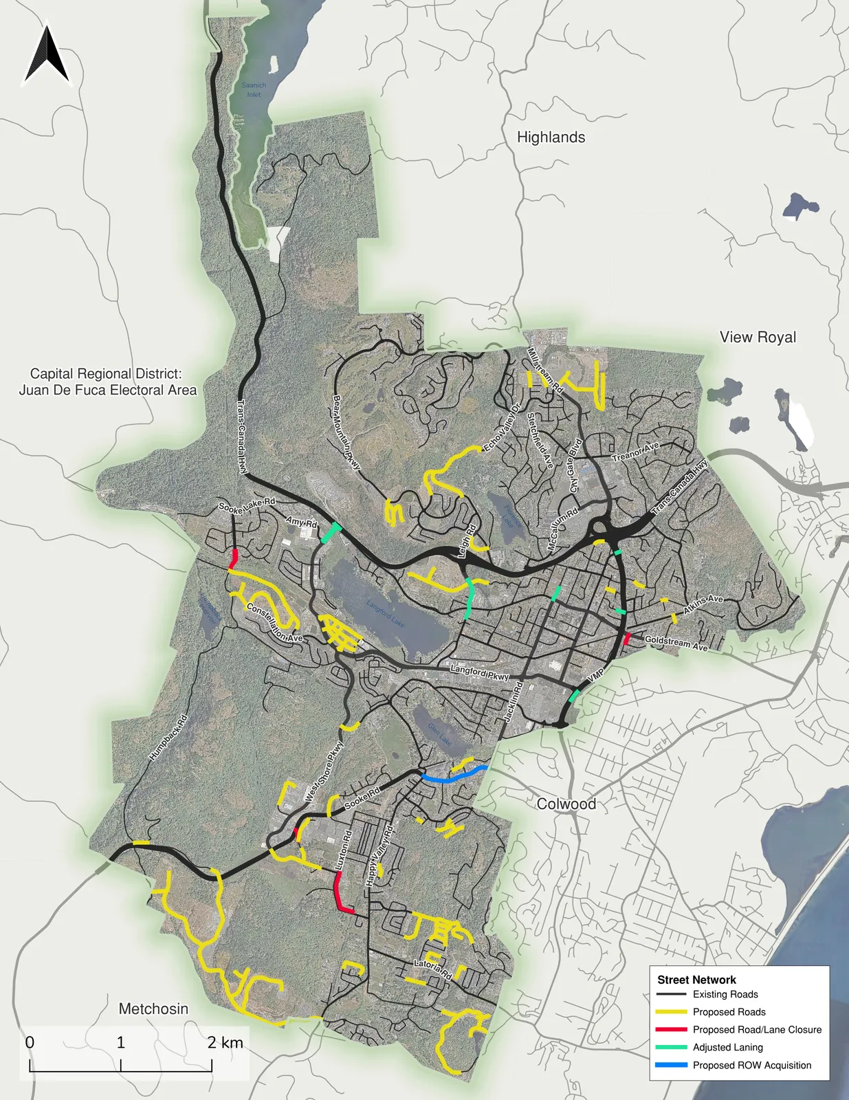
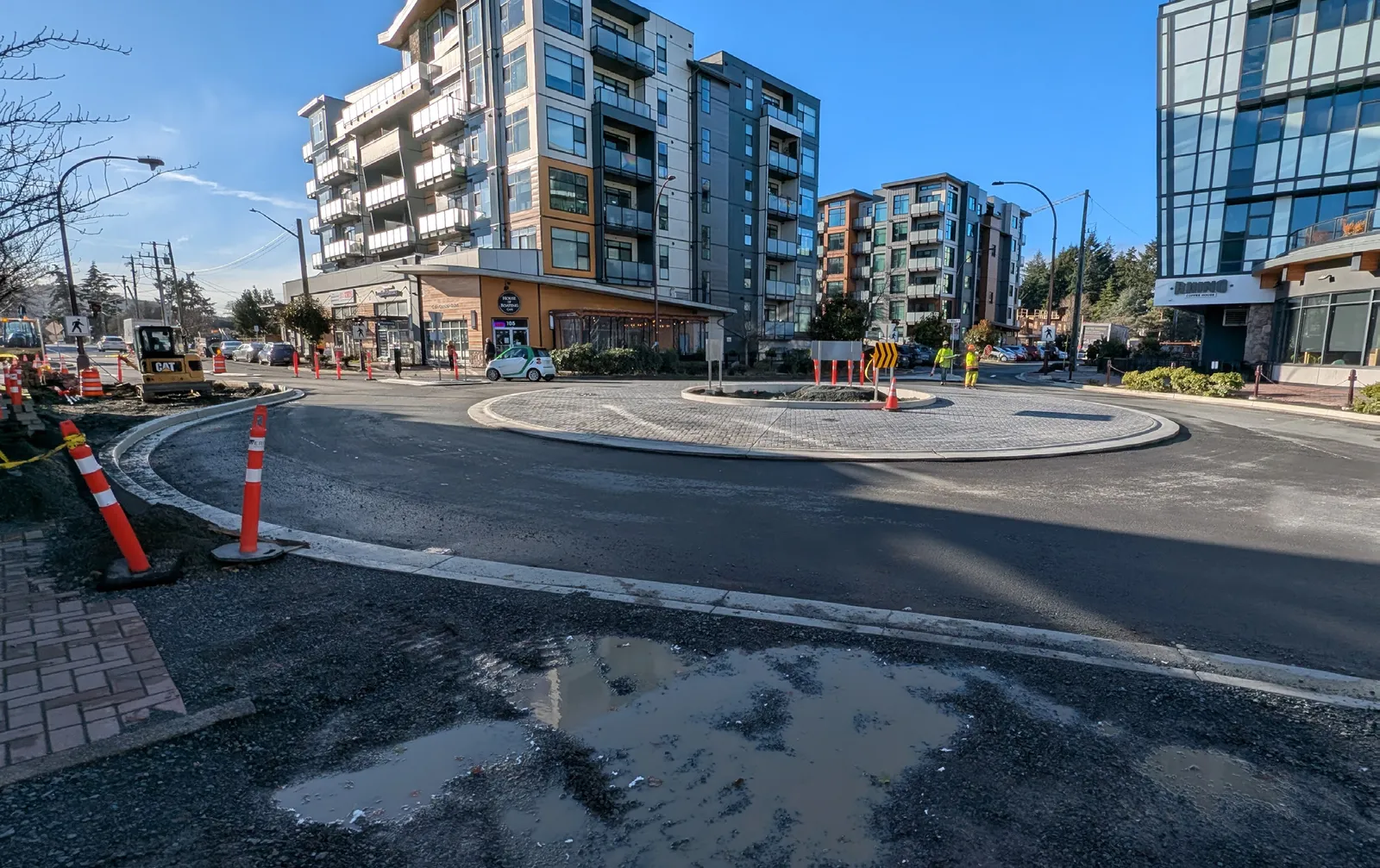
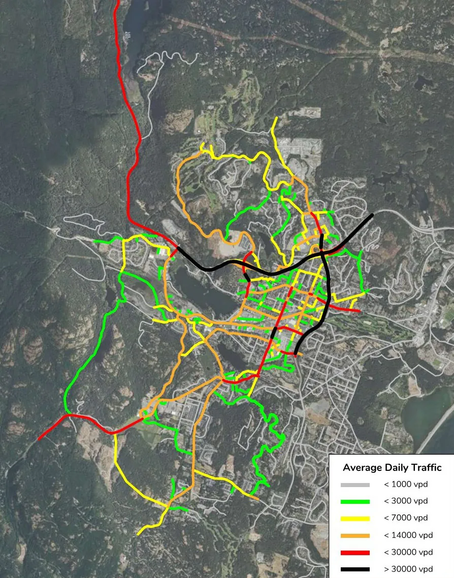
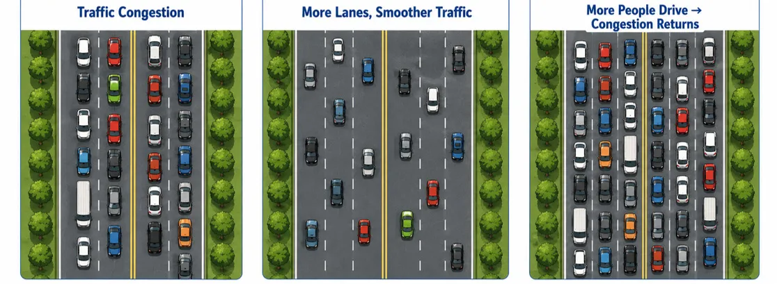
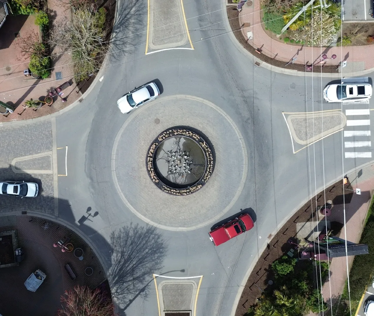
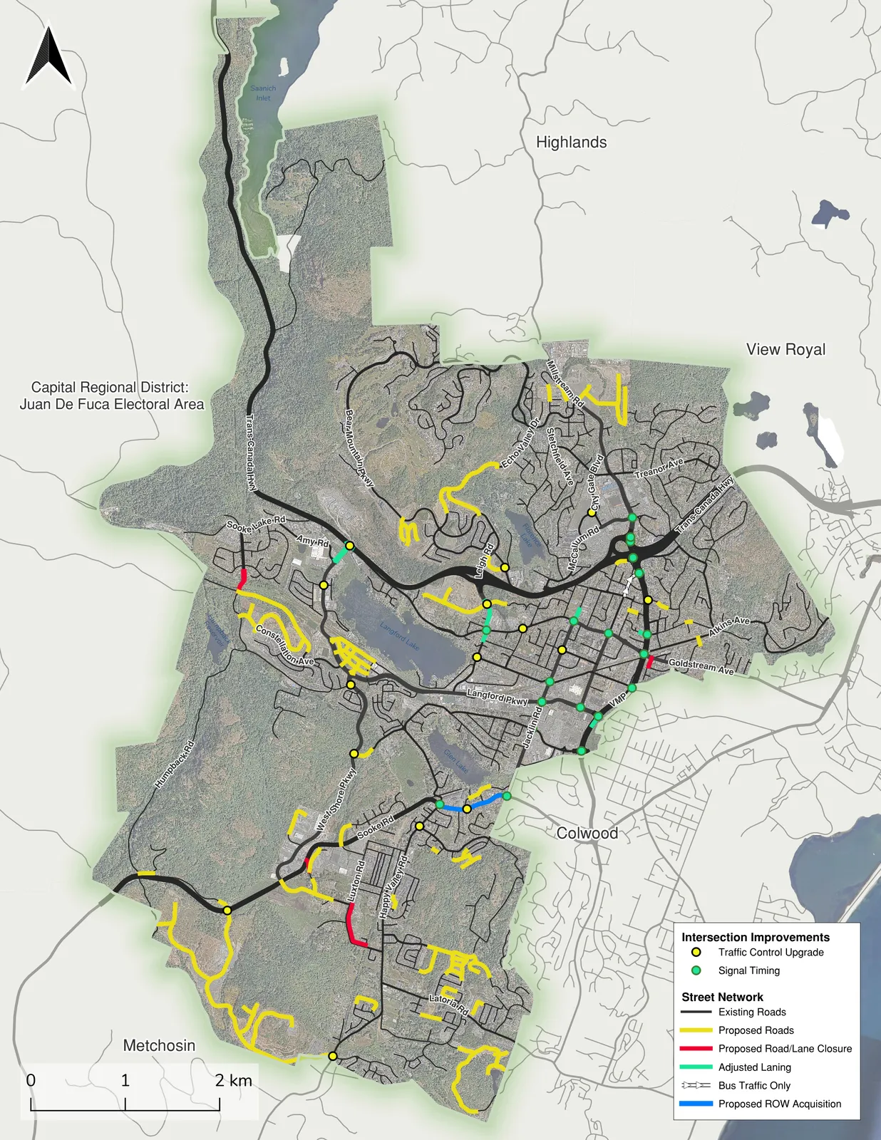
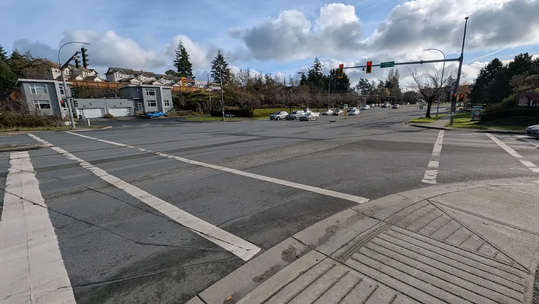
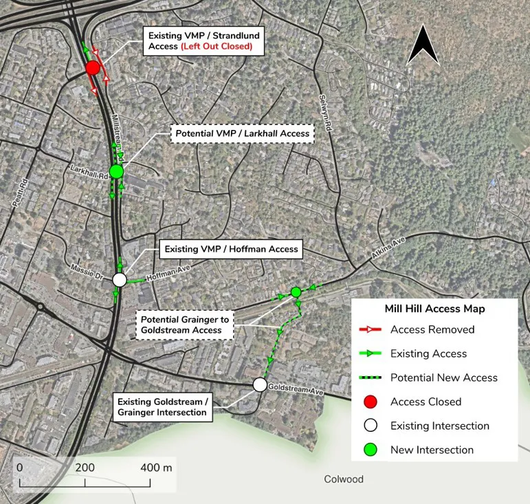
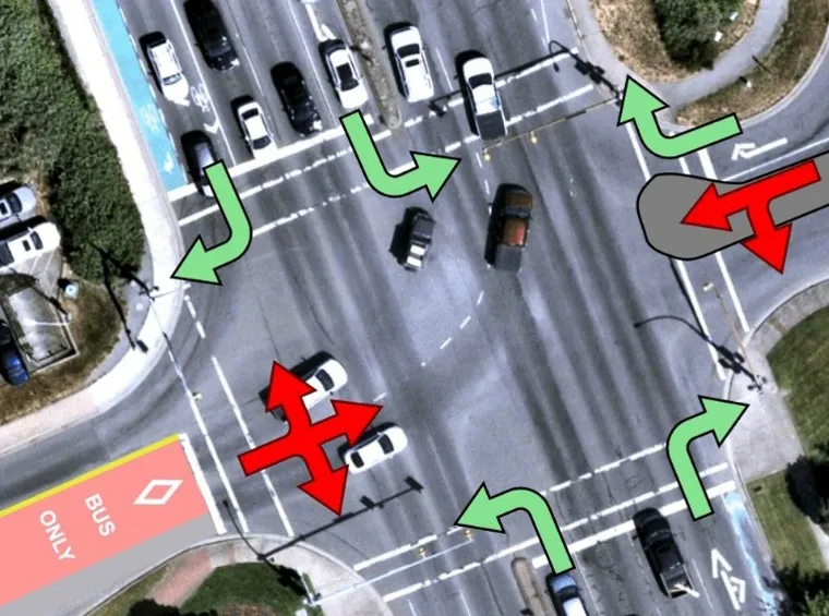
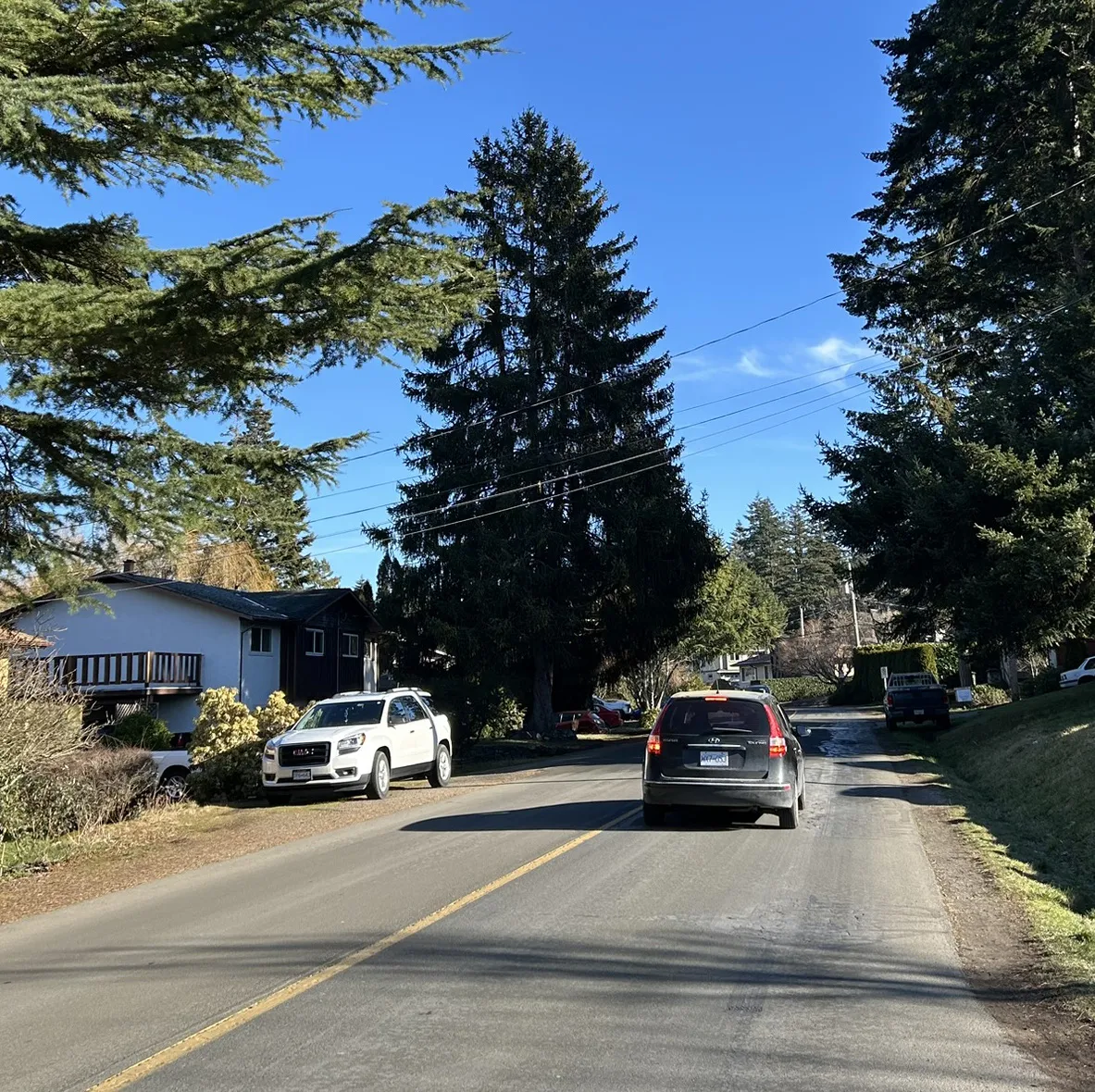
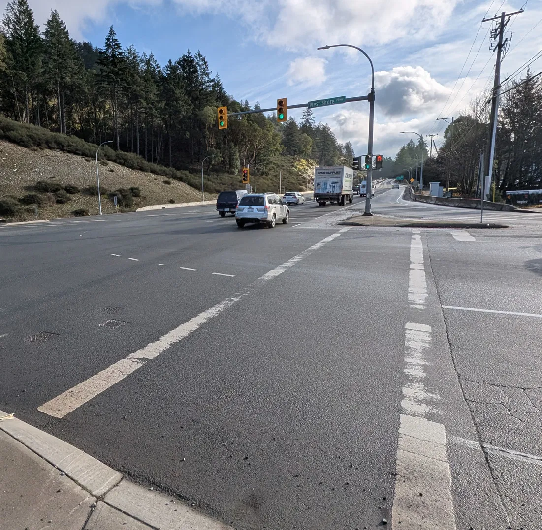
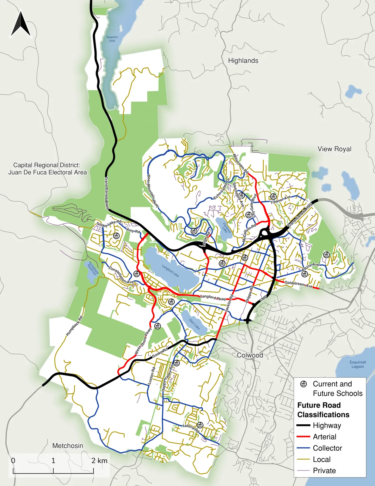
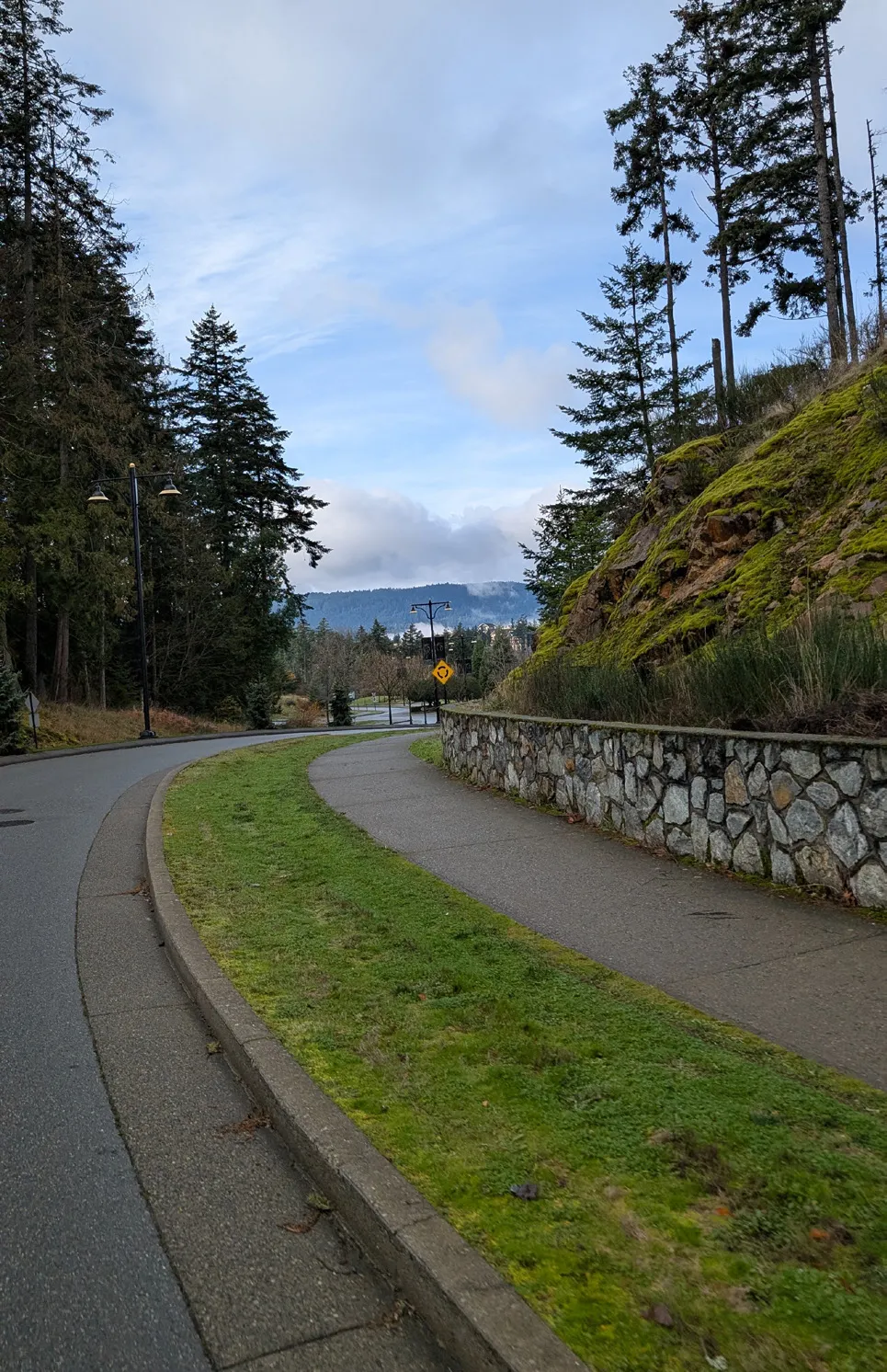
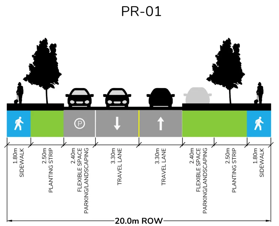
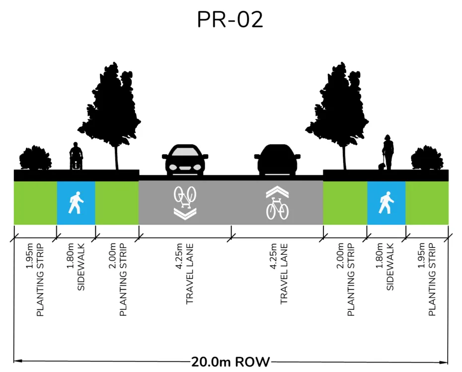
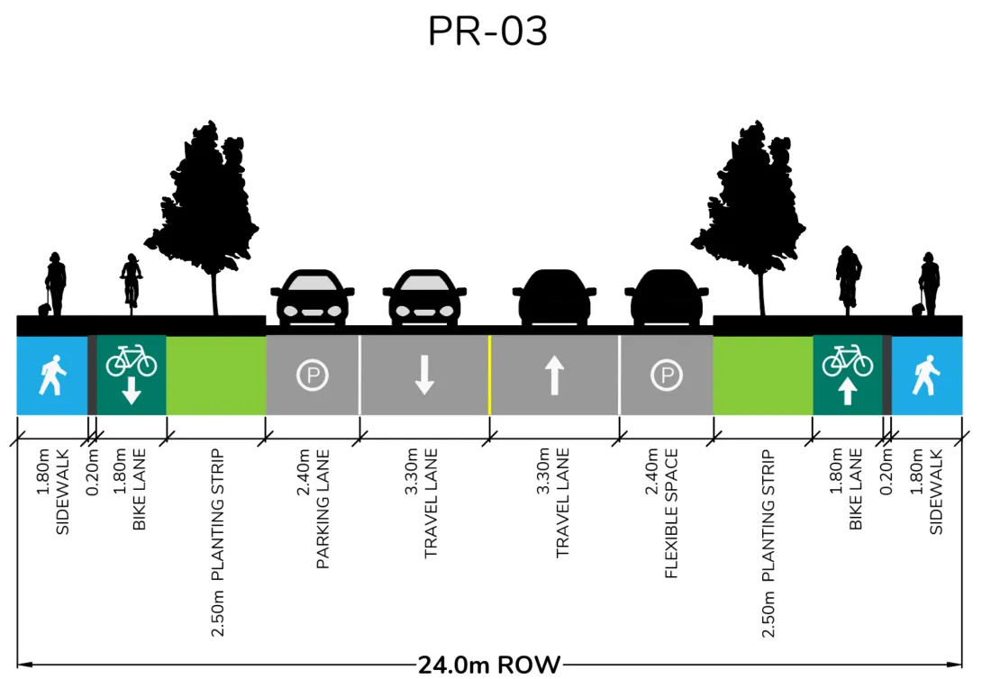
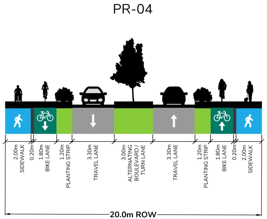
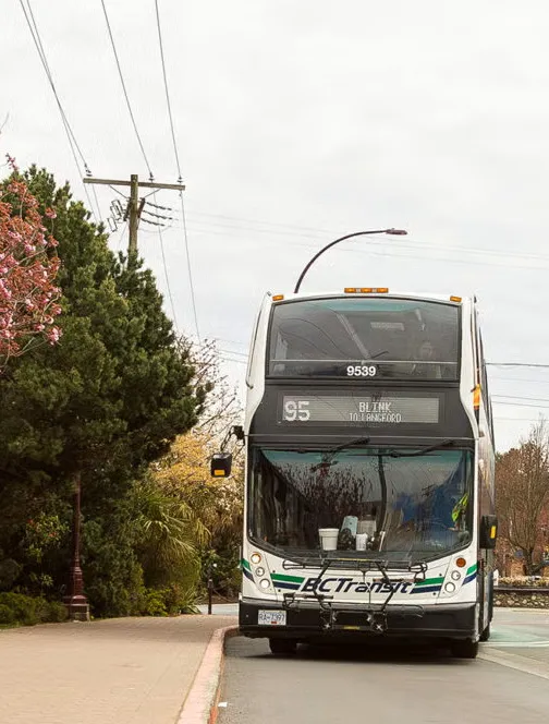
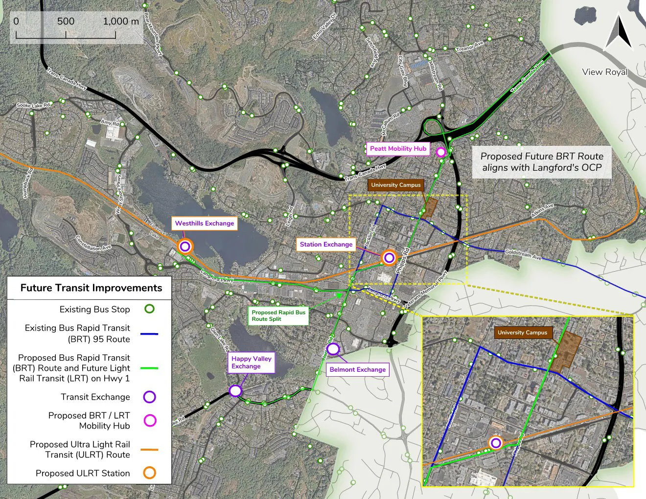
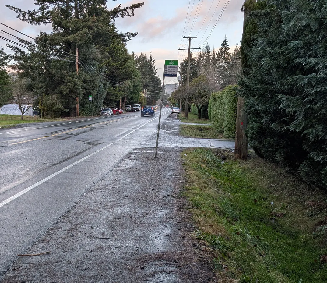
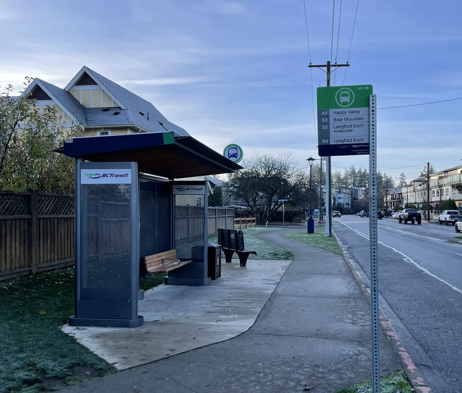
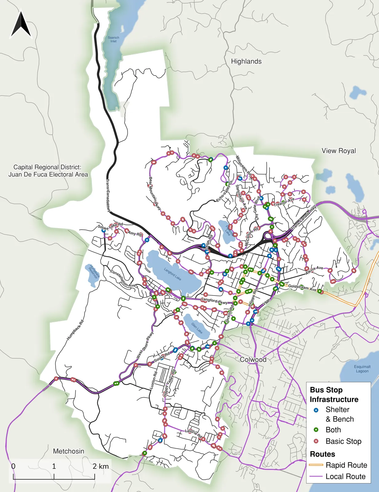



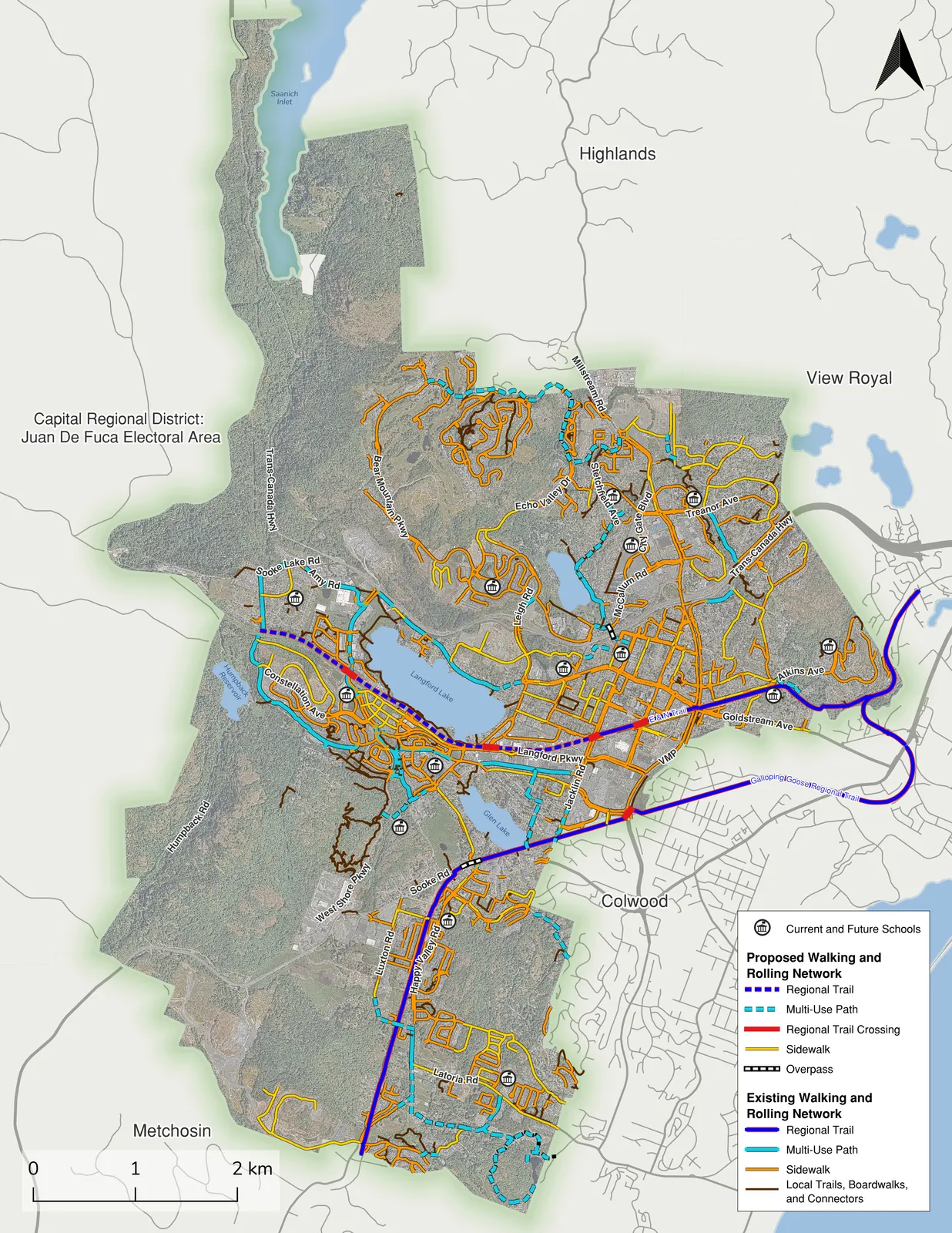

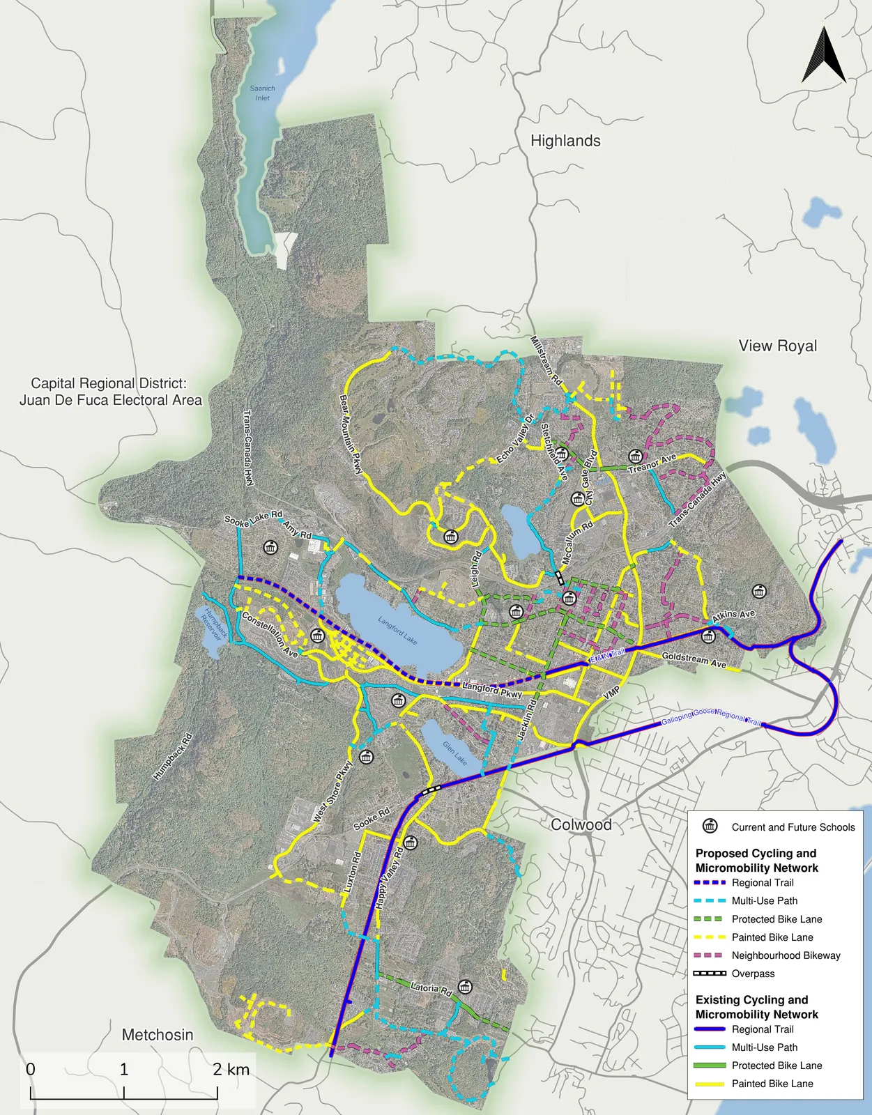

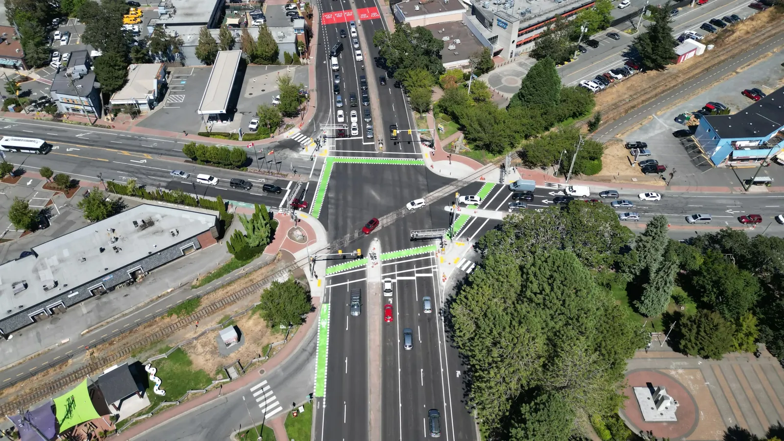
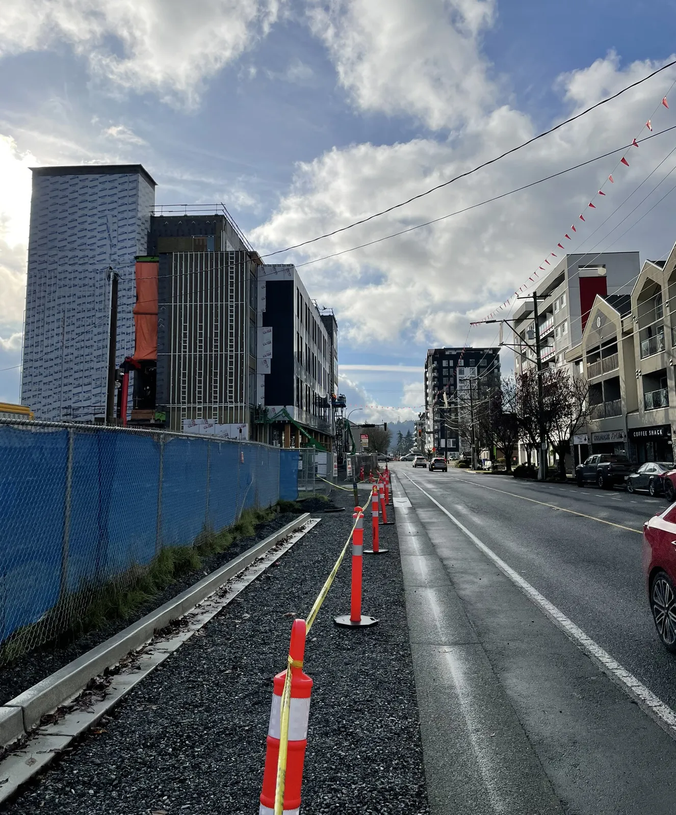
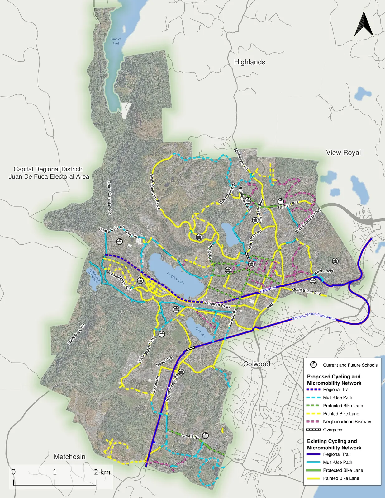
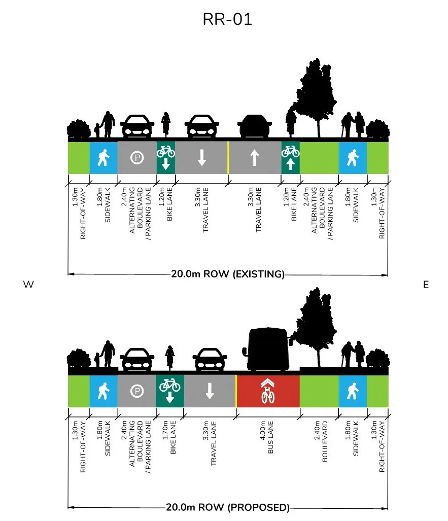
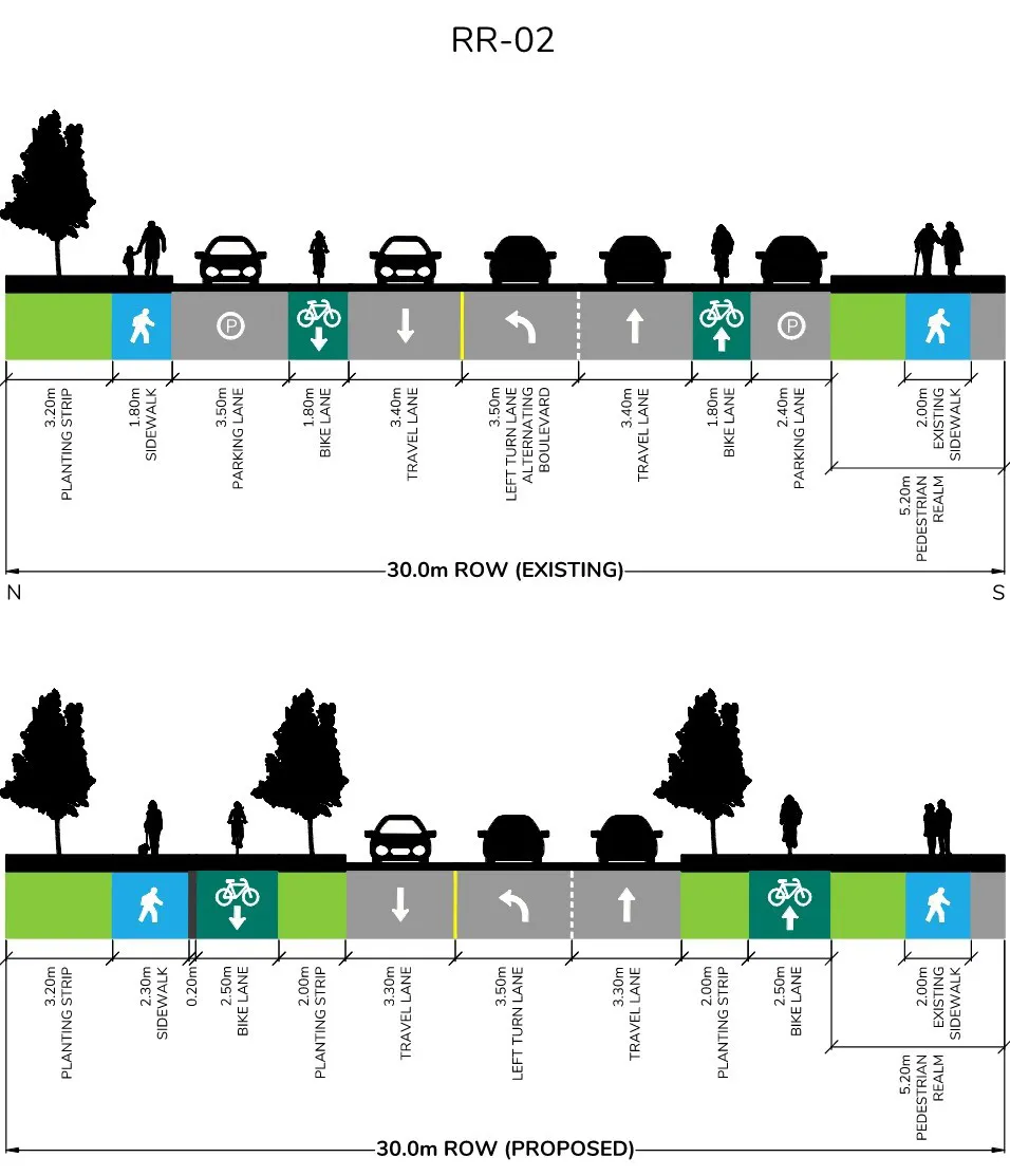
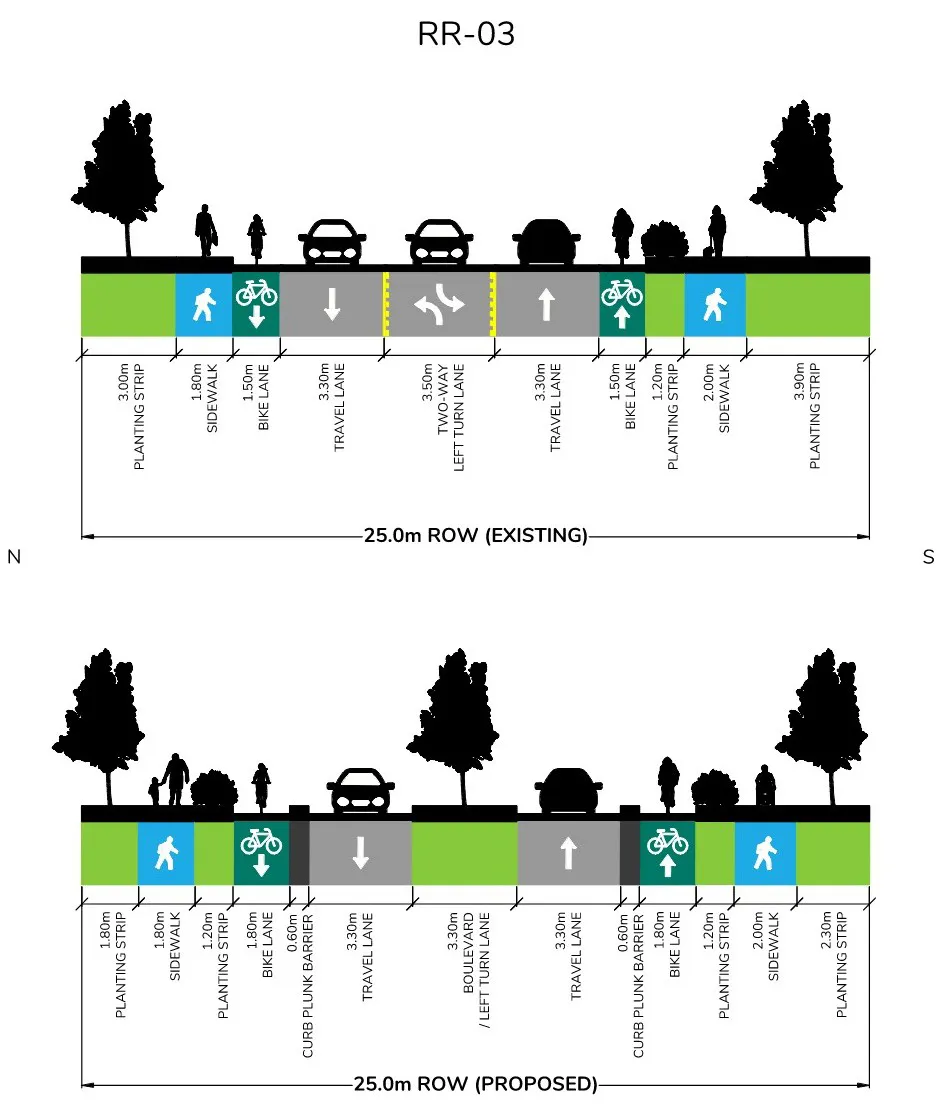
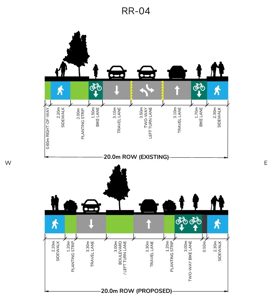
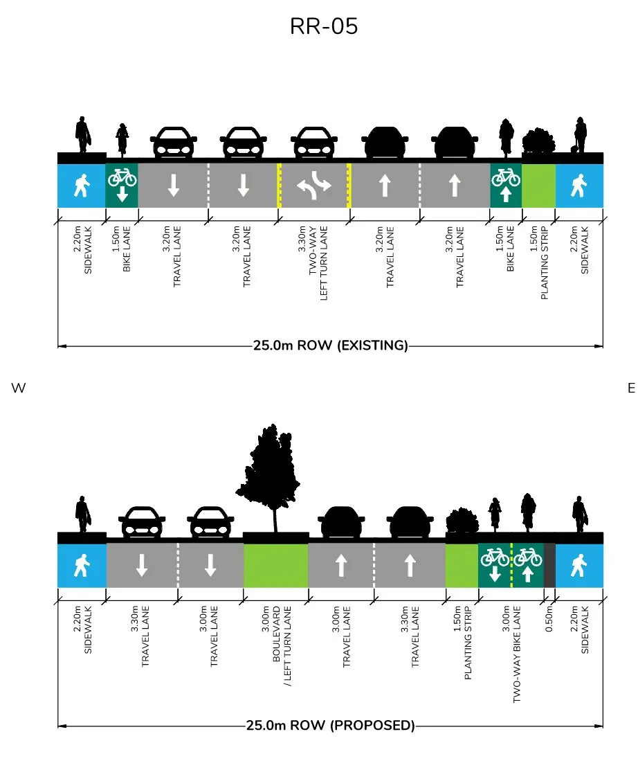
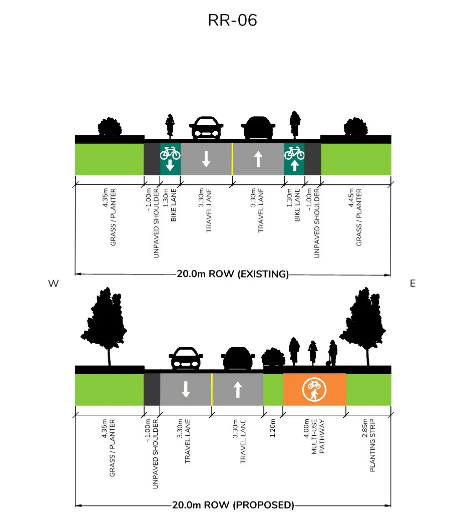
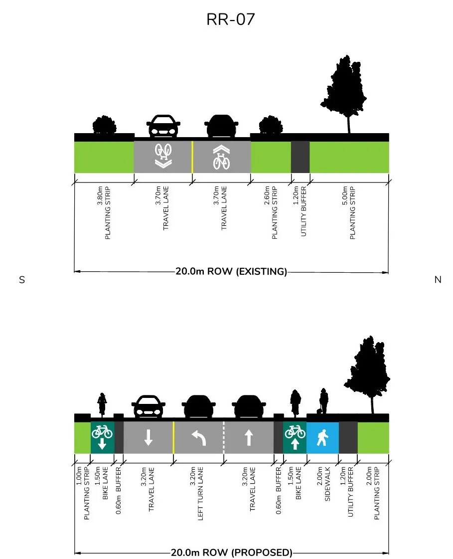
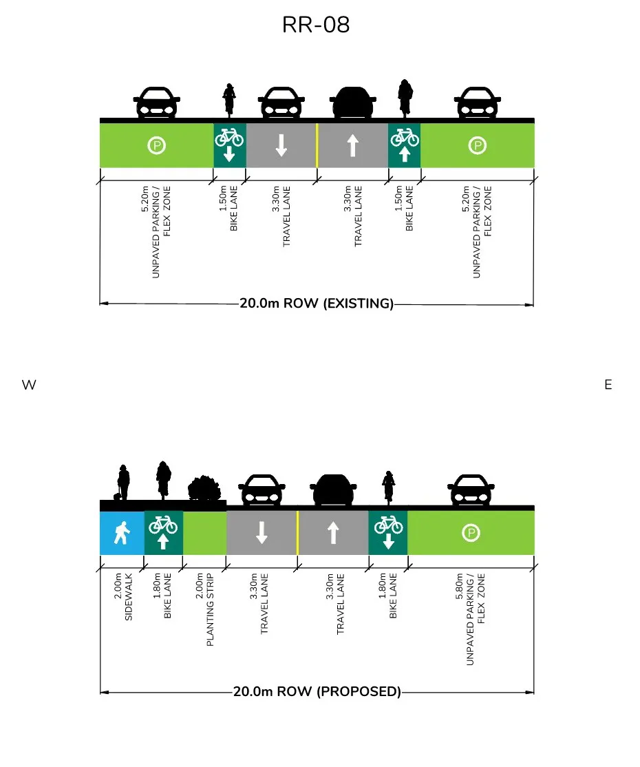
Document Images
(13)
extracted visual asset on page 1

extracted visual asset on page 3

extracted visual asset on page 12

extracted visual asset on page 12

extracted visual asset on page 12

extracted visual asset on page 12

extracted visual asset on page 12
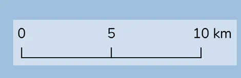
extracted visual asset on page 14

extracted visual asset on page 36

extracted visual asset on page 36

extracted visual asset on page 36

extracted visual asset on page 37

extracted visual asset on page 37